
We spent today in the Black Hills south of Rapid City, South Dakota. Our first destination was Mount Rushmore. We spent a few hours there before heading south to Custer State Park where we spent the rest of the day.
Mount Rushmore National Memorial
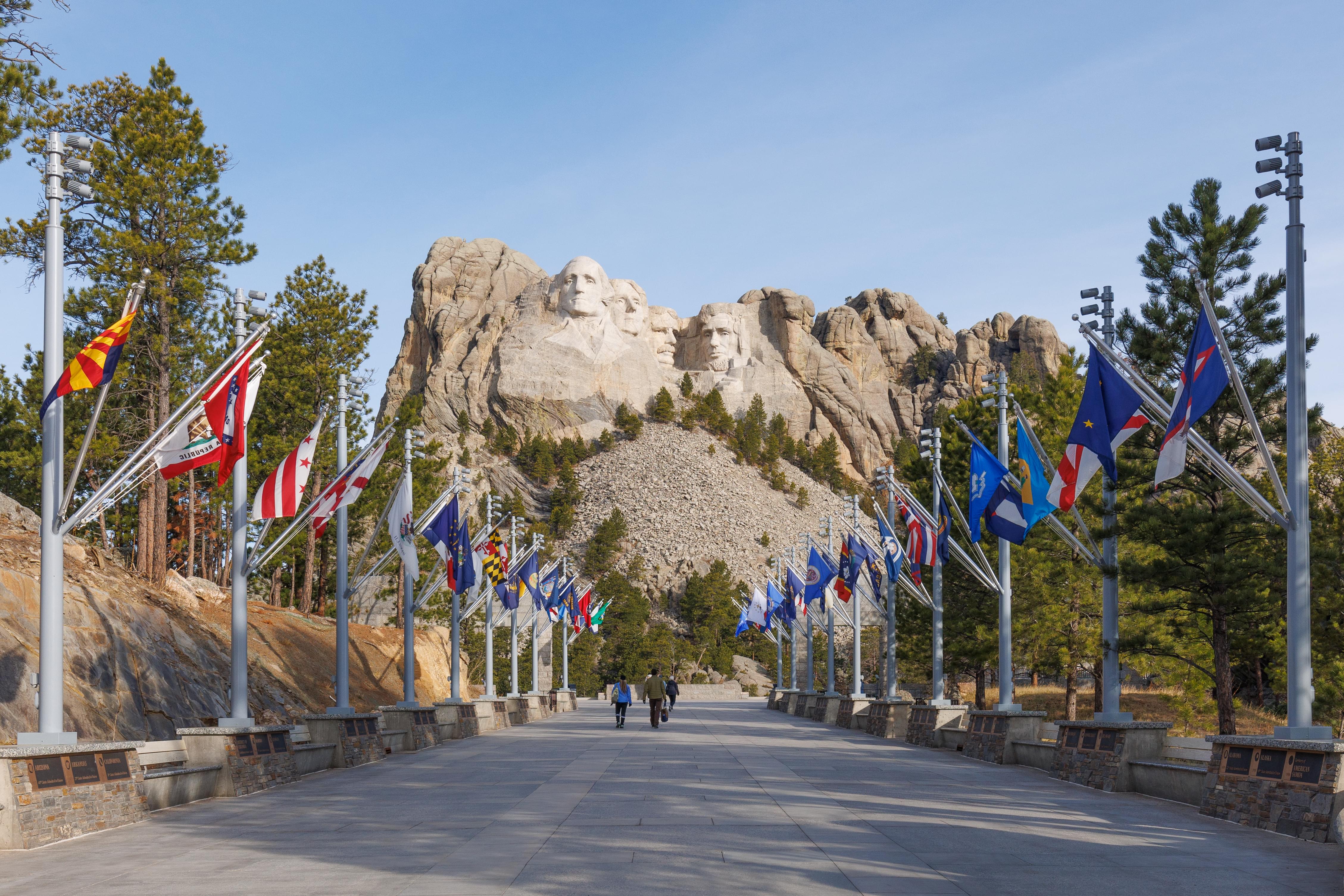
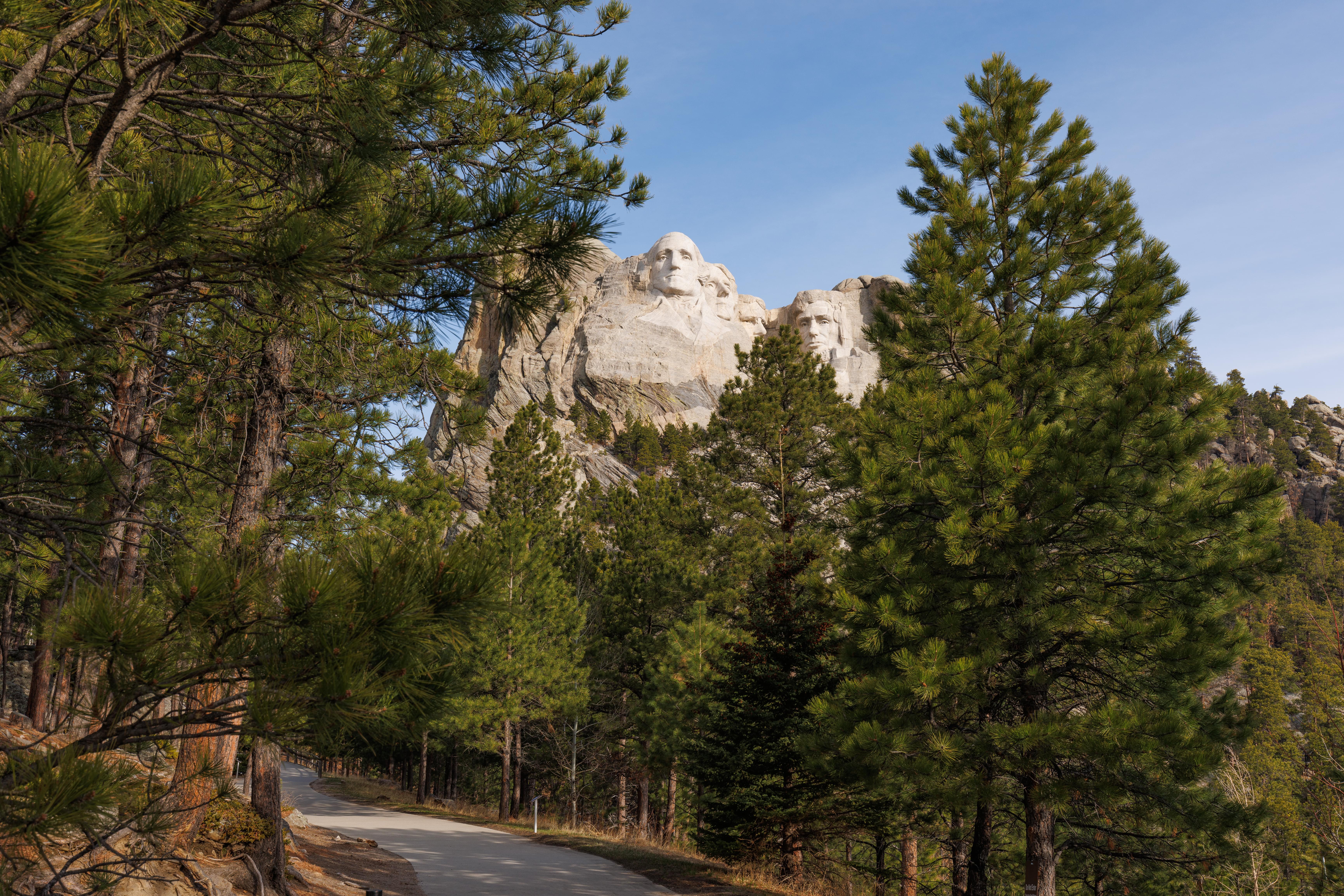
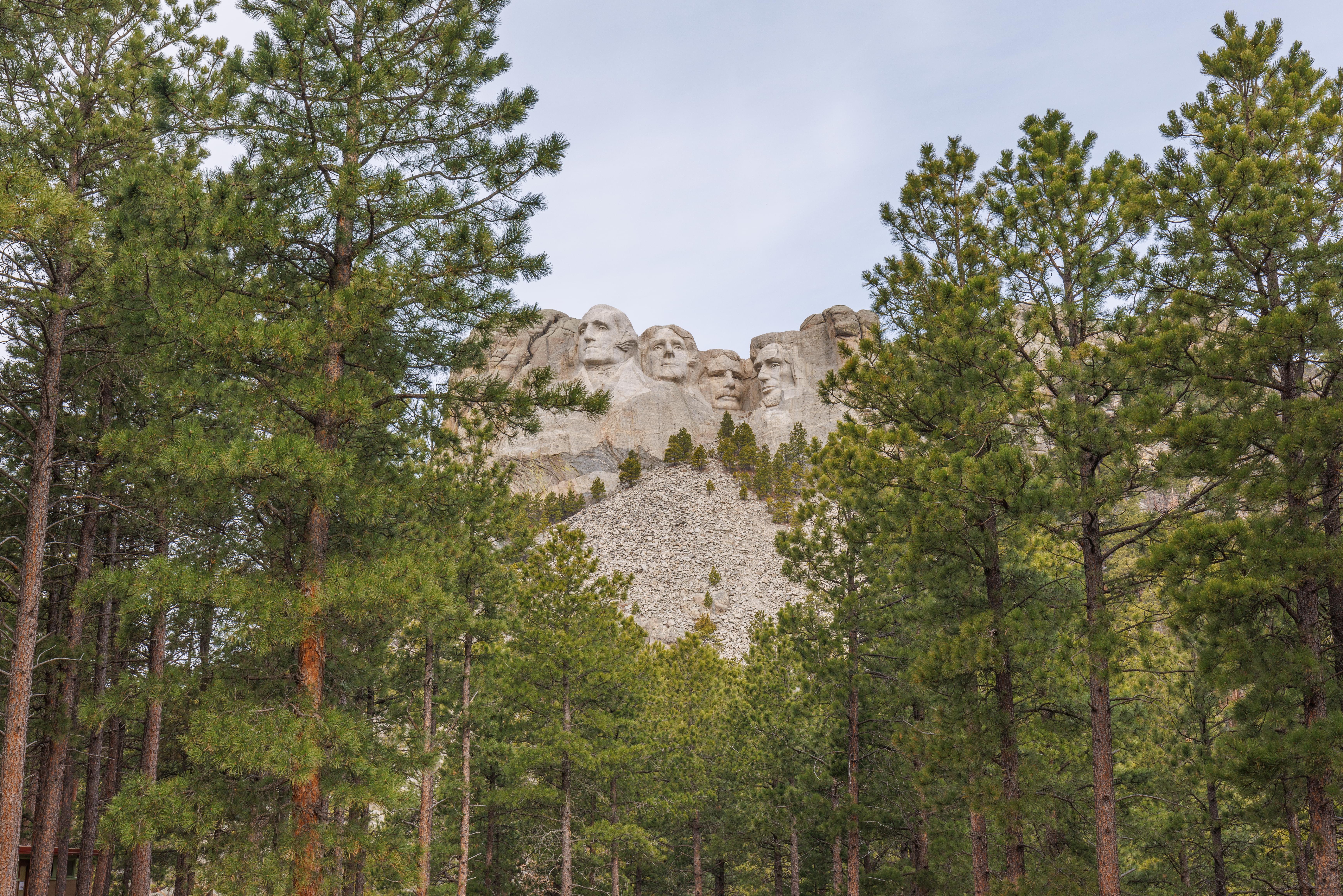
The view upon exiting the parking structure and entering the developed area of the memorial.

After walking by a visitor center, gift shop, and food concession, a long walkway is flanked by the flags of the 50 states as well as the US territories and Washington DC. The flags are in an odd alphabetical order where each trio of flags is ordered relative to each other trio but the three individual flags are ordered left to right when facing the flags from the middle of the walkway.
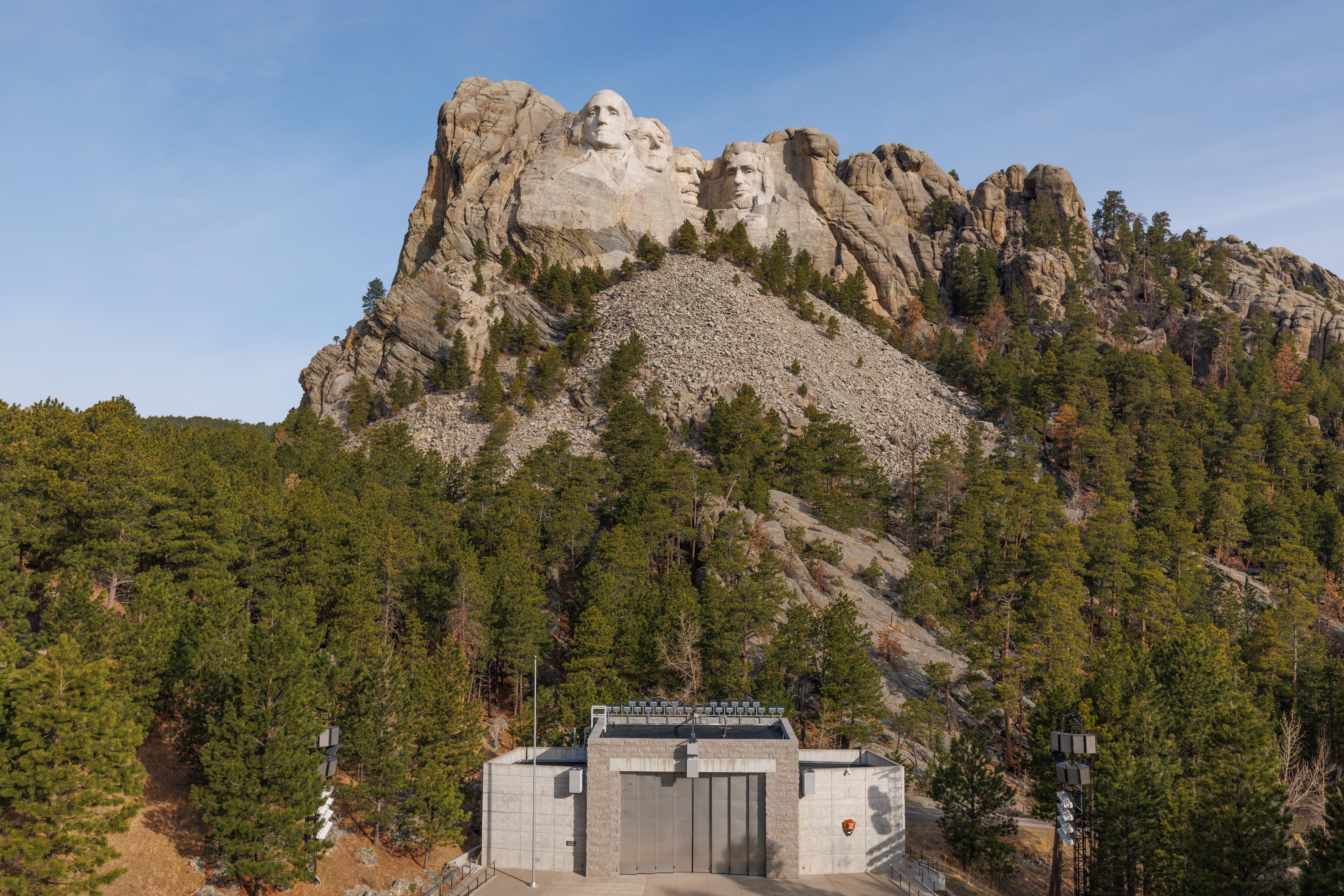
After walking past the flags, there is a large viewing area which sits atop a visitor center below. There is also an amphitheater with many seats as well as a stage in front of the presidents.
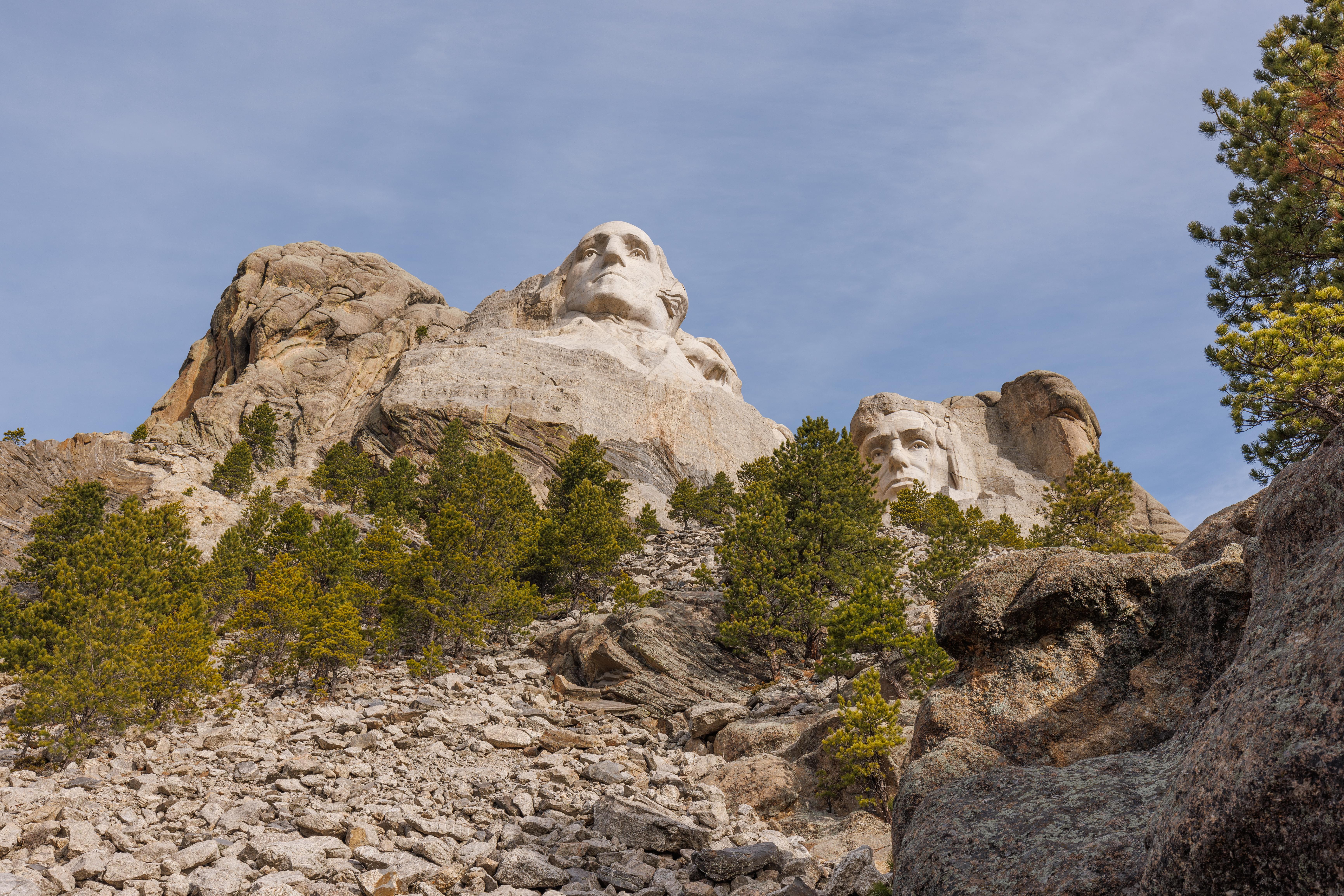
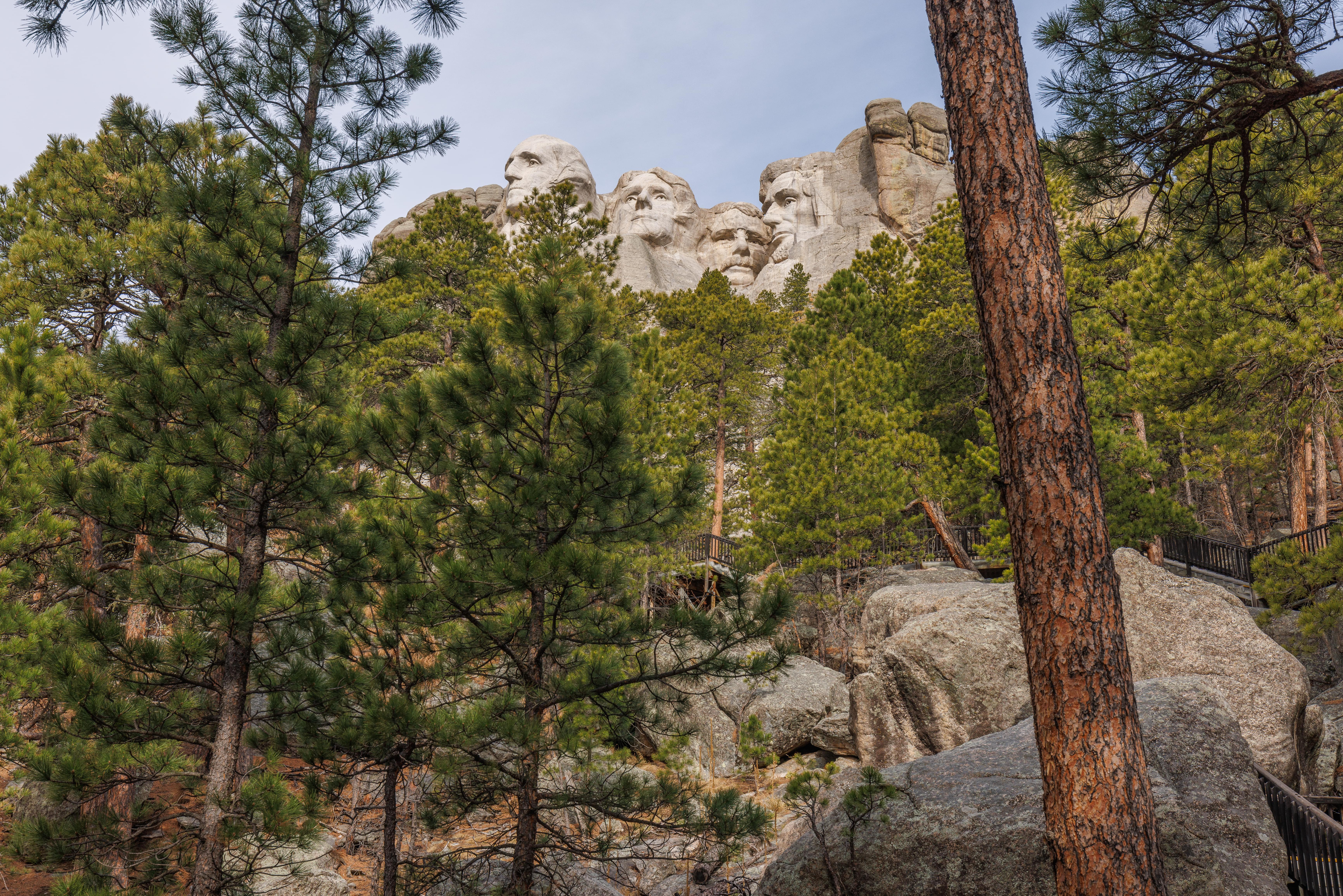
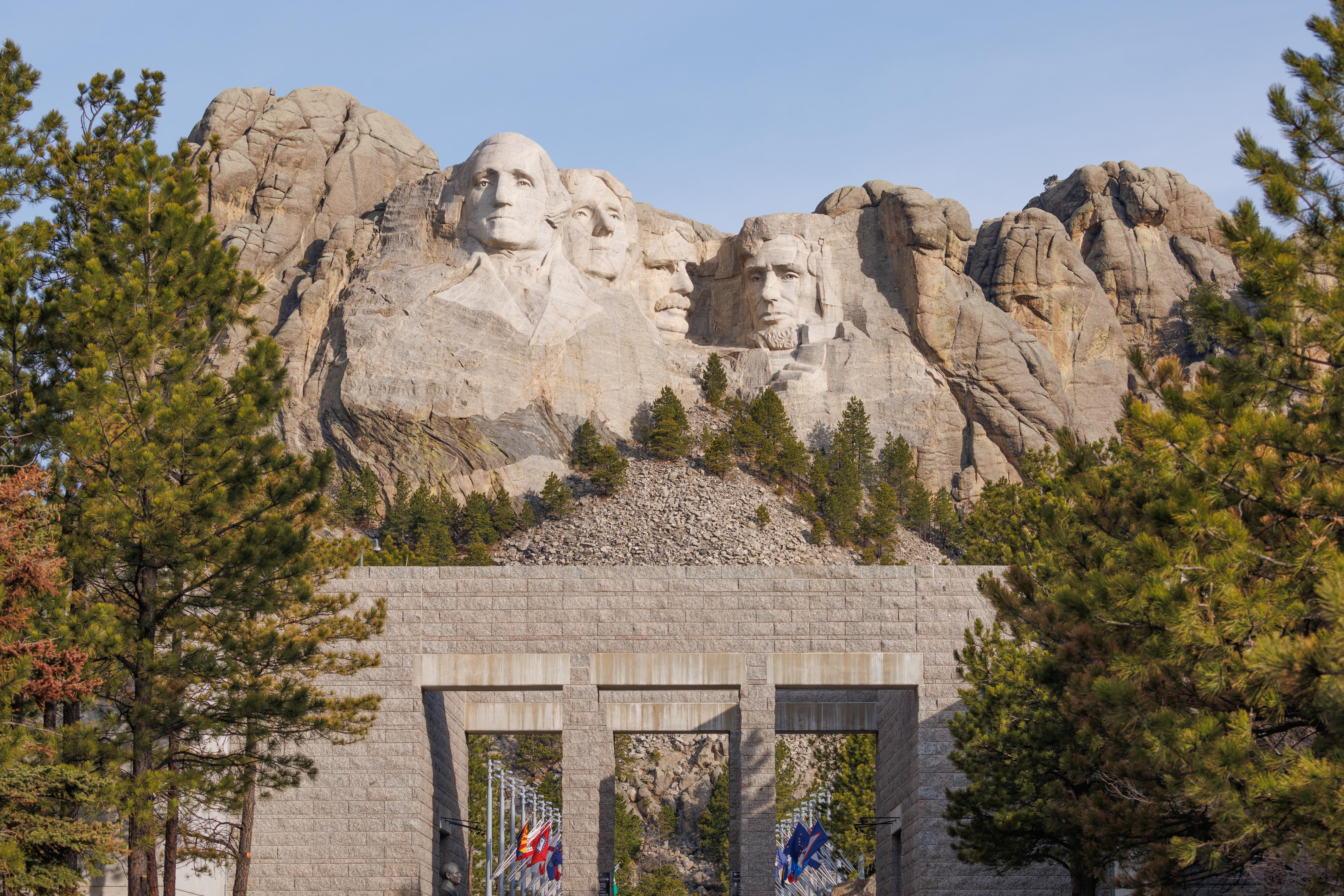
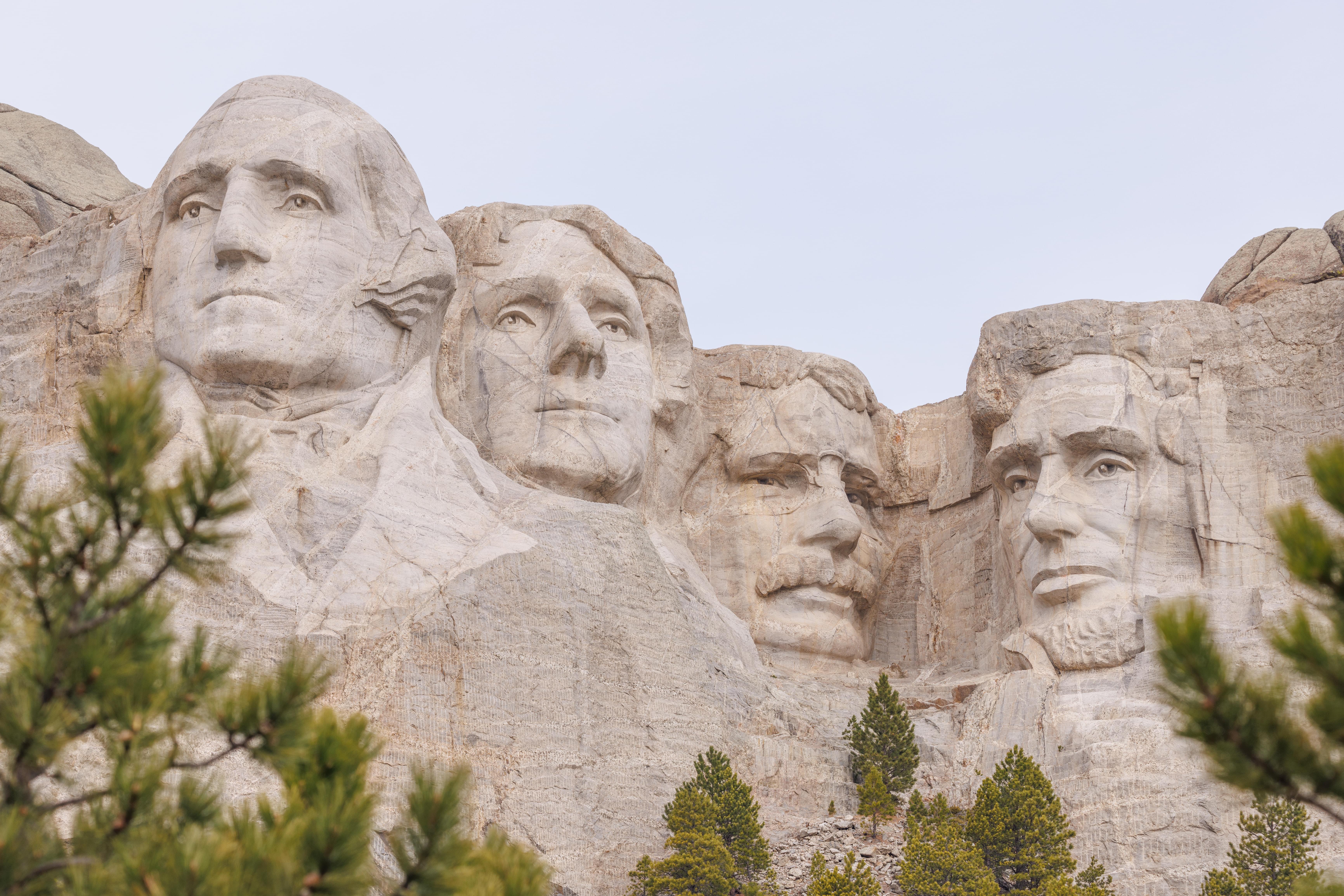
There is a short half mile or so loop trail, the Presidential Trail, which starts on either end of the viewing deck and runs just below the debris field created as a result of the sculpting process. It involved the use of dynamite to blow away the softer layers of rock before revealing granite suitable for sculpting. The trail provides various views of the four presidents.
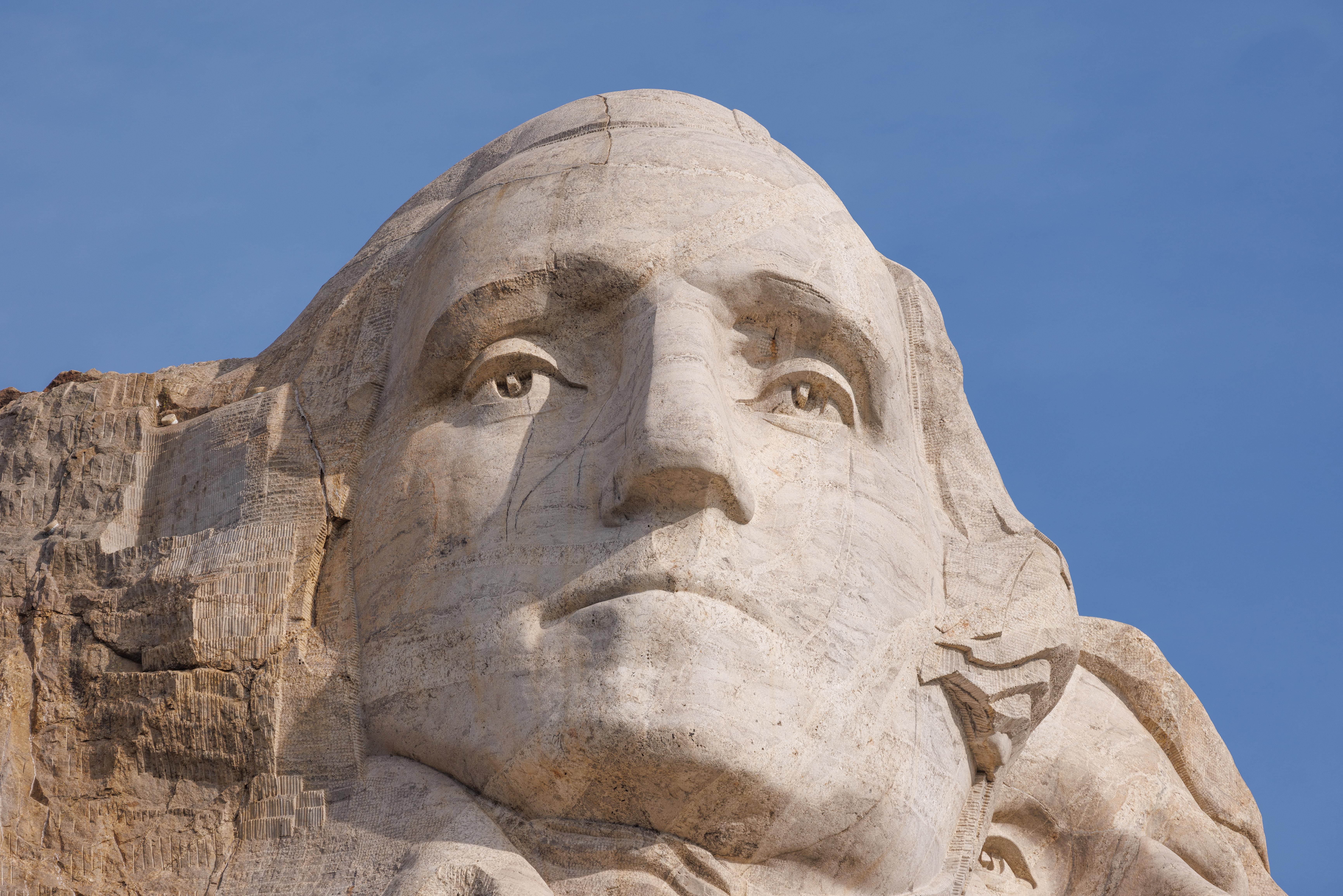
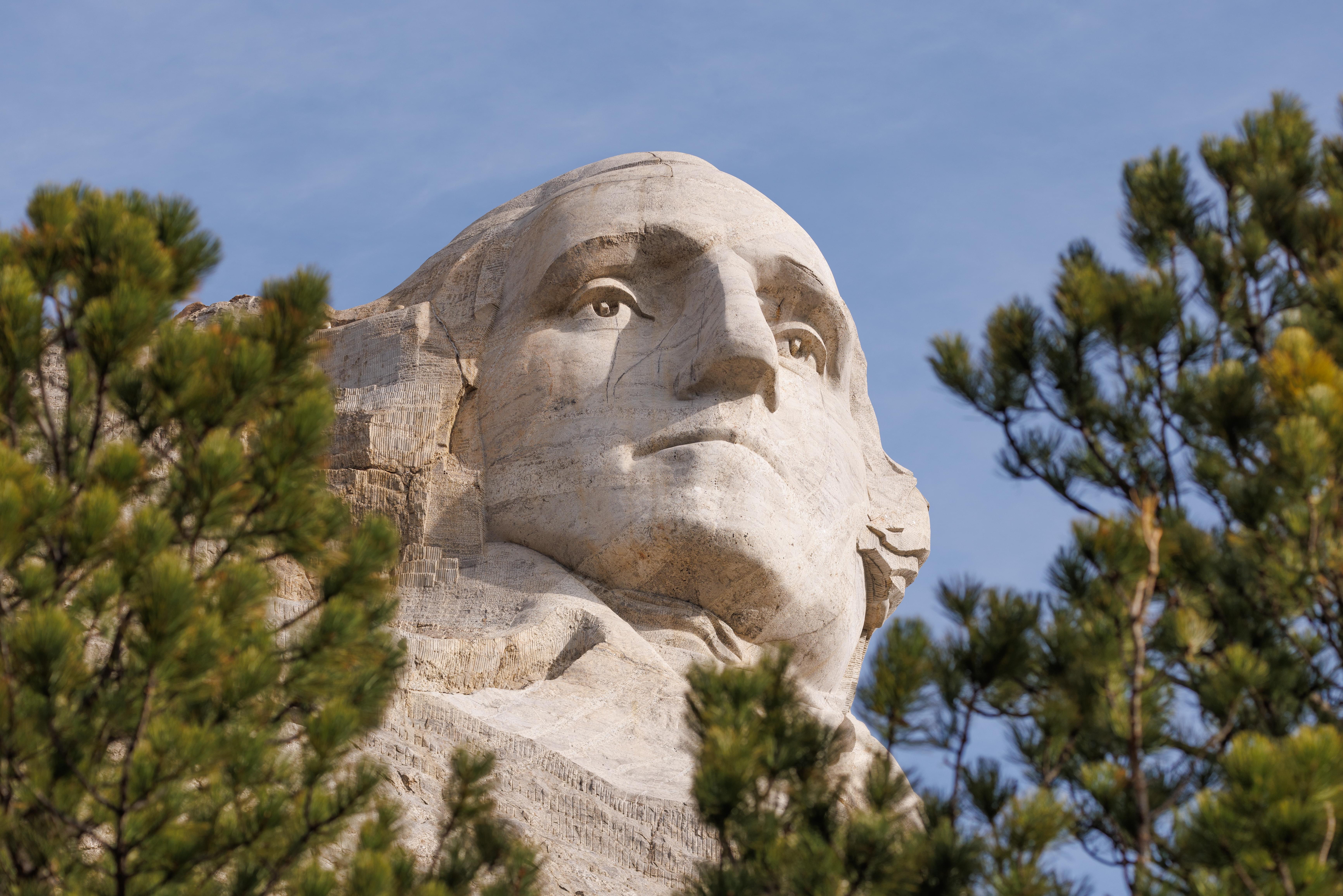
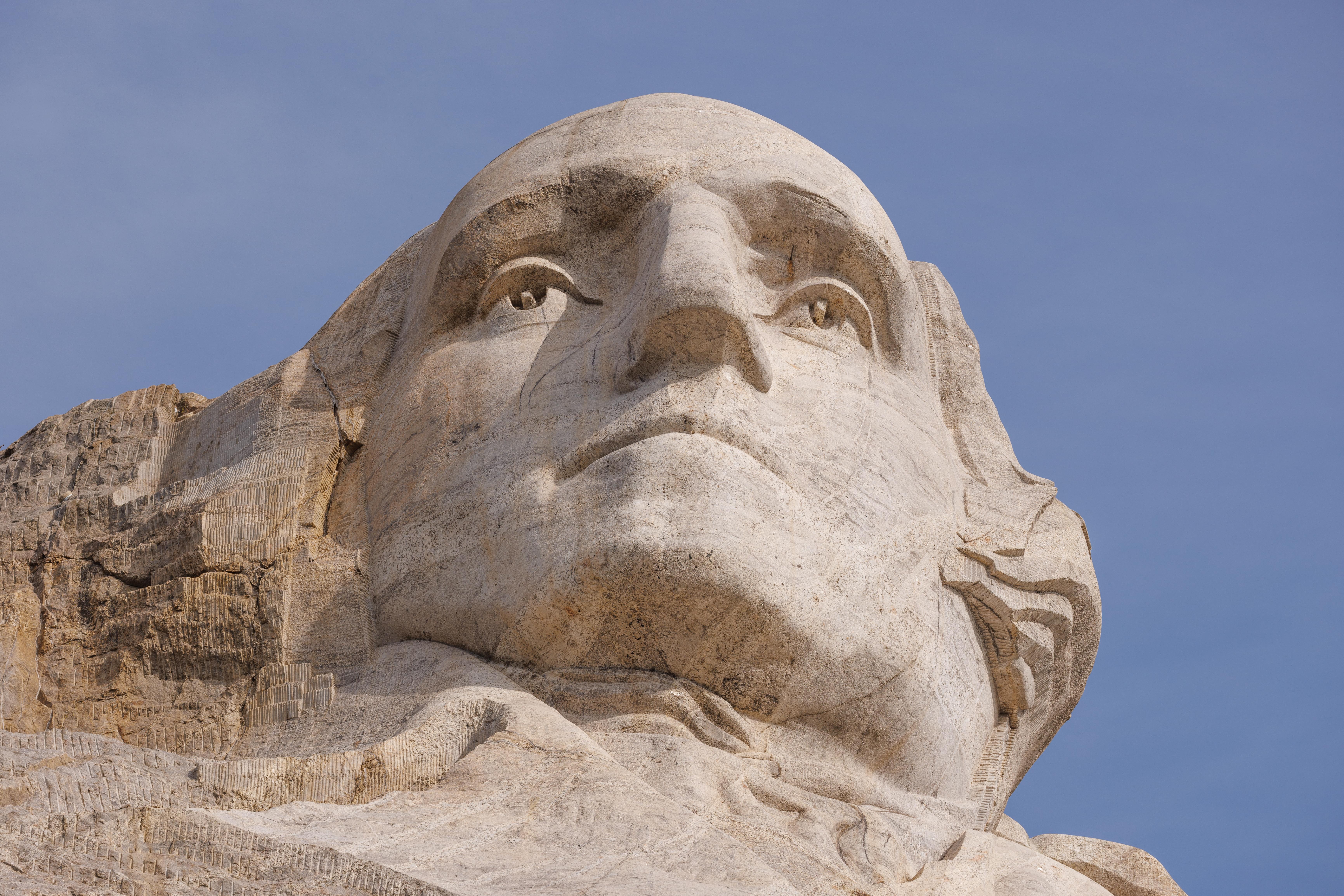
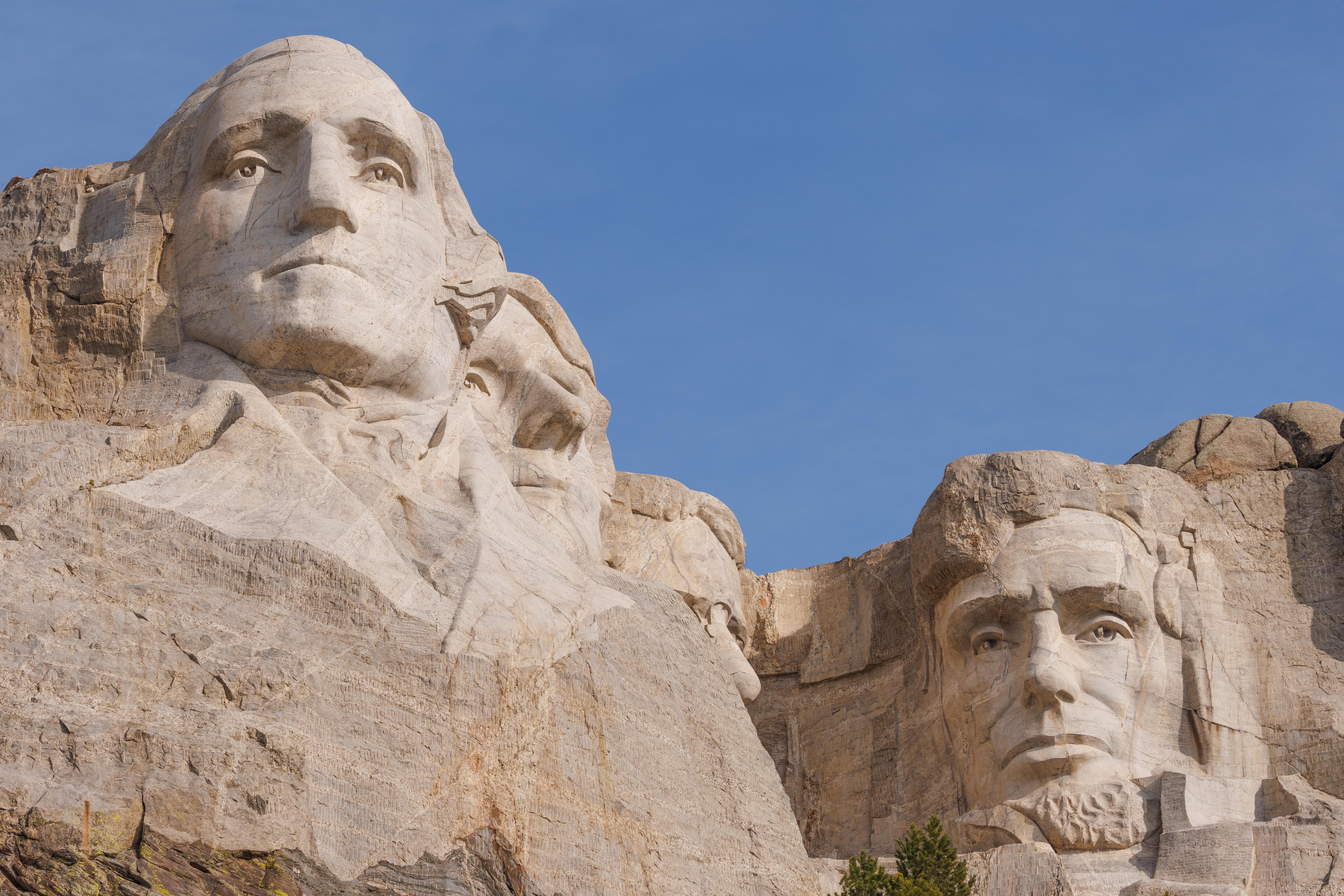
The trail provides various views of President Washington.
As well as President Lincoln. Presidents Jefferson and Teddy Roosevelt aren’t as visible from close up because they are offset to the rear a bit relative to the other two.
A telephoto view of some of the flat areas that are outside of the sculpted heads.
The appearance of the monument varies greatly depending on the light as well as viewing angle. The light was more uniform when we left and coming from a better direction. Earlier on in the morning Lincoln was casting a shadow on Roosevelt.
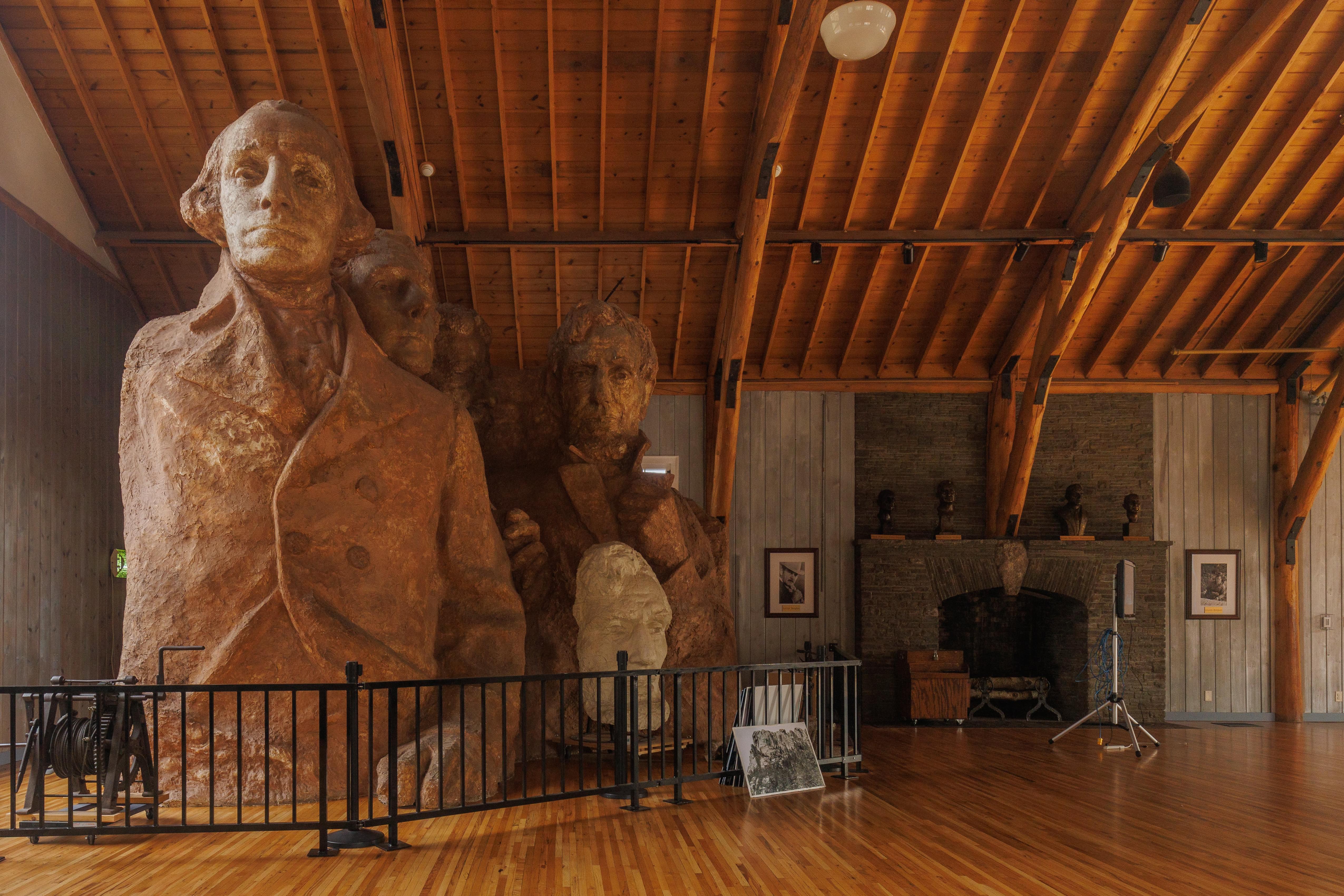
There is a studio on the Presidential Trail which contains artifacts from Gutzon Borglum, the sculptor of the monument. Unfortunately it only opens during the busy summer season. Looking thorough the window, we saw the 1/12th scale sculptures that were created by Borglum to aid in creating the full sized memorial.
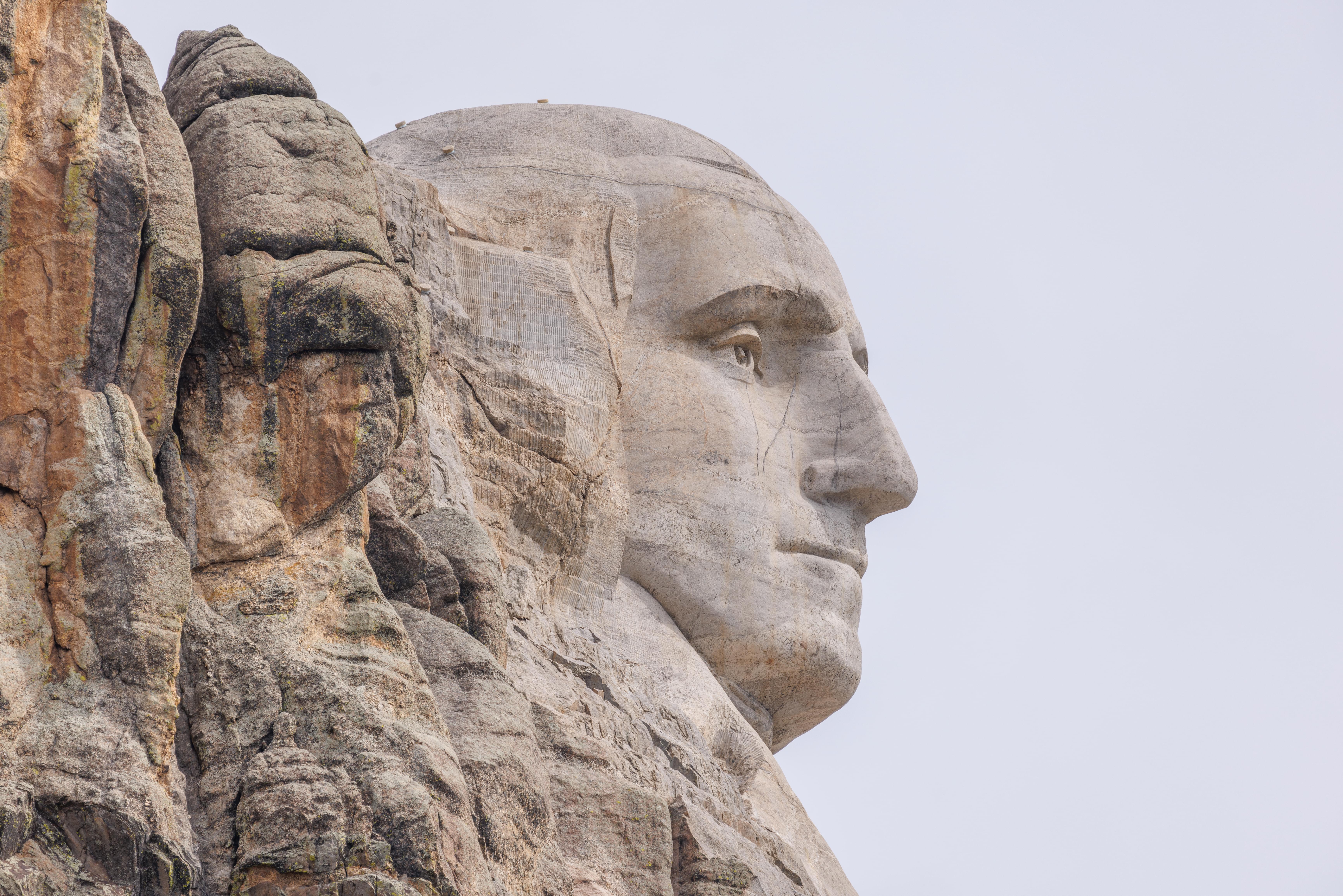
There is a viewpoint on the highway that provides a profile view of Washington. None of the other presidents can be seen from this angle.
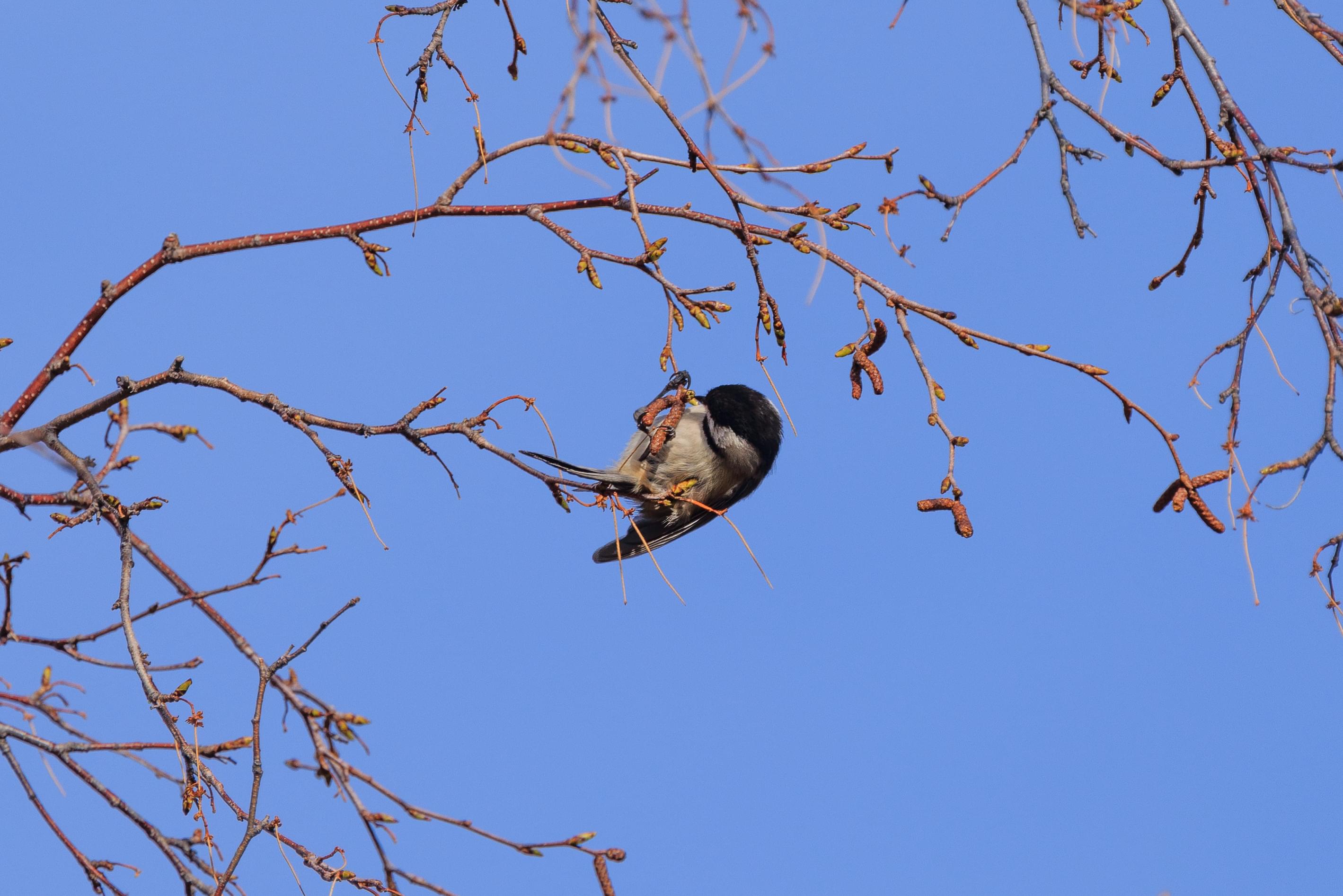
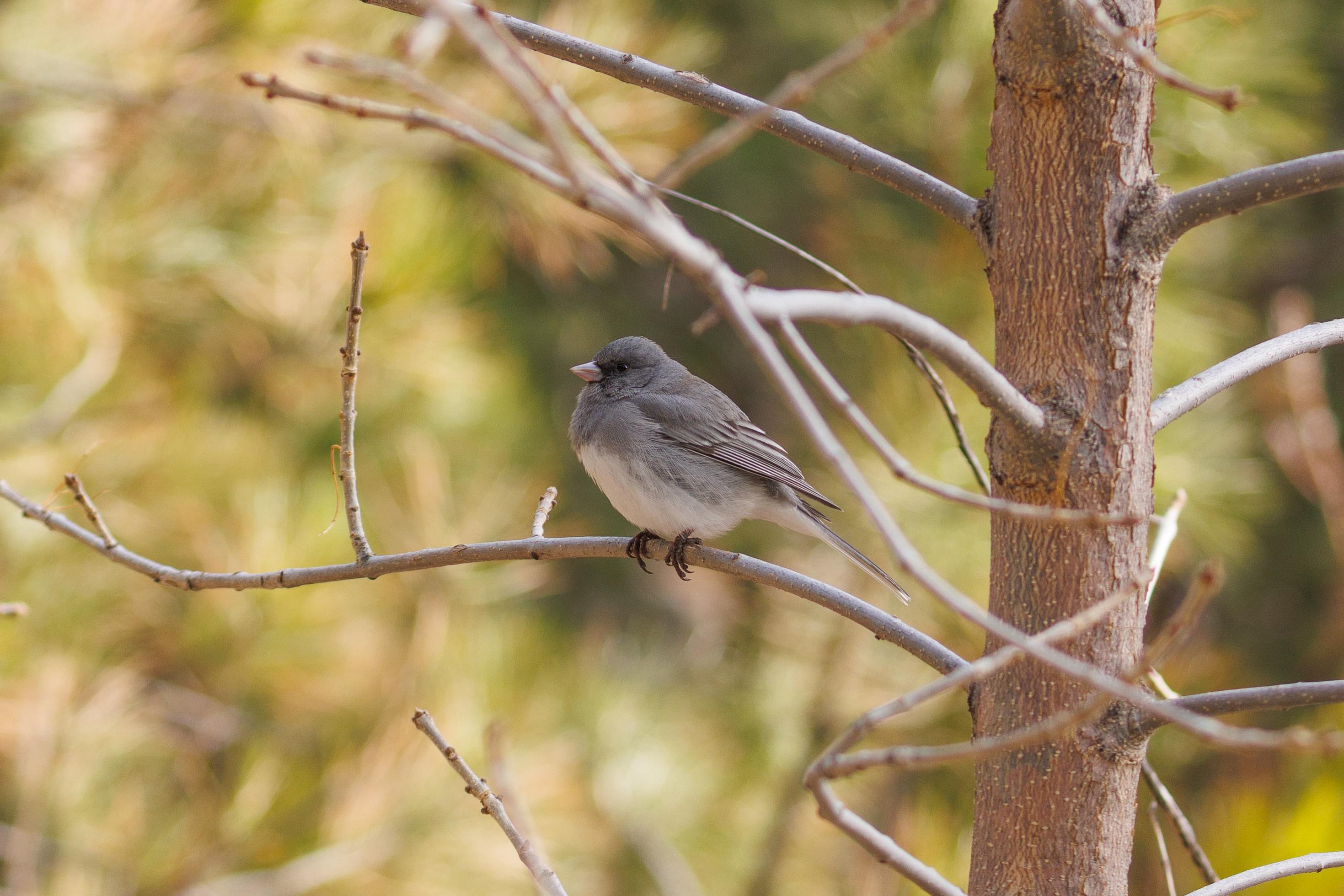
Mount Rushmore is located in a wilderness area and is surrounded by forest. We heard birds as we were walking along the Presidential Trail. We were able to photograph a Black-Capped Chickadee and Dark-Eyed Junco. We also saw American Robins. Most of the birds were elusive as usual though.
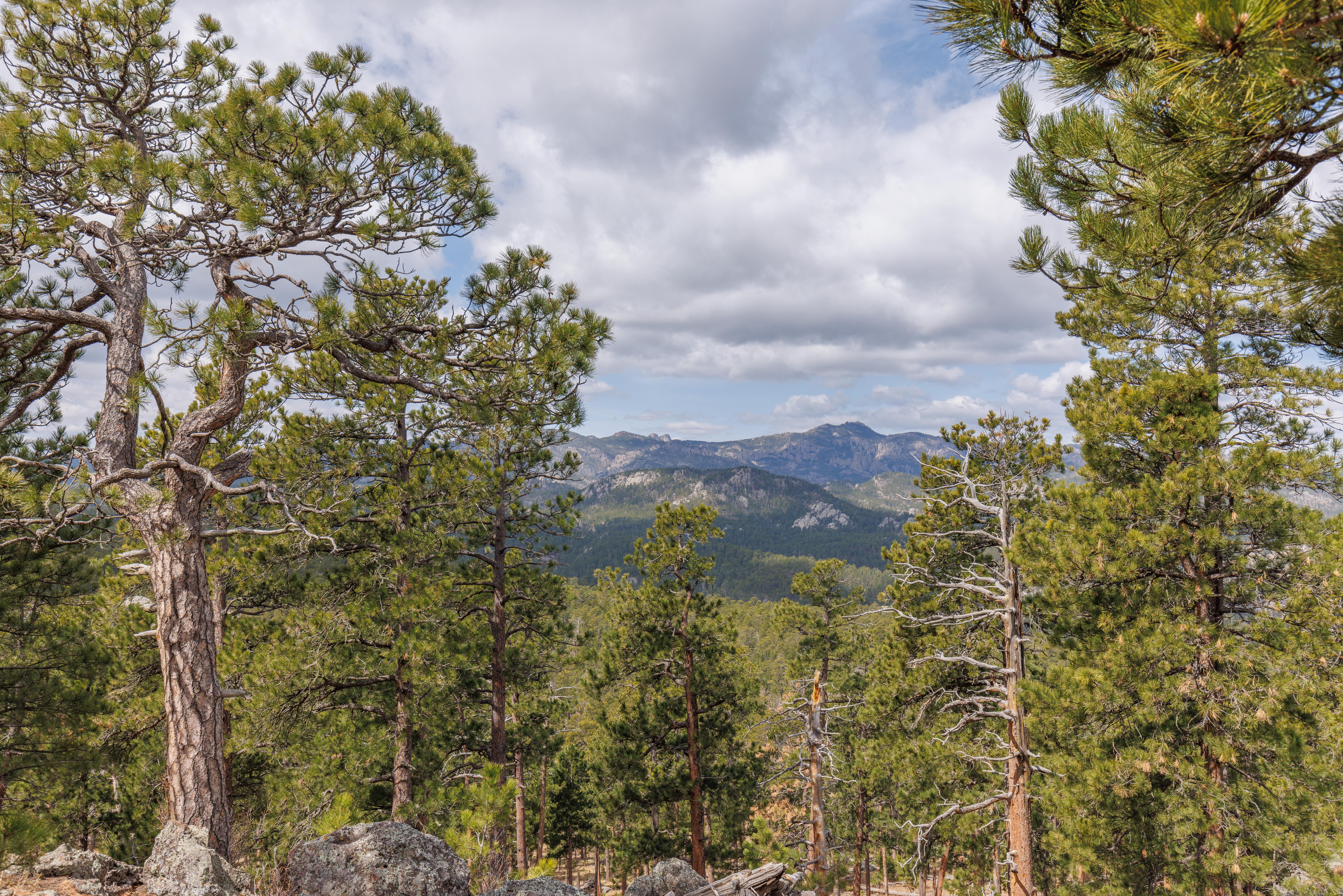
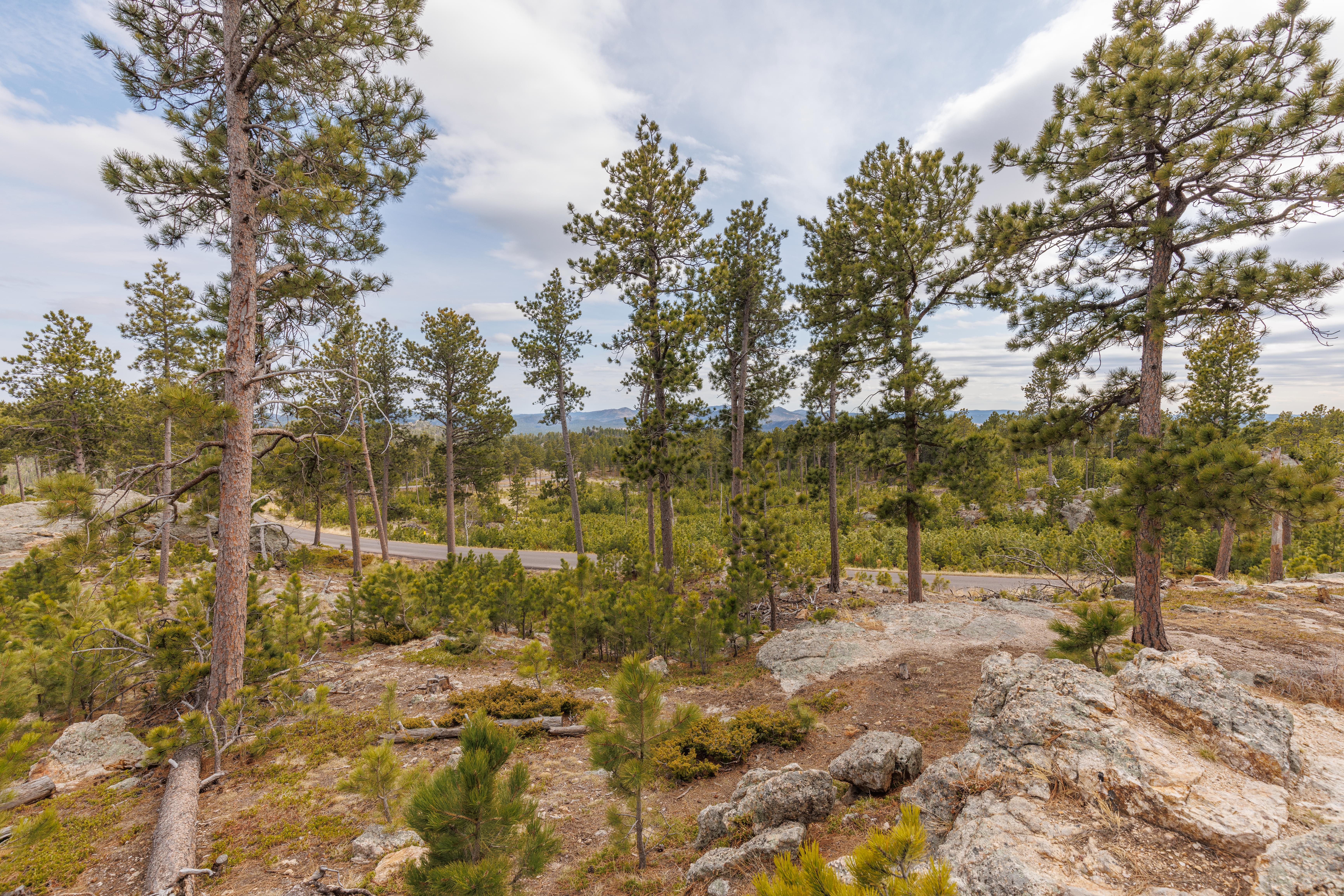
Iron Mountain Road
The scenic Iron Mountain Road, US Highway 16A, runs by Mount Rushmore and Custer State Park.
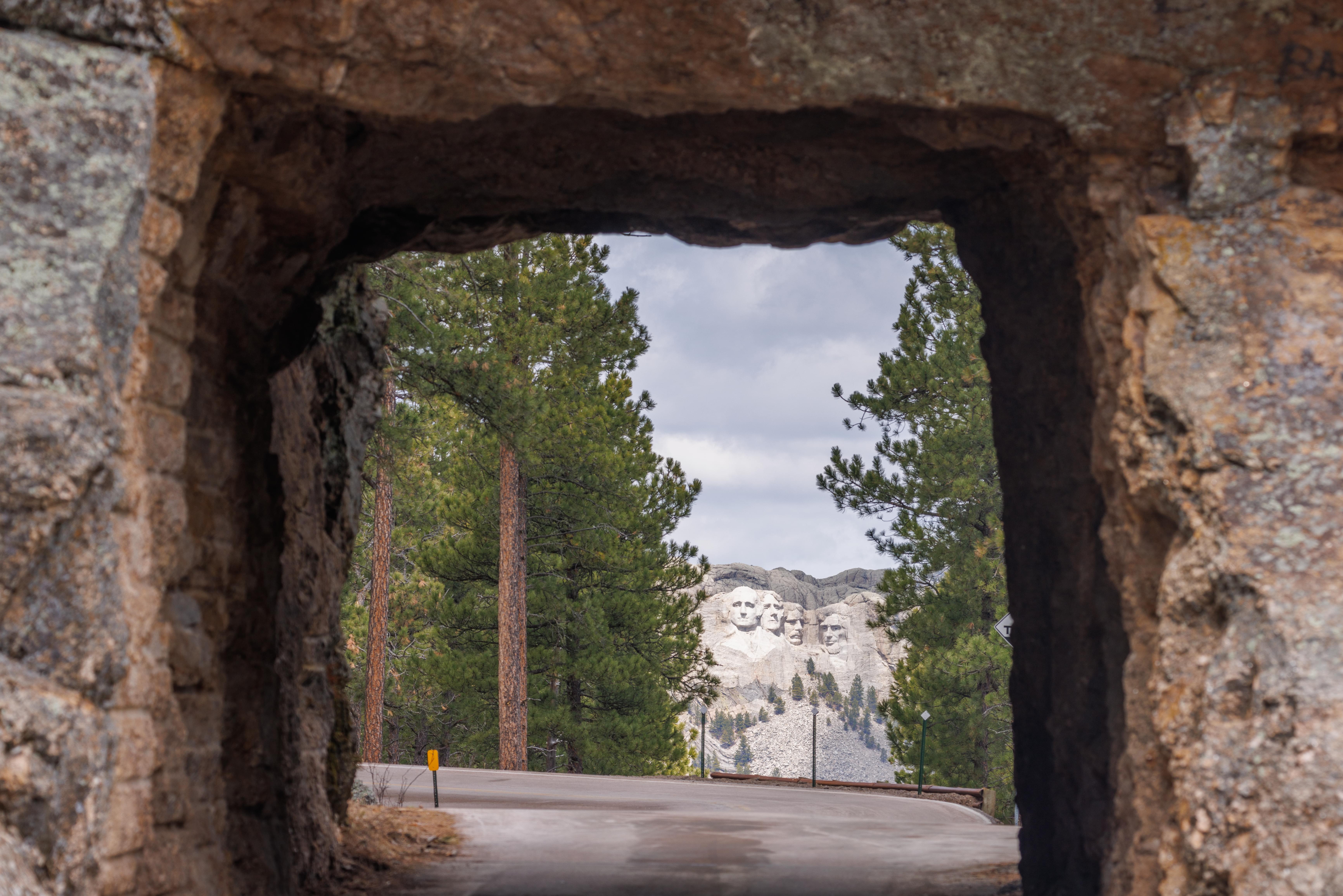
Doane Robinson Tunnel
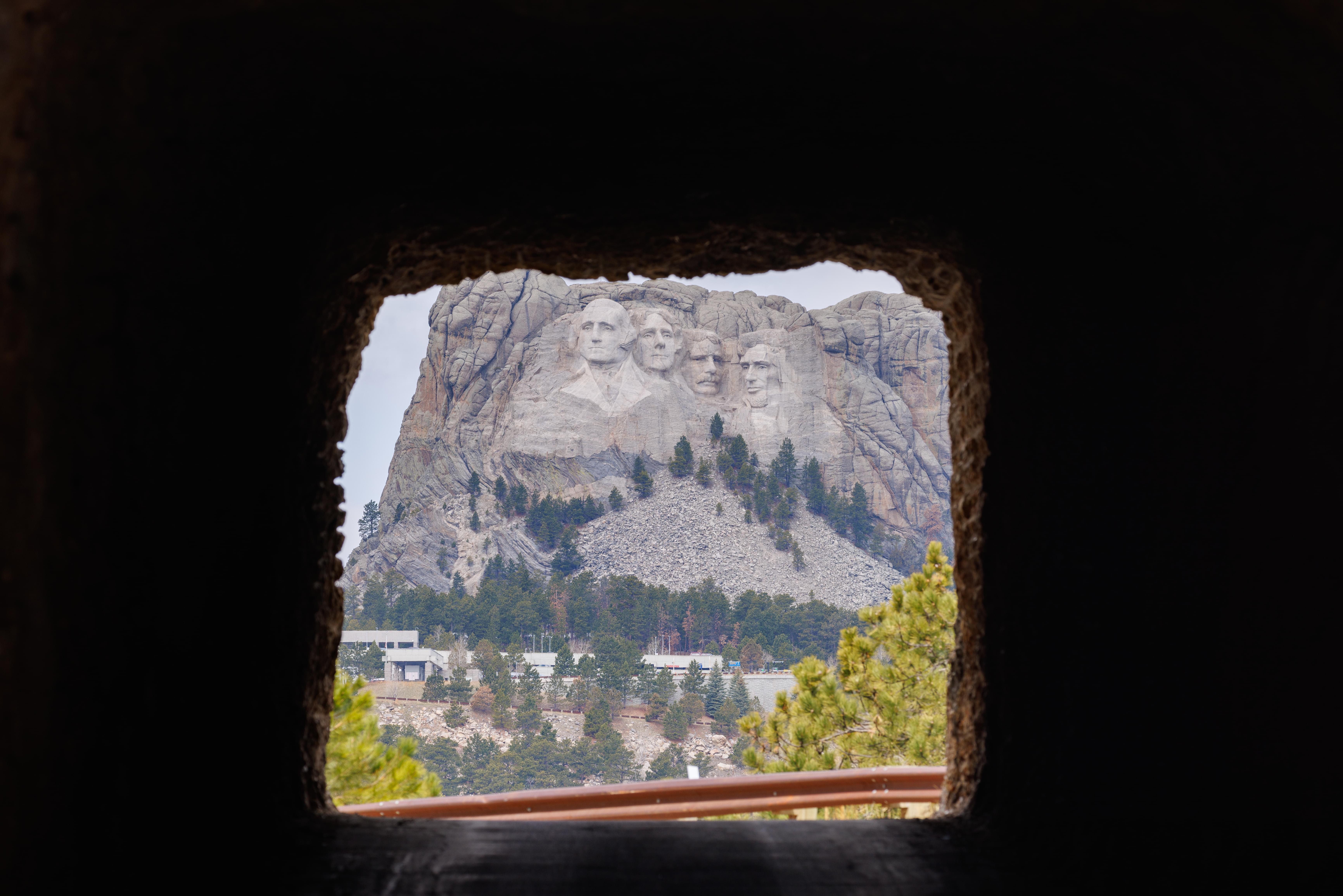
Some of the tunnels are aligned so that Mount Rushmore is visible when looking through! This was the view from the far end of the Doane Robinson Tunnel, the closest one to the monument.
Norbeck Overlook
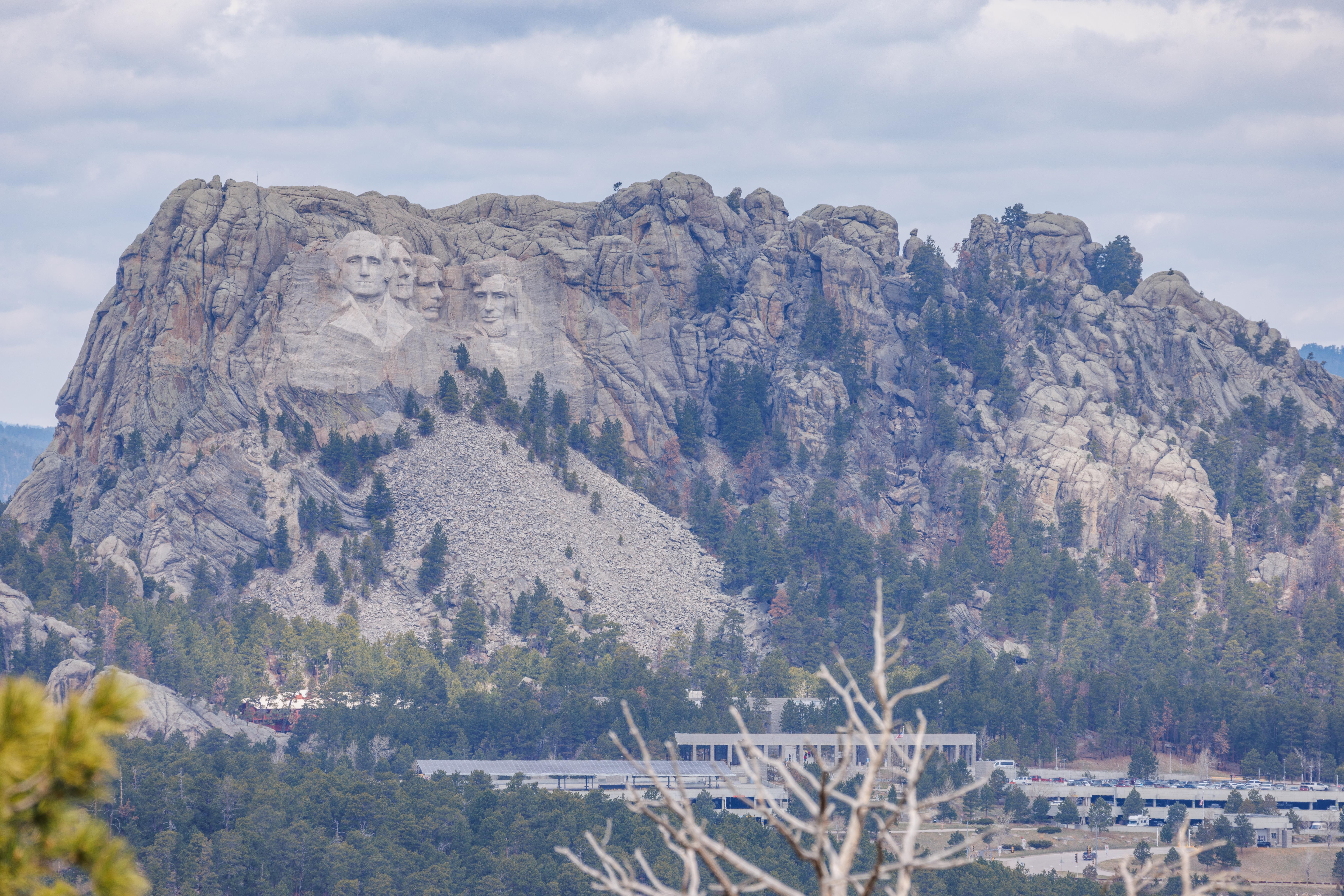
The Norbeck Overlook provides a distant view of all of Mount Rushmore as well as the monument’s structures down below.
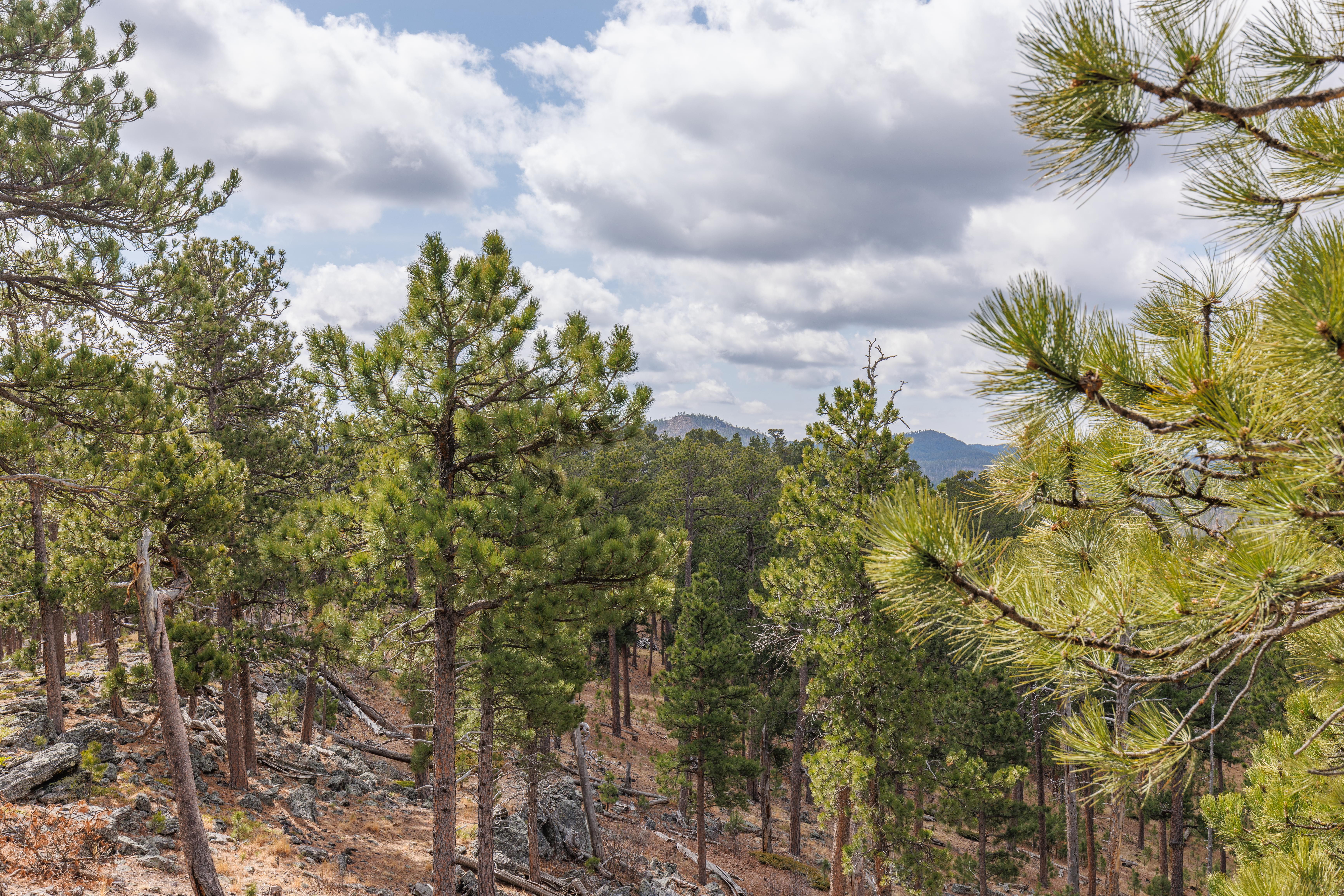
It also has some nice scenery!
Scovel Johnson Tunnel
The Scovel Johnson tunnel also has a view of Mount Rushmore. But it appears rather small as the tunnel is much further away than the first one.
Custer State Park
After arriving at Custer State Park and having lunch at the State Game Lodge, we headed south on the Wildlife Loop. It wasn’t quite a simple loop due to a road closure due to construction. We worked our way past using some of the narrow unpaved roads in the park.
Afterwards, we headed north on the scenic Needles Highway before ending our day at Sylvan Lake.
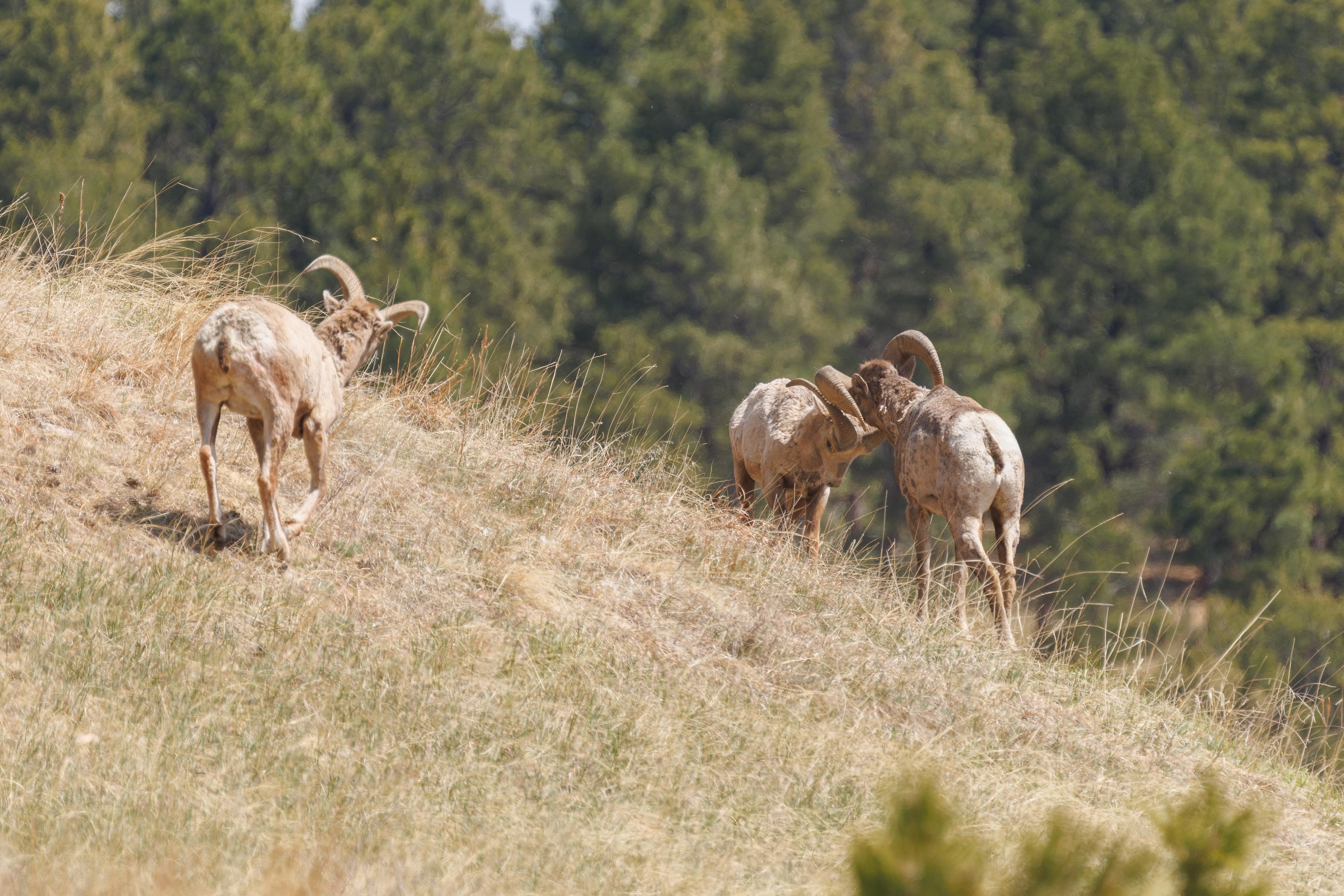
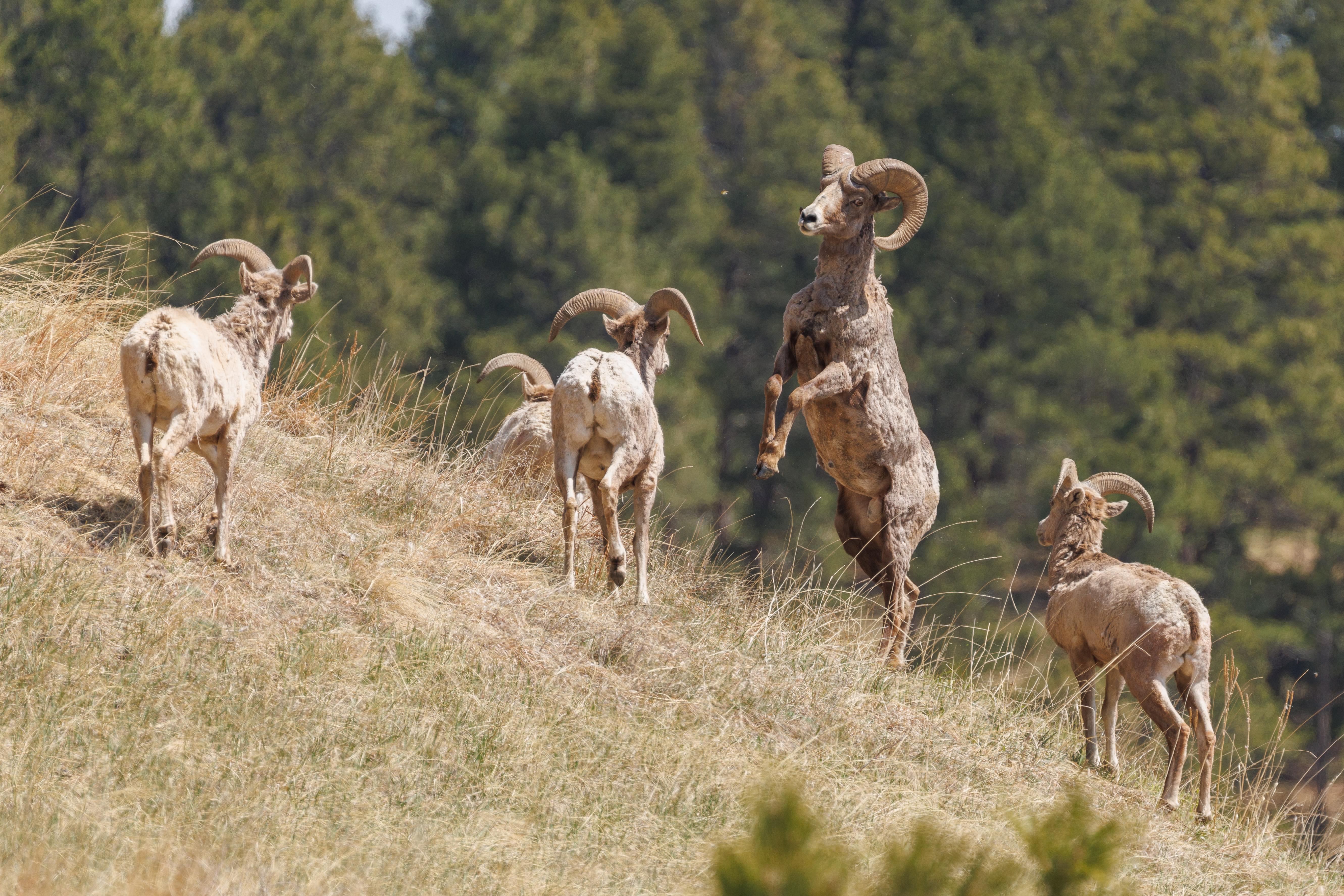
We saw a group of male Bighorn Sheep shortly upon entering Custer State Park! They were walking on the side of a hill next to the road and would have been easy to miss, we only noticed because we saw other vehicles stopped. We’re not familiar with sheep behavior but these appeared to be young males engaged in a bit of play fighting while walking away together.
Wildlife Loop
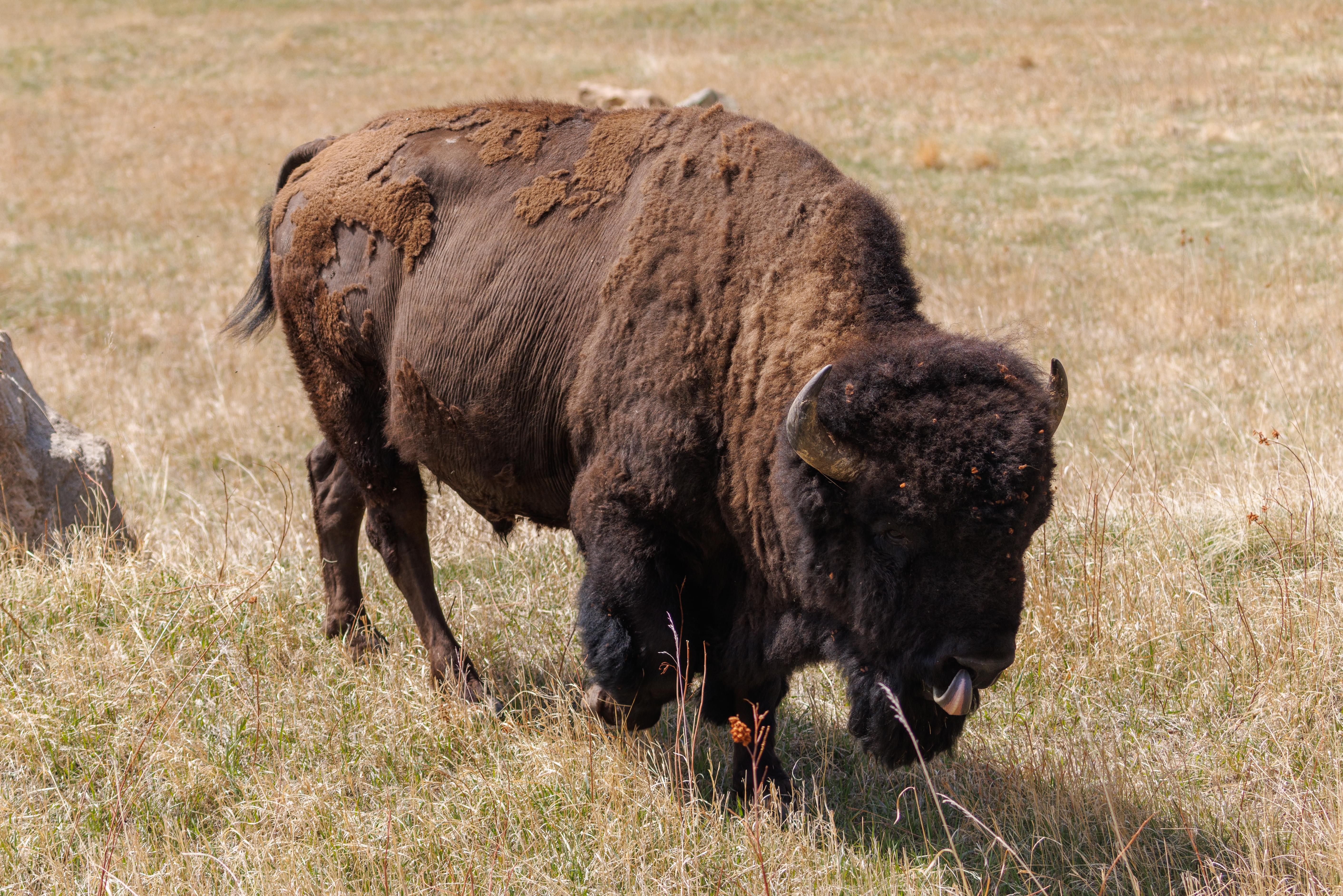
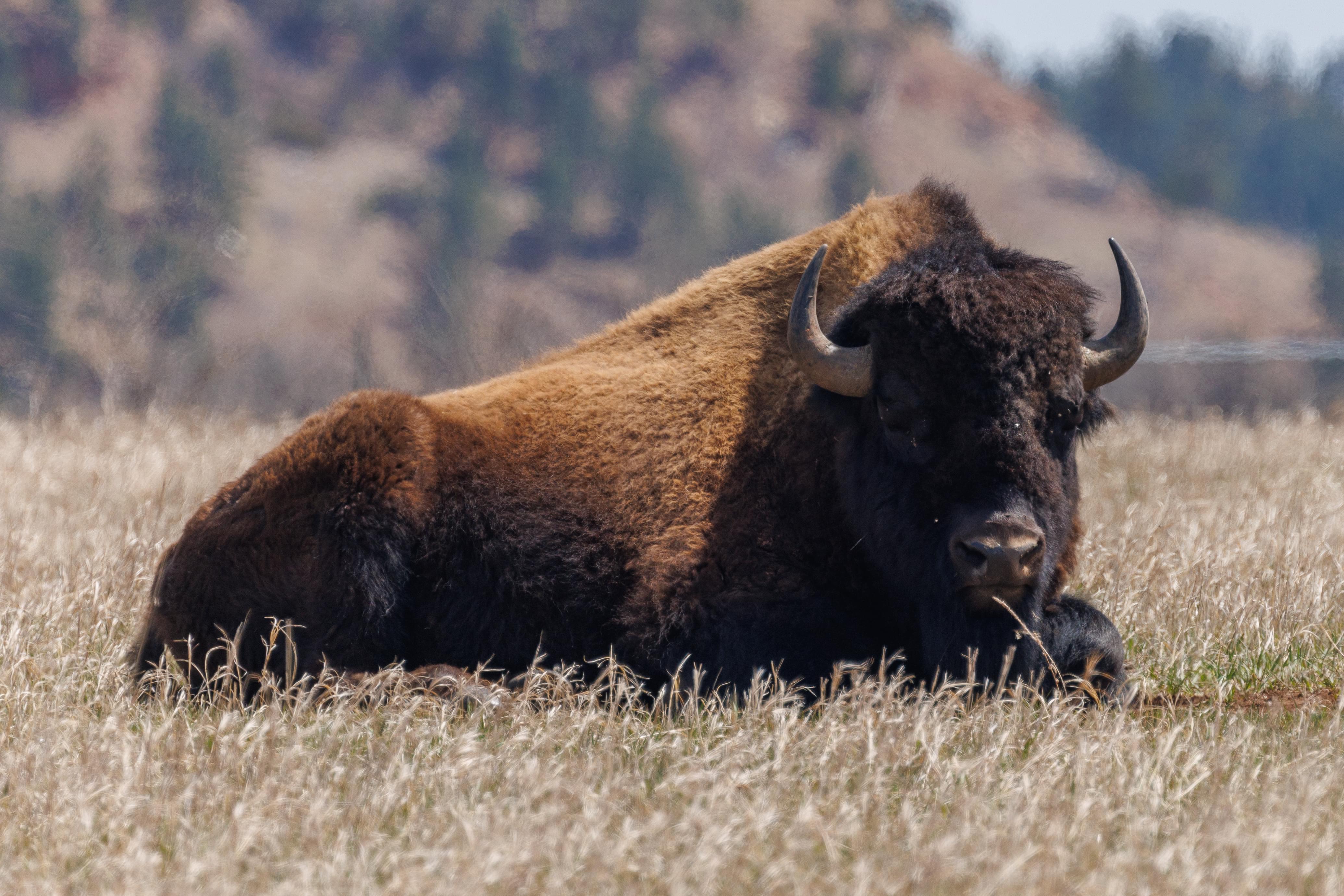
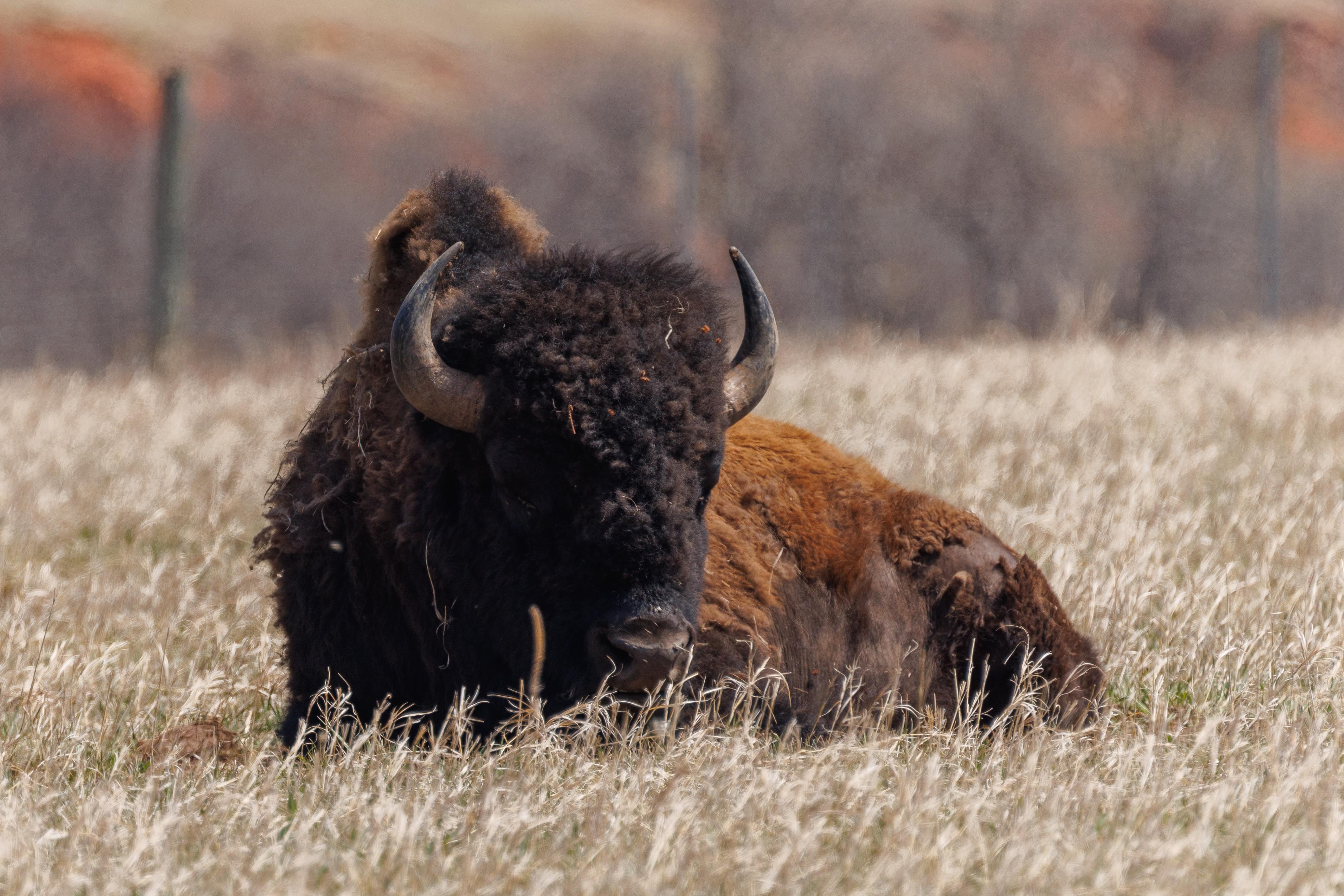
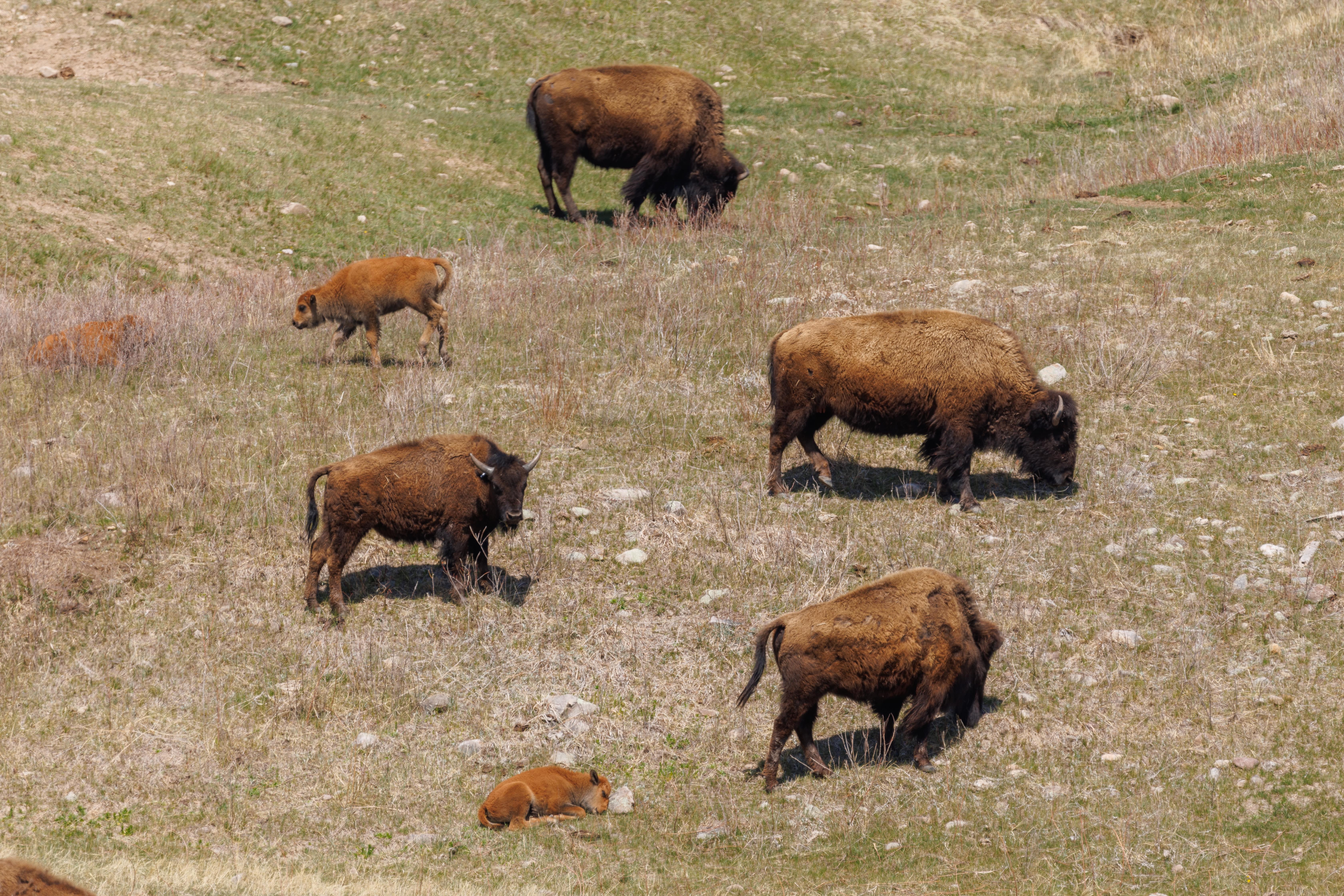
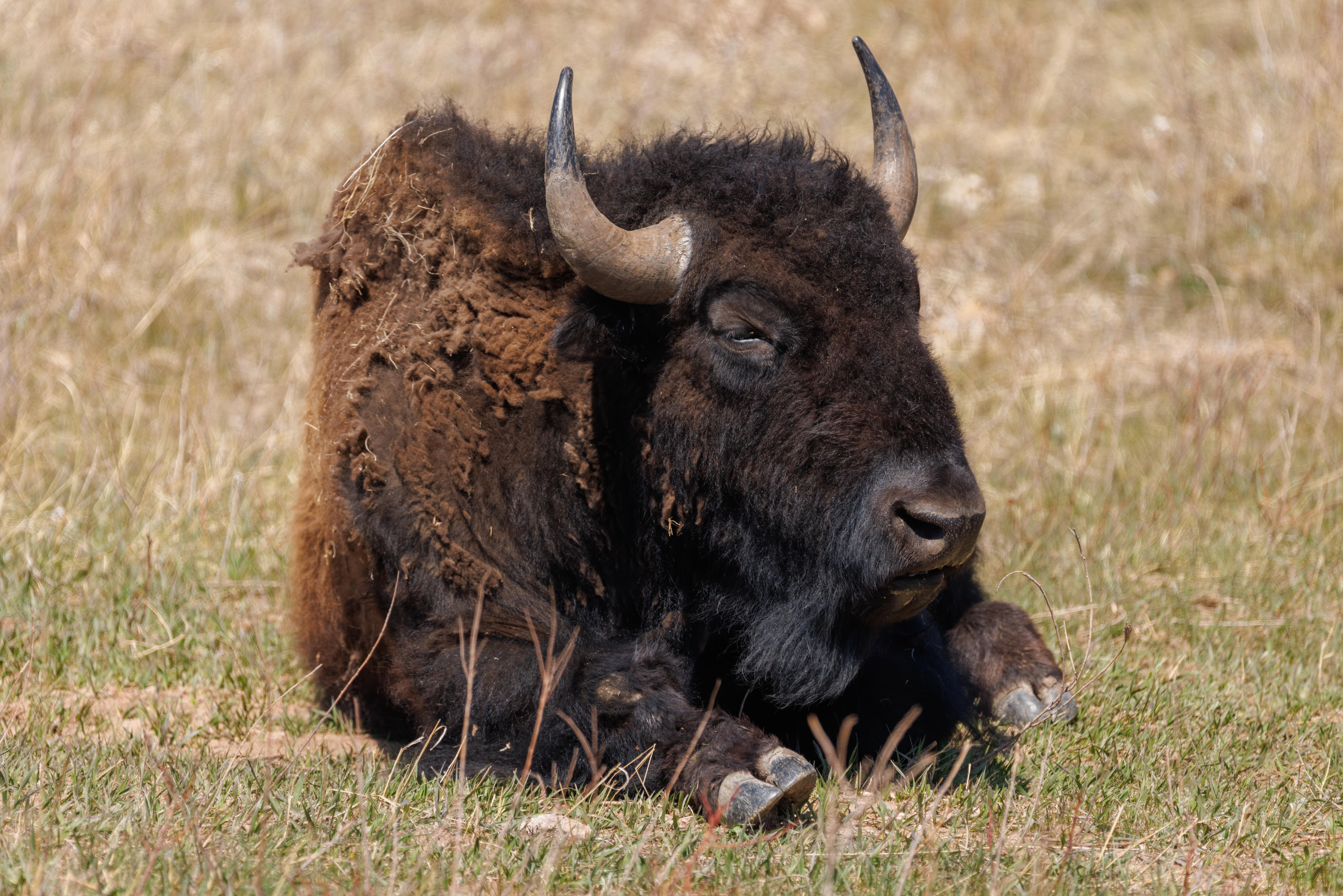
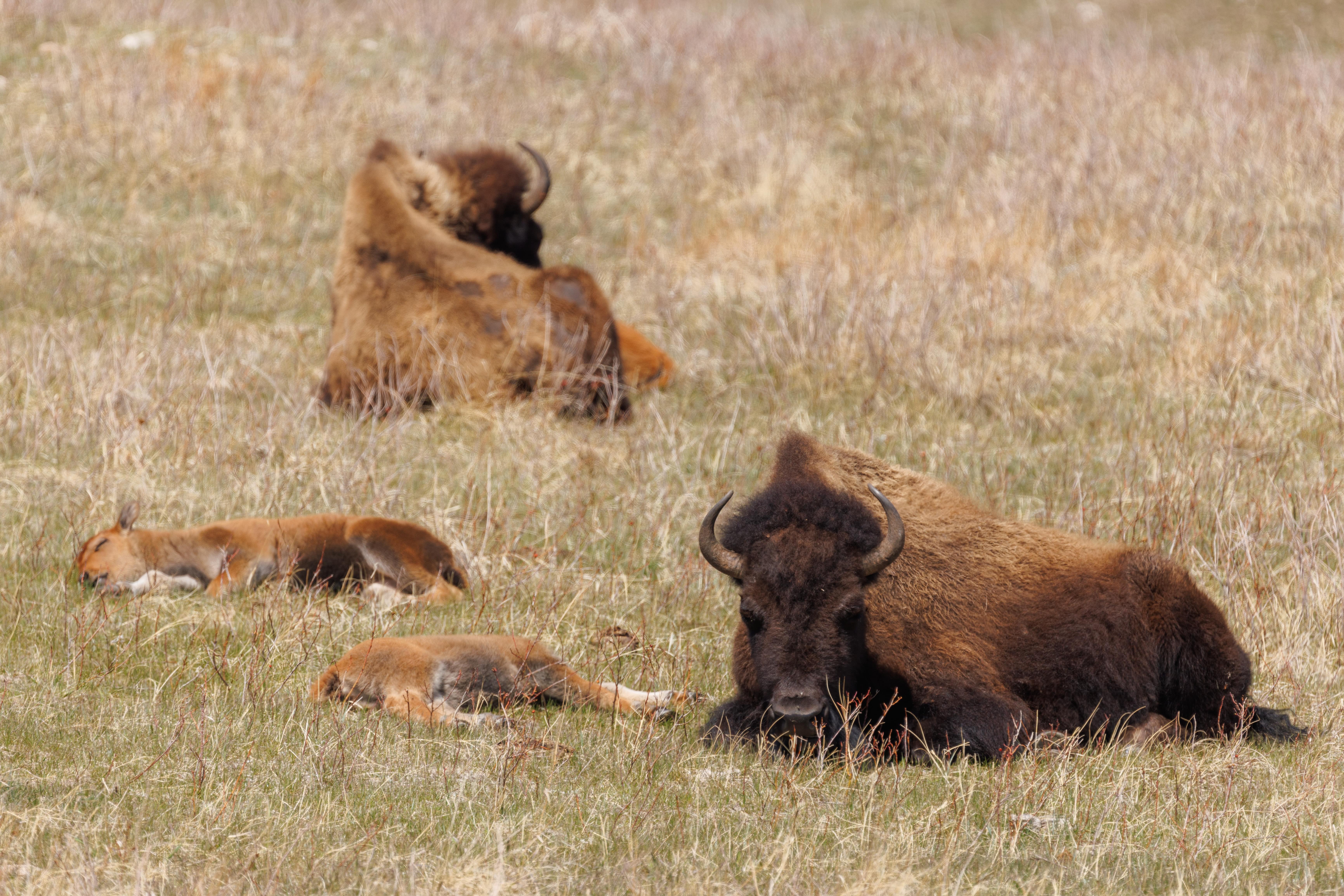
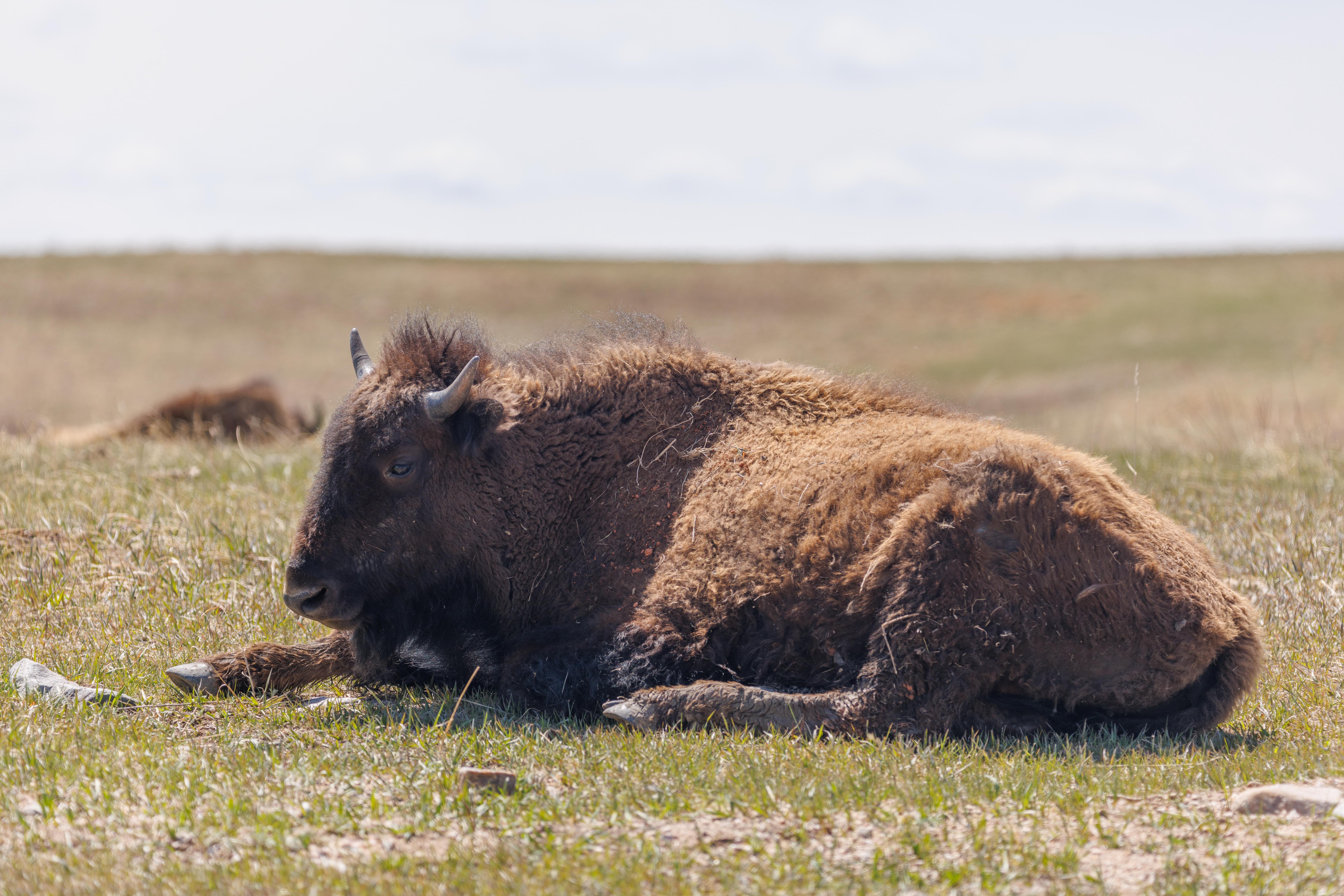
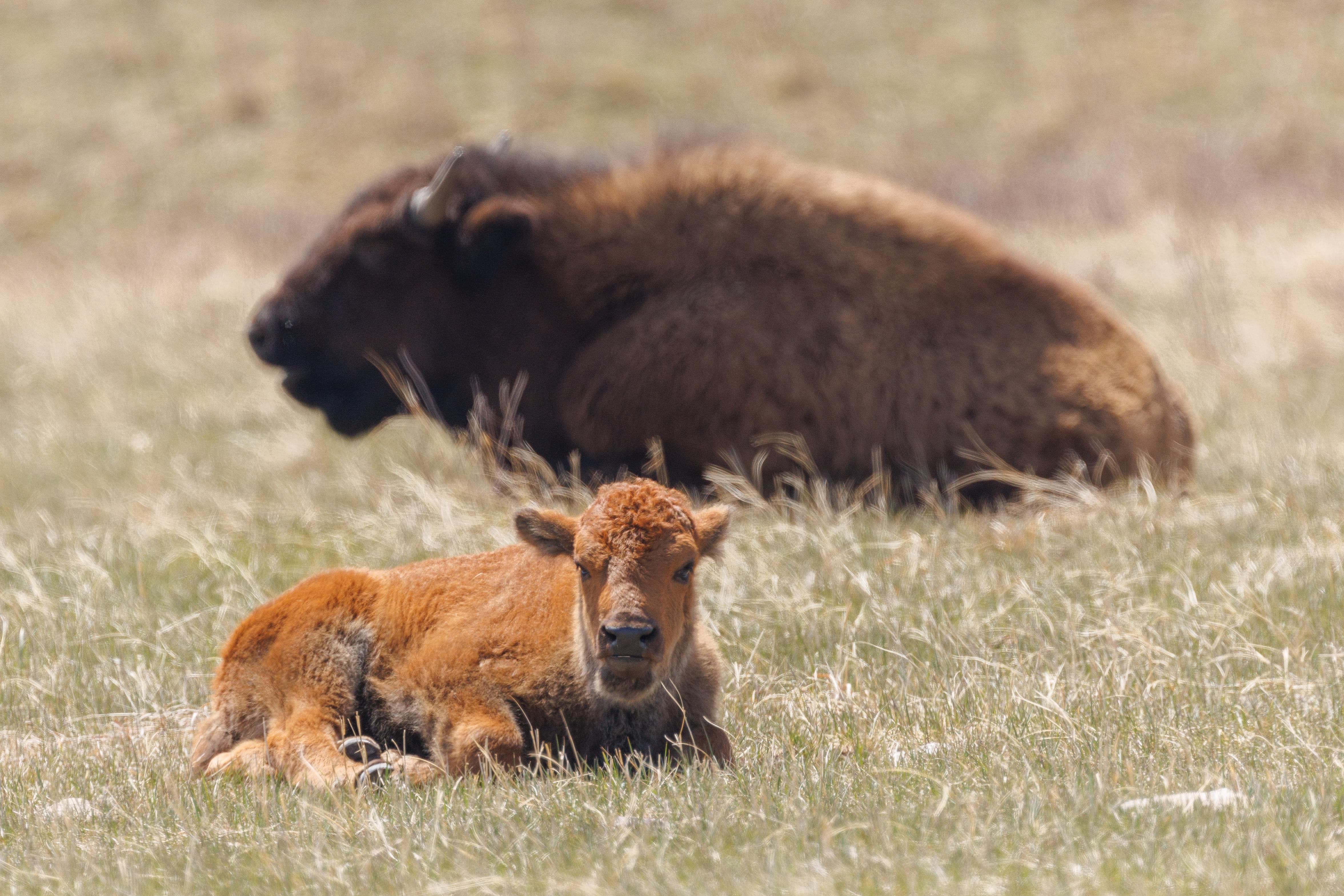
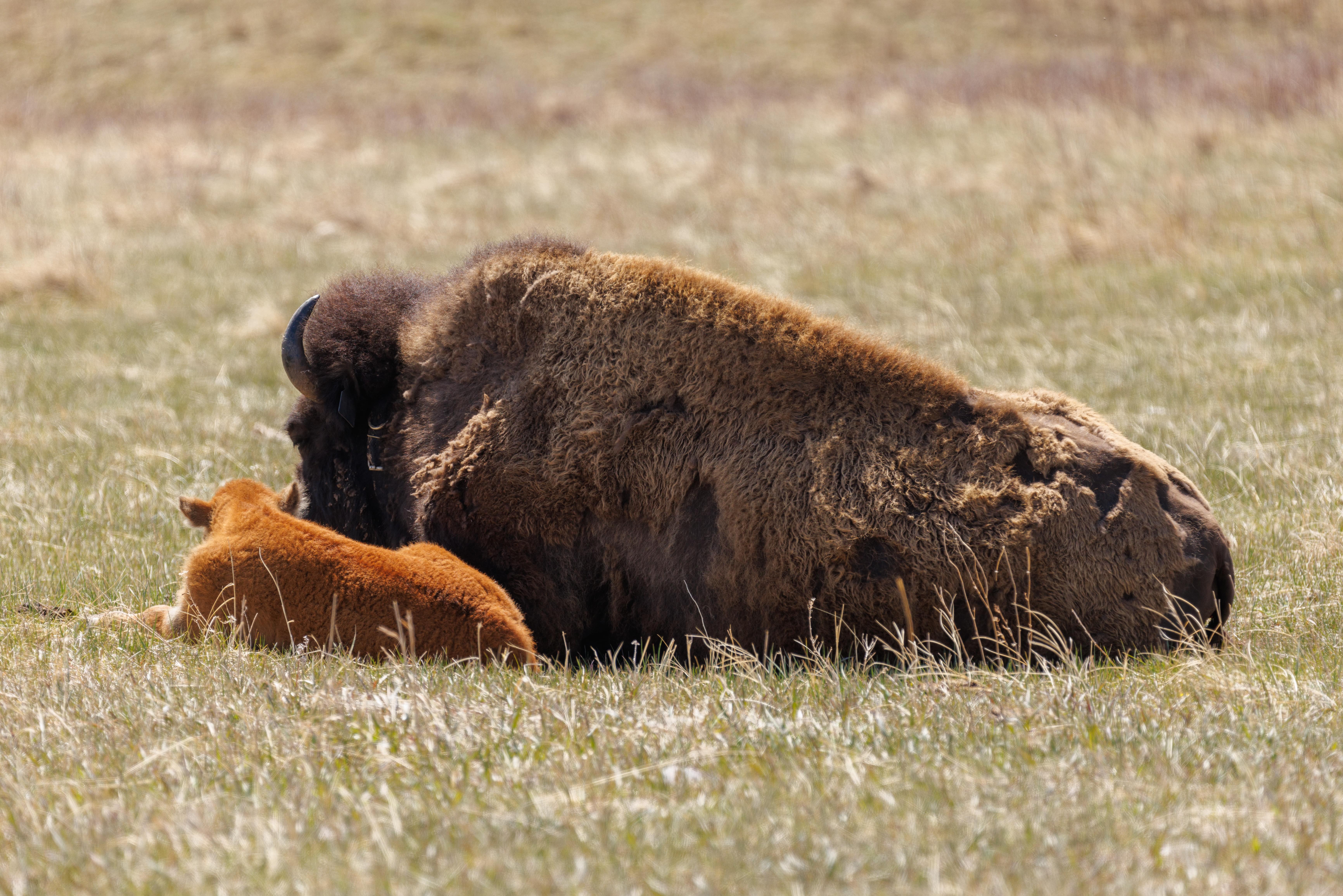
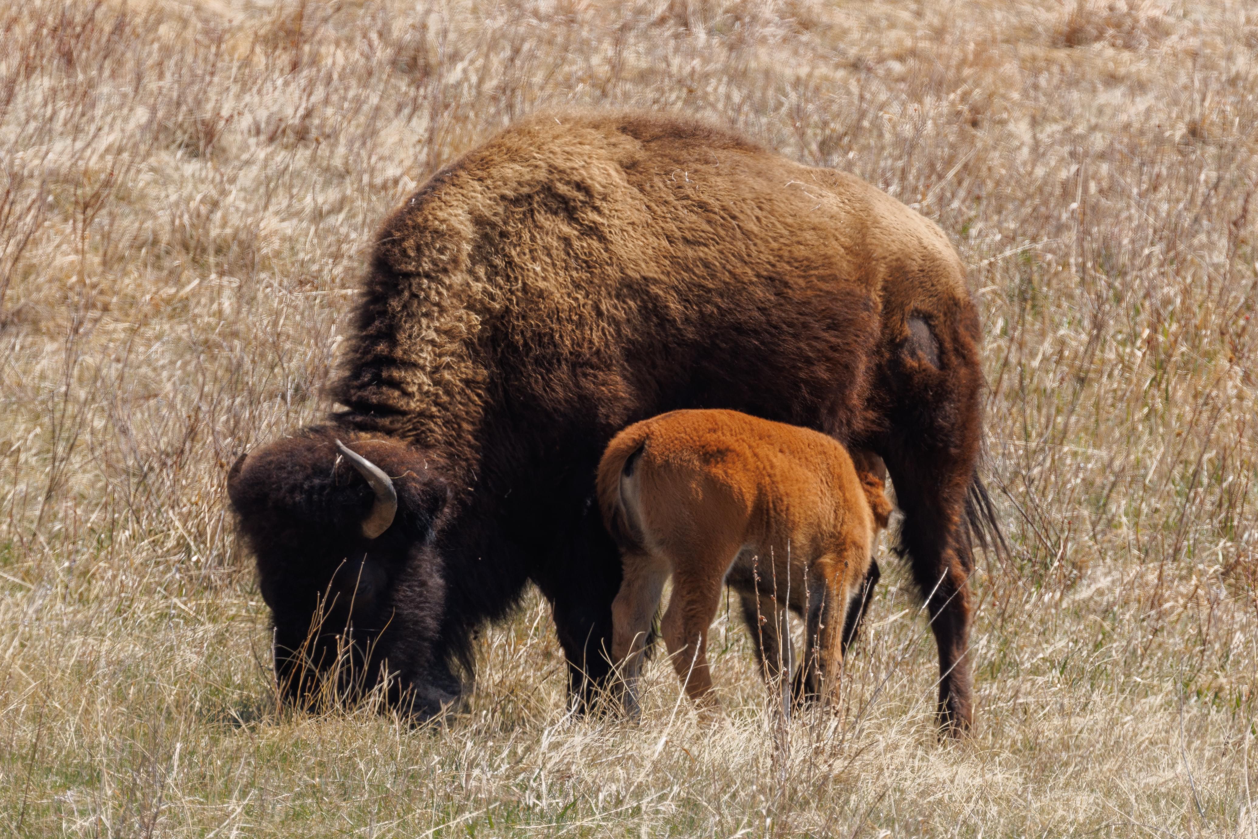
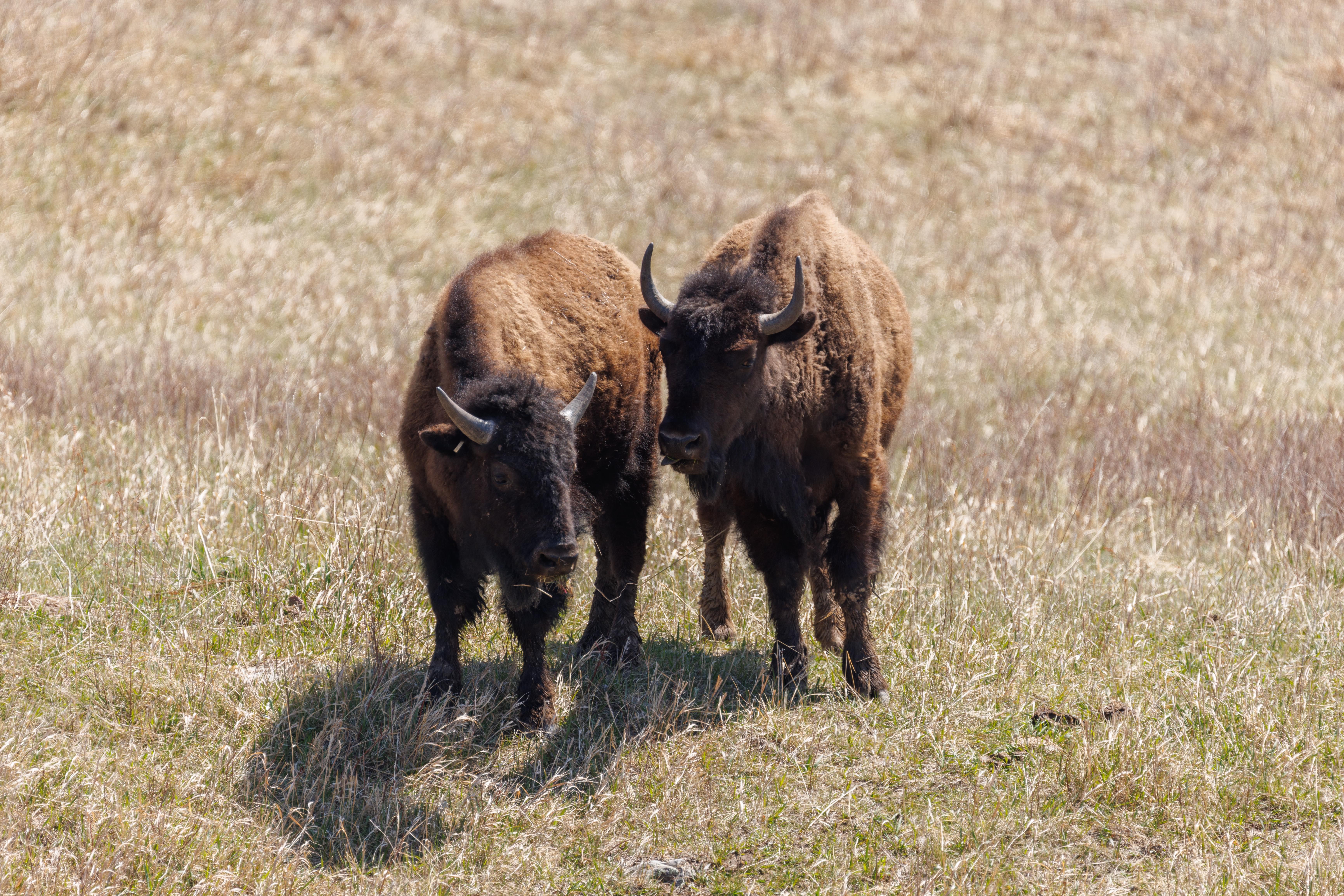
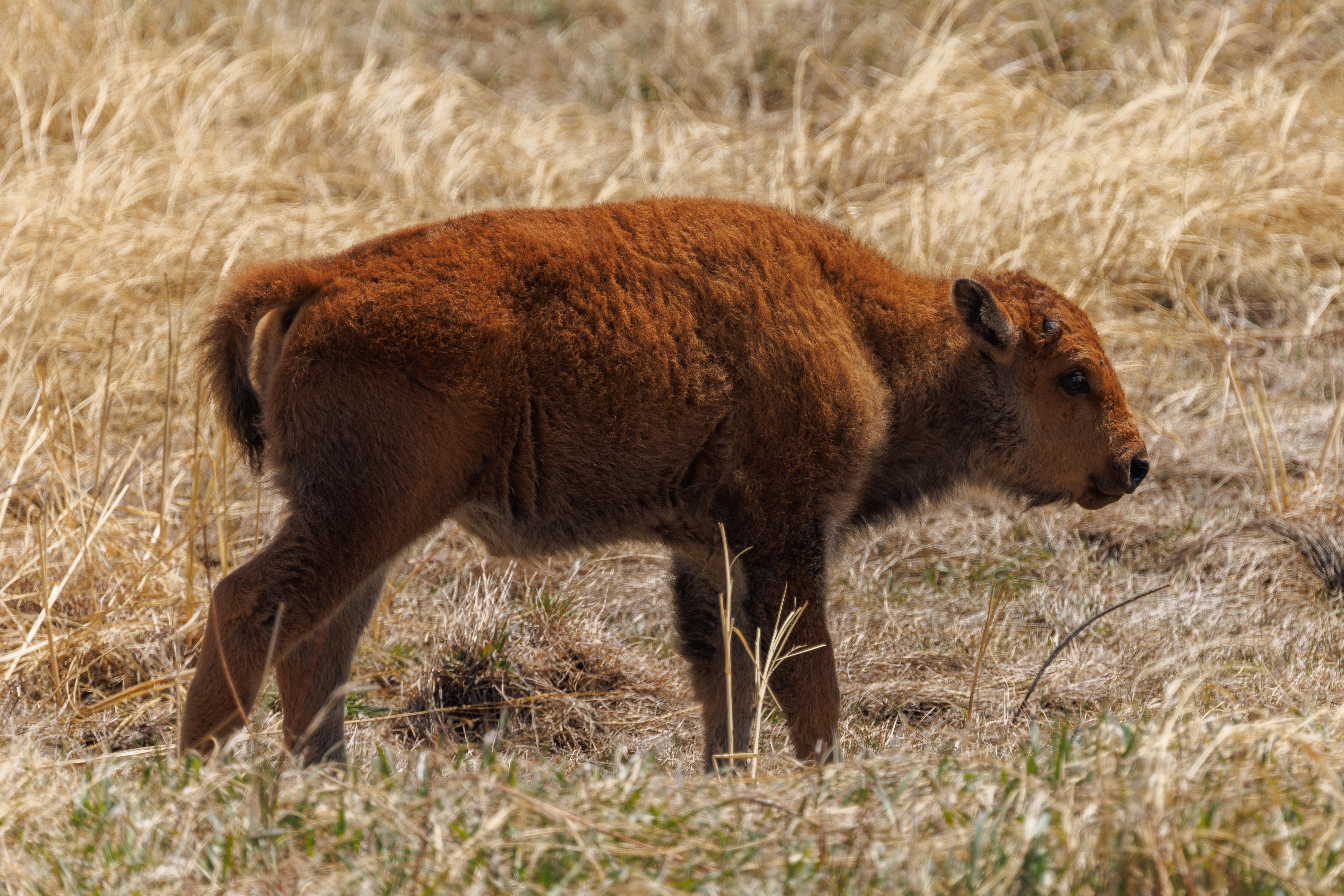
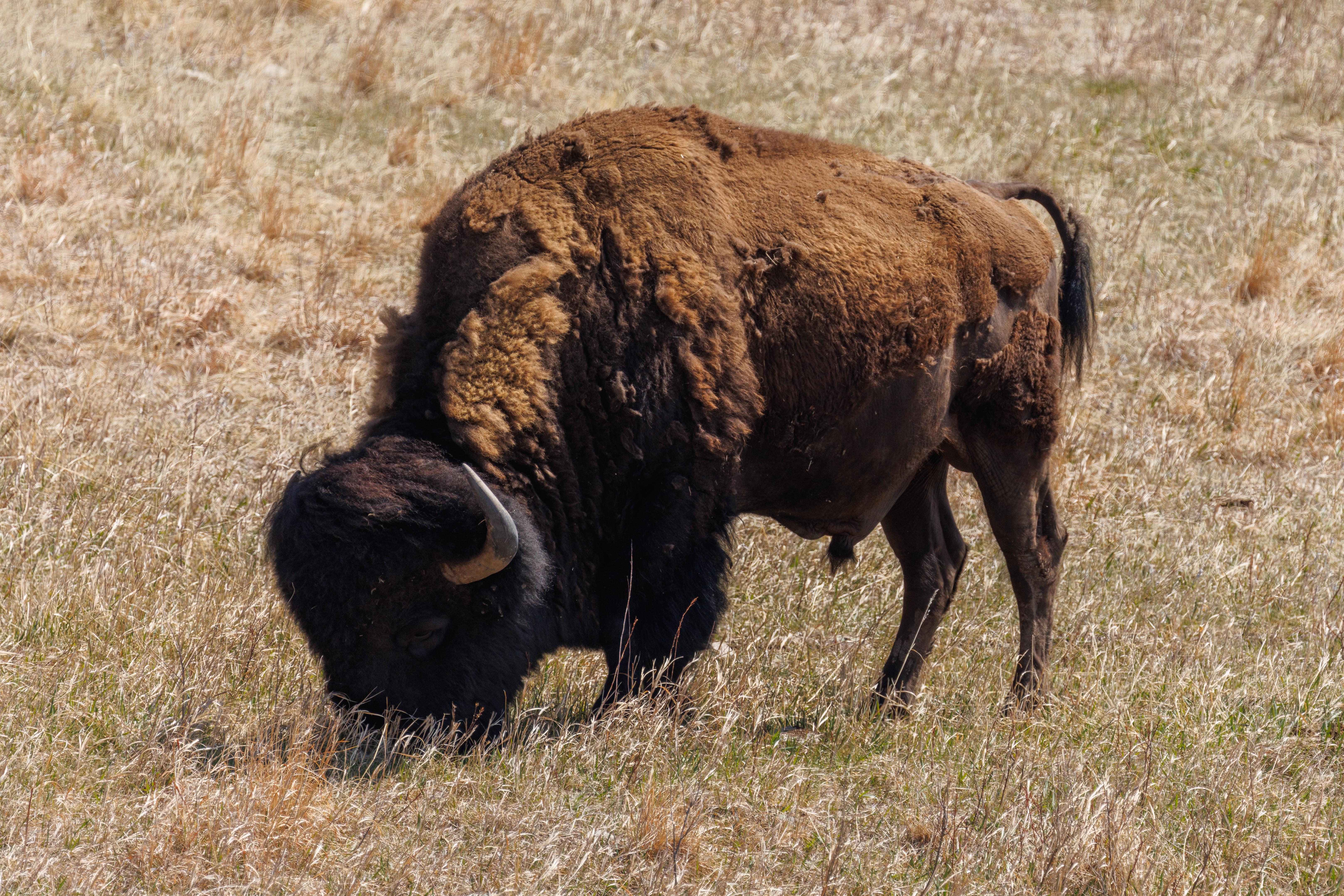
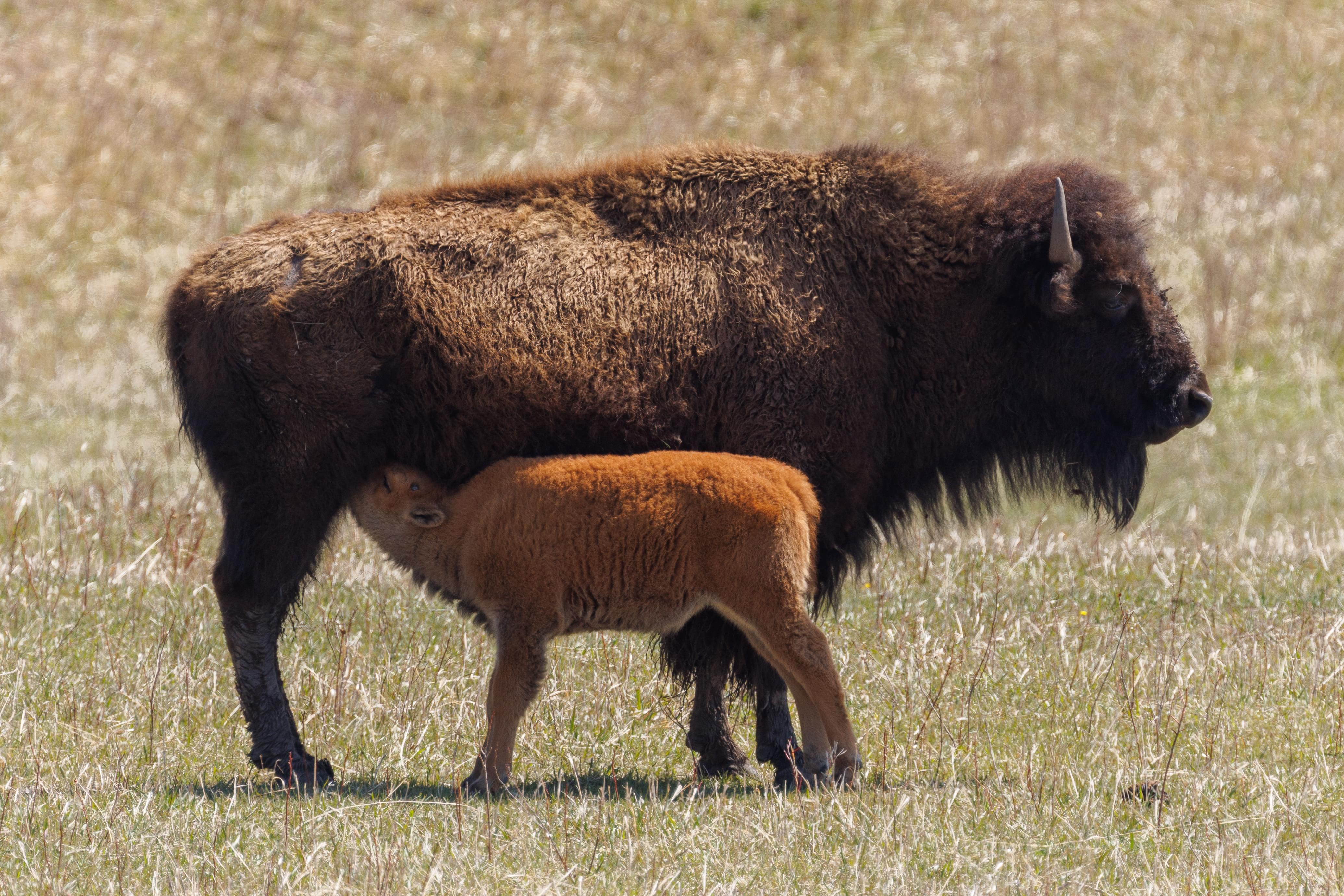
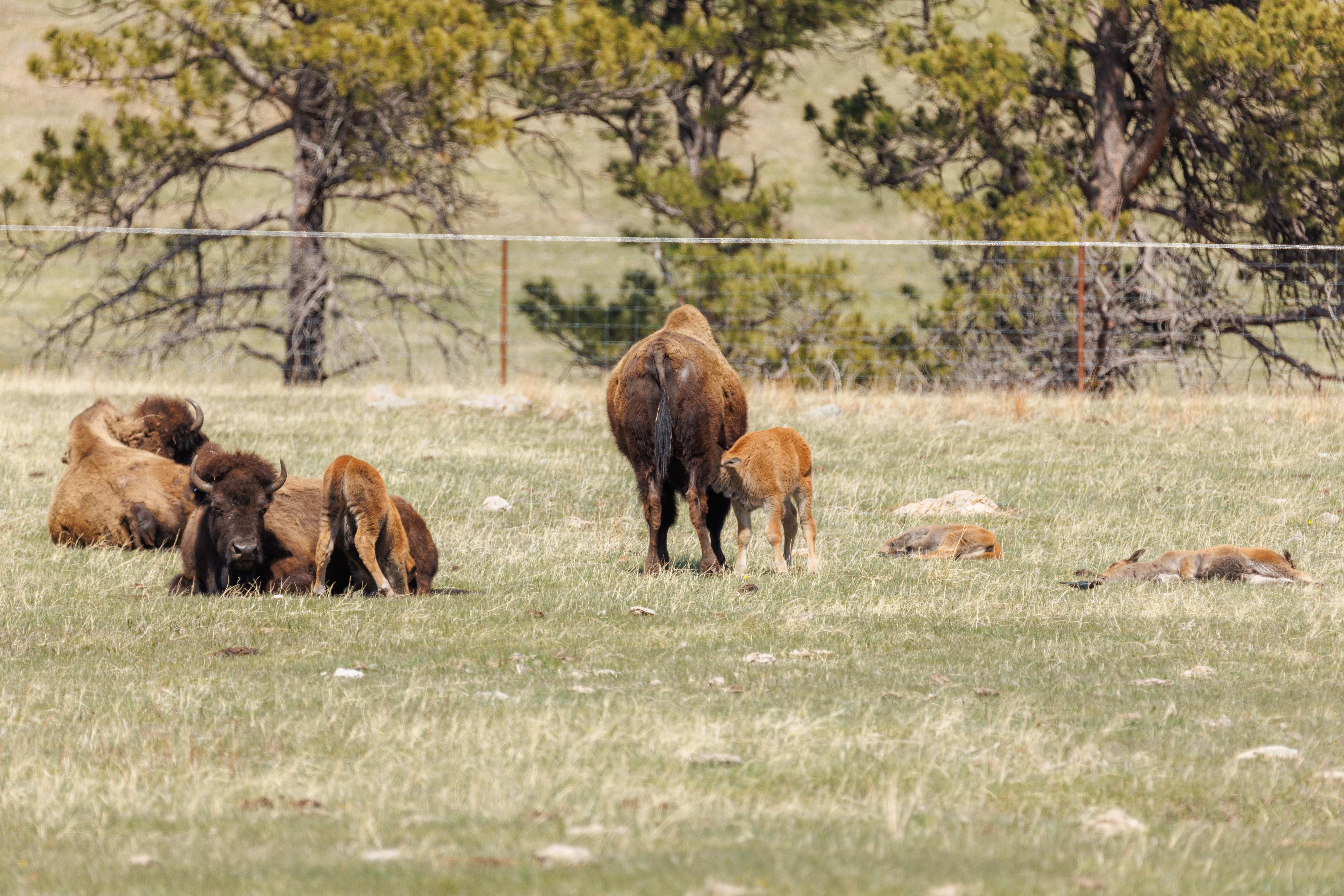
While there are many animals that live within the park, the most visible of them all are the bison! We saw a few males here and there and also spotted large groups of females with their calves from this year! Many of them were resting in the grass and a few were drinking milk. We saw one tired calf that was sleeping raise its head, look around, and sleepily plop back down onto the grass. We also saw a calf that was probably trying to get its mother to stand up so it could drink milk. That didn’t happen and the calf fell onto the grass.
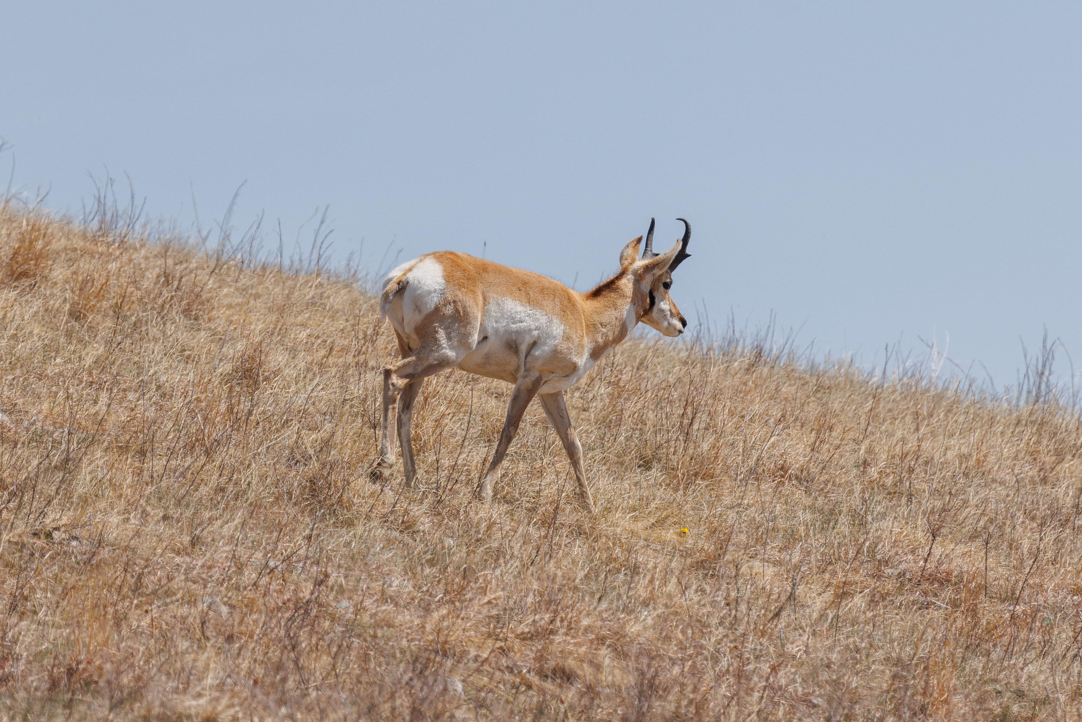
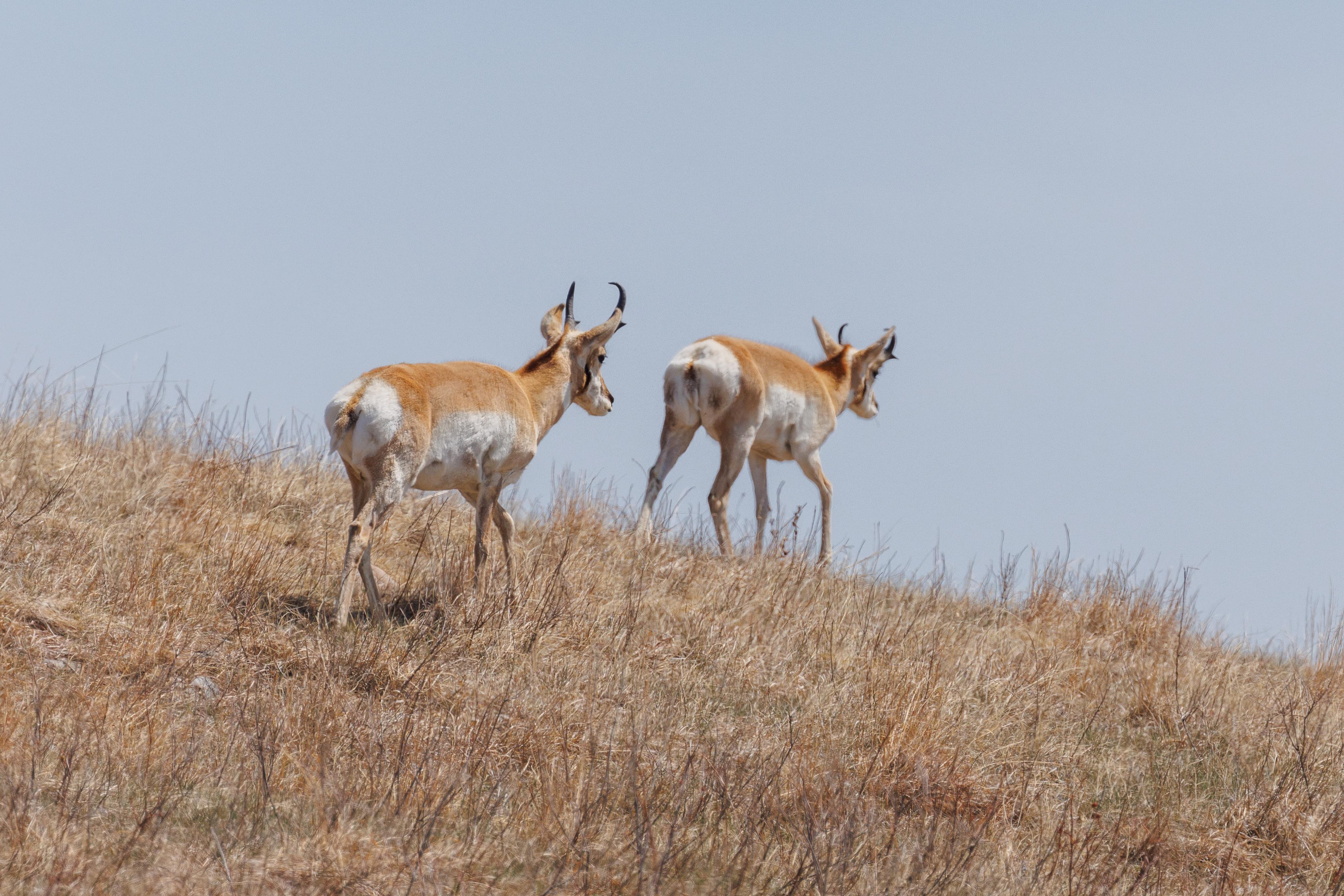
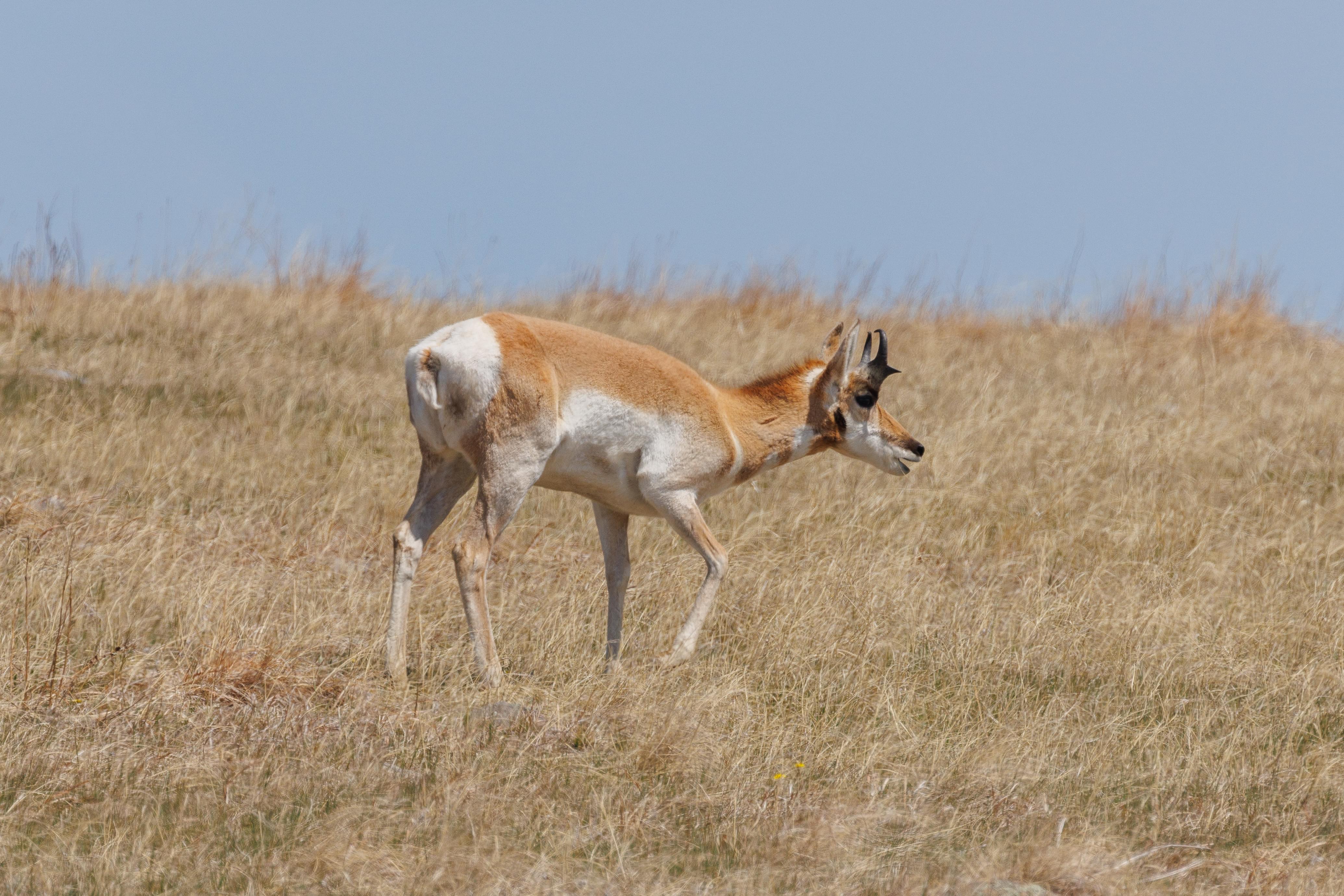
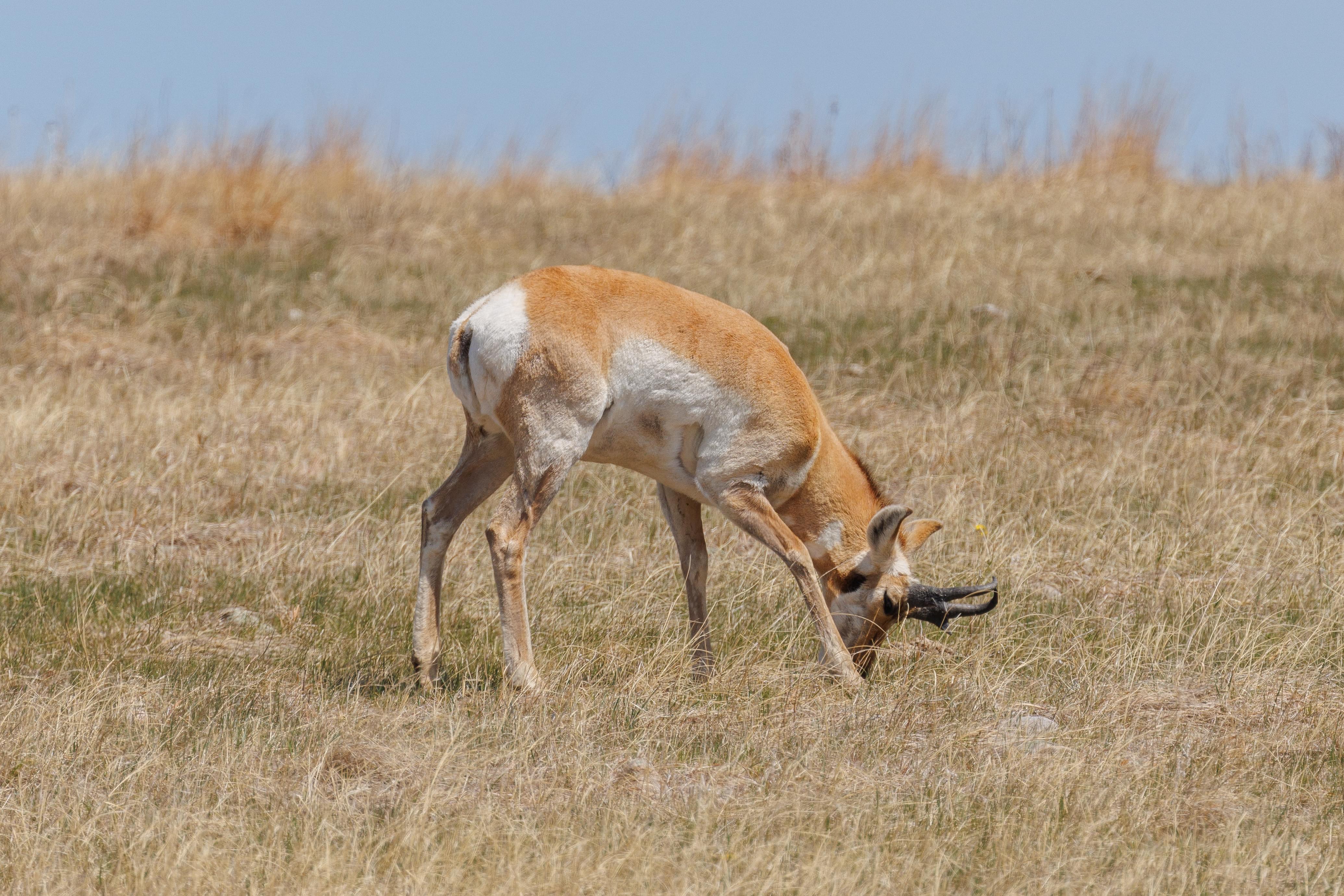
We also saw a small group of pronghorns! These are often misnamed as antelopes but have no relation to them. Generally we haven’t seen this species much in our travels in the US.
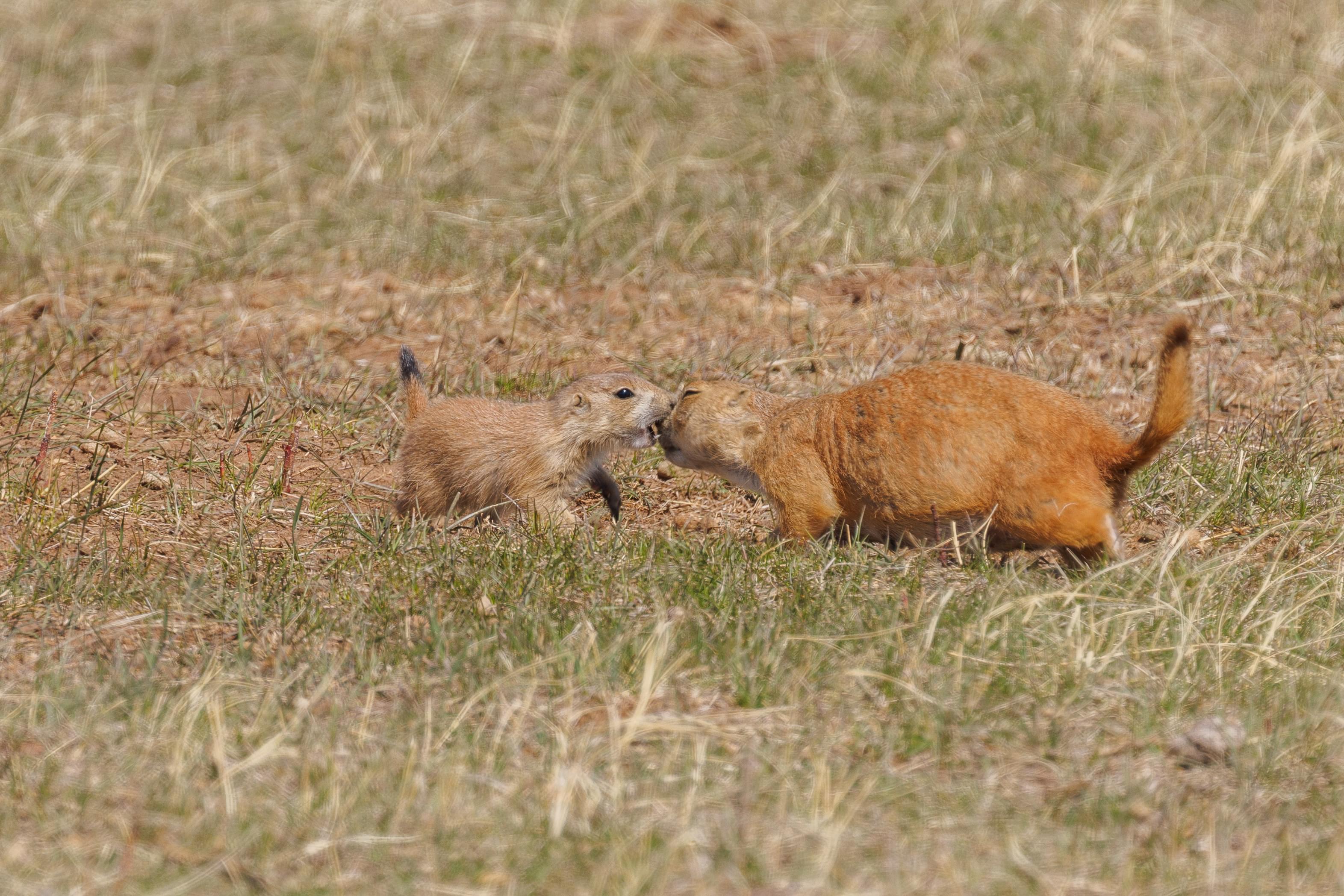
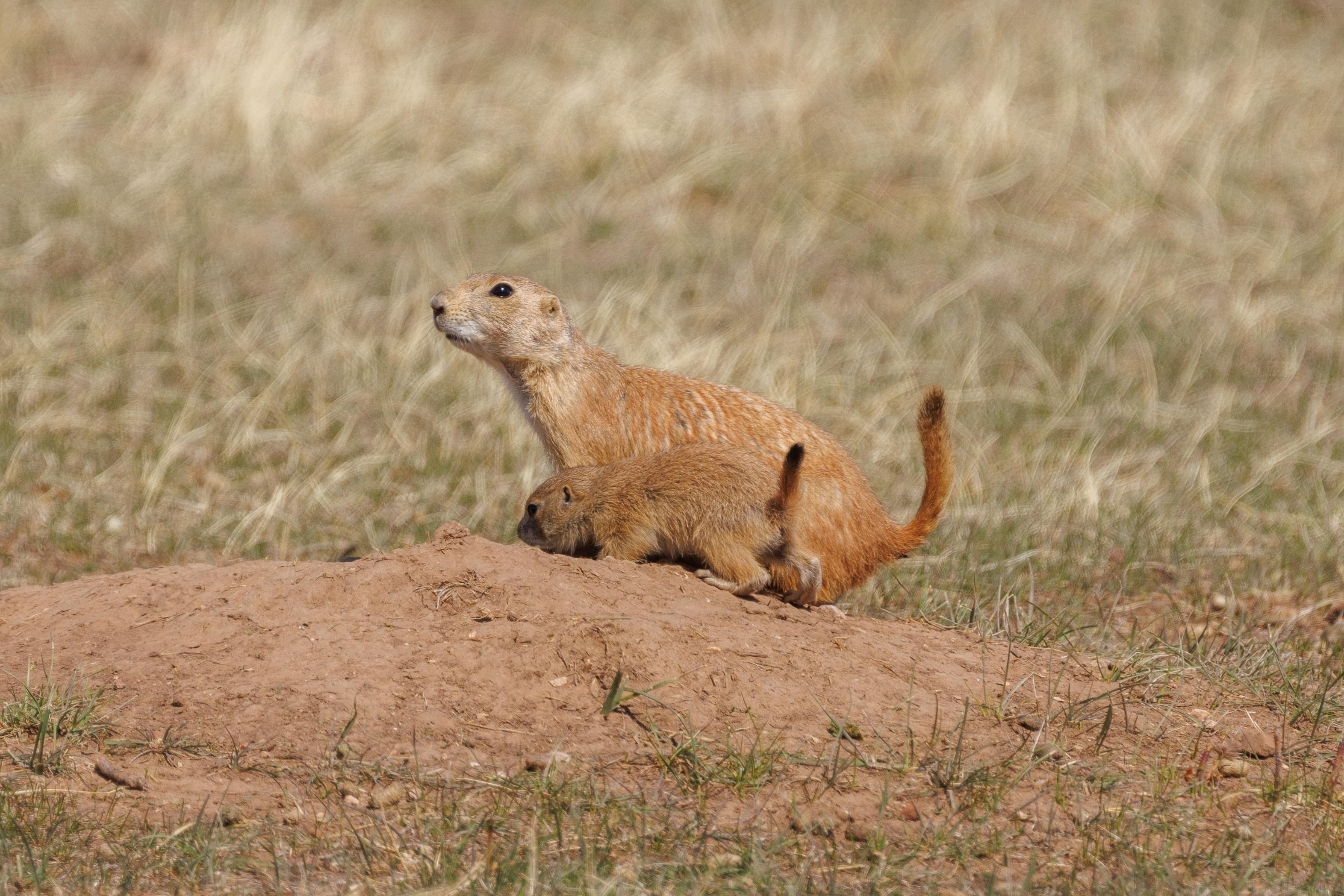

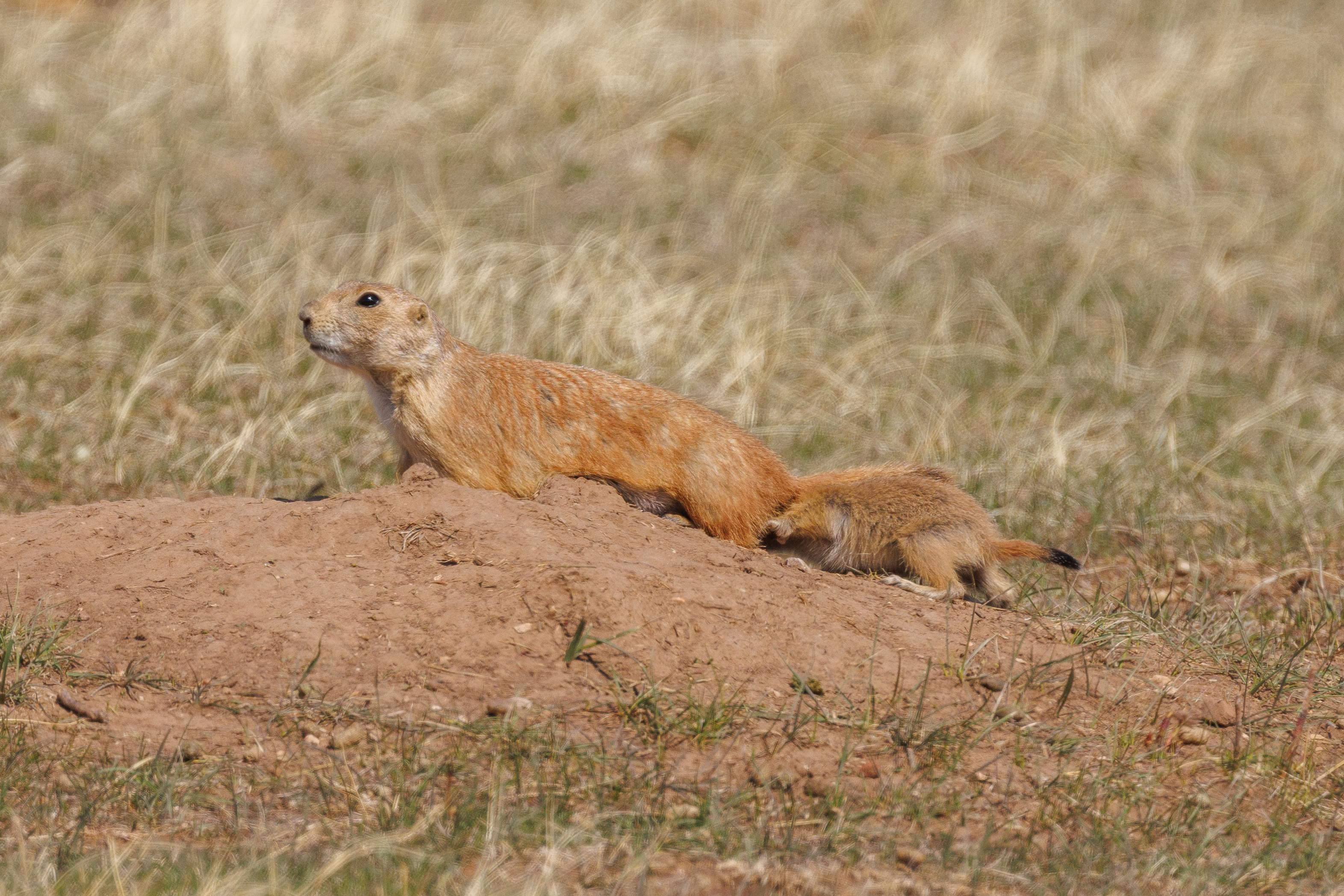
We drove by a large prairie dog town. We spotted this baby prairie dog interacting with its mother!
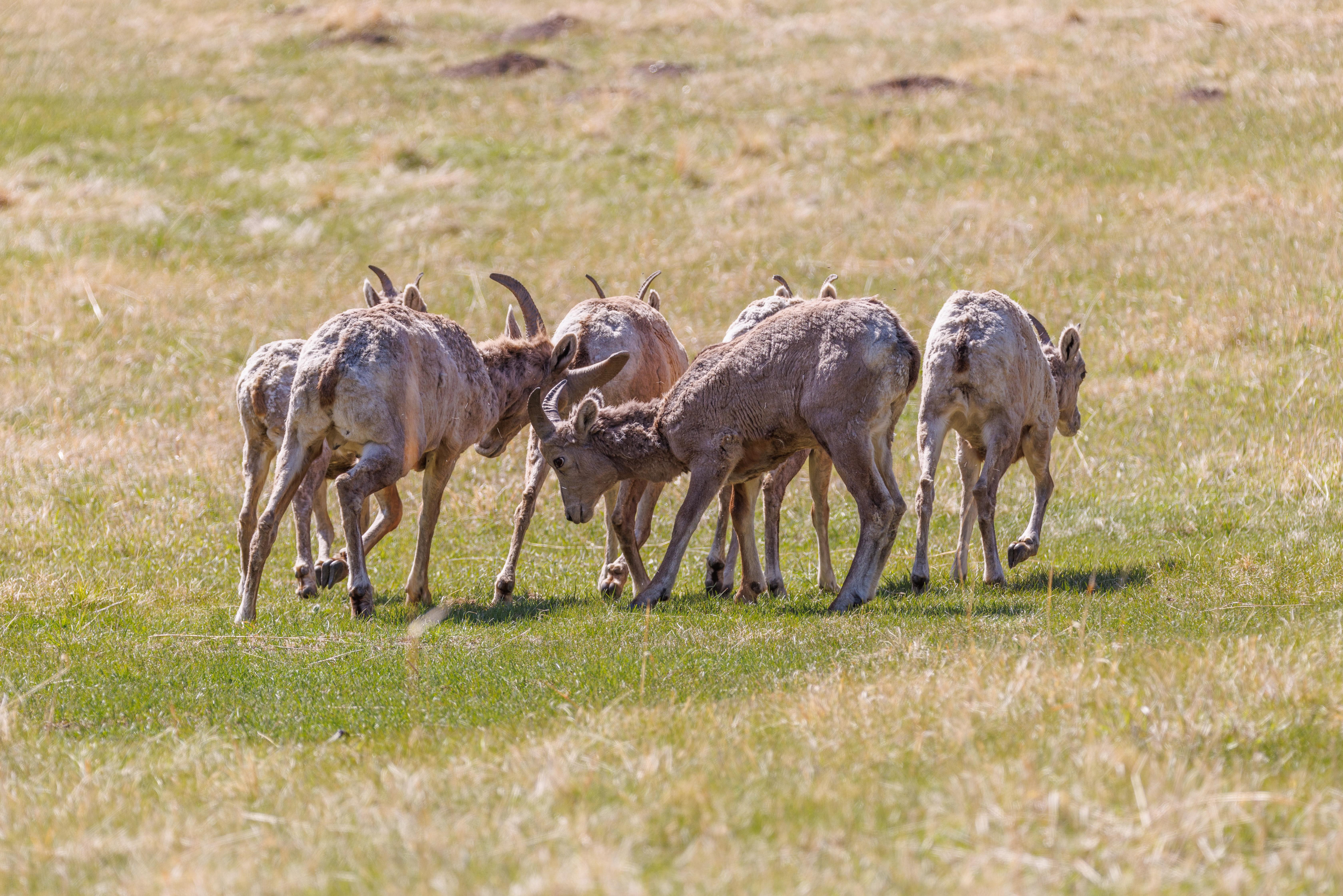
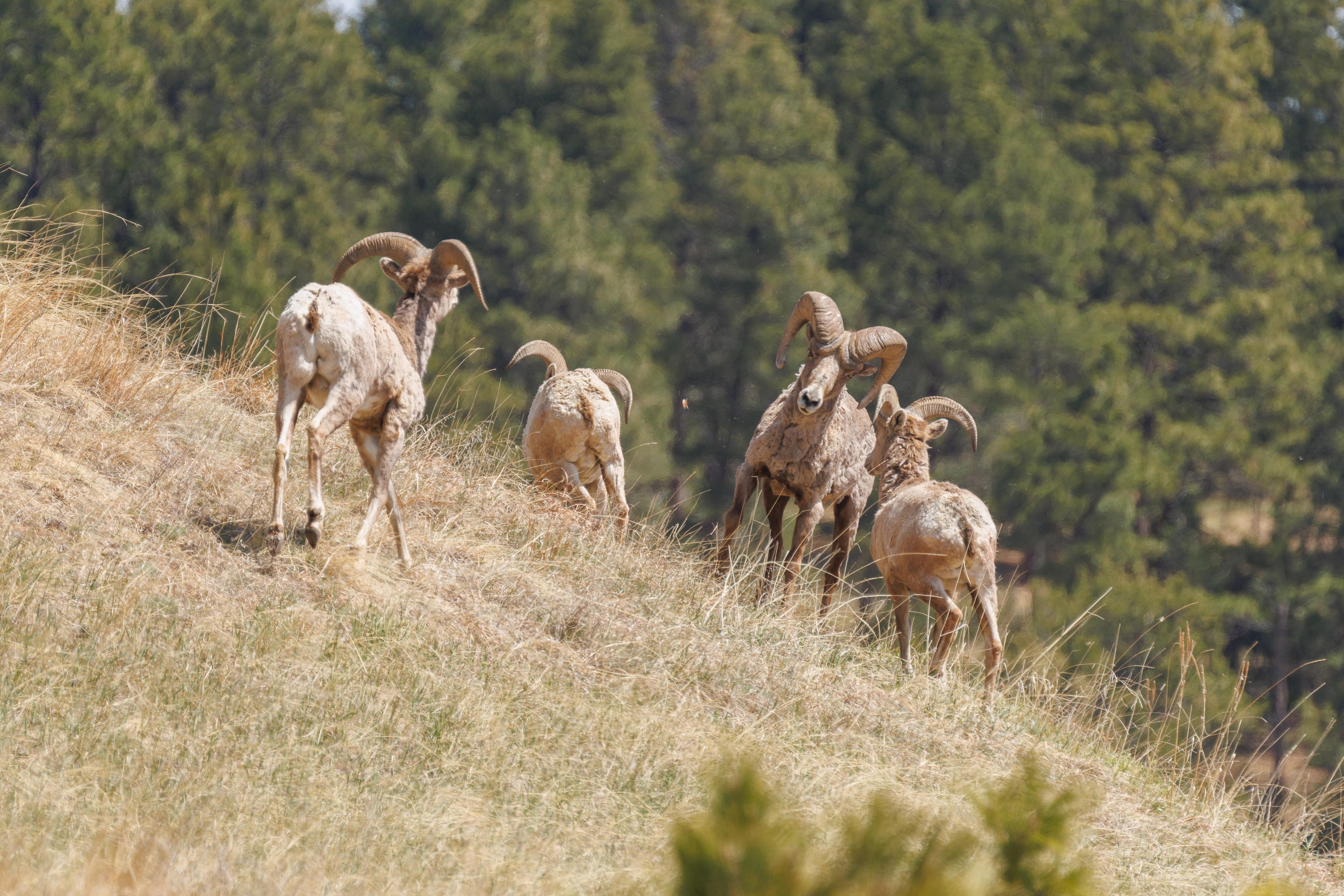
We also spotted this group of male bighorn sheep. This appears to be a group of males of various ages? Some of them were resting on the ground but they all got up together and moved away as we were driving by.
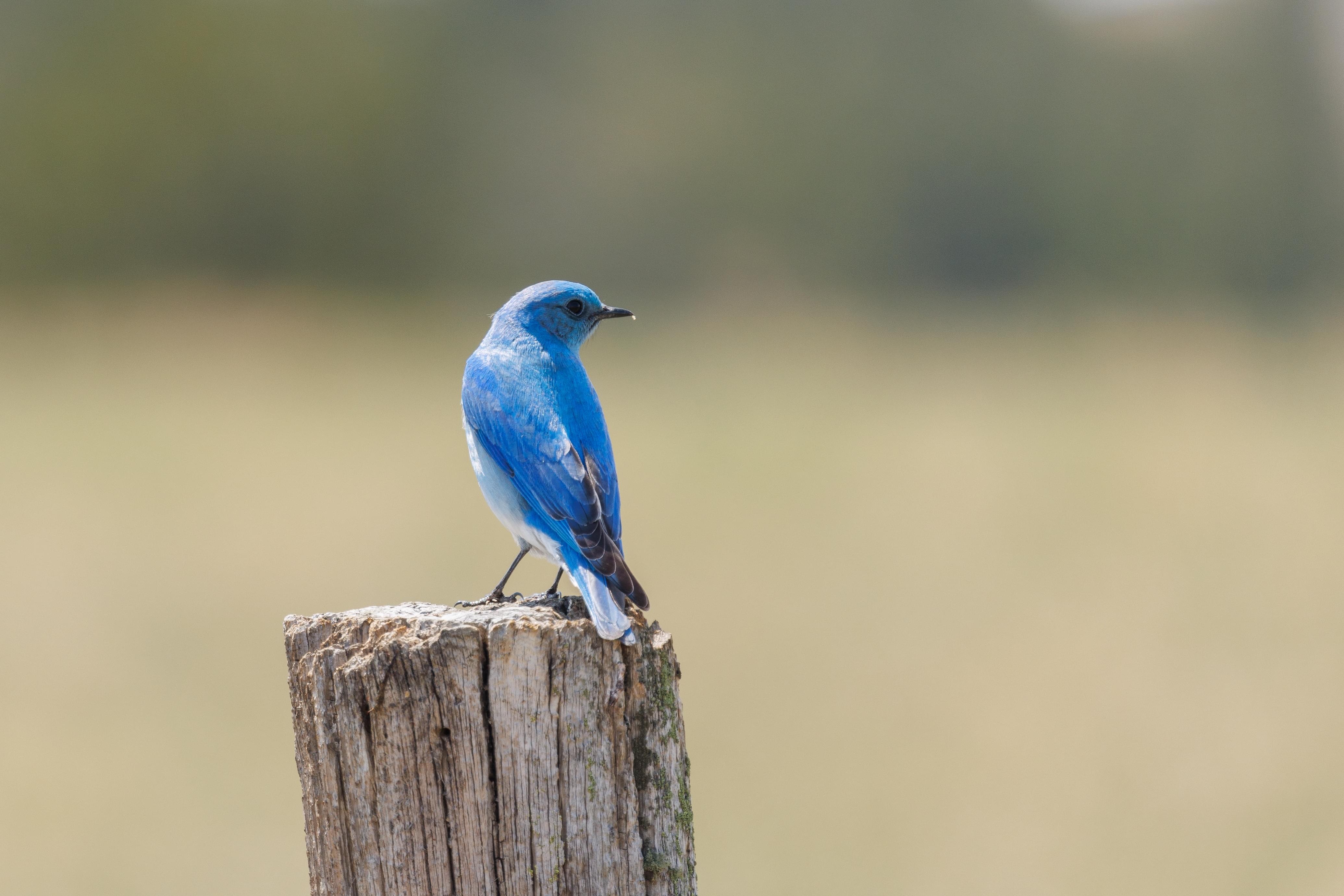
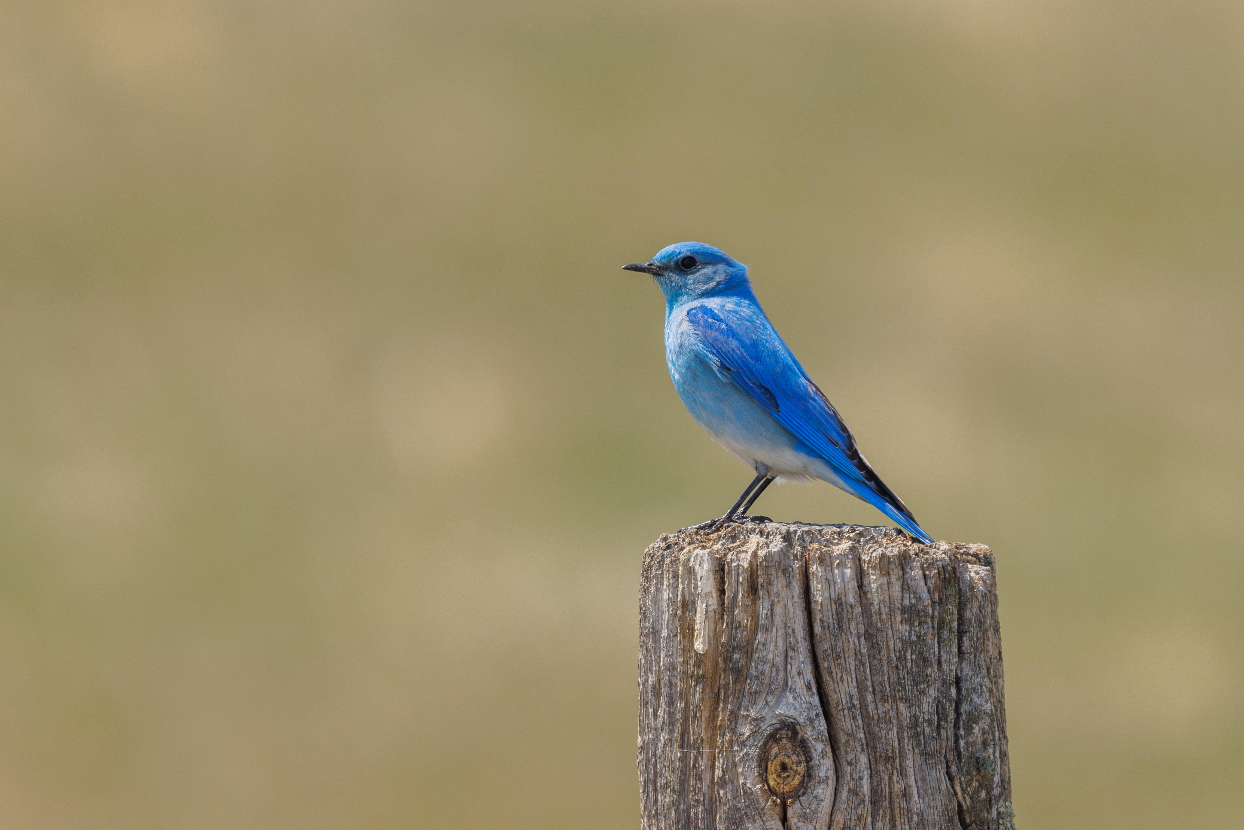
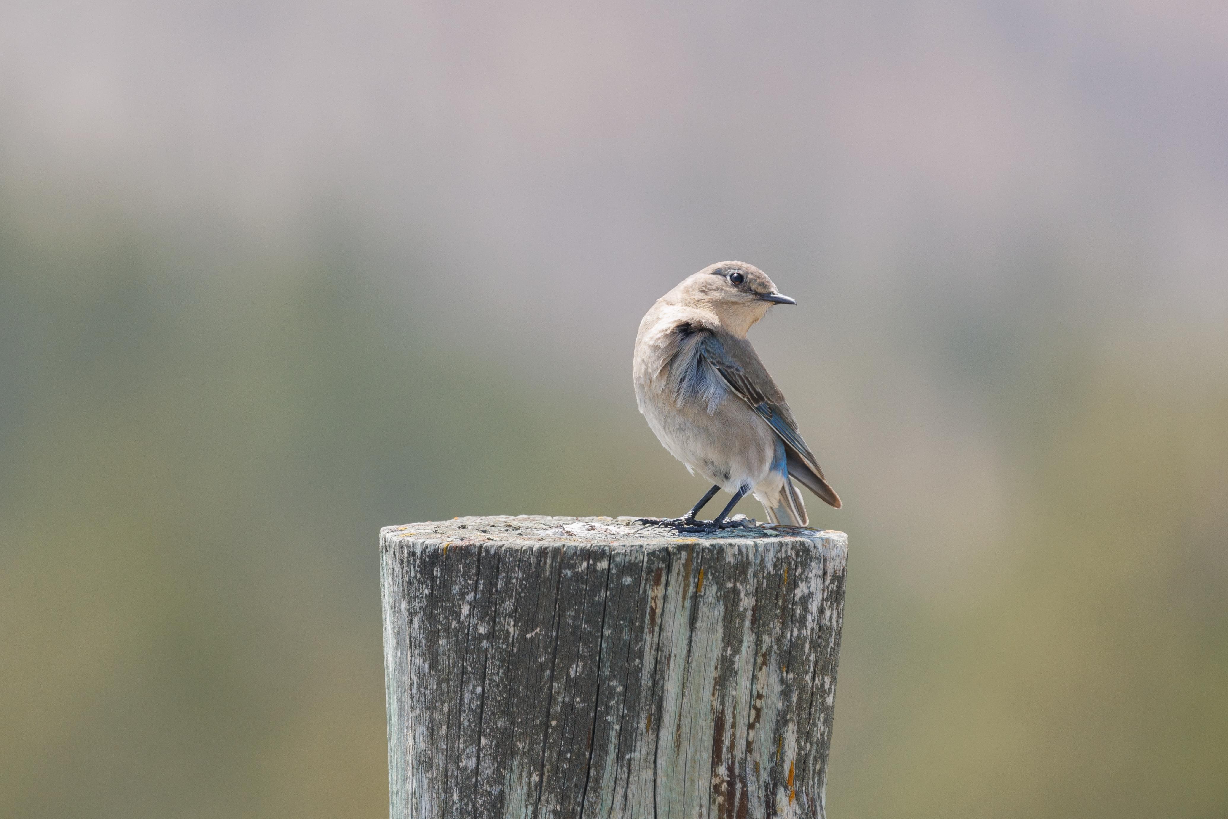
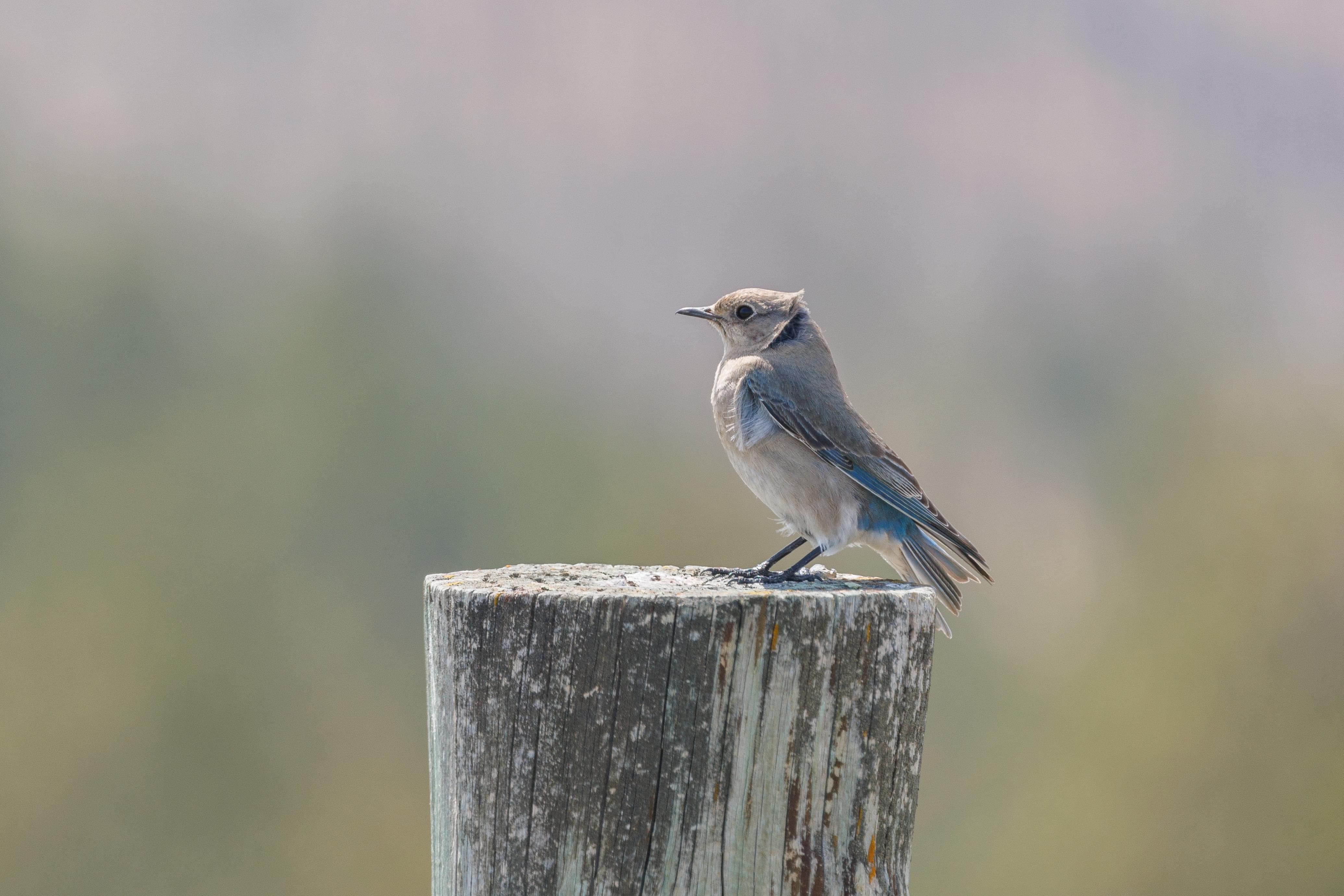
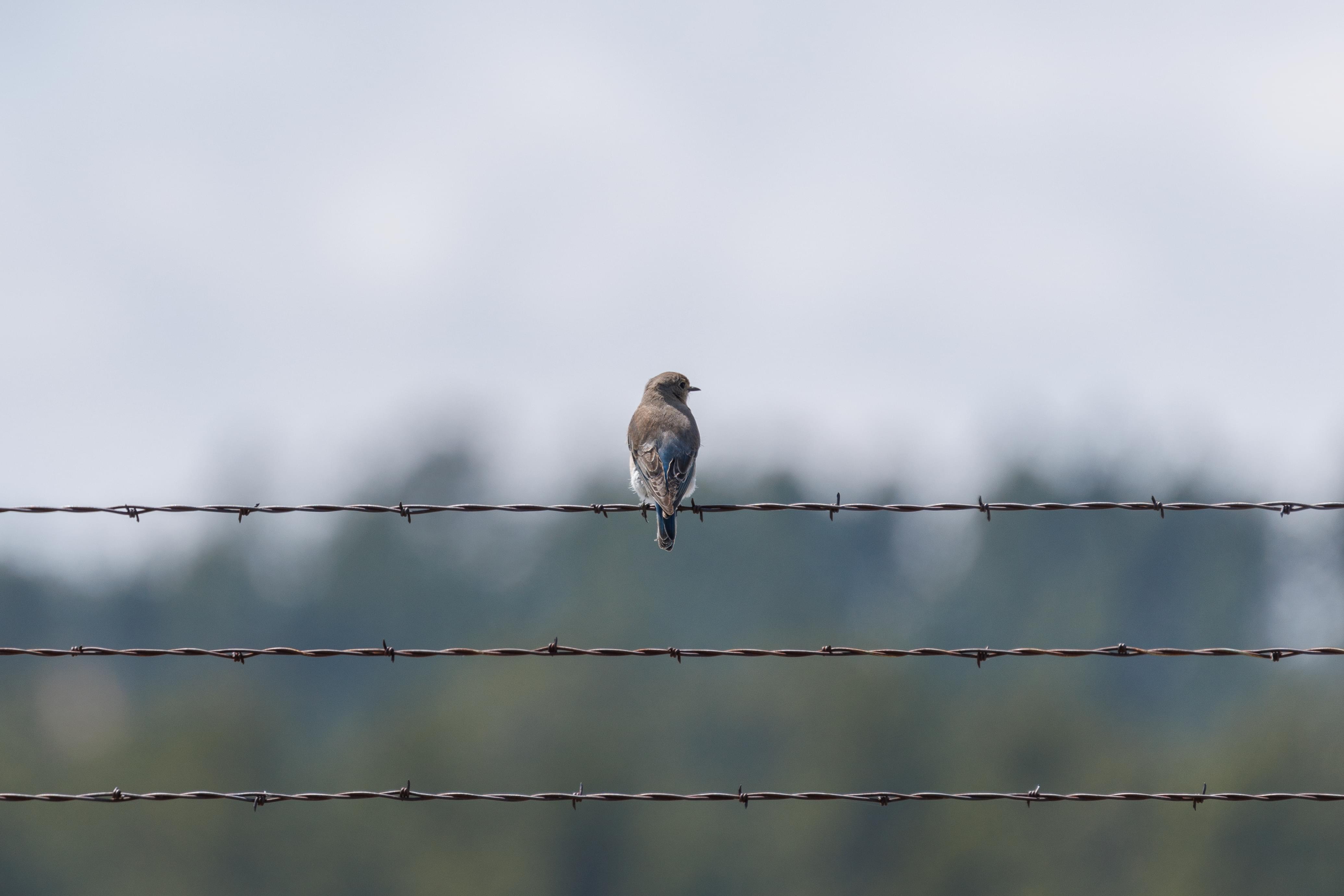
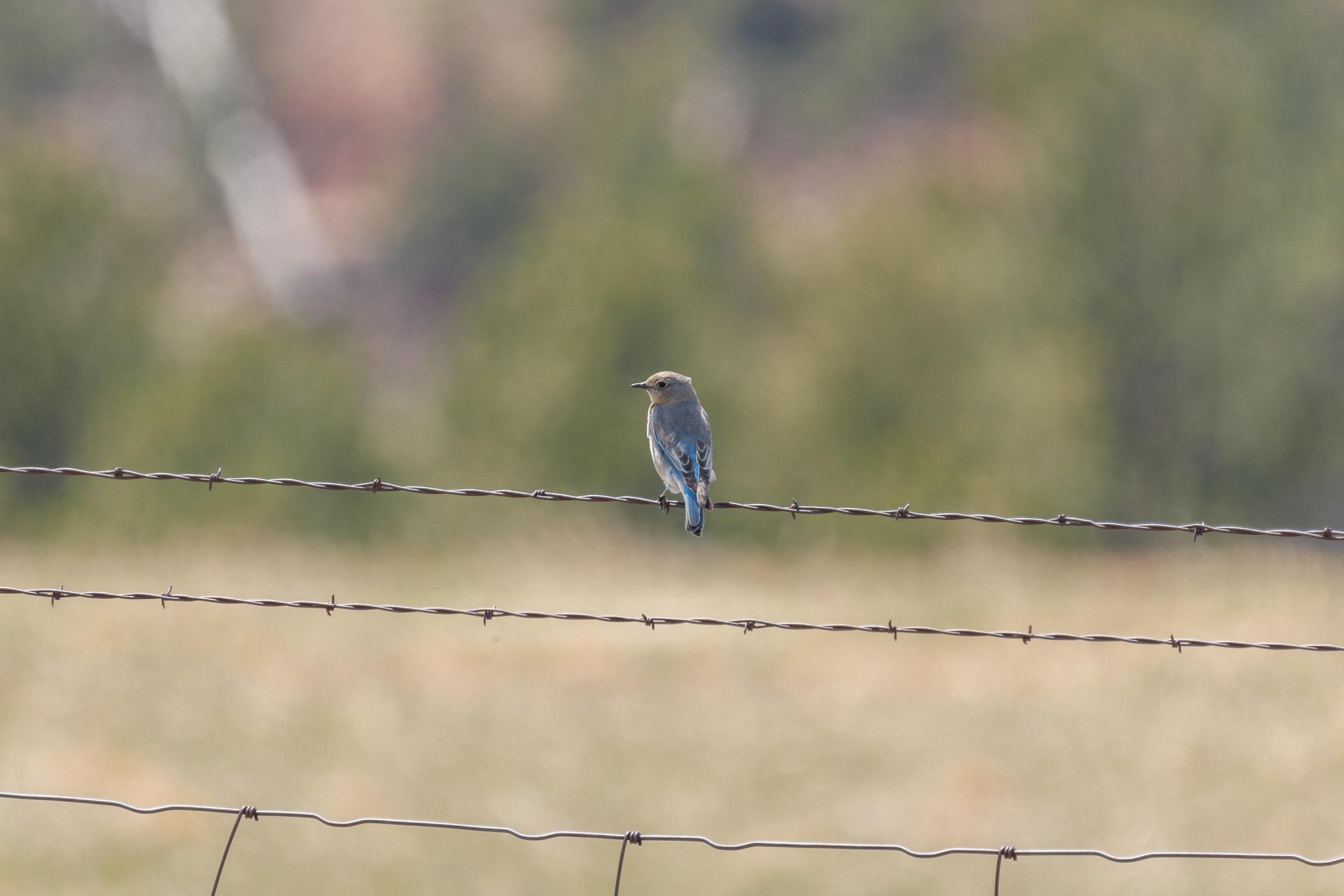
There were various wire fences in the park near the road. Some of them had bird houses on their posts. And we often saw birds on the wires near those houses. We saw Mountain Bluebird males, the colorful ones, as well as females, the ones with duller colors.
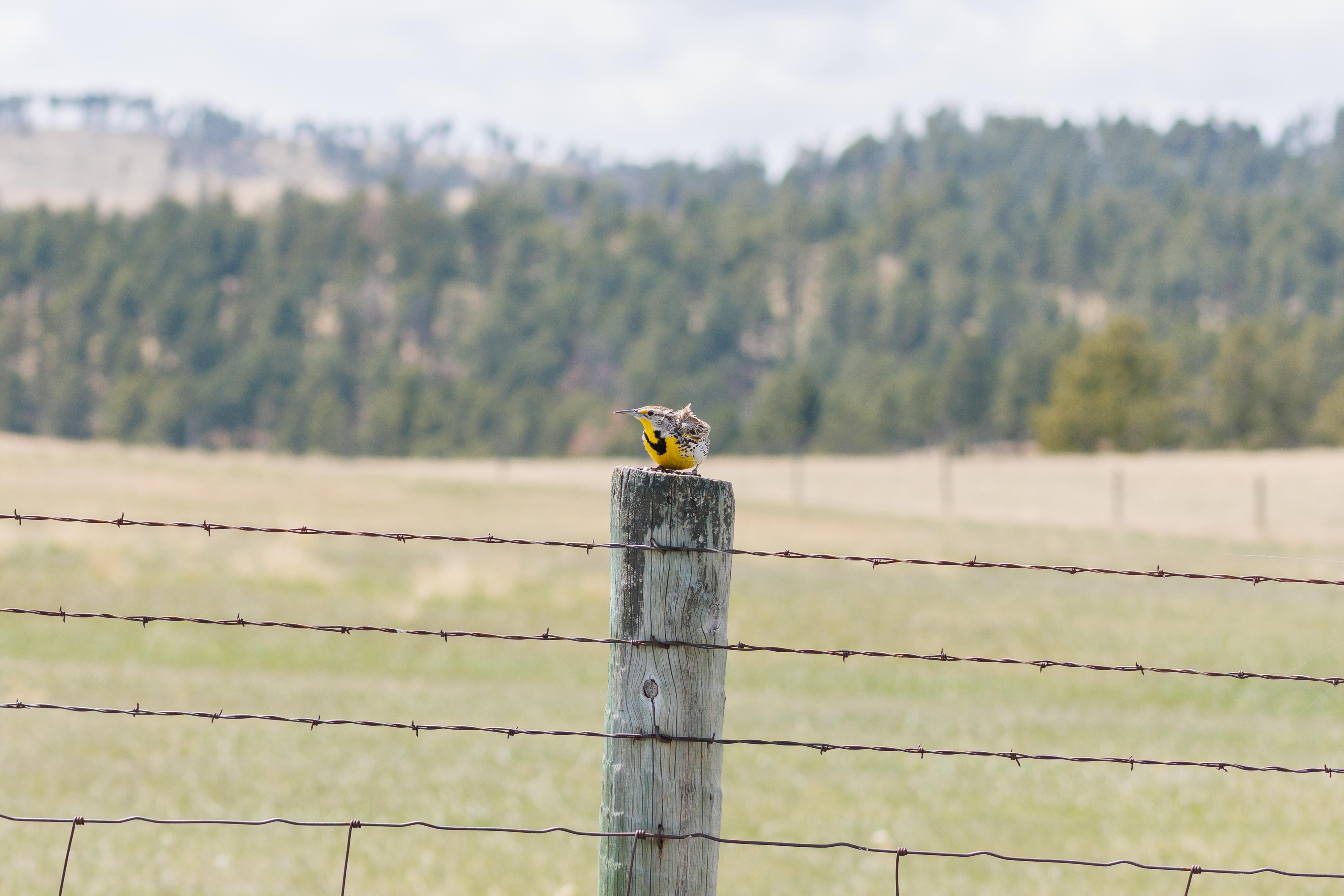
We also saw Western Meadowlarks, though this species was rather hard to photograph as they had a tendency to fly away into the tall grass, never to be seen again!
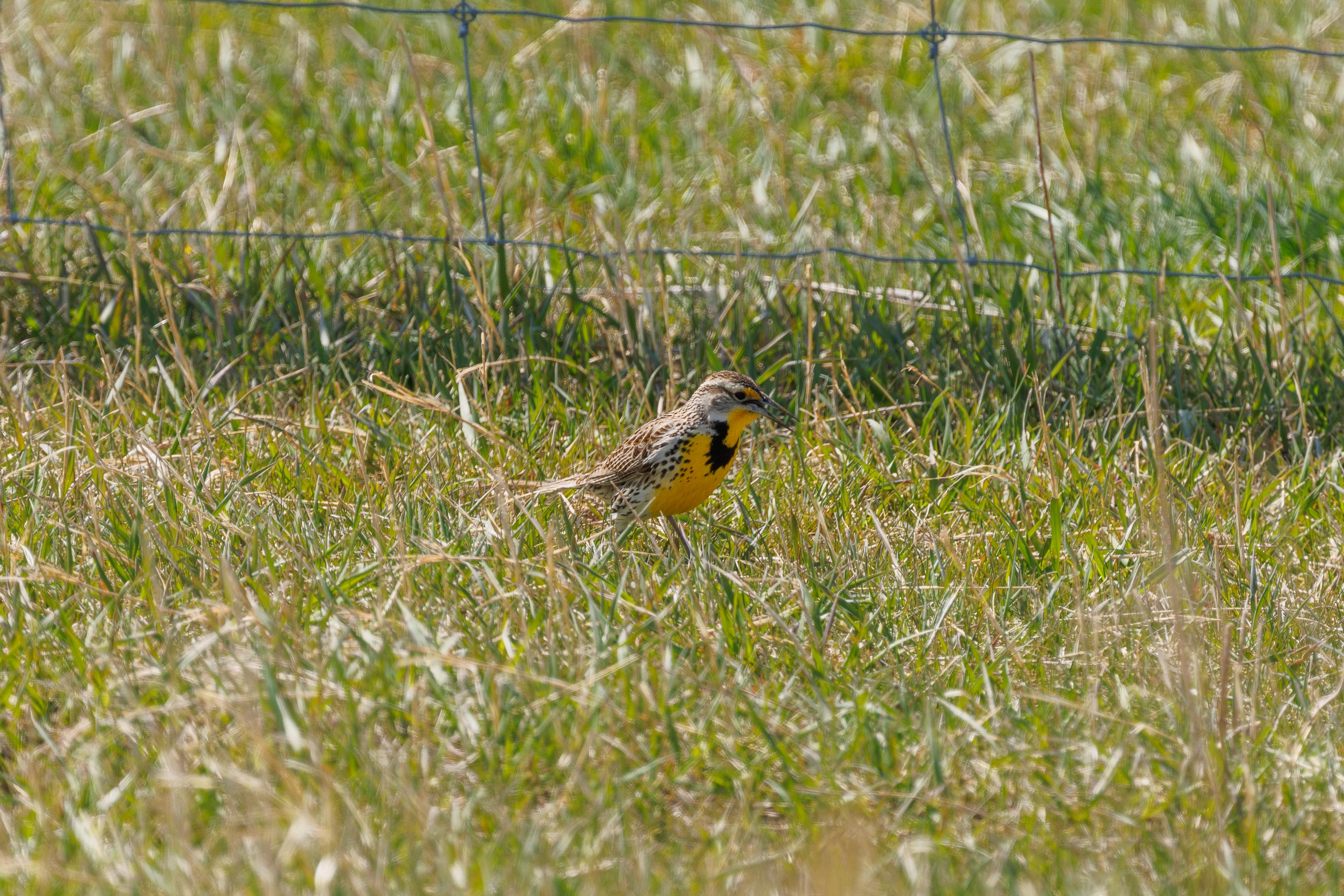
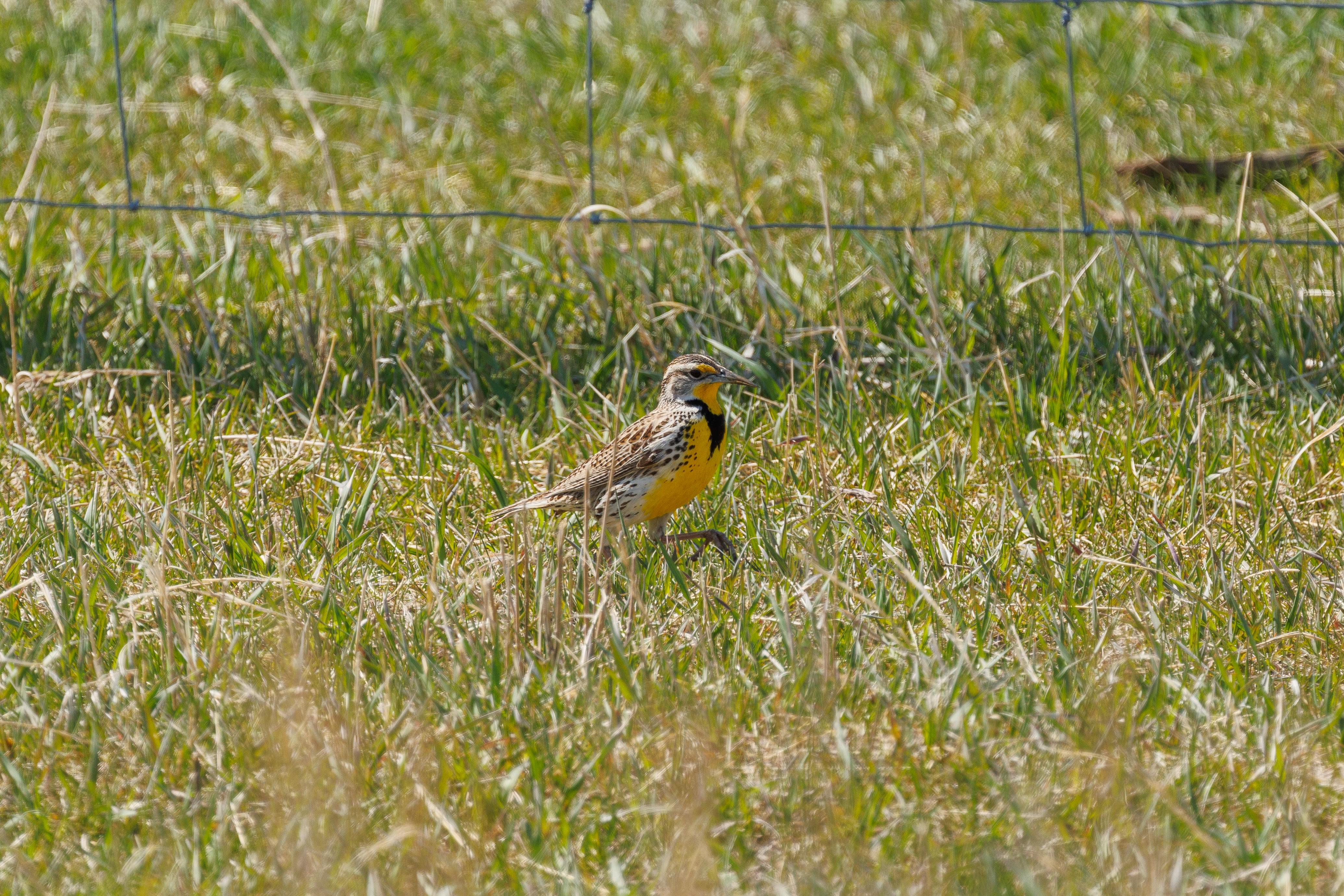
This Western Meadowlark was hunting for bugs in some low grass near a fence, making it very easy to track!
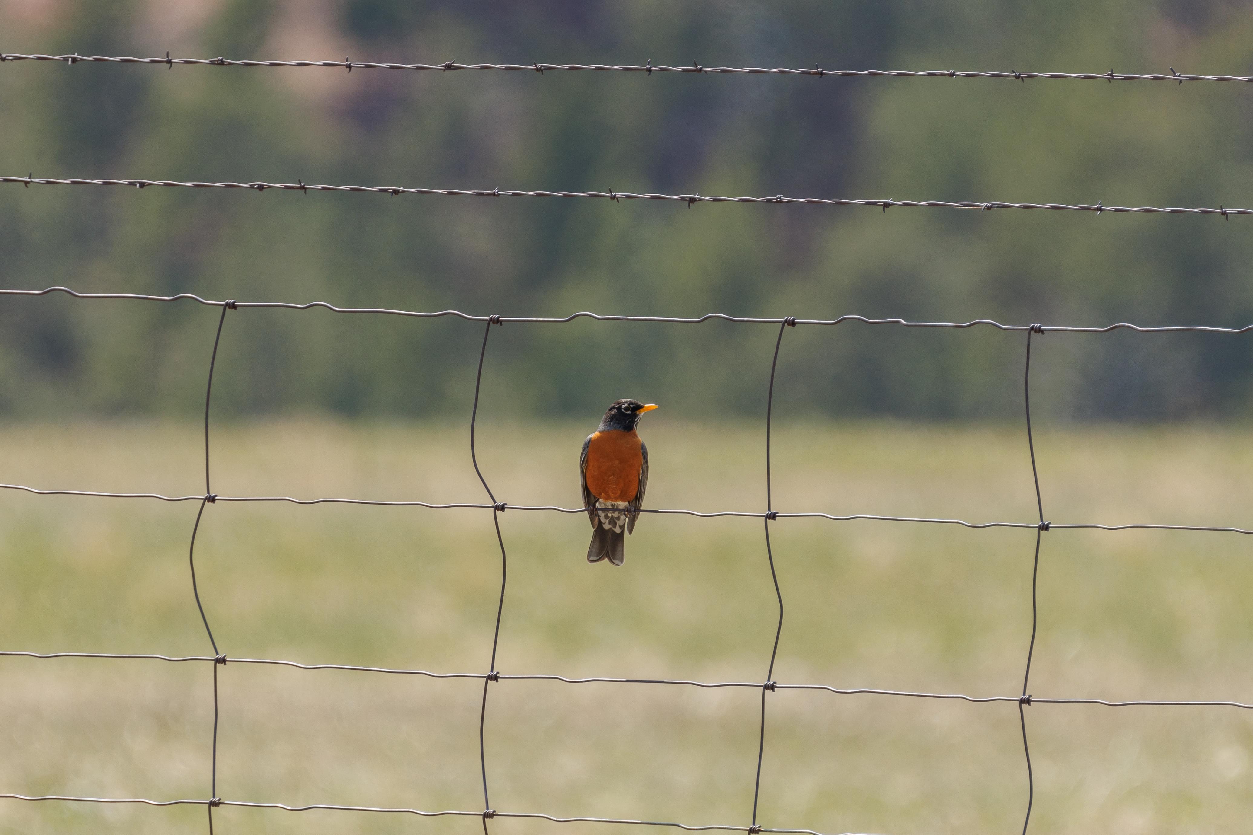
We saw this one American Robin perched on one of the wire fences. They don’t appear to be very common here.
Needles Highway
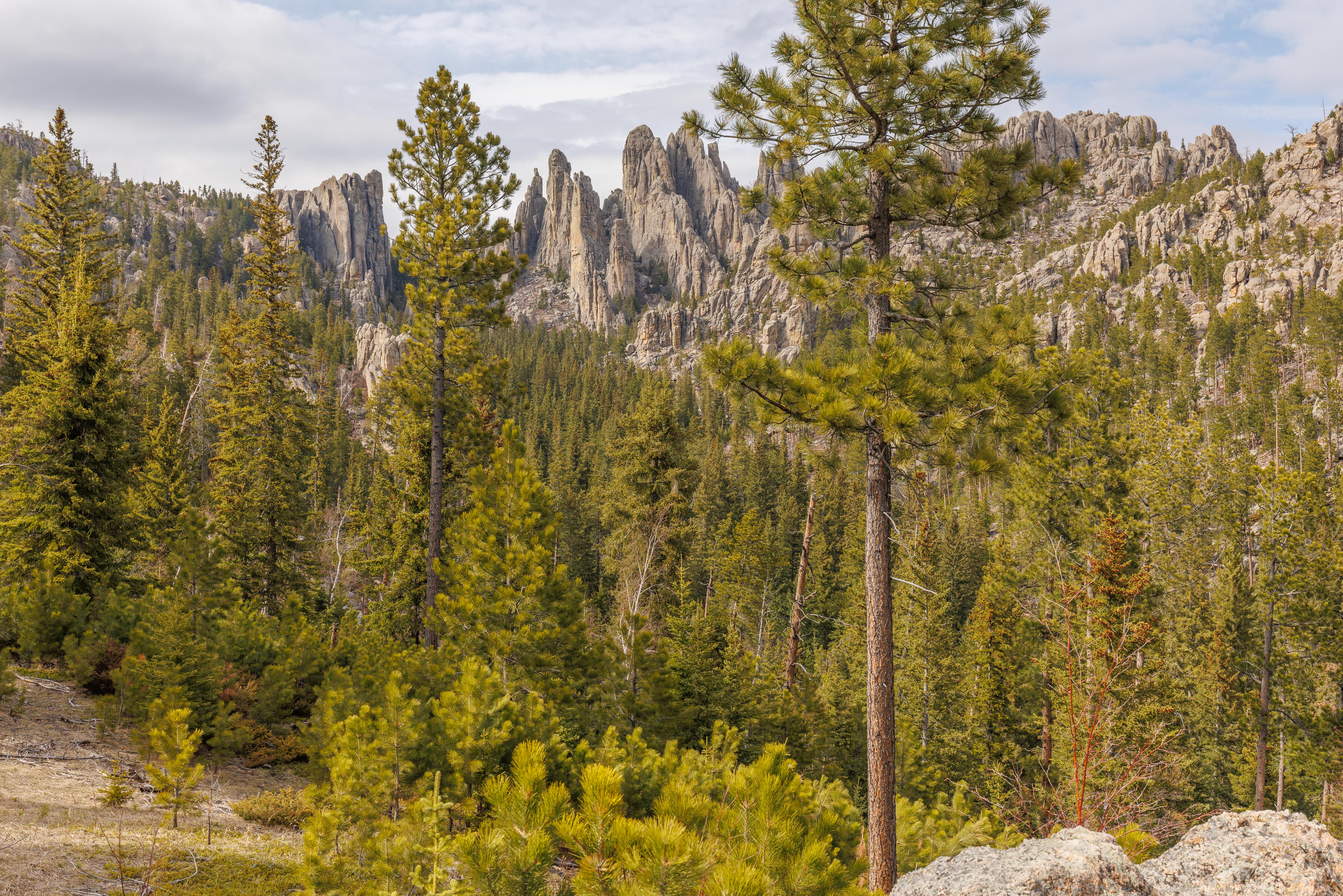
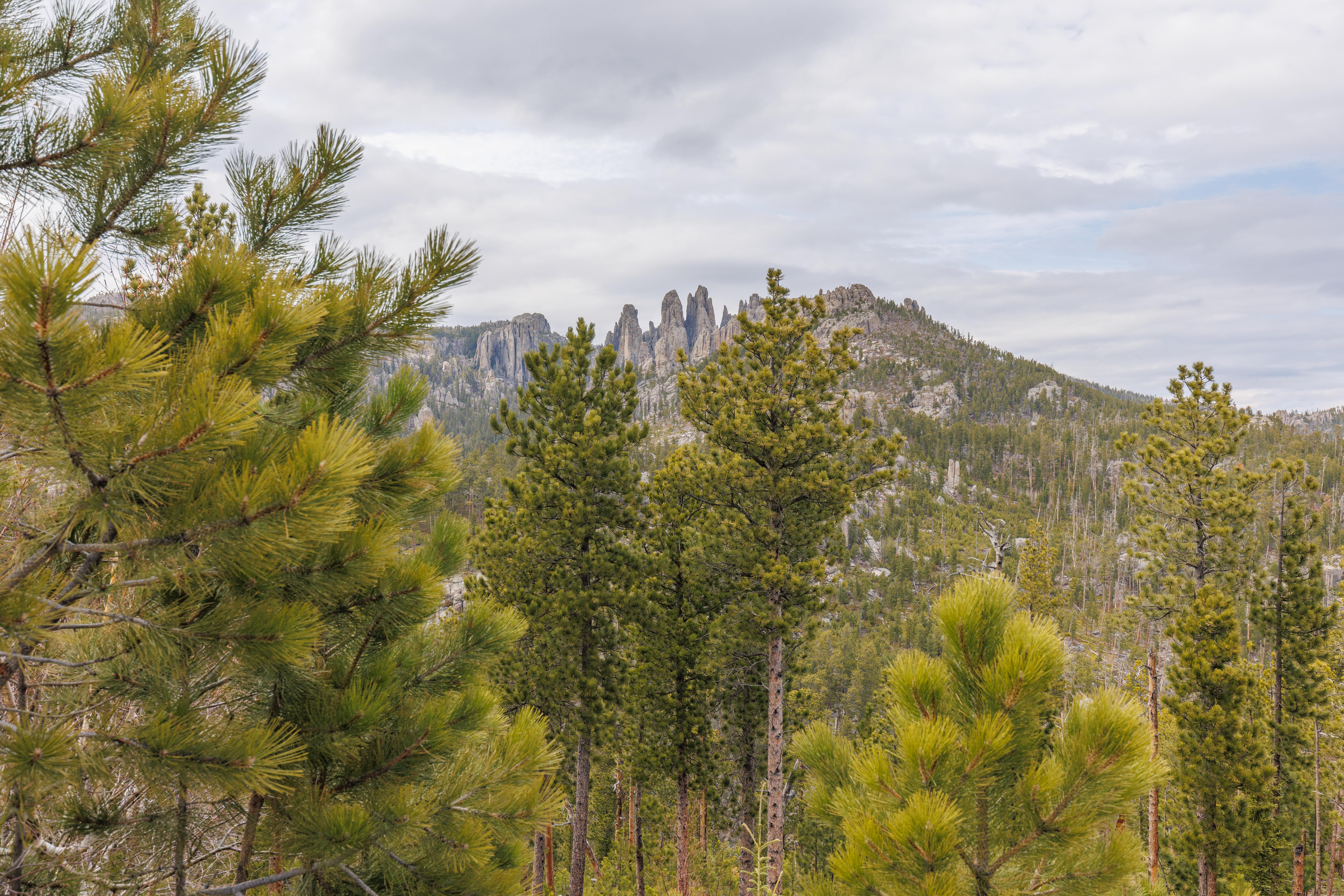
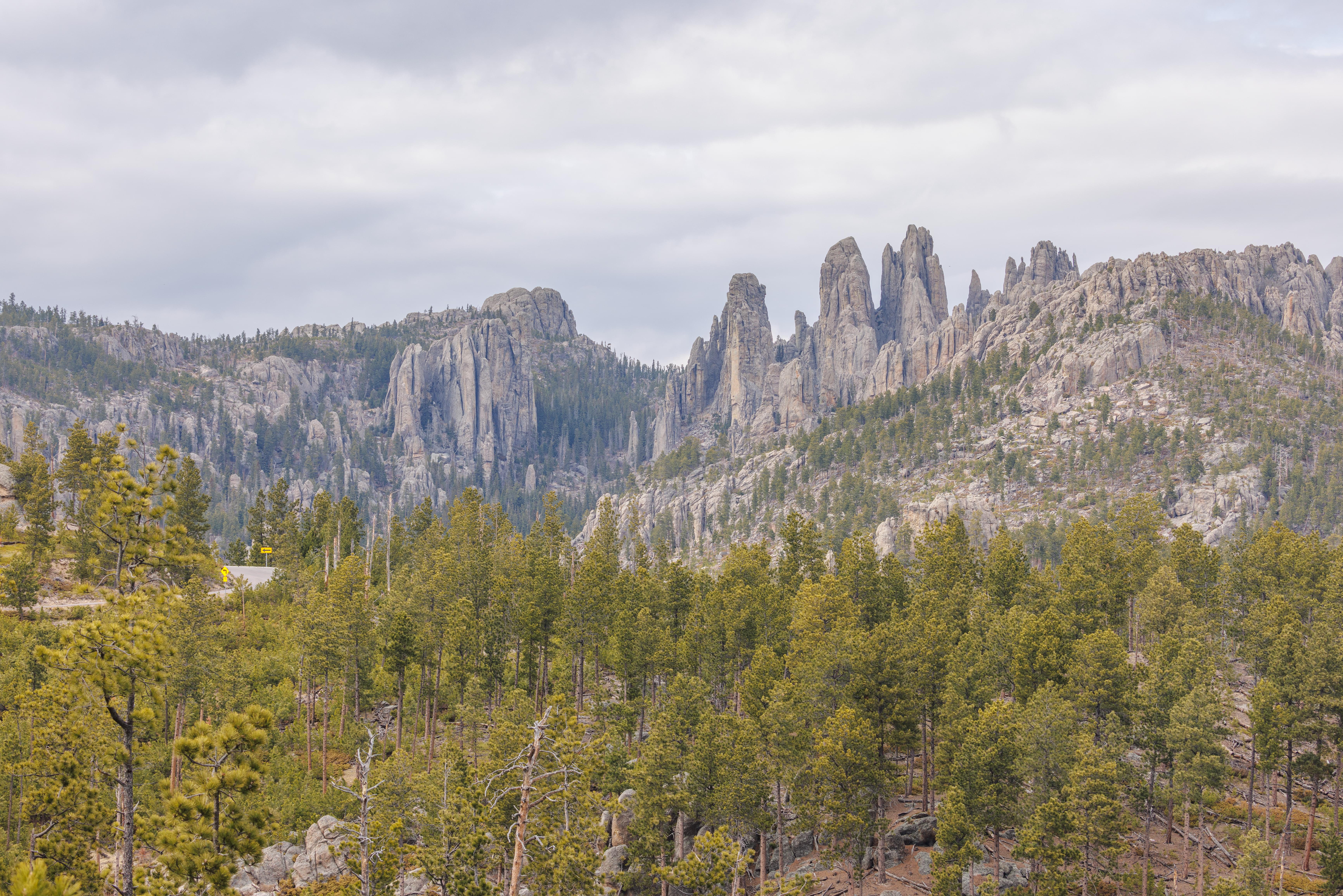
The Needles Highway gets its name from these tall needle-like formations on the northern end of the route.
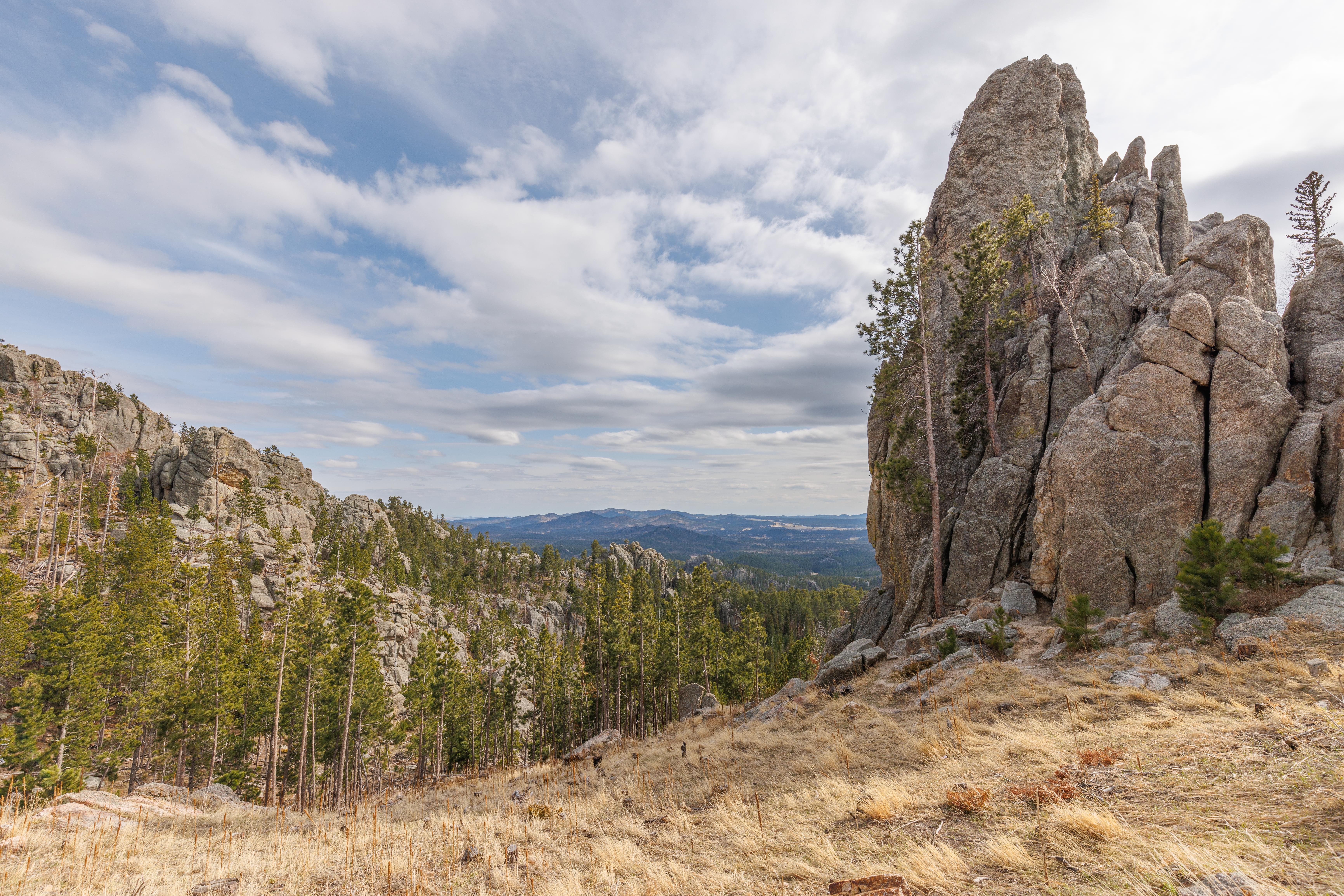
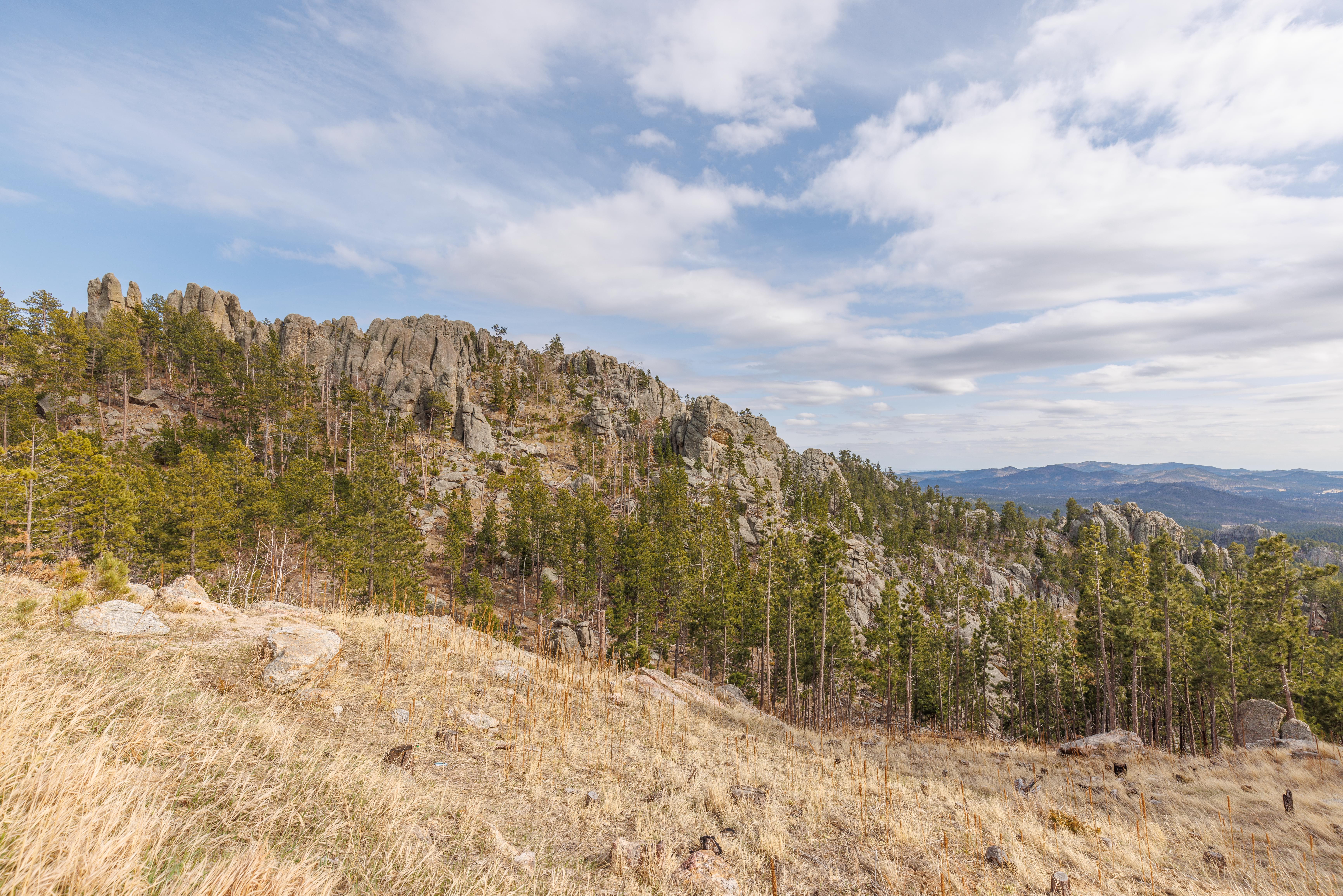
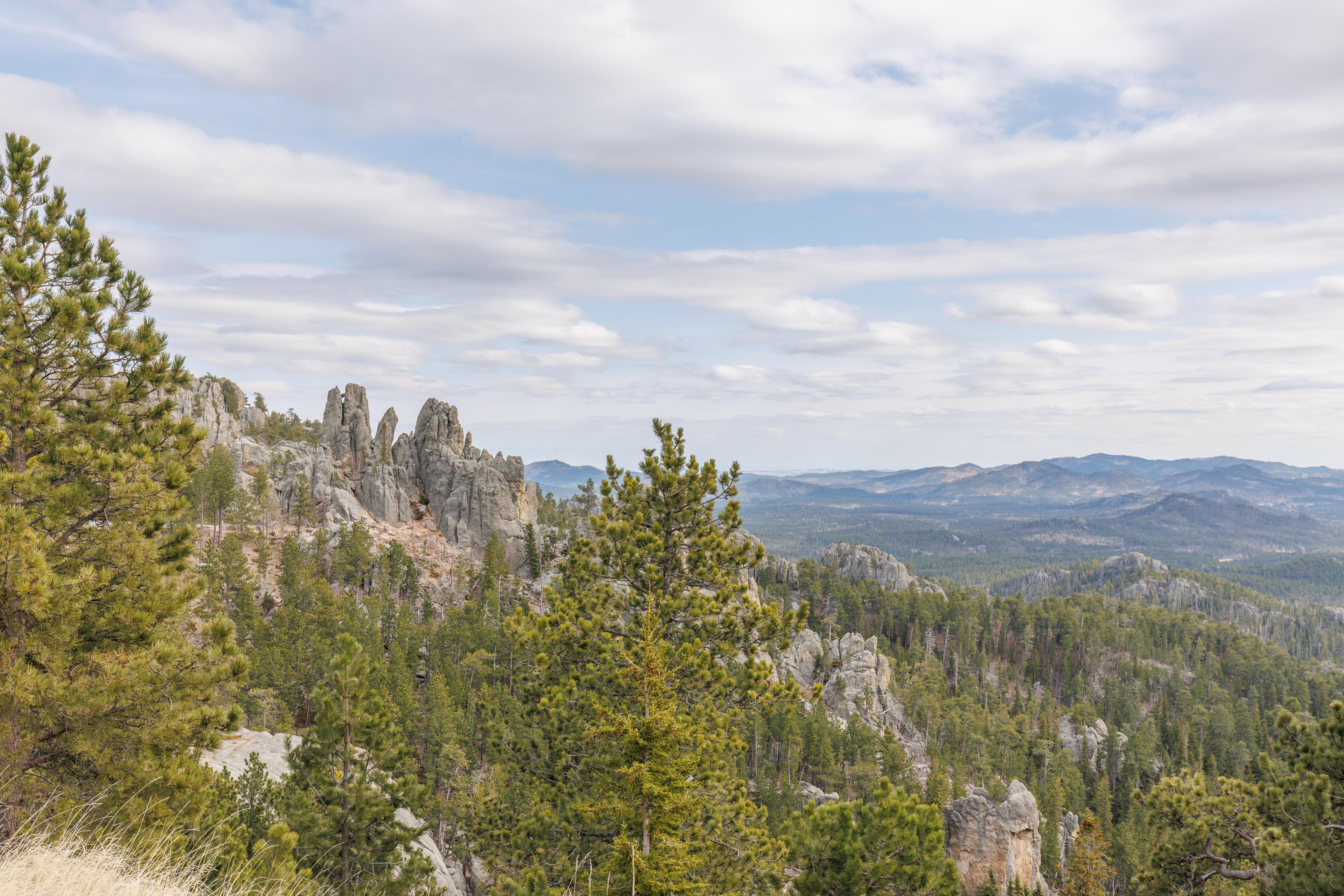
There are many pullouts along the way with some nice scenery!
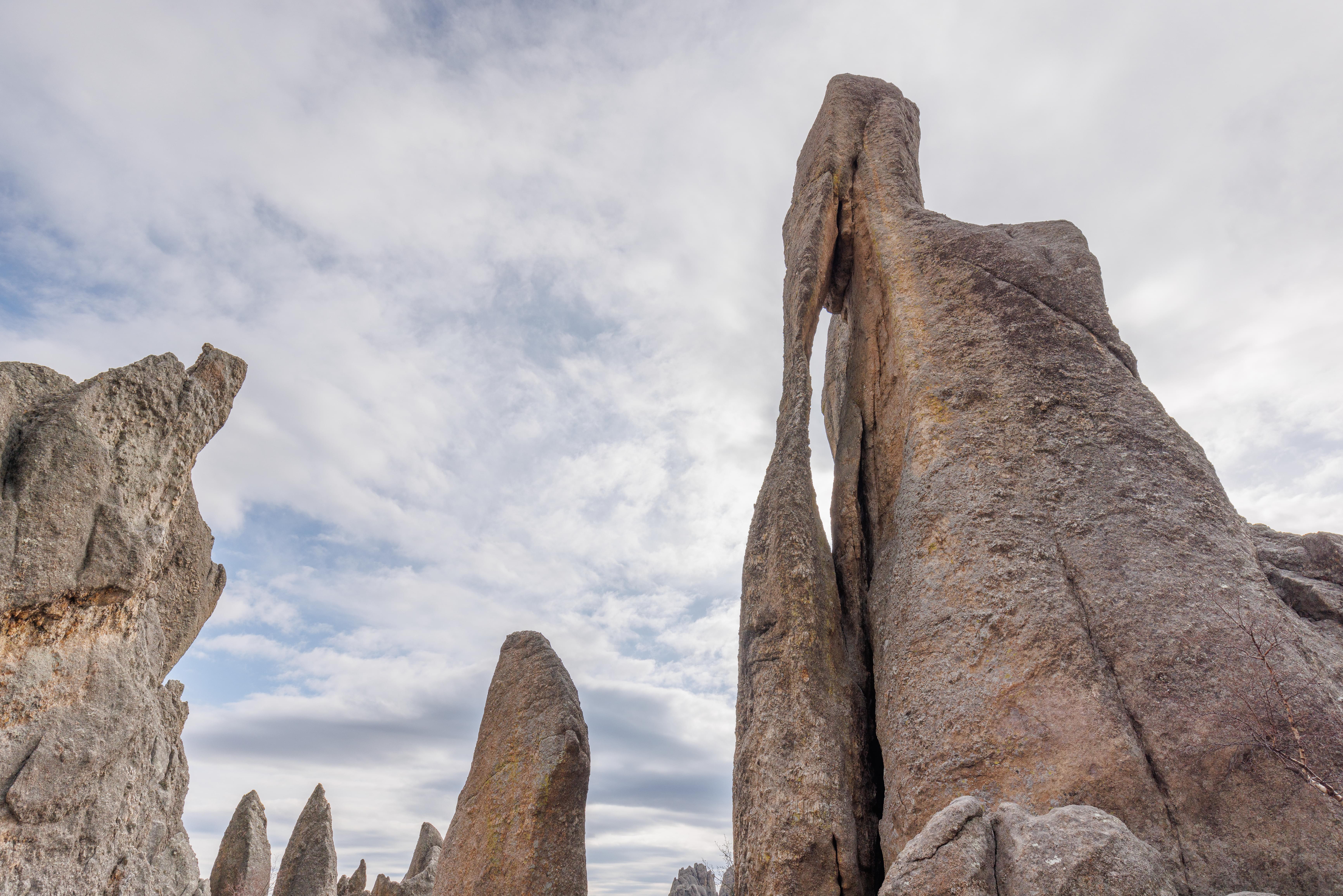
Near the northern end of the road, there is a tunnel called the Needle’s Eye Tunnel. Immediately after the tunnel is this formation, called the Needle’s Eye!
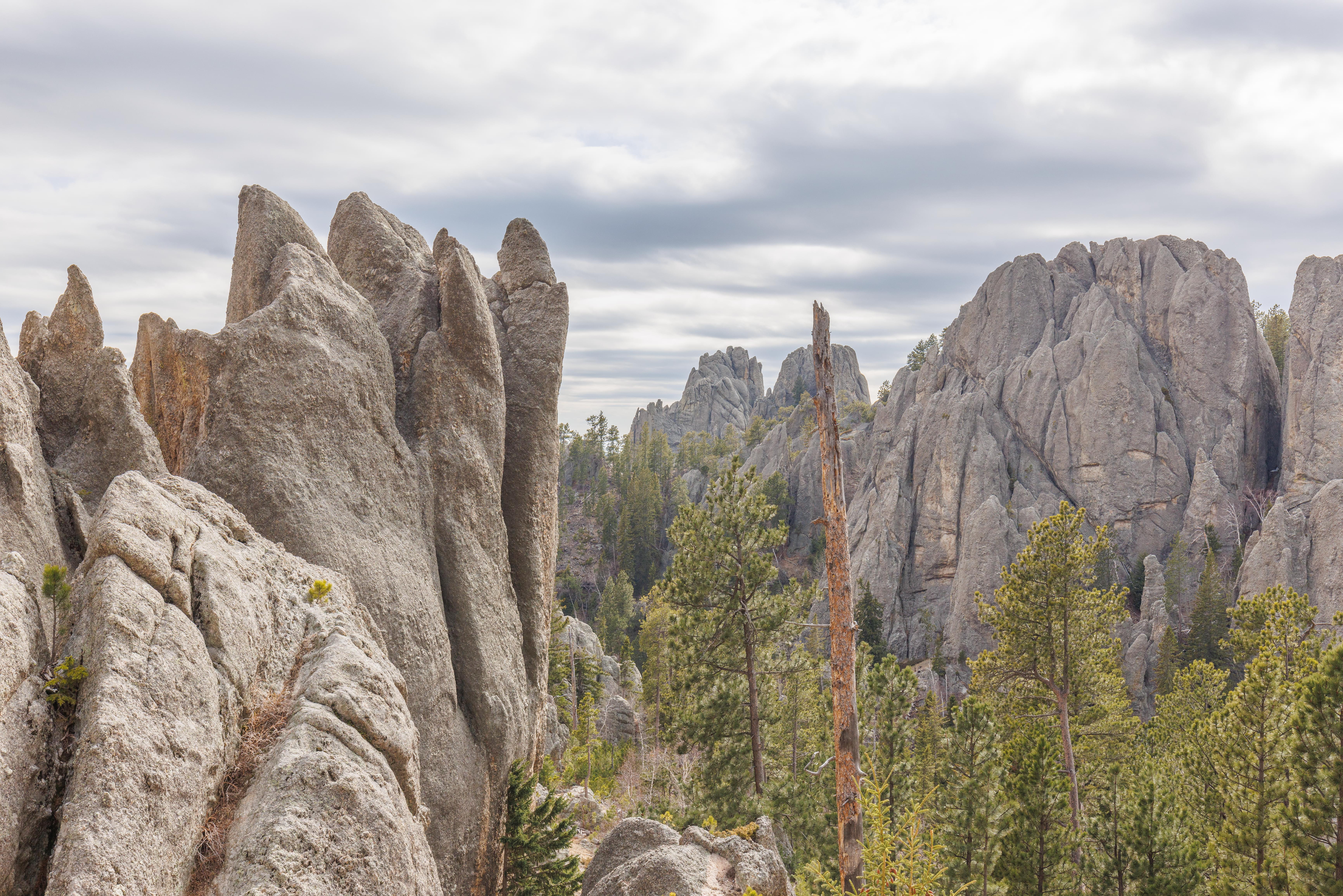
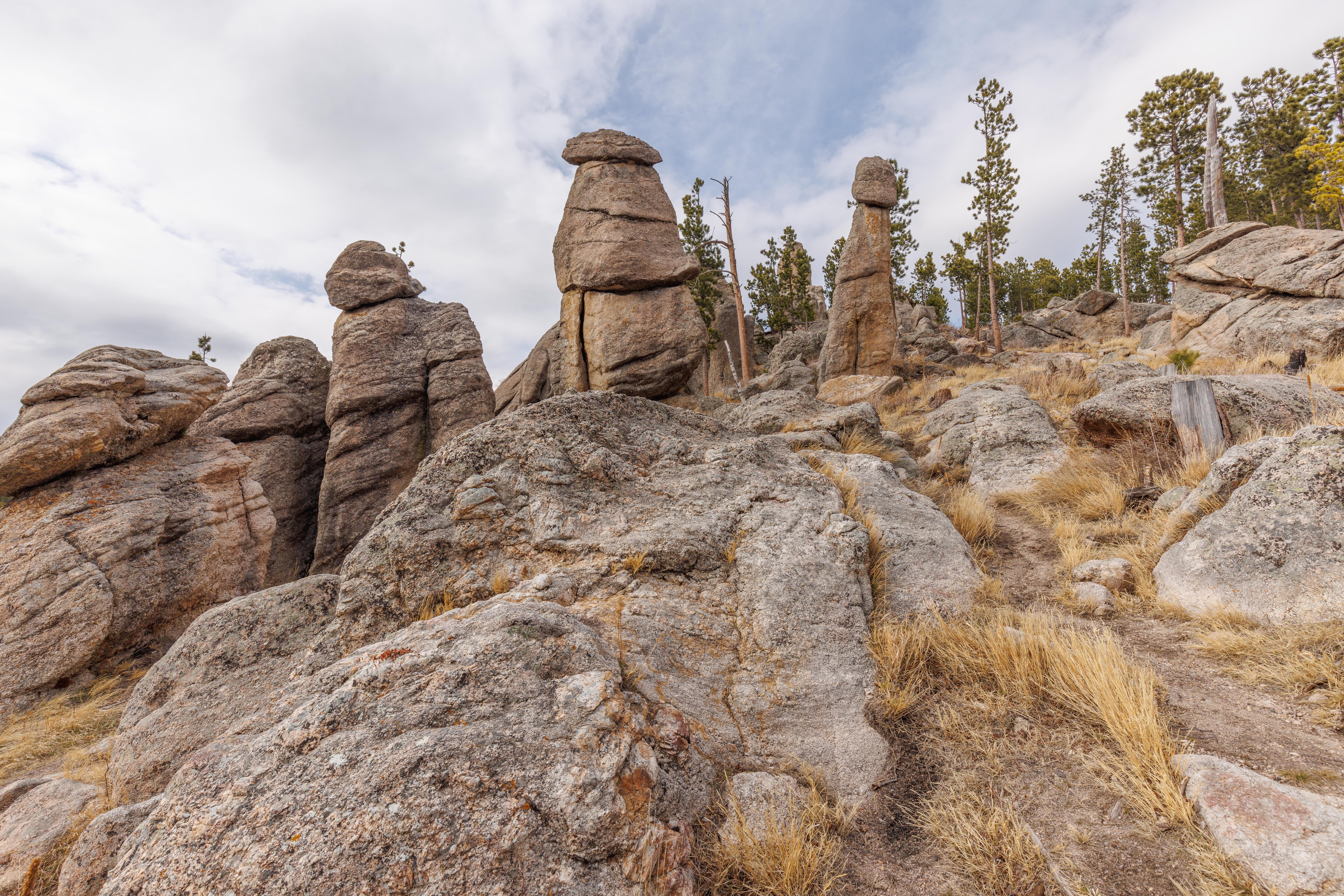
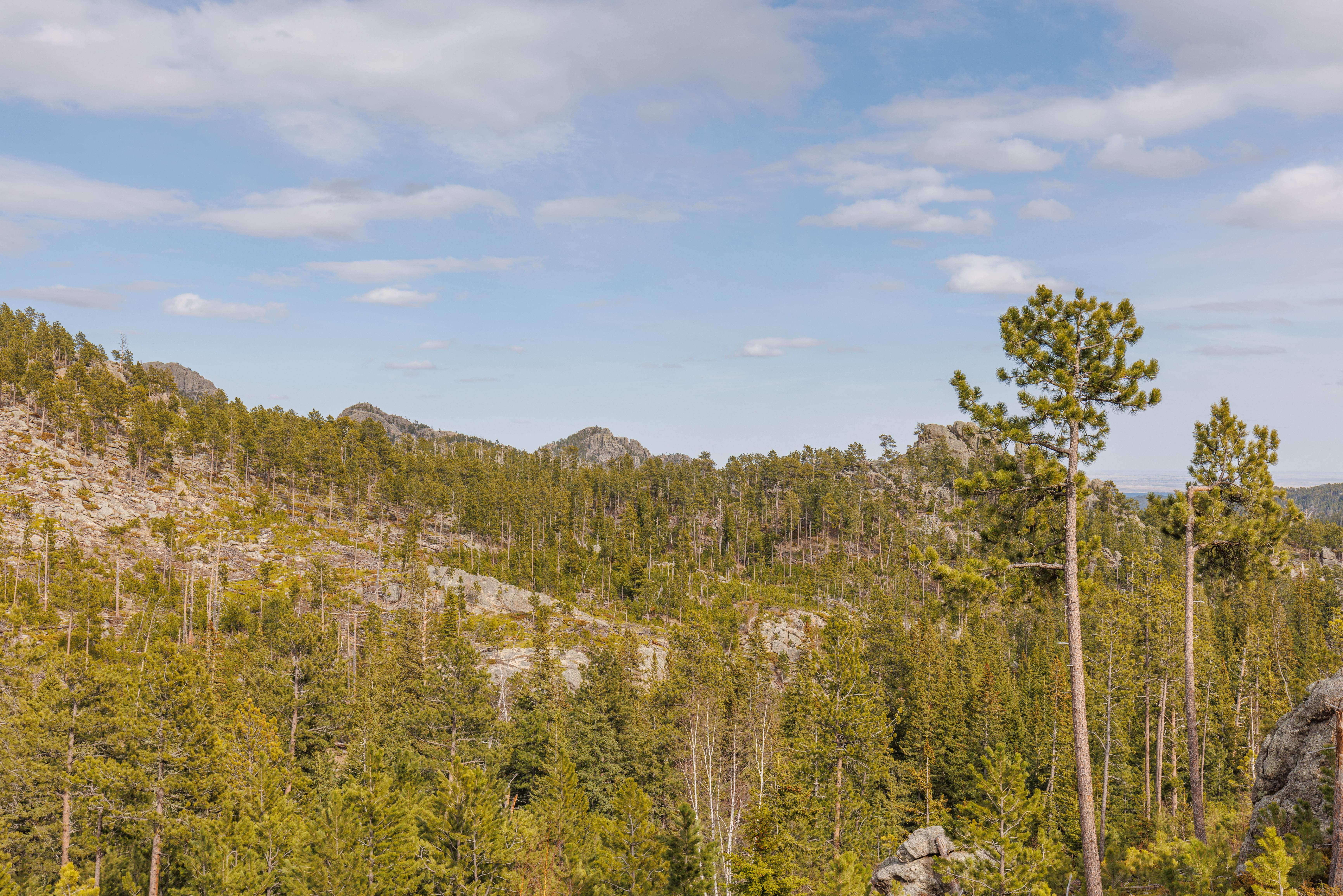
There are many formations in the immediate area.
Sylvan Lake
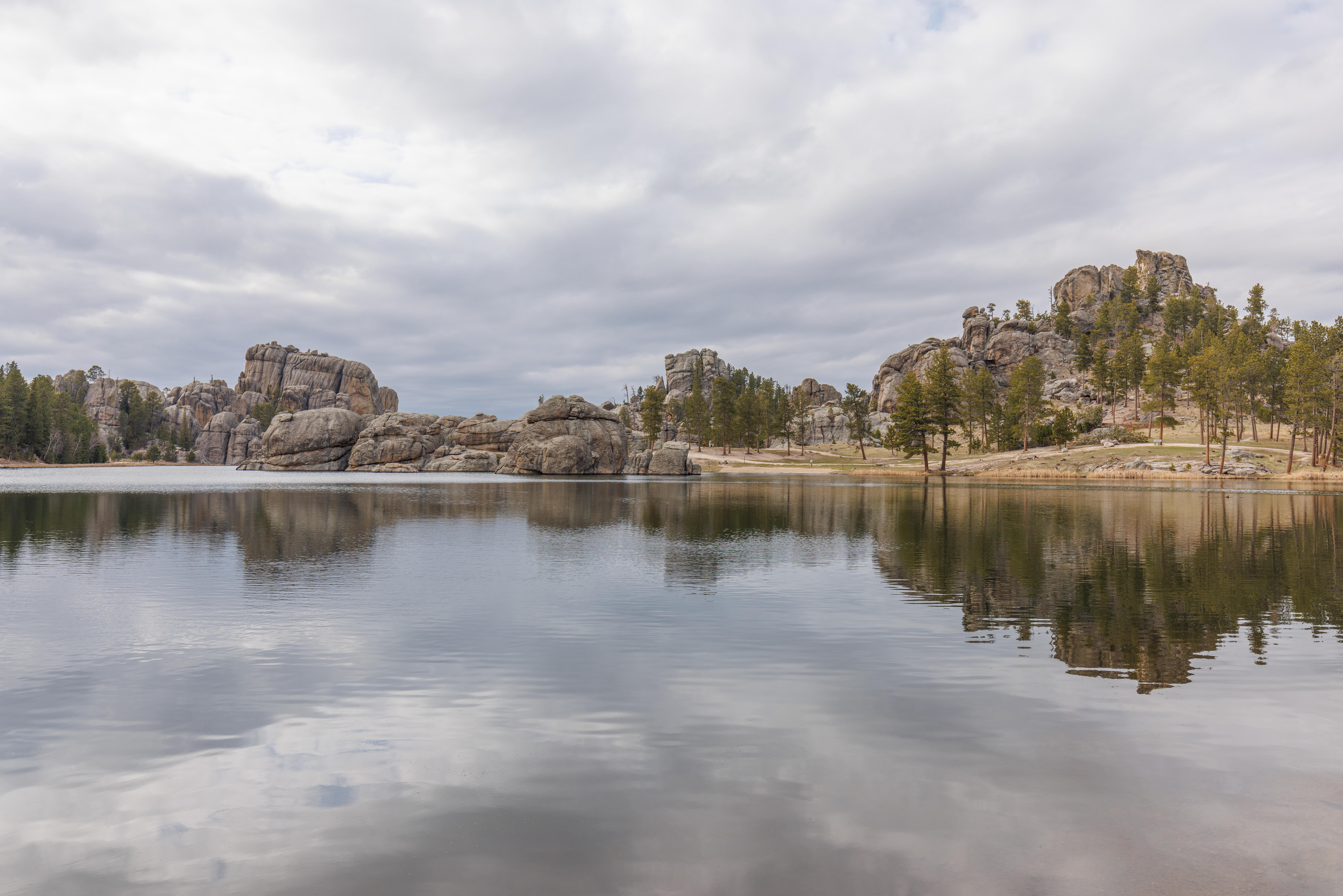
We ended our day at Sylvan Lake. It was already getting late so we just briefly enjoyed the view before moving on. If it was earlier in the day, we would have hiked the trail around the lake.