

We started the day in Canterbury, home of the Archbishop of Canterbury who is responsible for crowning the monarch. The most recent coronation was just two weeks ago for King Charles III. Unfortunately, Canterbury Cathedral was closed due to filming. We walked over to St. Augustine’s Abbey. It was originally going to be our second destination of the day. Afterwards, we planned on visiting St. Martin’s Church, also nearby. It is the oldest church still in use in England. Unfortunately, it is not open to visitors on Tuesdays. We ended up driving to Walmer Castle and Gardens, just north of Dover. After spending some time there, where the Duke of Wellington, who defeated Napoleon, died, we drove a mile or two further north to Deal Castle. After exploring the castle, we headed back to Canterbury where we took a walk on the city walls and through a park.
Canterbury
We started out the day in Canterbury by heading towards Canterbury Cathedral. We could see it towering above the other smaller buildings in the city.
Upon arriving at the gate, we found out it was closed for filming. There were some film crew outside of the cathedral gate as well. Nothing much seemed to be going on though.
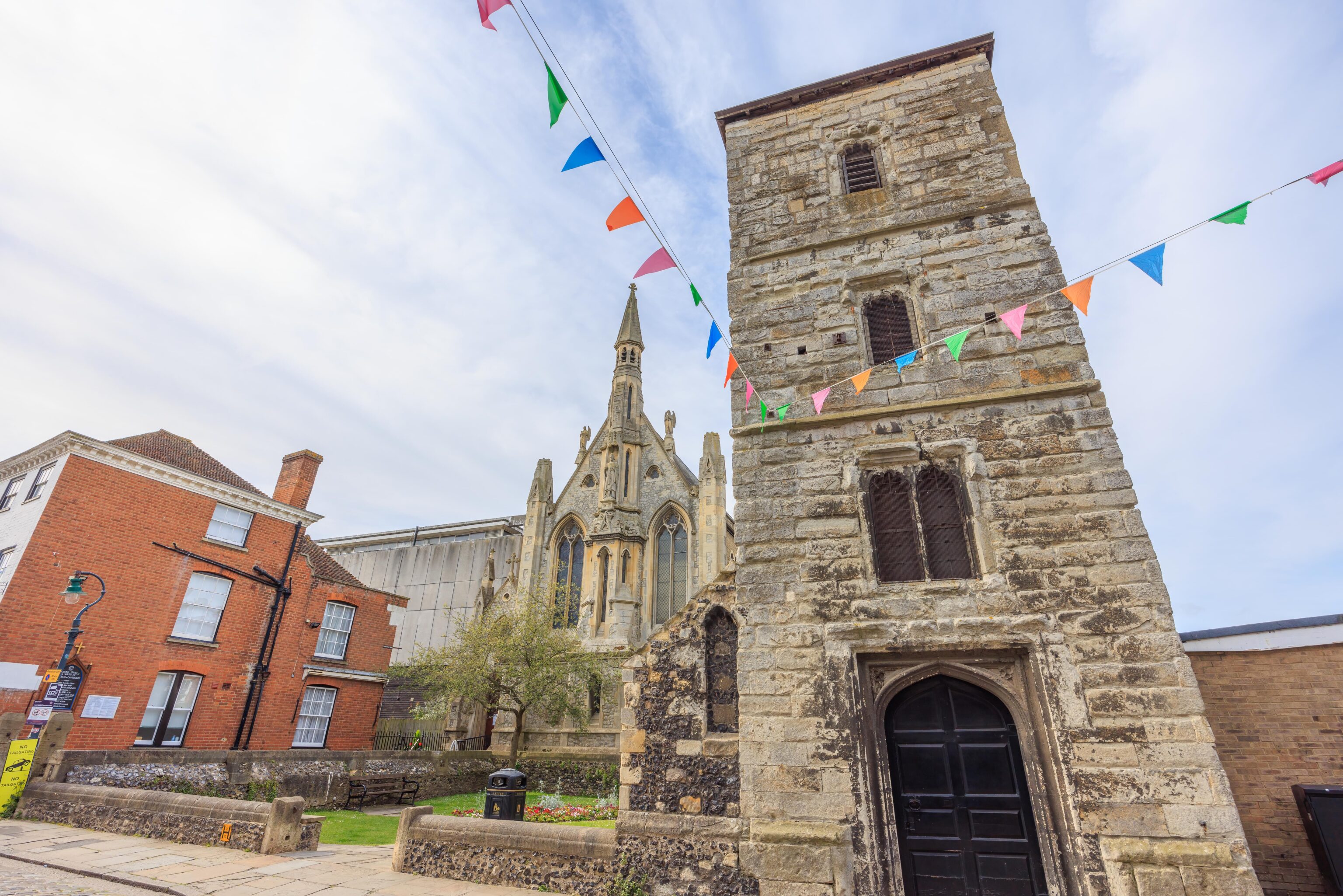
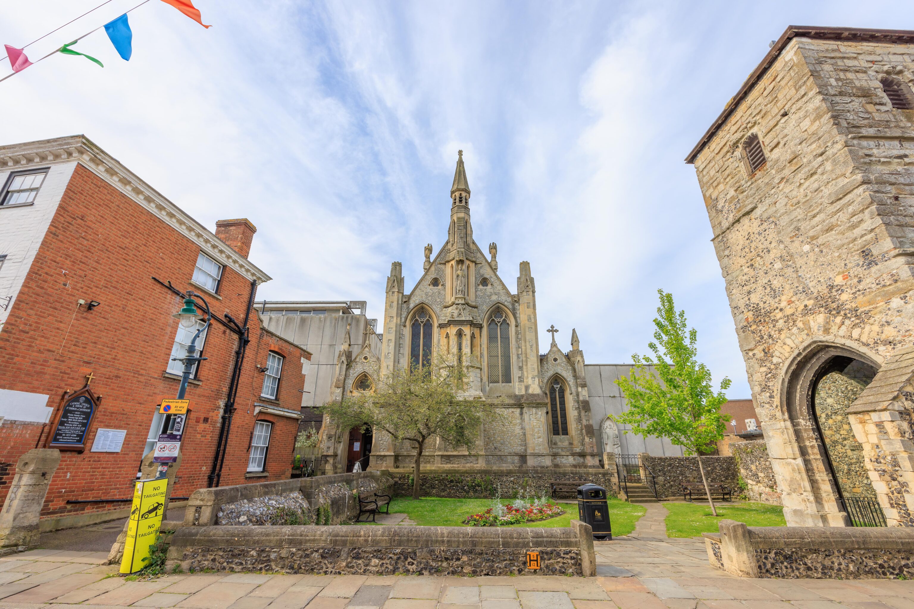
We decided to walk towards St. Augustine’s Abbey. About half way to the remnants of the city wall, we passed by St. Thomas’ Church. The tower on the right is the Tower of St. Mary Magdalene. It was built in the 1500s and is all that is left of a previous church that was here.
St. Augustine’s Abbey
We arrived a bit early to St. Augustine’s Abbey as it was originally supposed to be our second destination of the morning. We waited outside until opening time about 15 minutes later and were the first visitors in. We spent some time in the visitor center as it gave some good historical information about the abbey.
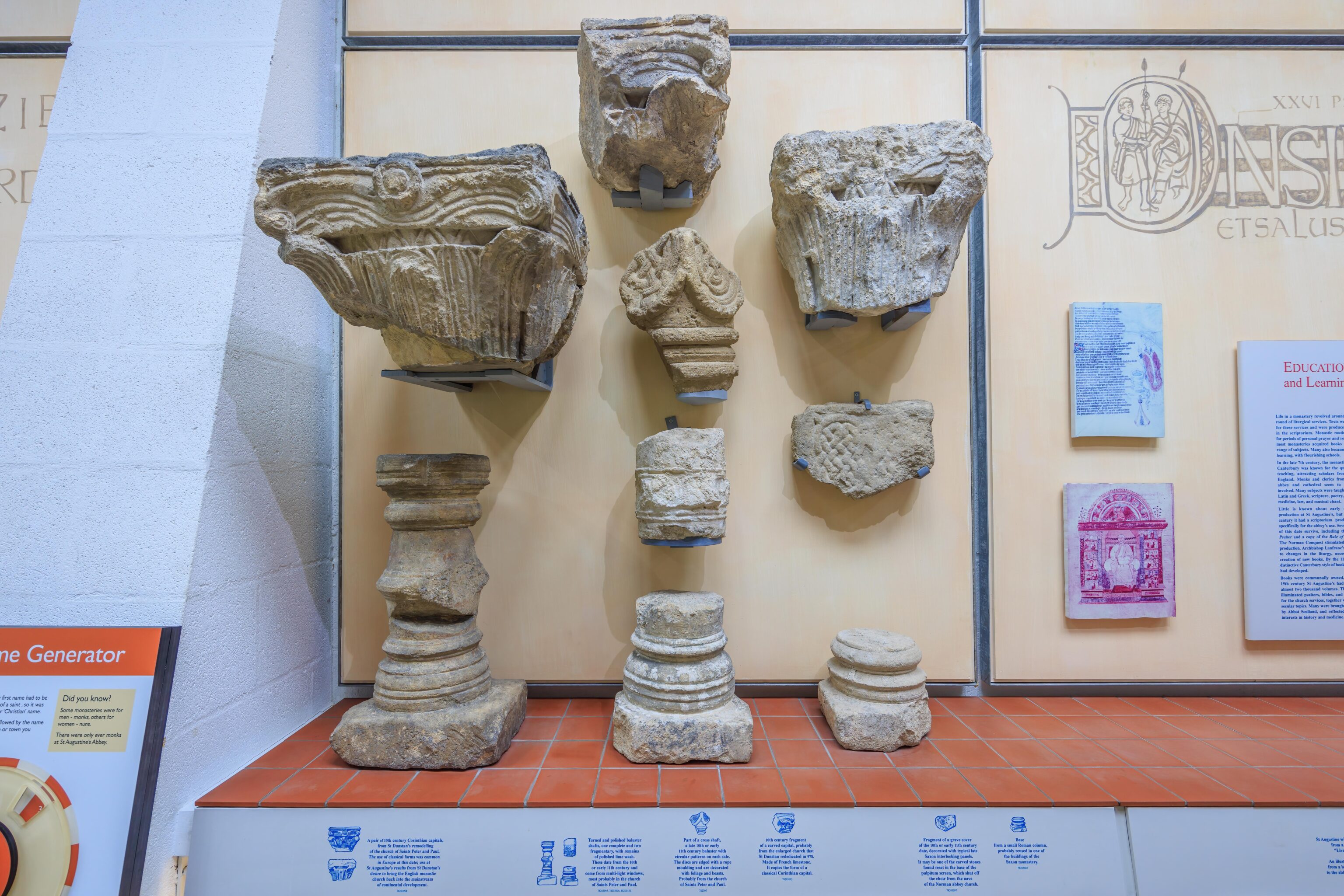
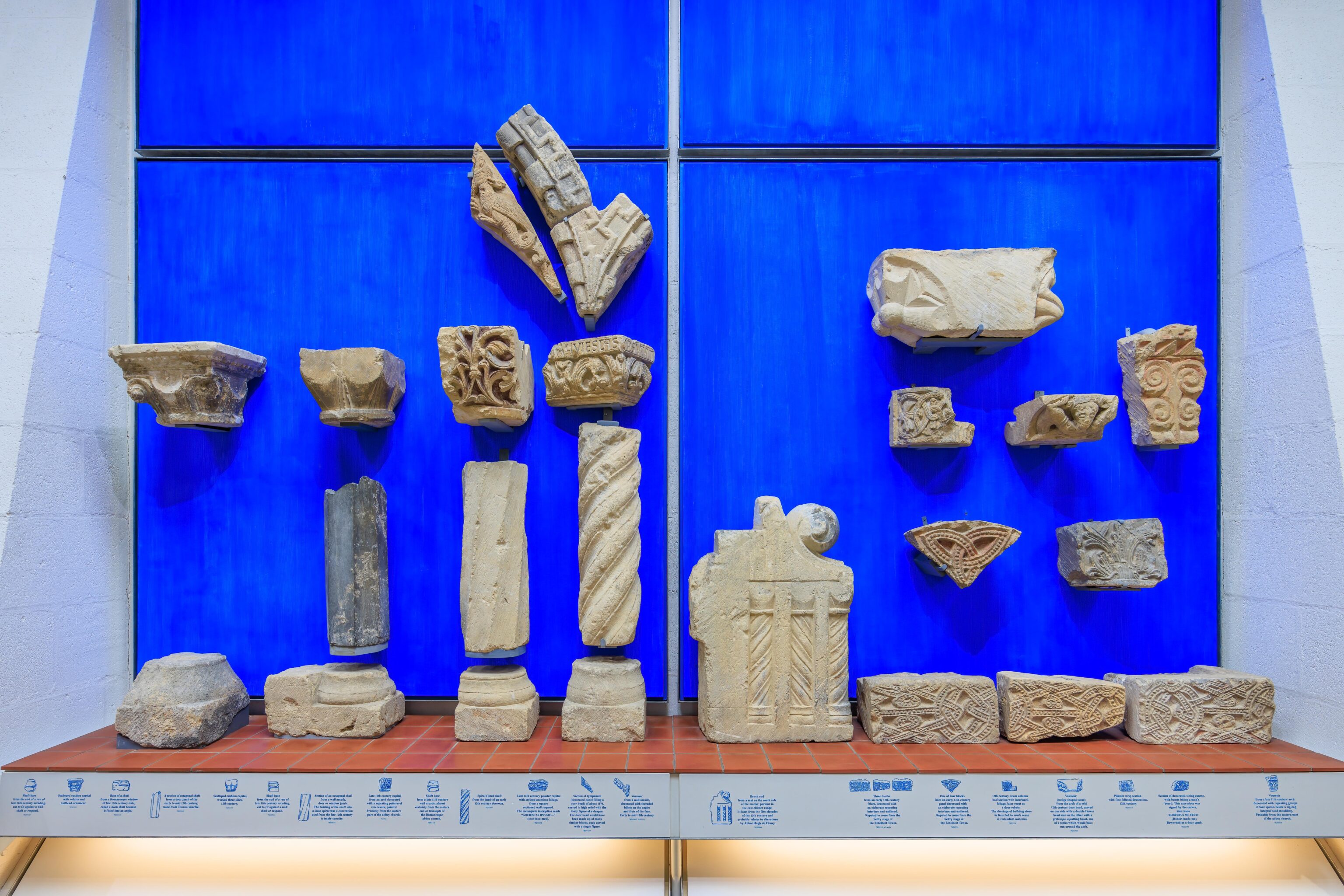
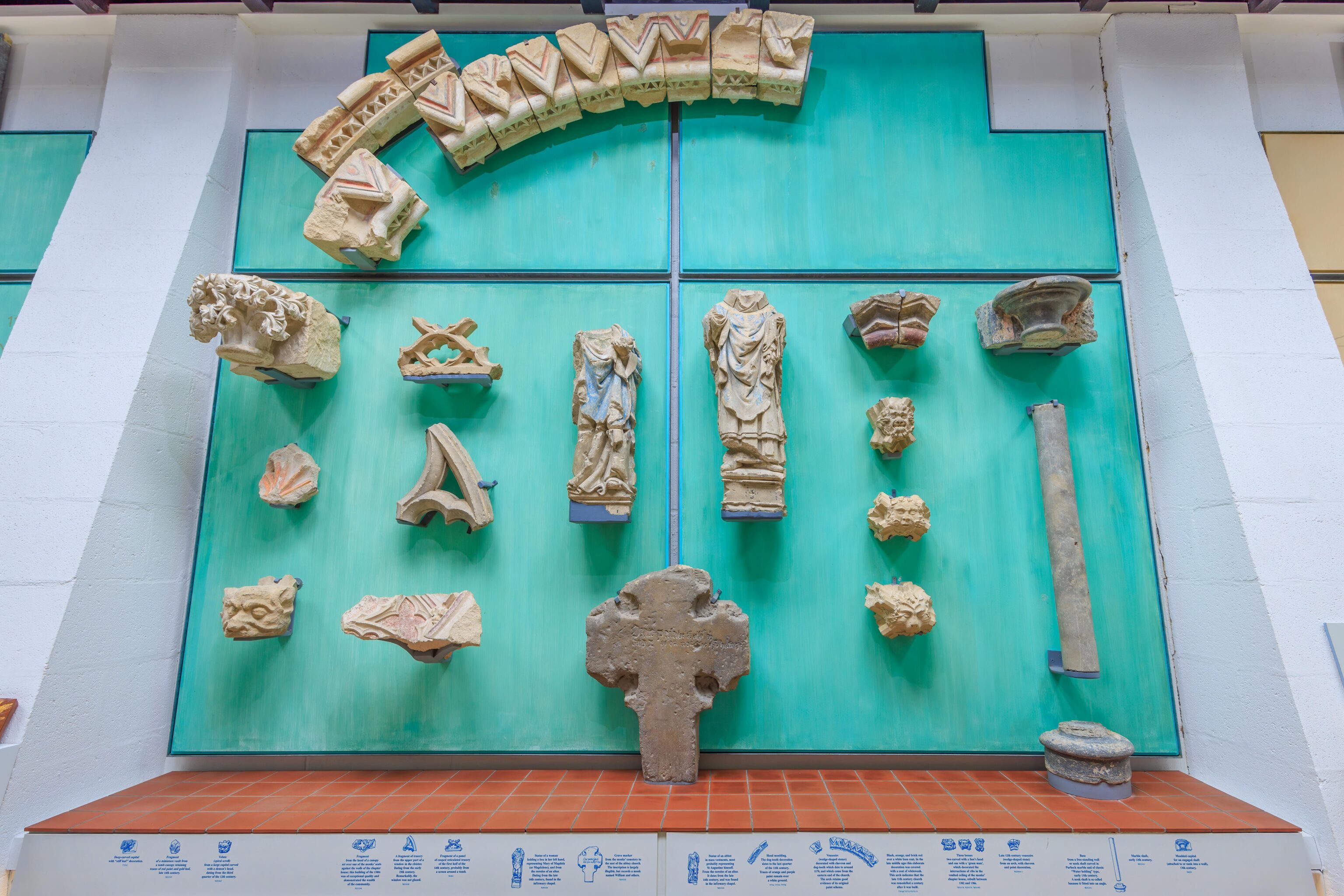
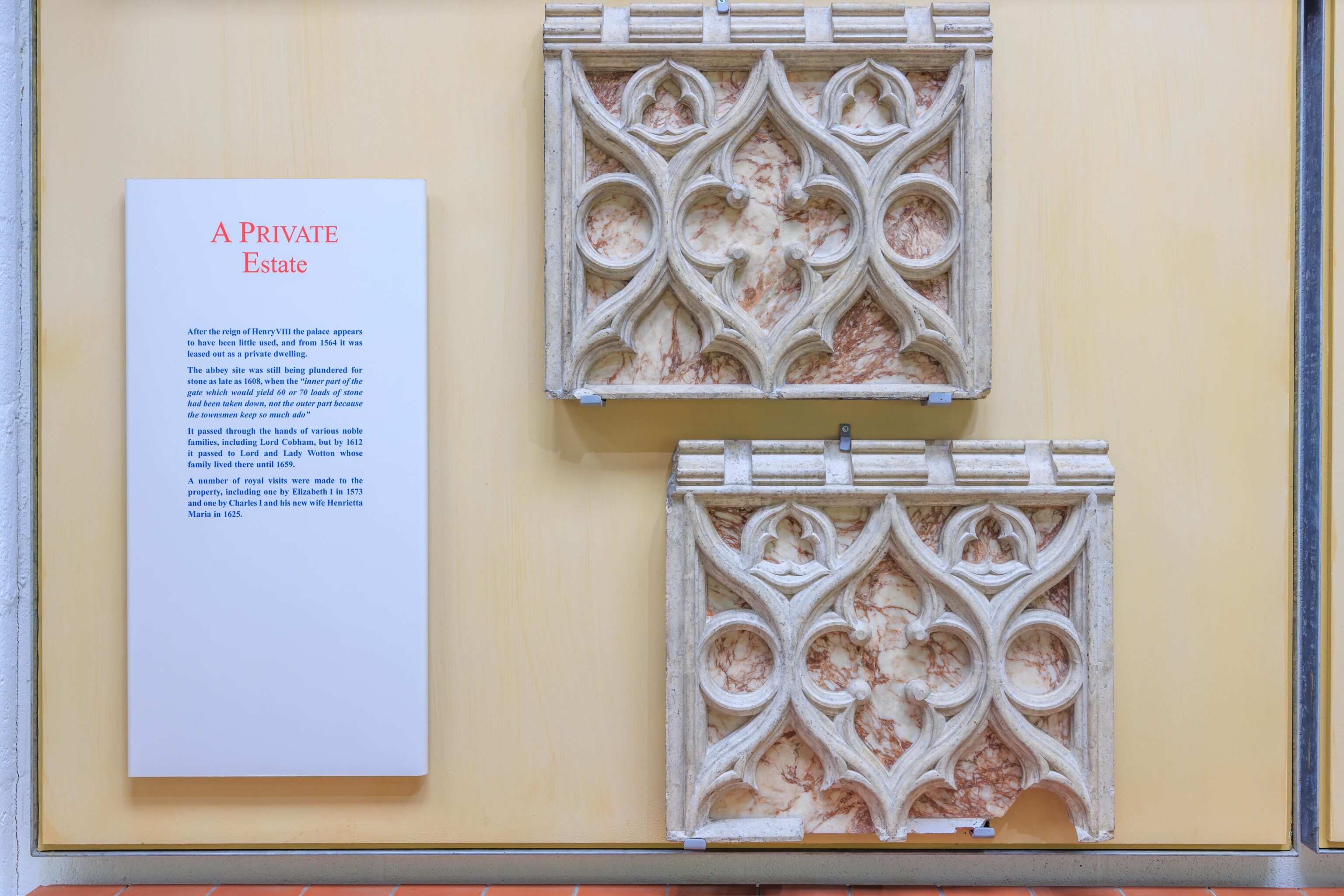
There were informational displays with text that explained the history of the abbey as well as some artifacts that were obtained from the site.
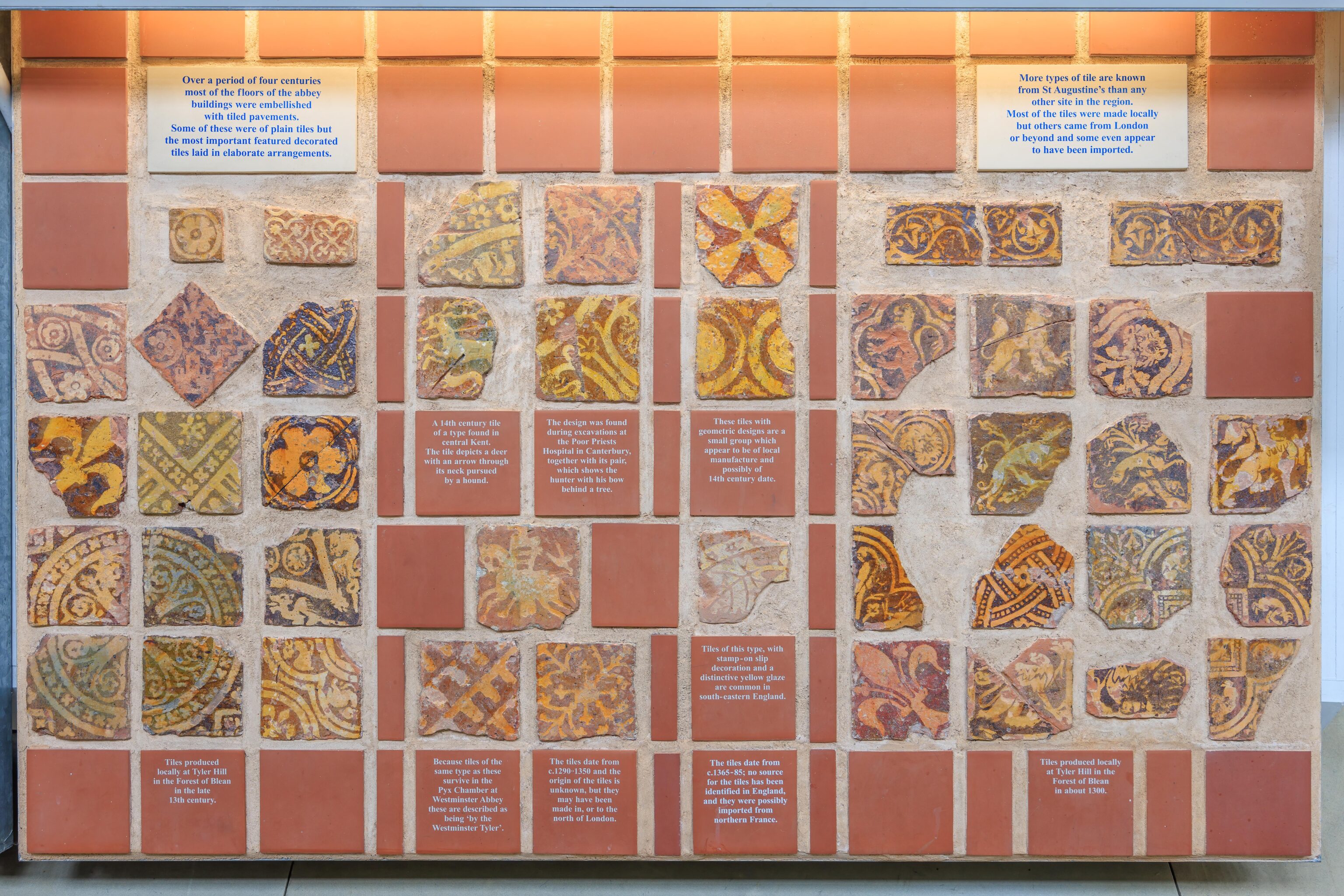
There were also some examples of floor tiles that had survived.
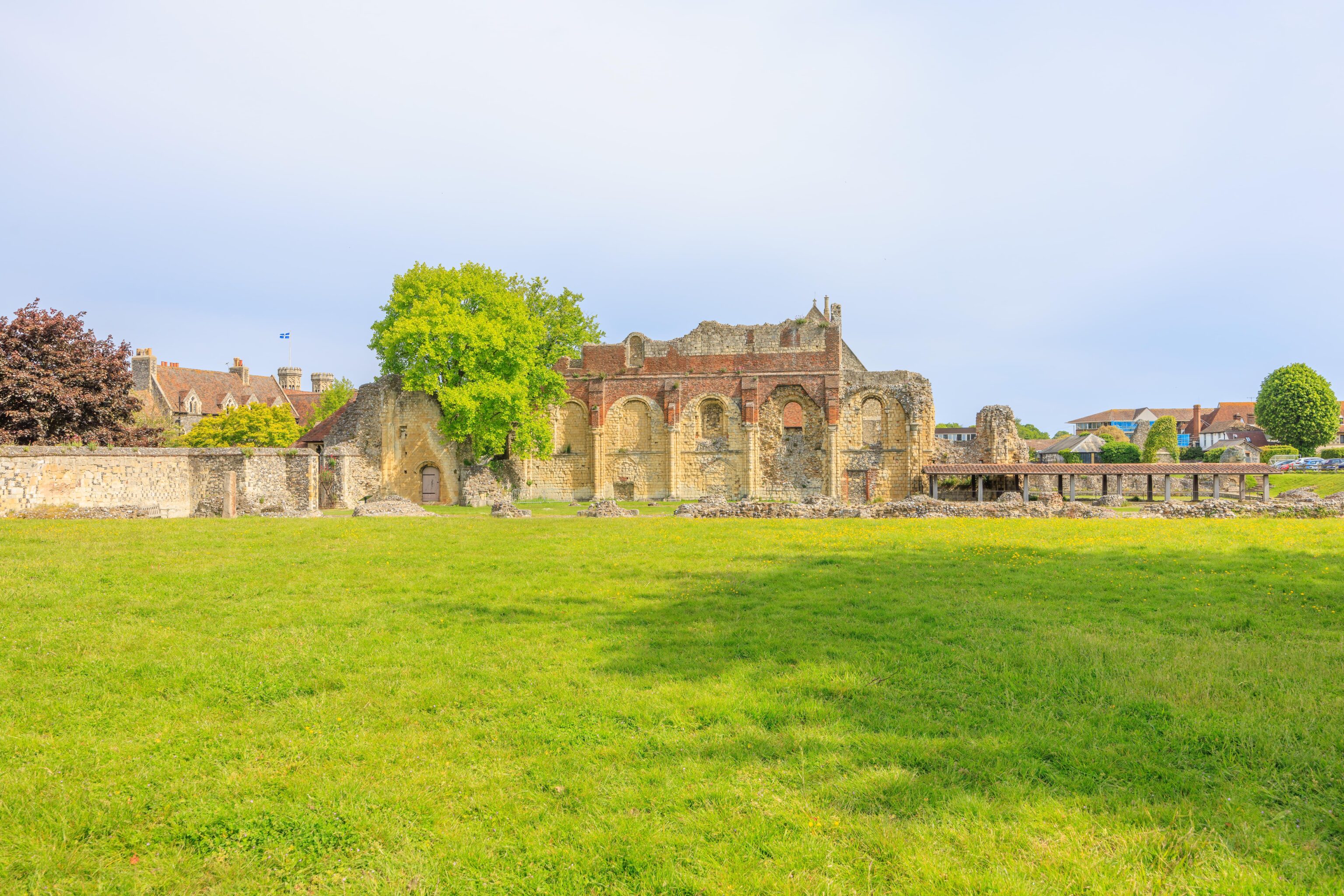
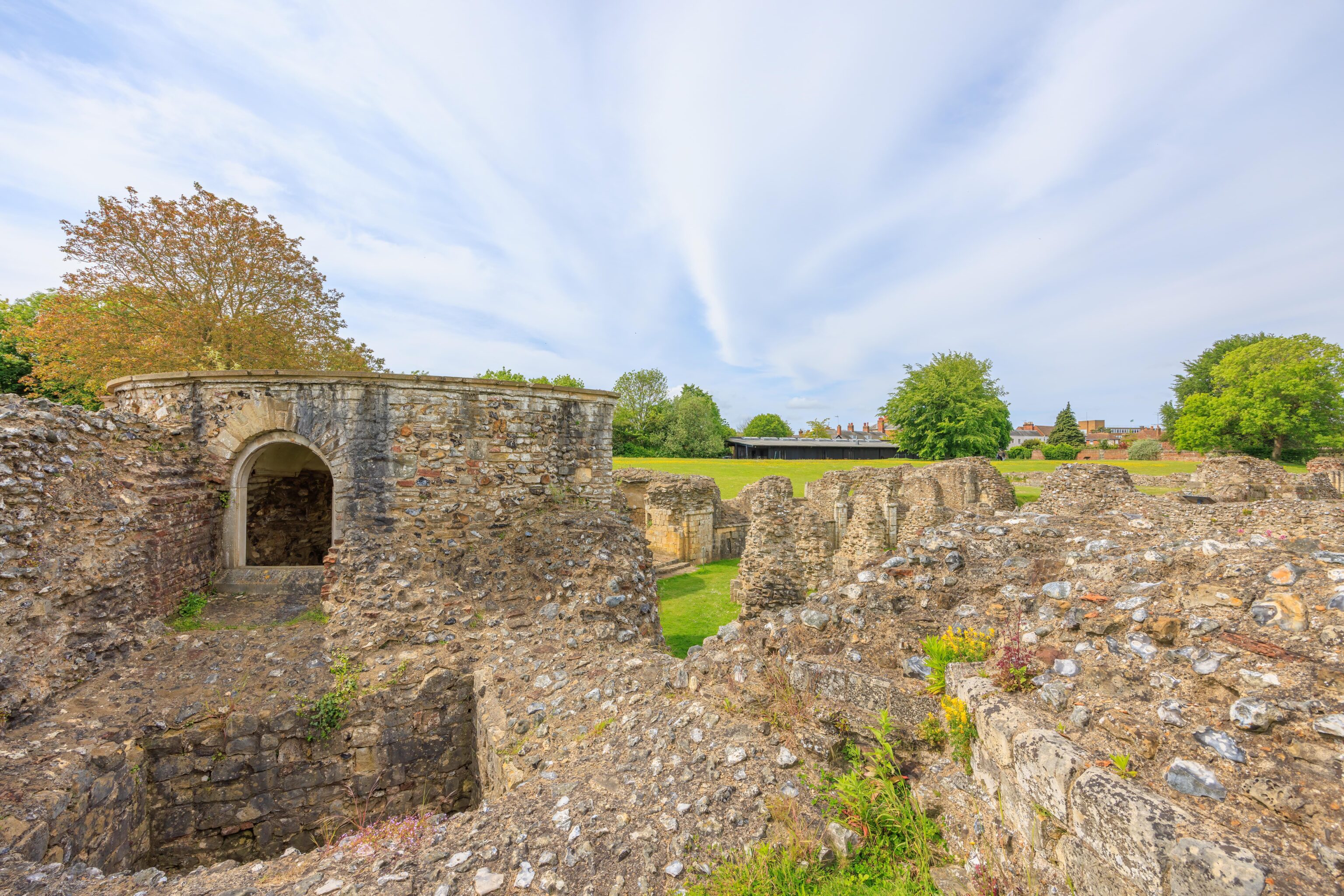
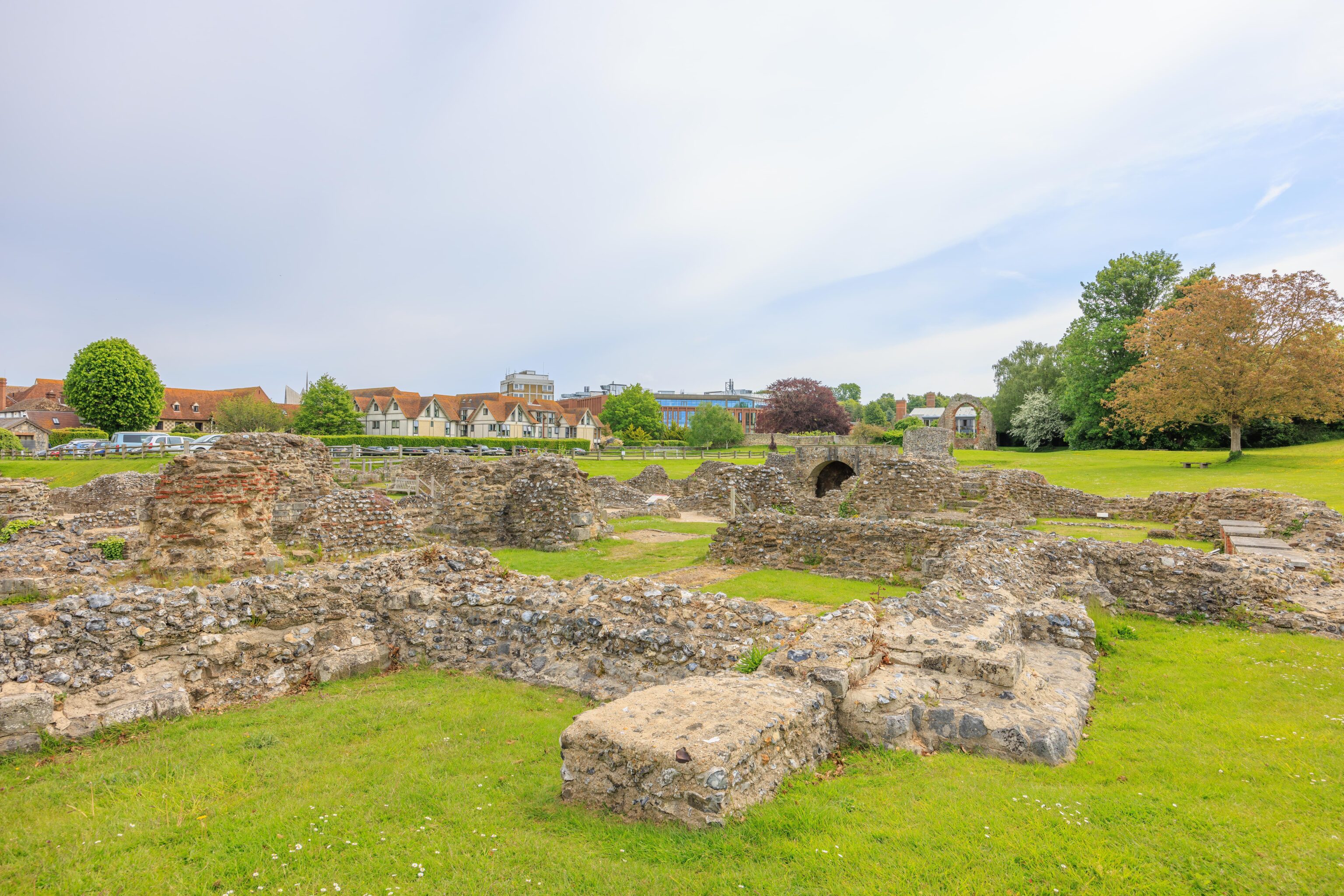
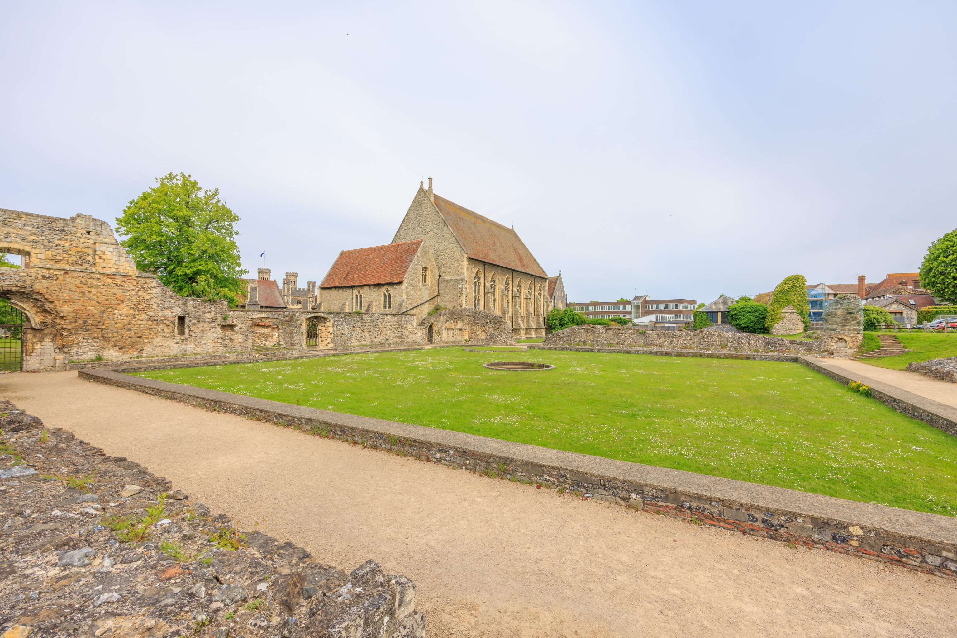
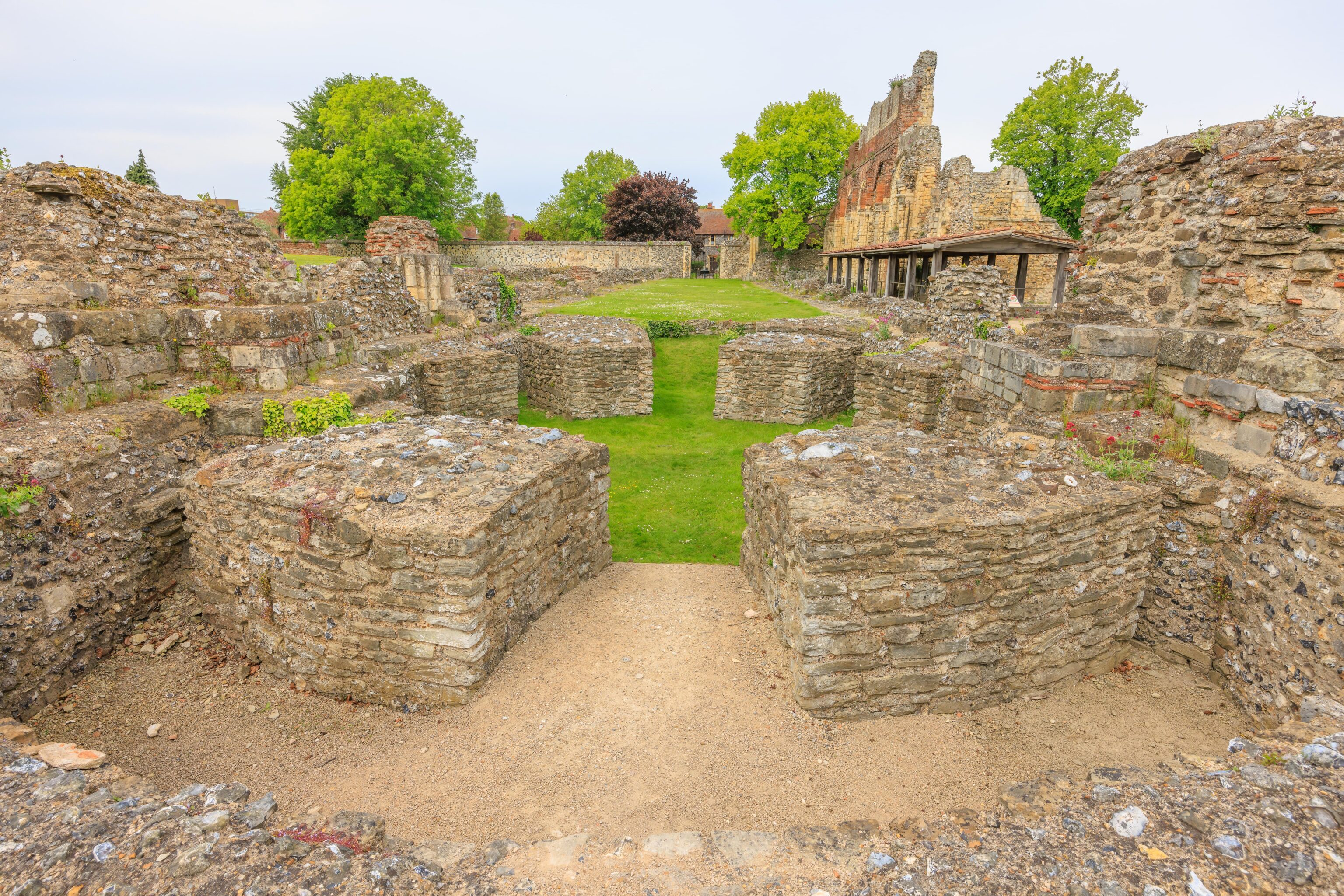
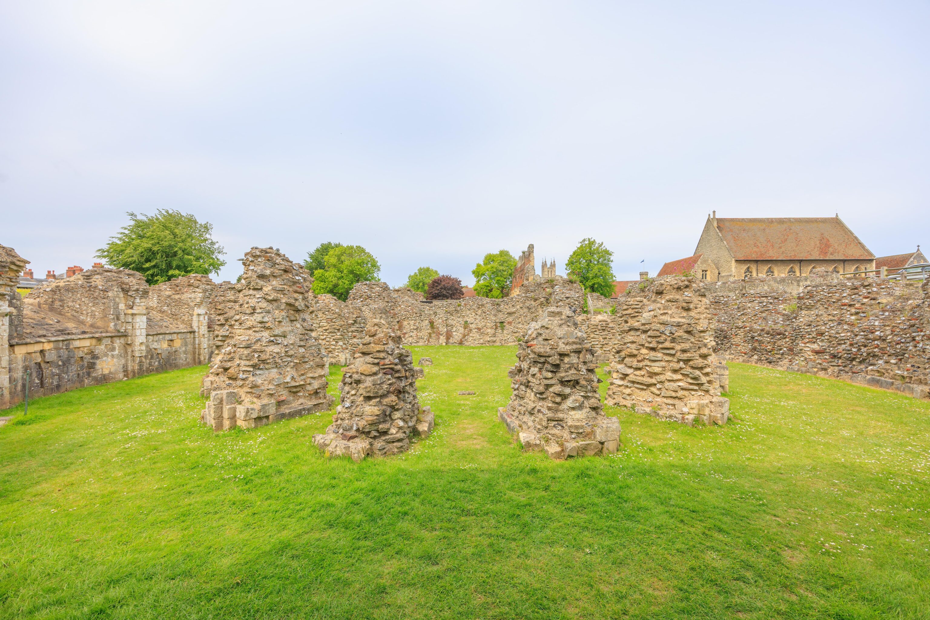
Not much remains of the abbey today. The initial view after exiting the visitor center shows a wall and some foundation stones.
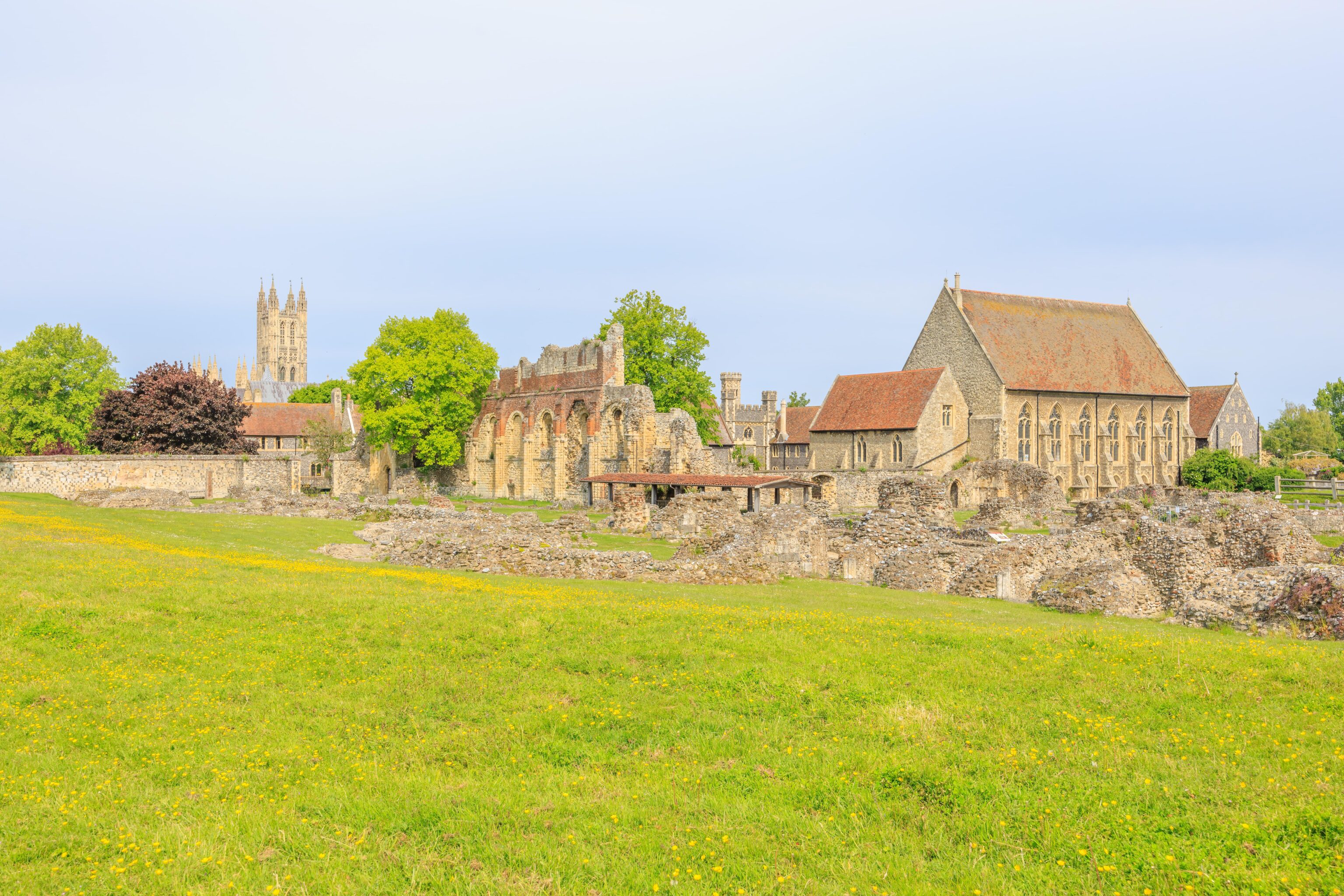
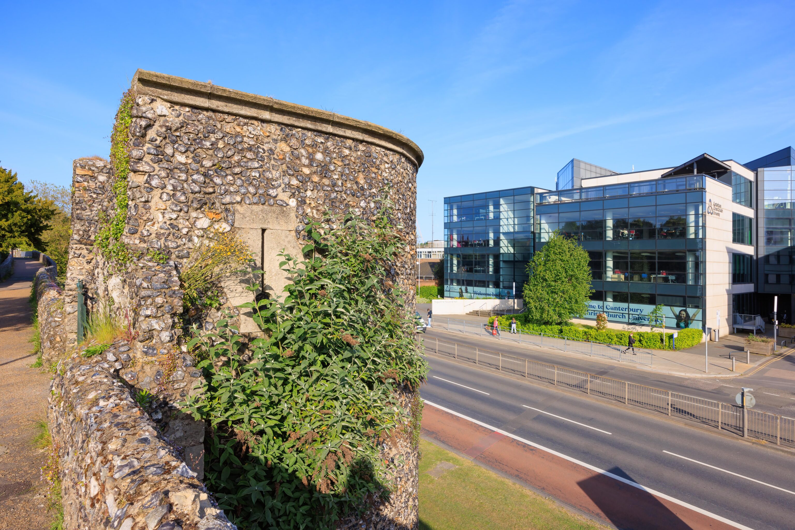
We decided to walk around to the right, or east, first. We could see Canterbury Cathedral towering over everything else in the distance. The intact buildings adjacent to the abbey ruins are part of the current Canterbury Christ Church University.
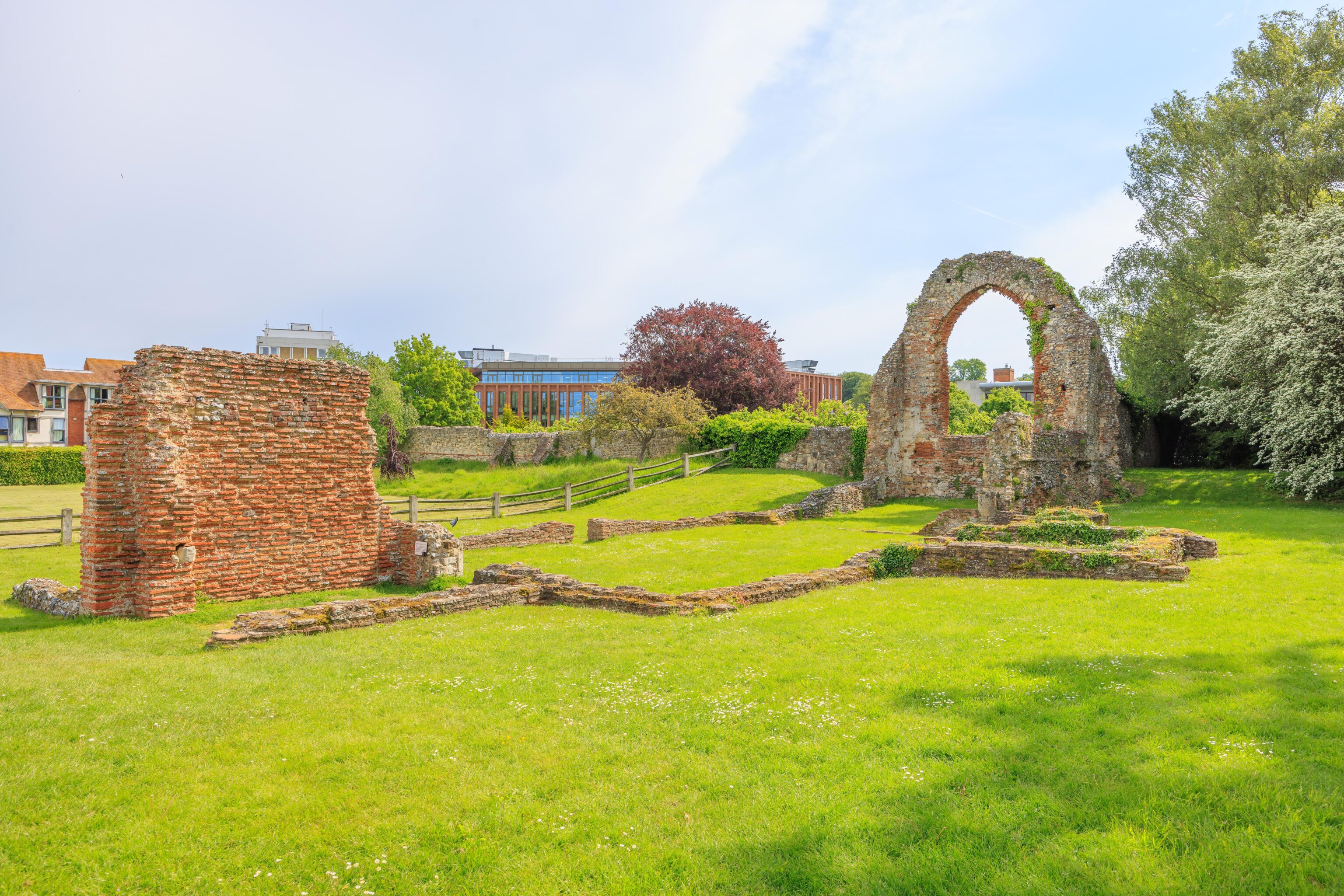
As we continued walking to the east, we saw the remains of the eastern end of the abbey building, forming a windowless arch.
From the east, it is hard to decipher exactly what is what in the ruins. We could see that there was a lower level, roughly in the middle of the remains. After walking around the eastern part of the ruins, we headed back west via the northern side. Part of the route there is a modern day wooden boardwalk which was closed for maintenance. There was no way to continue so we had to backtrack to where we began.
After rotating back around the ruins, we headed west on the southern side.
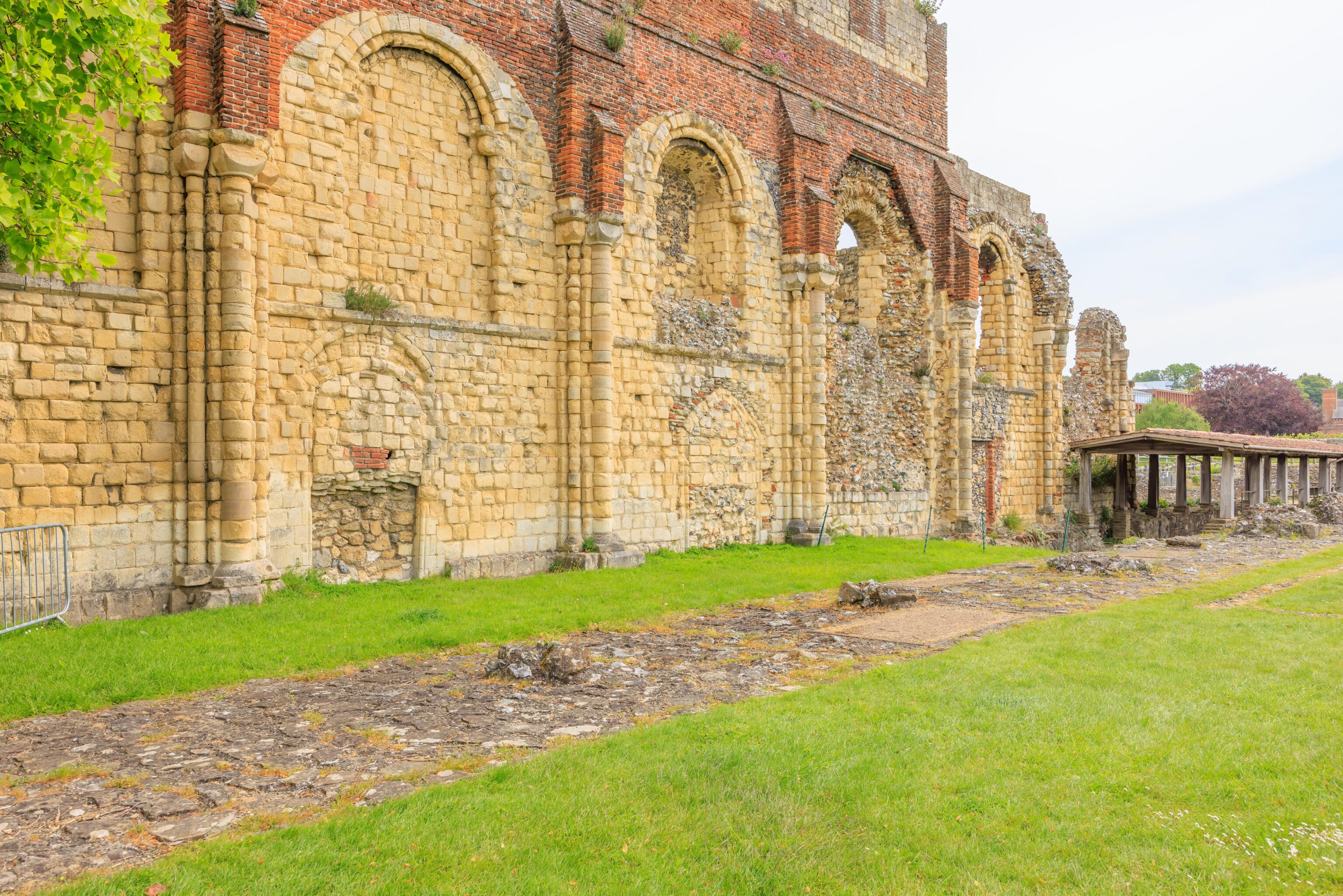
We walked into the abbey, next to the remaining wall. It is very church, or even cathedral, like in appearance.
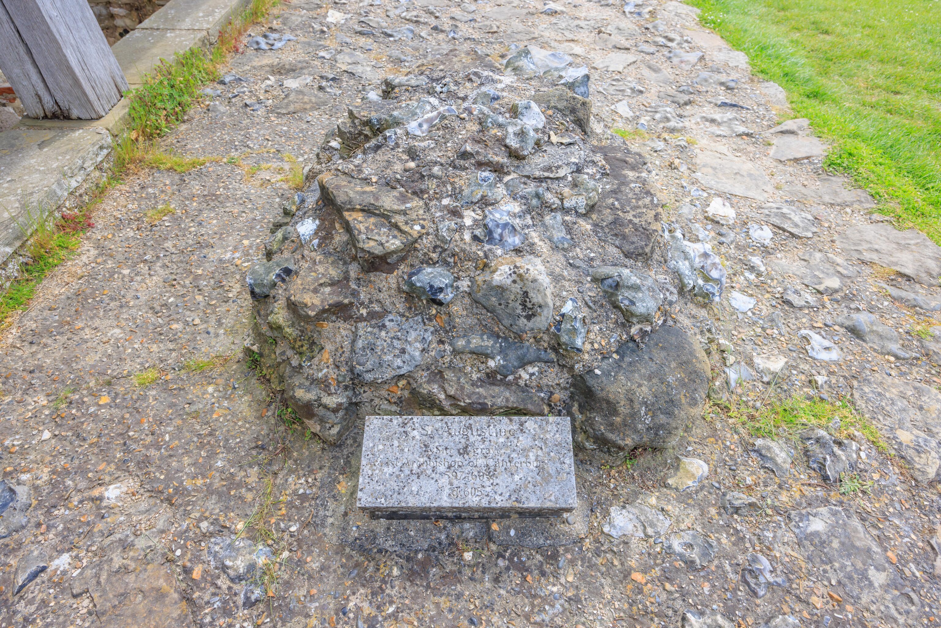
We came across this grave where St. Augustine was buried! St. Augustine was a monk who was sent on a mission by the Pope to what is now England to convert the Anglo-Saxons to Christianity. He founded this abbey and was ultimately successful. After he died, he was buried here and became a saint.
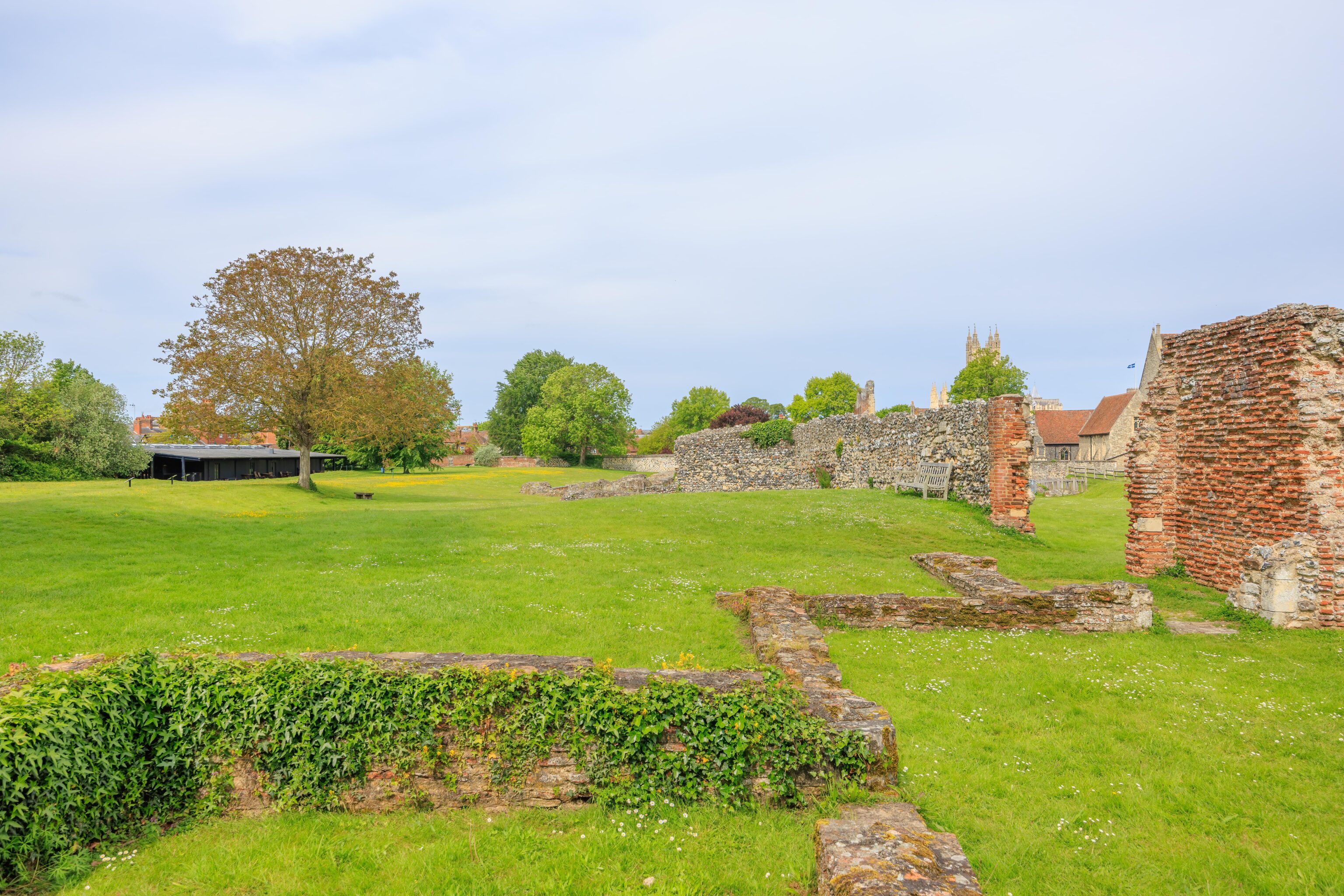
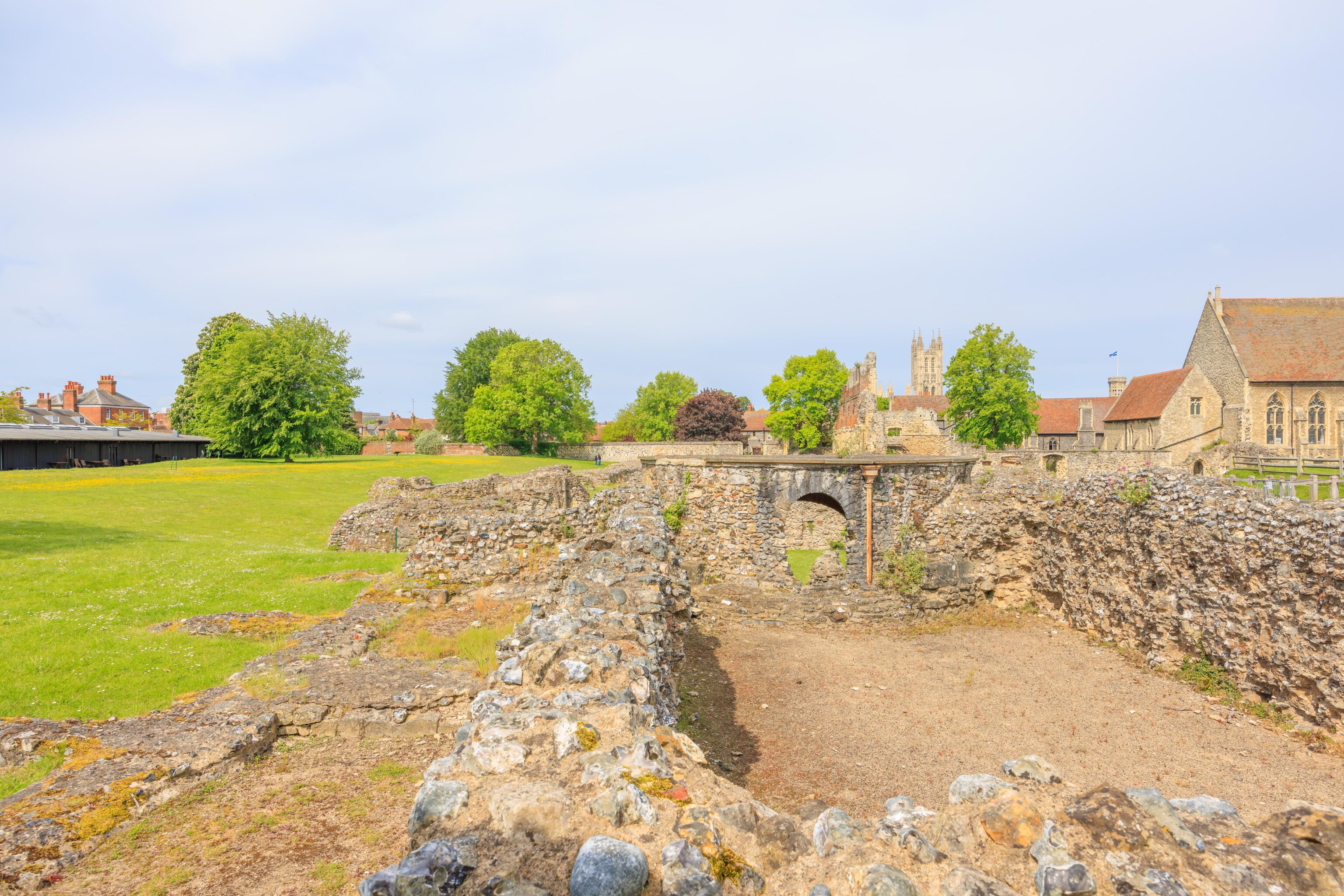
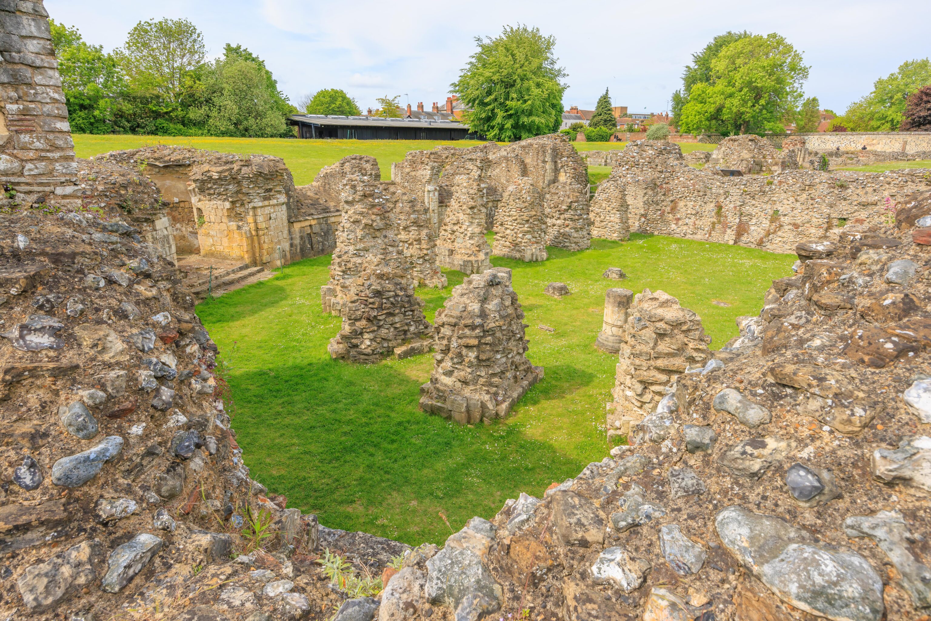
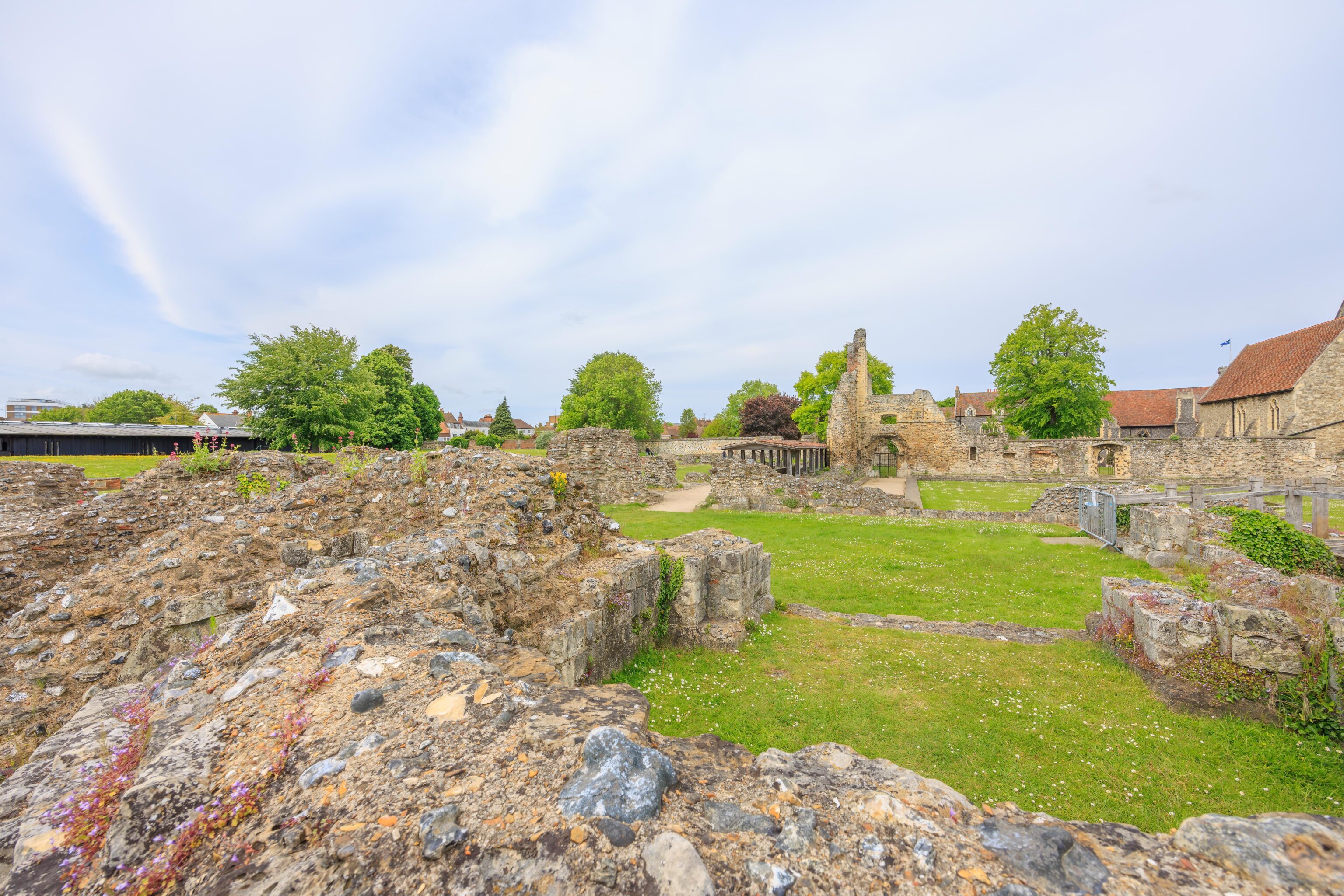
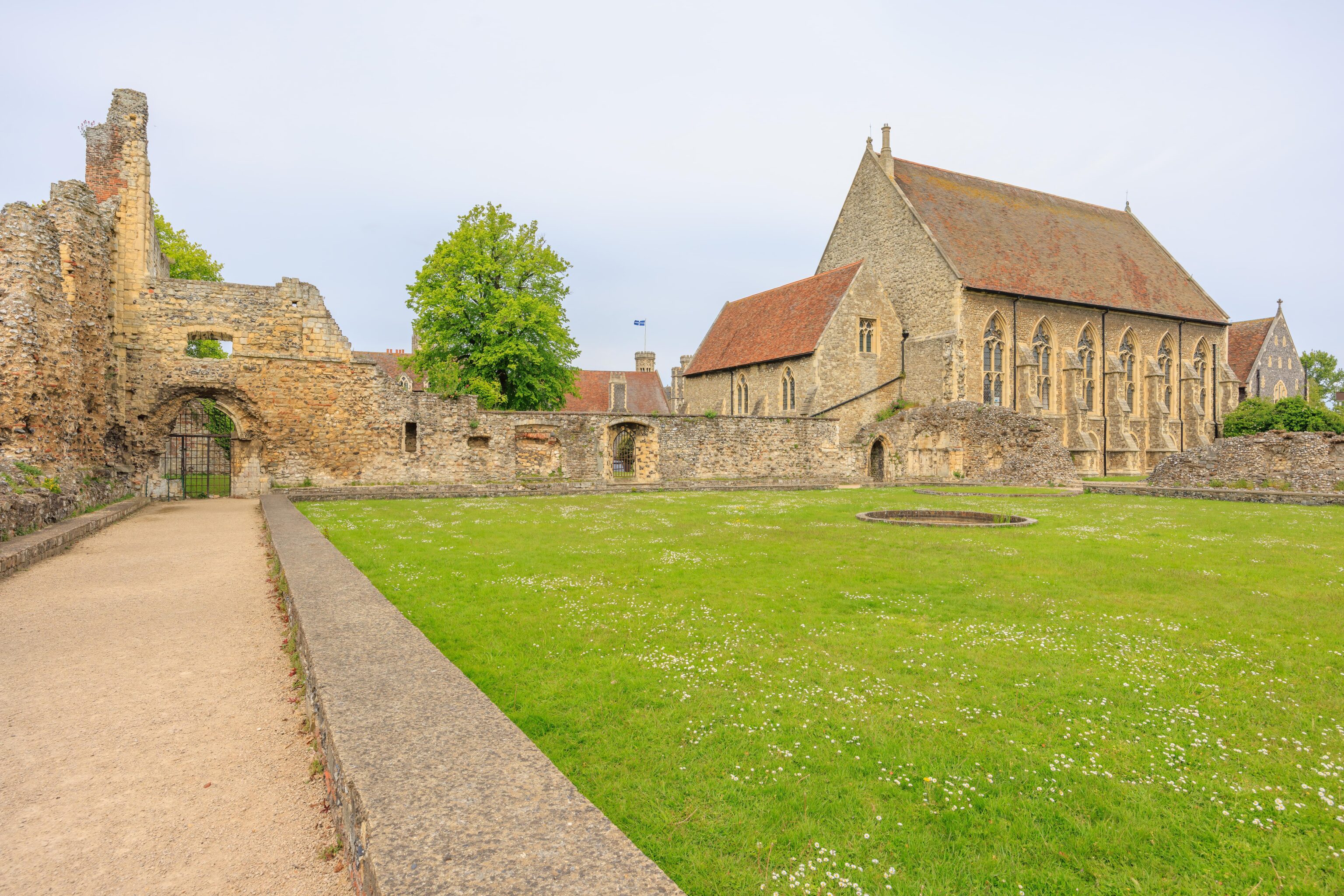
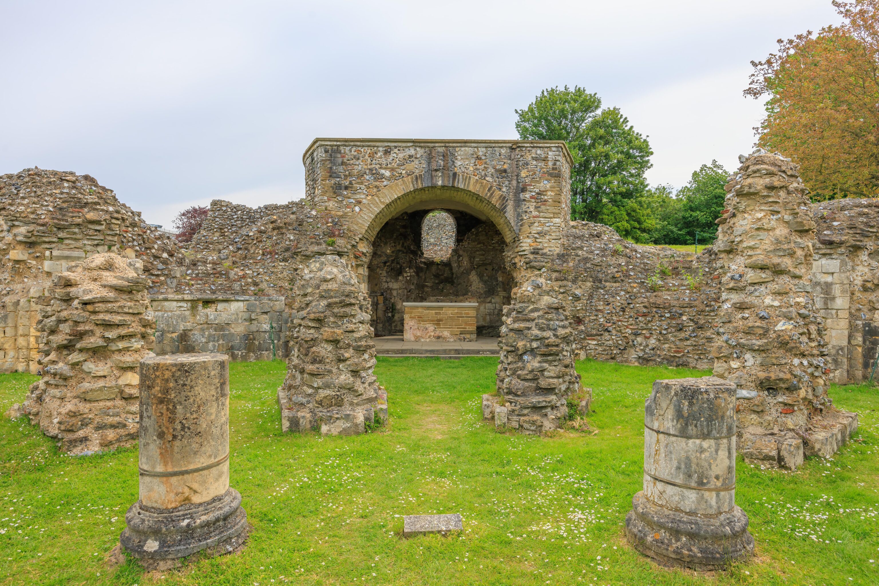
The ruins make more sense when viewed from the western end. The layout is extremely familiar and similar to most large Christian churches. We should have taken a photo from the far western end of the abbey looking through the ruins to the east. For some unknown reason, we did not. A map of the site helps to understand exactly what is what. The arch that we passed earlier on the east was actually part of a separate structure, the Church of St. Pancras. There is a newer chapel, from the 15th and 16th centuries, on the rear of the main abbey building but slightly angled by a few degrees.
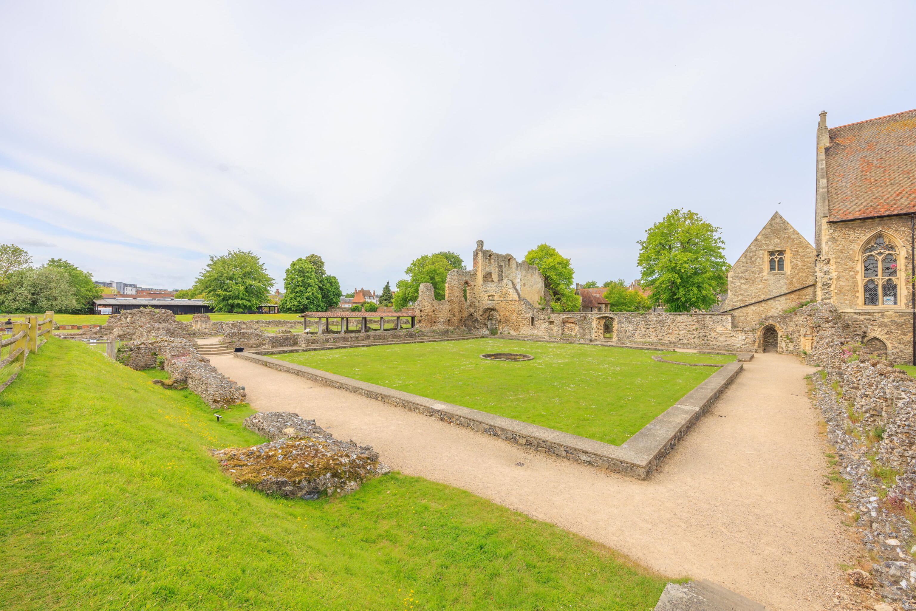
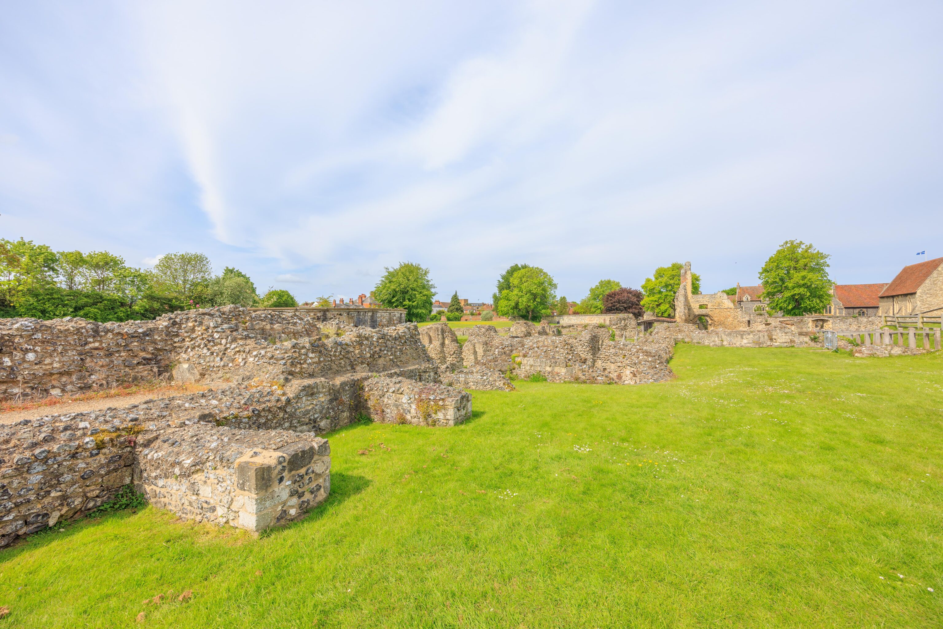
There was a large square path on the northern end of the abbey, near where the route was interrupted when we had tried circling around from the east. Having been to Salisbury Cathedral earlier on this trip, we recognized this as a cloister, a covered passage around a square courtyard.
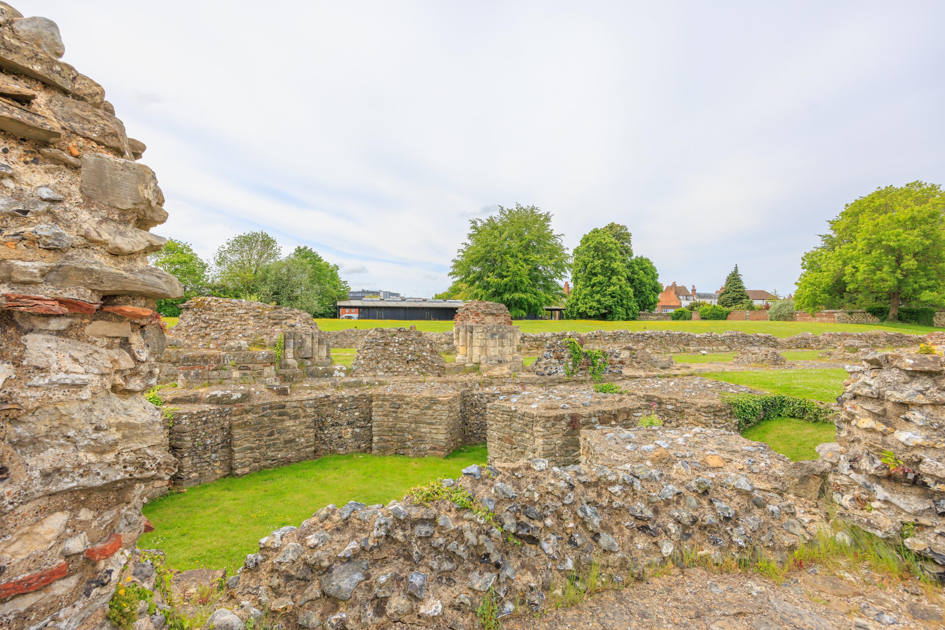
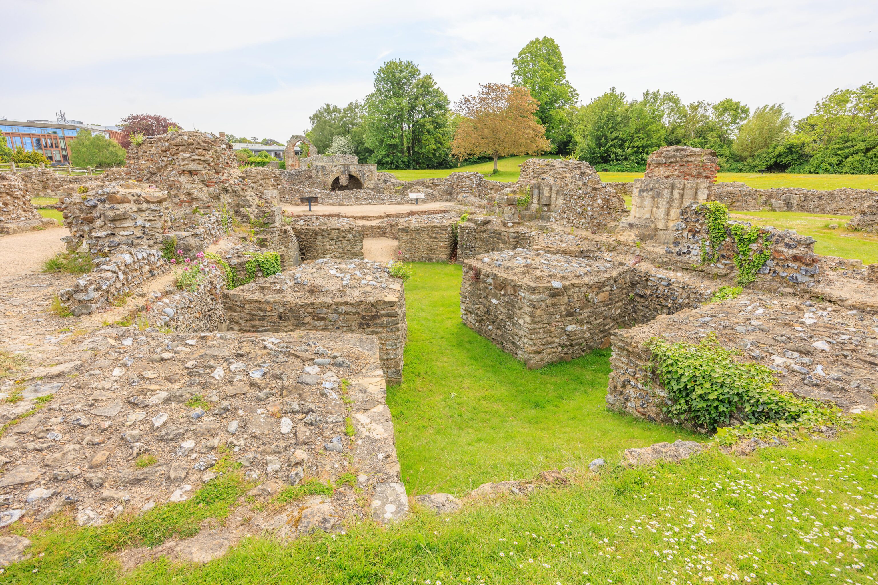
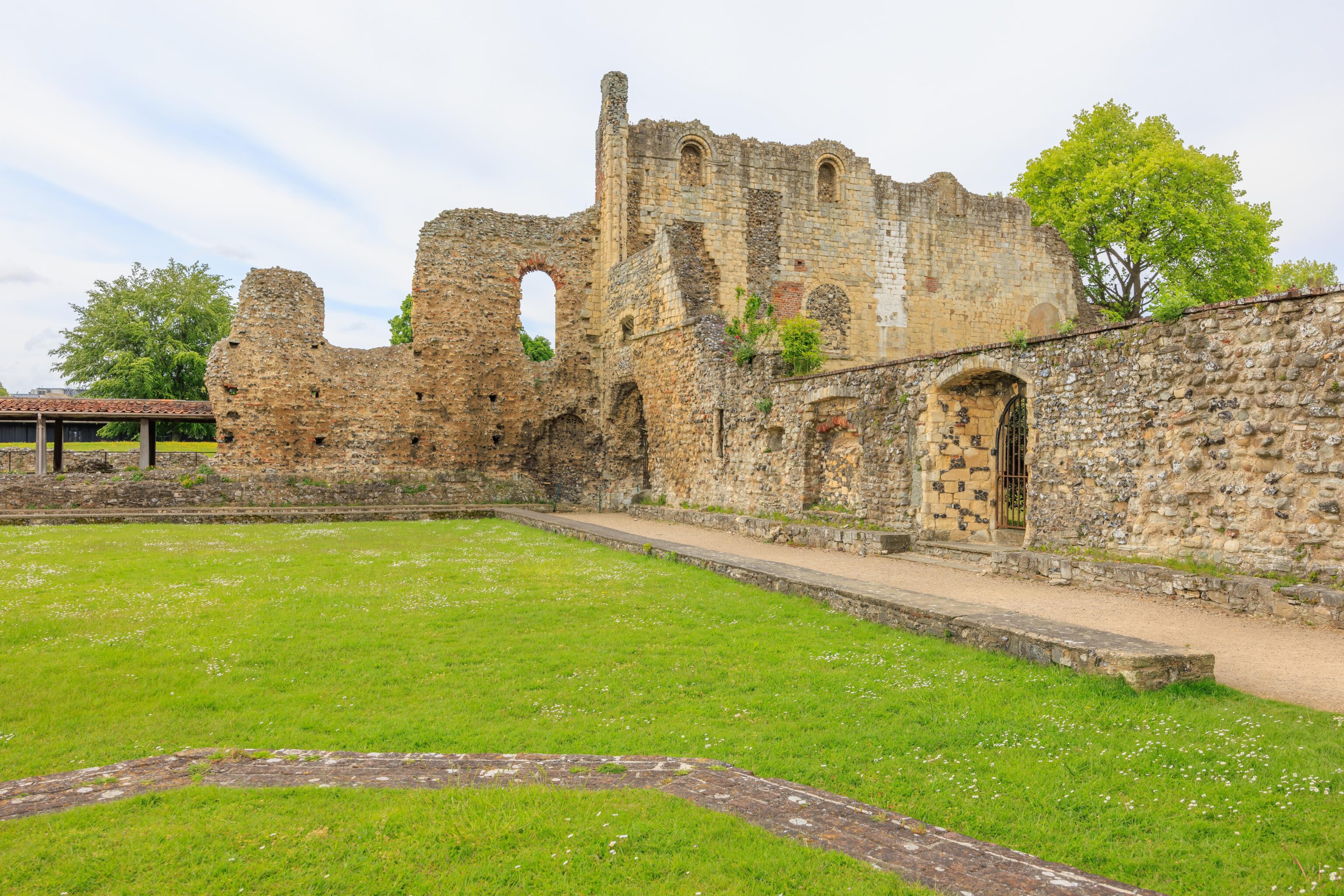
After walking around the cloisters, we headed back to the main structure of the abbey. Much of the ruins are simply the rough stone that would have been inside of the walls. But we did see a bit of what looked like the outside stone that made up the structure’s columns.
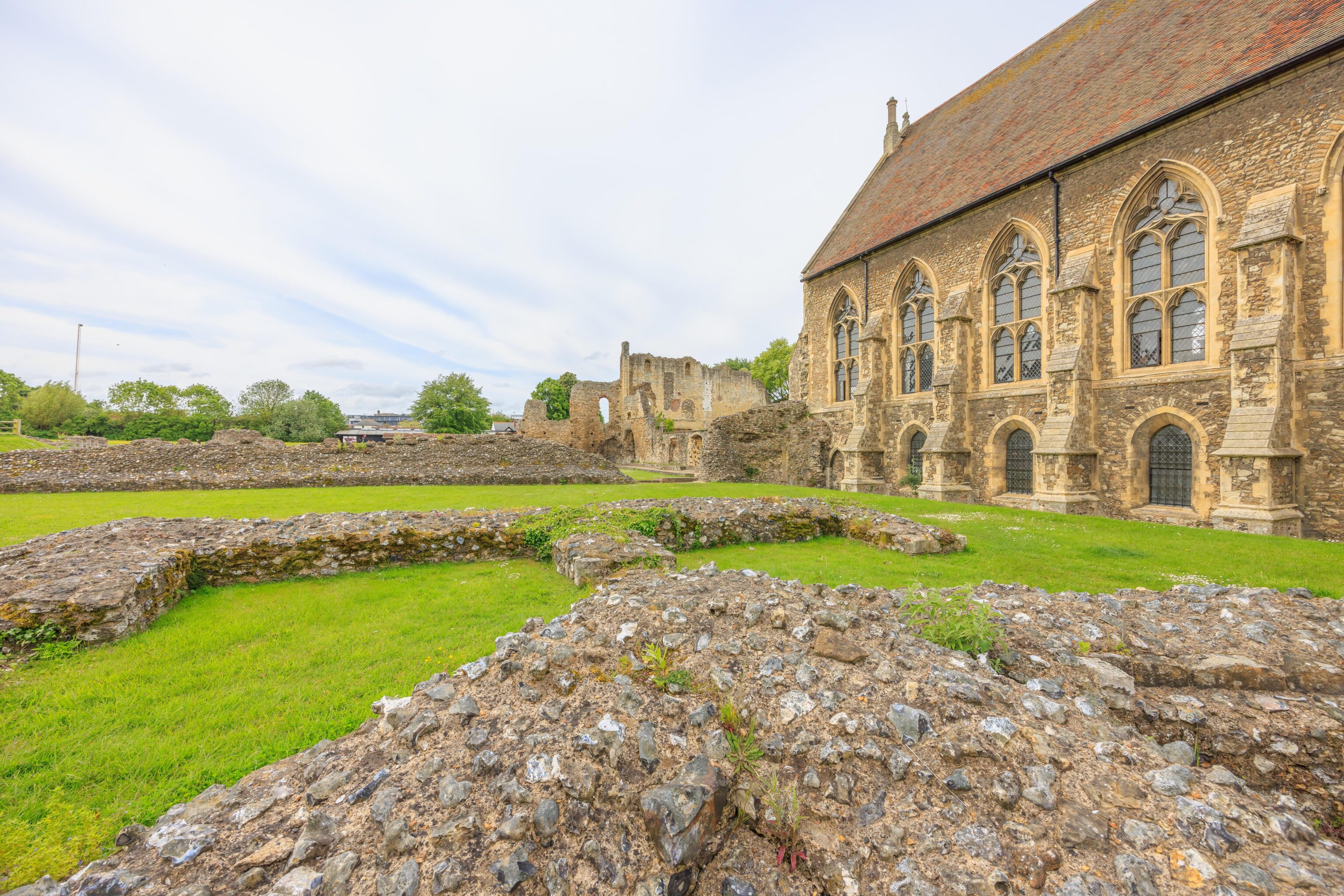
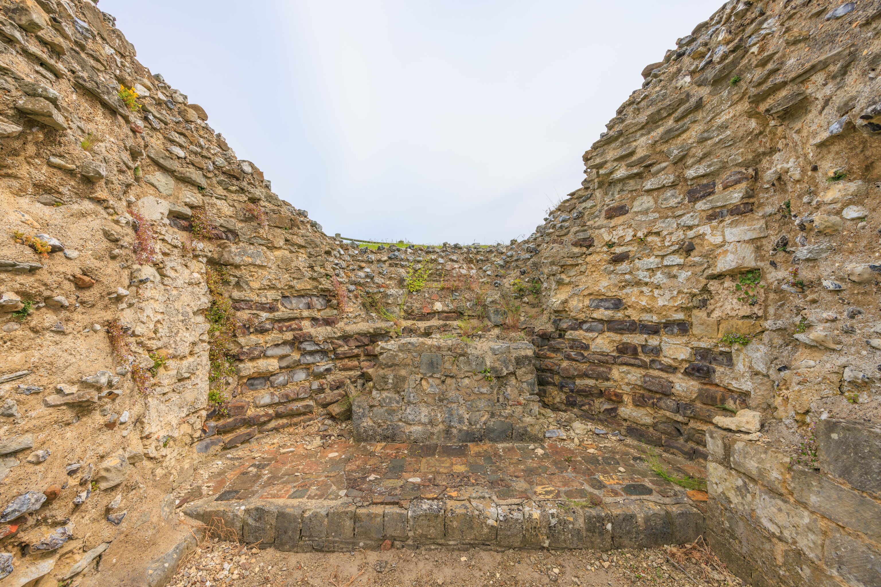
Looking though the abbey remains to the west, the large rectangular grassy area would have been the nave.
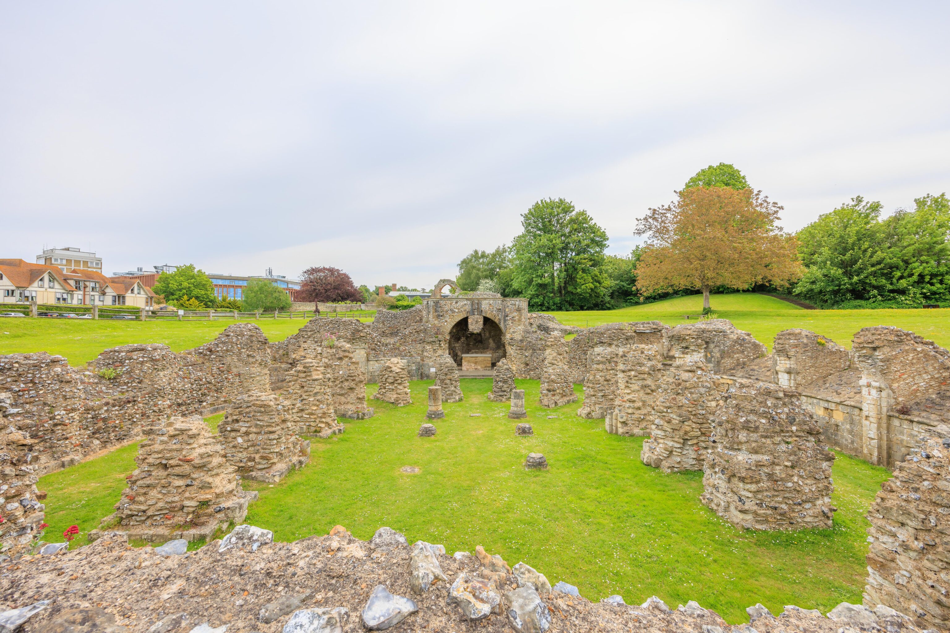
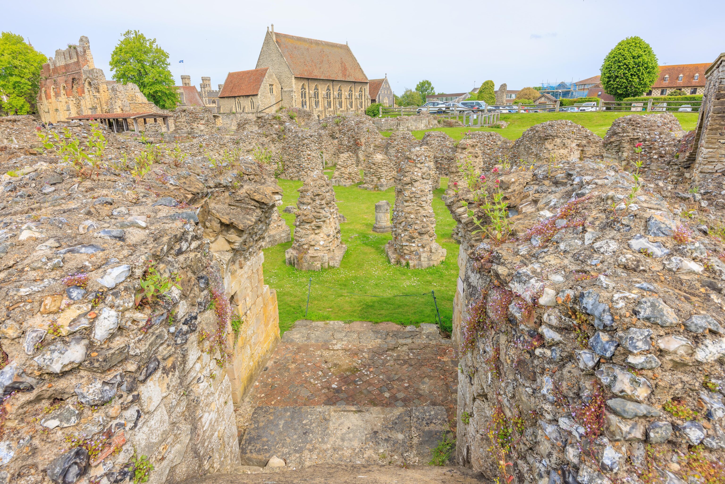
Looking in the opposite direction, this subterranean level that we noticed before was the crypt.
The Chapel of the Blessed Virgin Mary is at the far end of the crypt. A sign states, “This chapel was used for the singing of mass for nearly 200 years.”
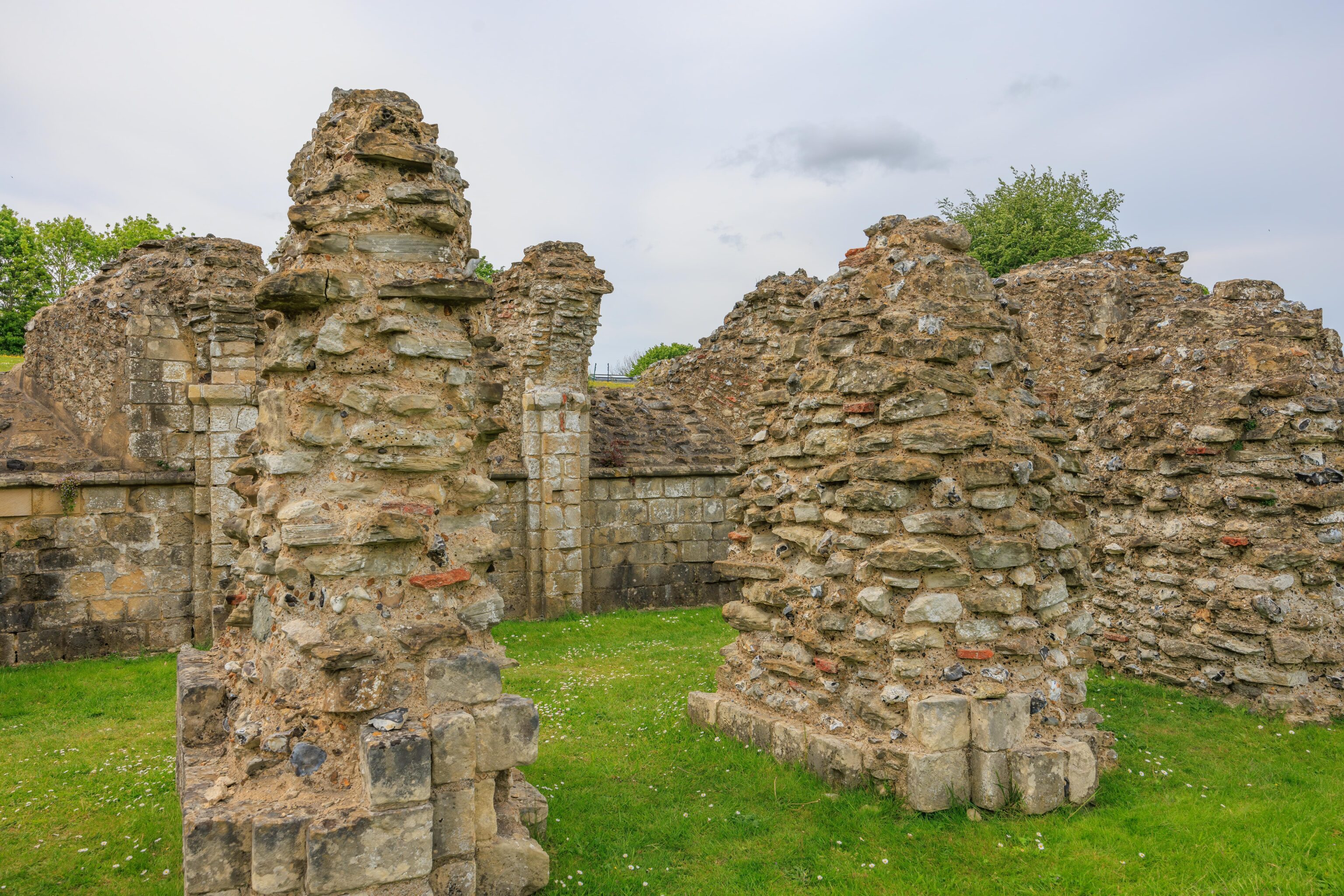
There are some more exterior wall stones remaining here.
Looking back to the west from the eastern end of the crypt.
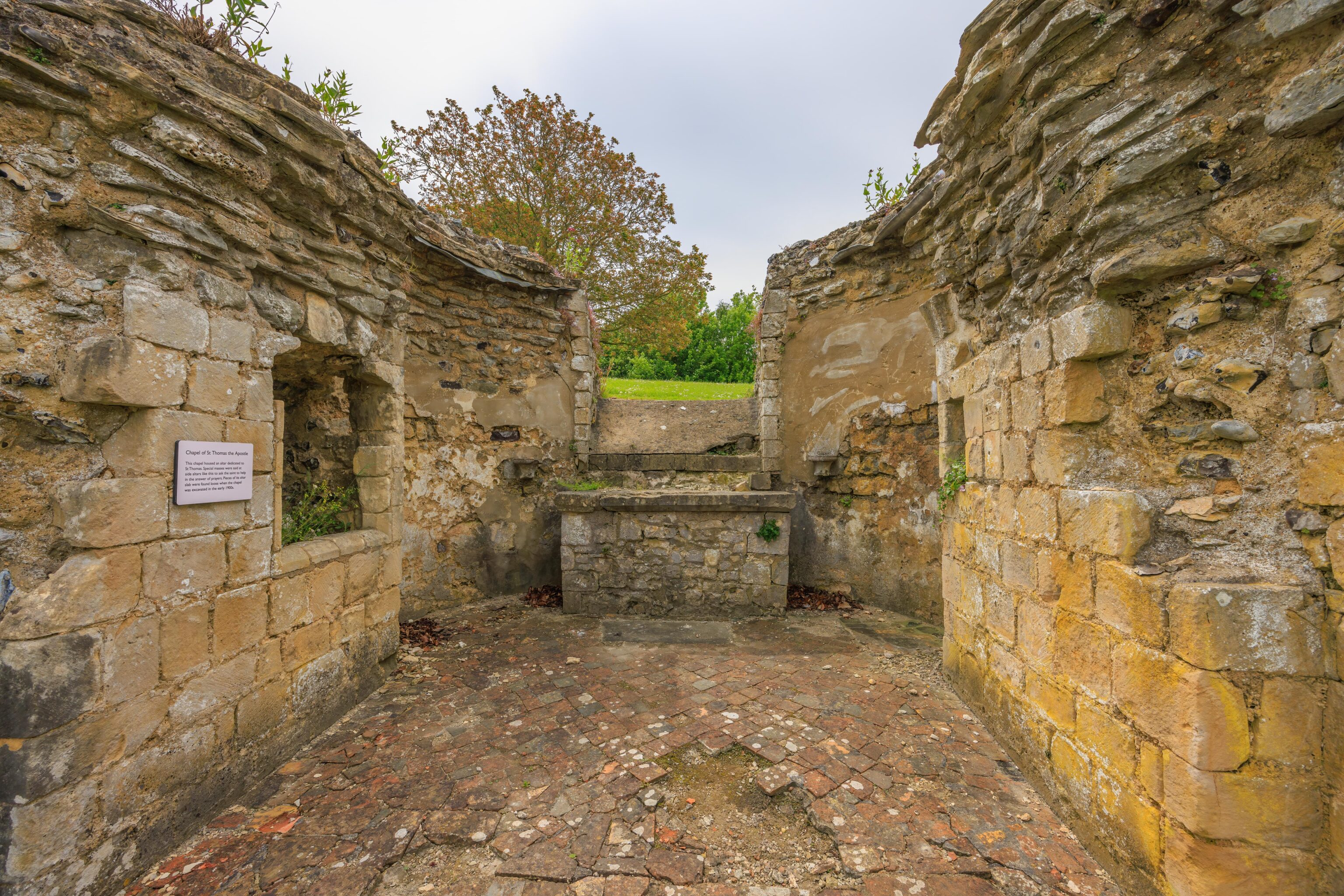
This was the Chapel of St. Thomas the Apostle.
This was the Chapel of Richard of Chichester.
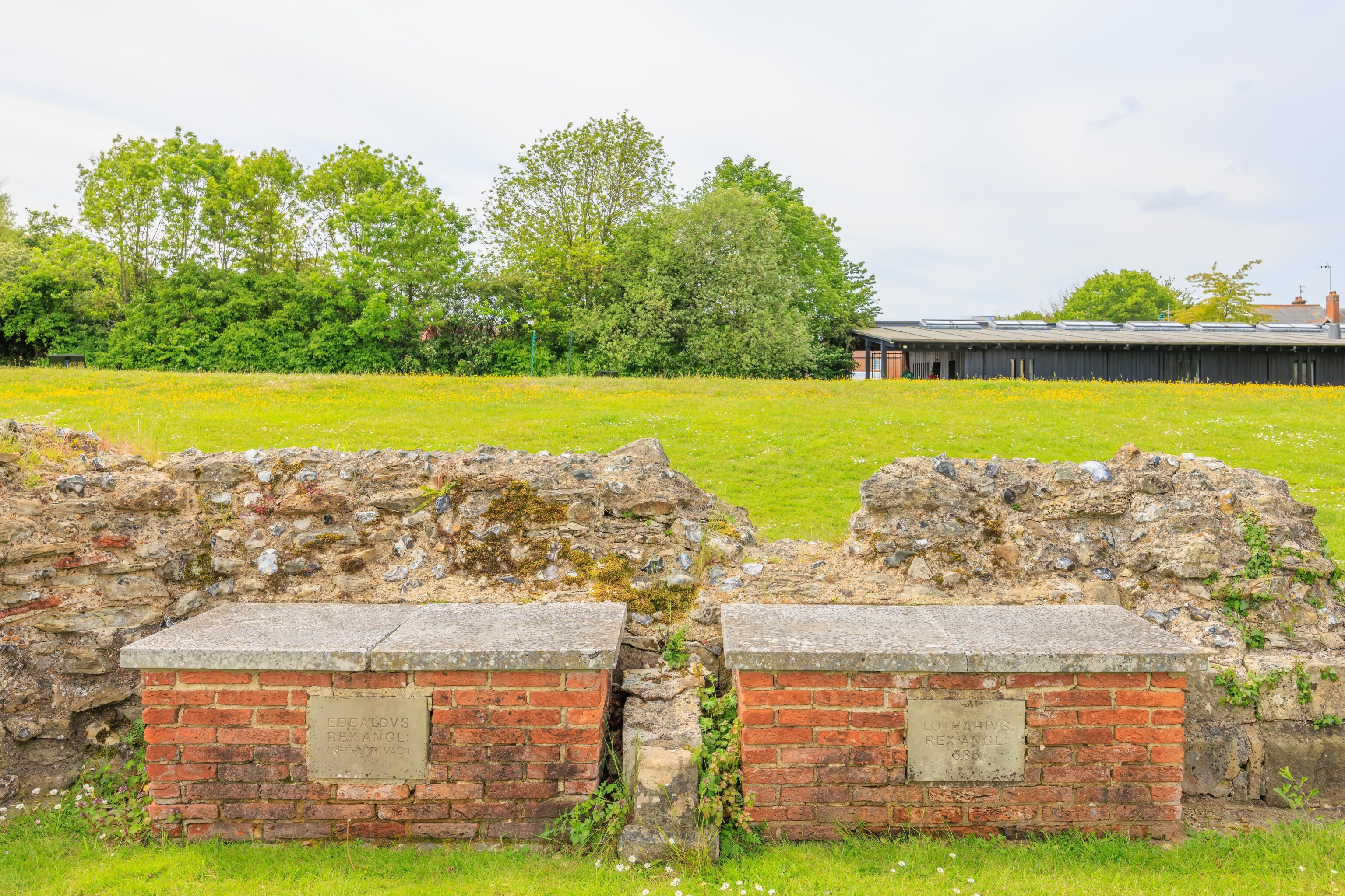
Two graves of Anglo-Saxon kings. The one on the right is dated 685, about 80 or so years after St. Augustine’s death.
After our visit, we headed back into Canterbury to have a quick lunch and to get our car from the car park. We walked a bit around the section of the city wall that still remains on the east end of the cathedral property to see if we could get a better view. The wall is too high to be able to really see anything without being high up above the ground.
Walmer Castle
After having lunch, we drove over to Walmer to visit Walmer Castle. We didn’t really know much about Walmer Castle other than the structure is similar to Deal Castle a mile or two to the north. We could have gone to either first. We picked Walmer because the ticket price is higher. We have the Overseas Visitor Pass so all English Heritage sites are free.
We parked a paid car park across the street in from Walmer Castle and walked in via the entrance road. It wasn’t apparent to us at the time but there is actually a new free parking lot on-site. English Heritage members get a parking pass that they can use for free parking at English Heritage sites. The Overseas Visitor Pass doesn’t provide the parking pass. However, we found out that it is possible to get a free day pass if it is a staffed site like this one.
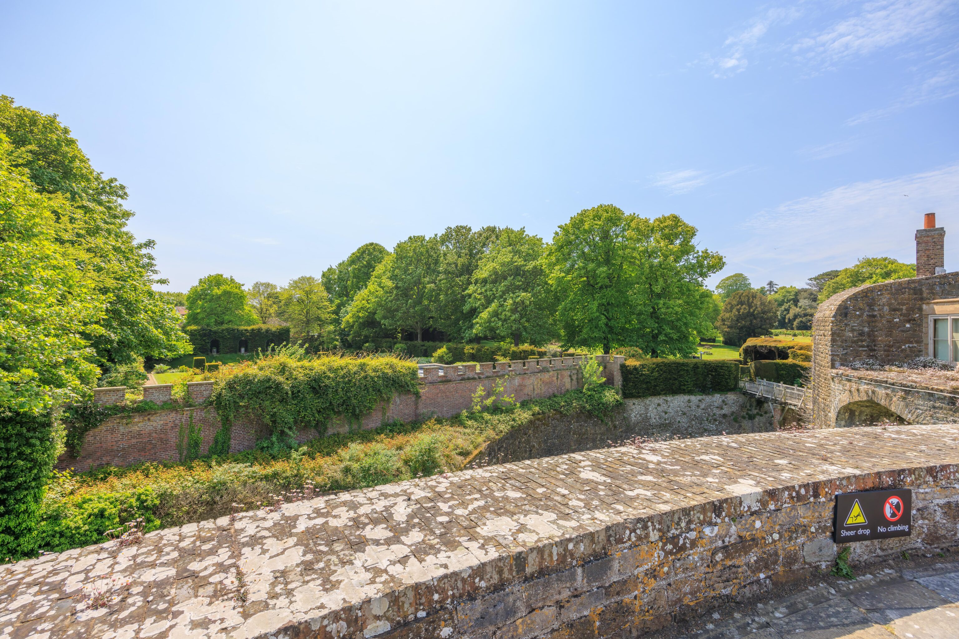
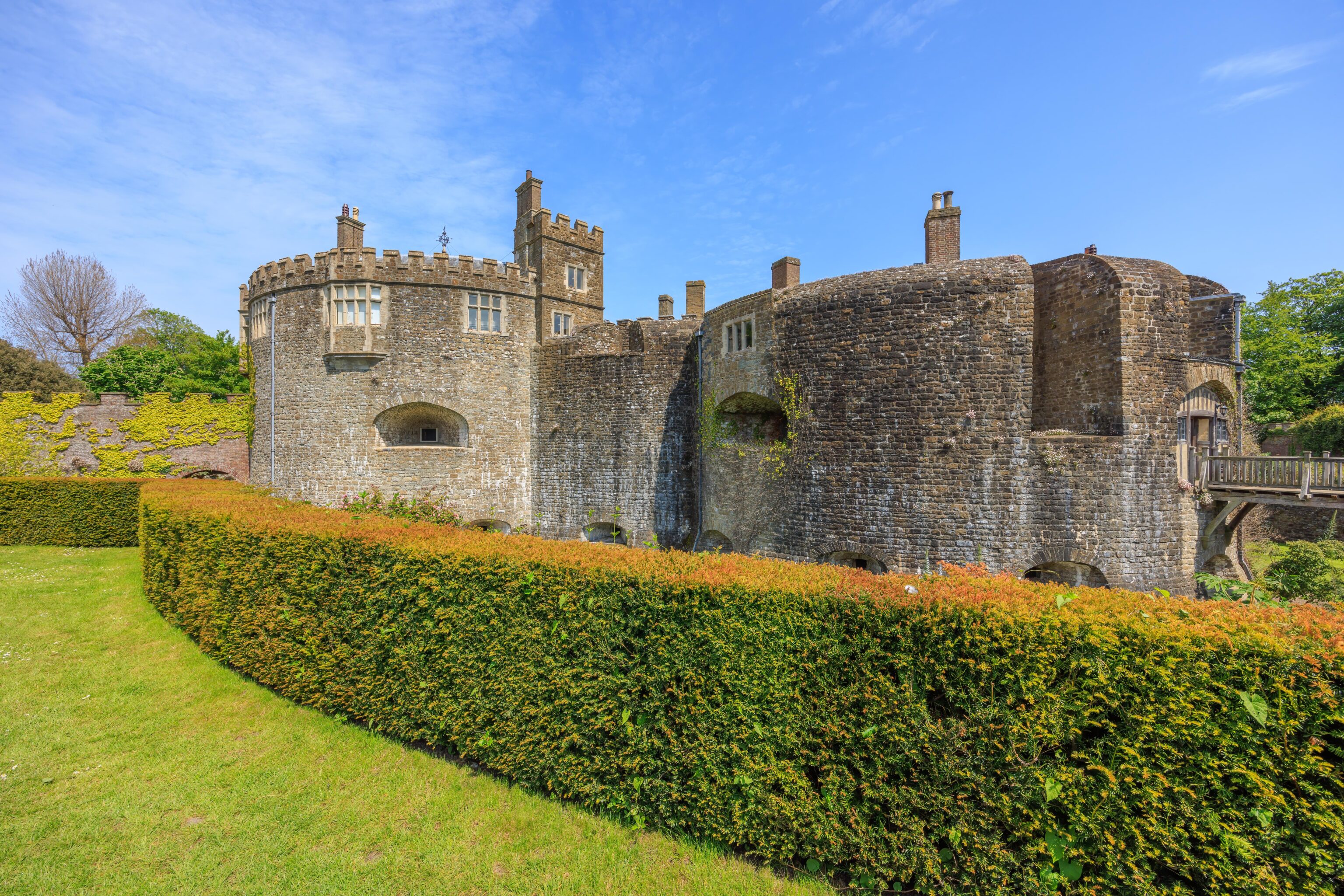
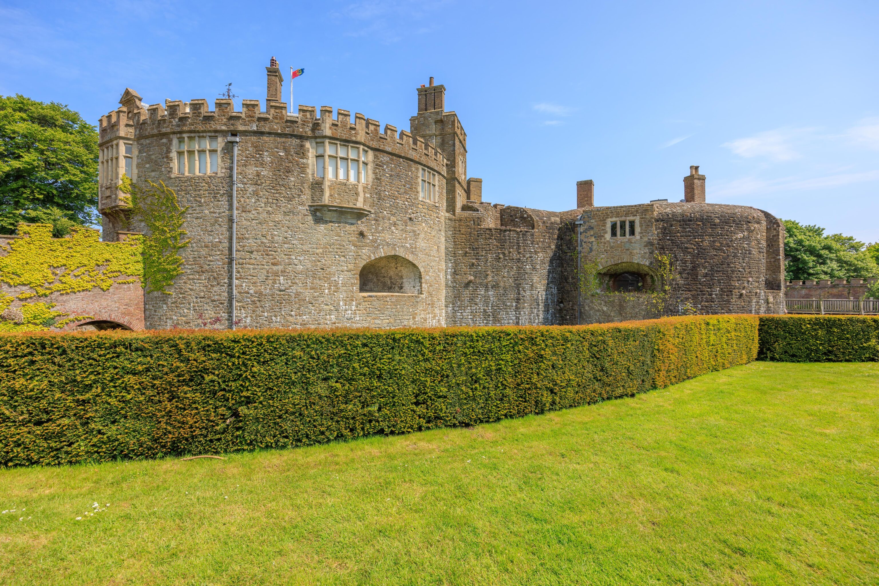
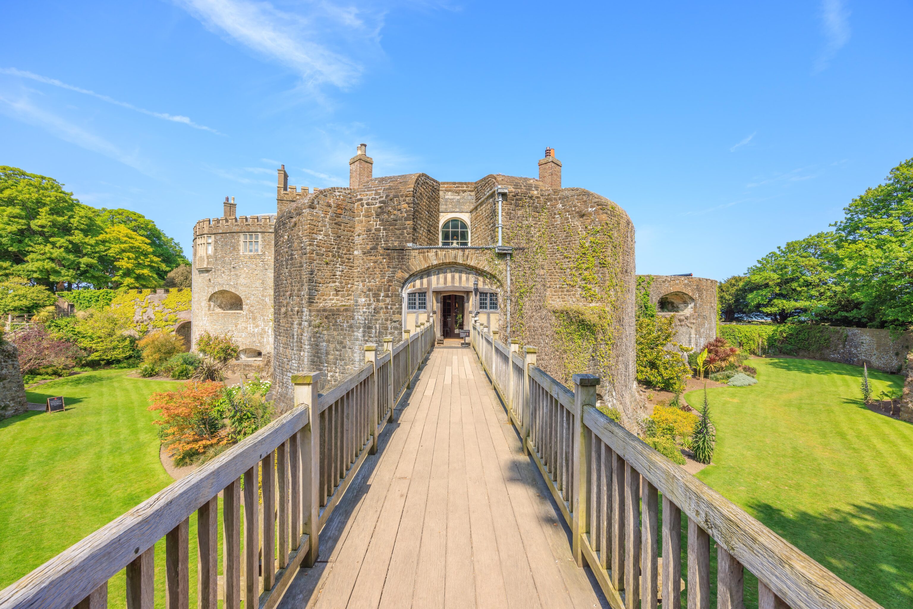
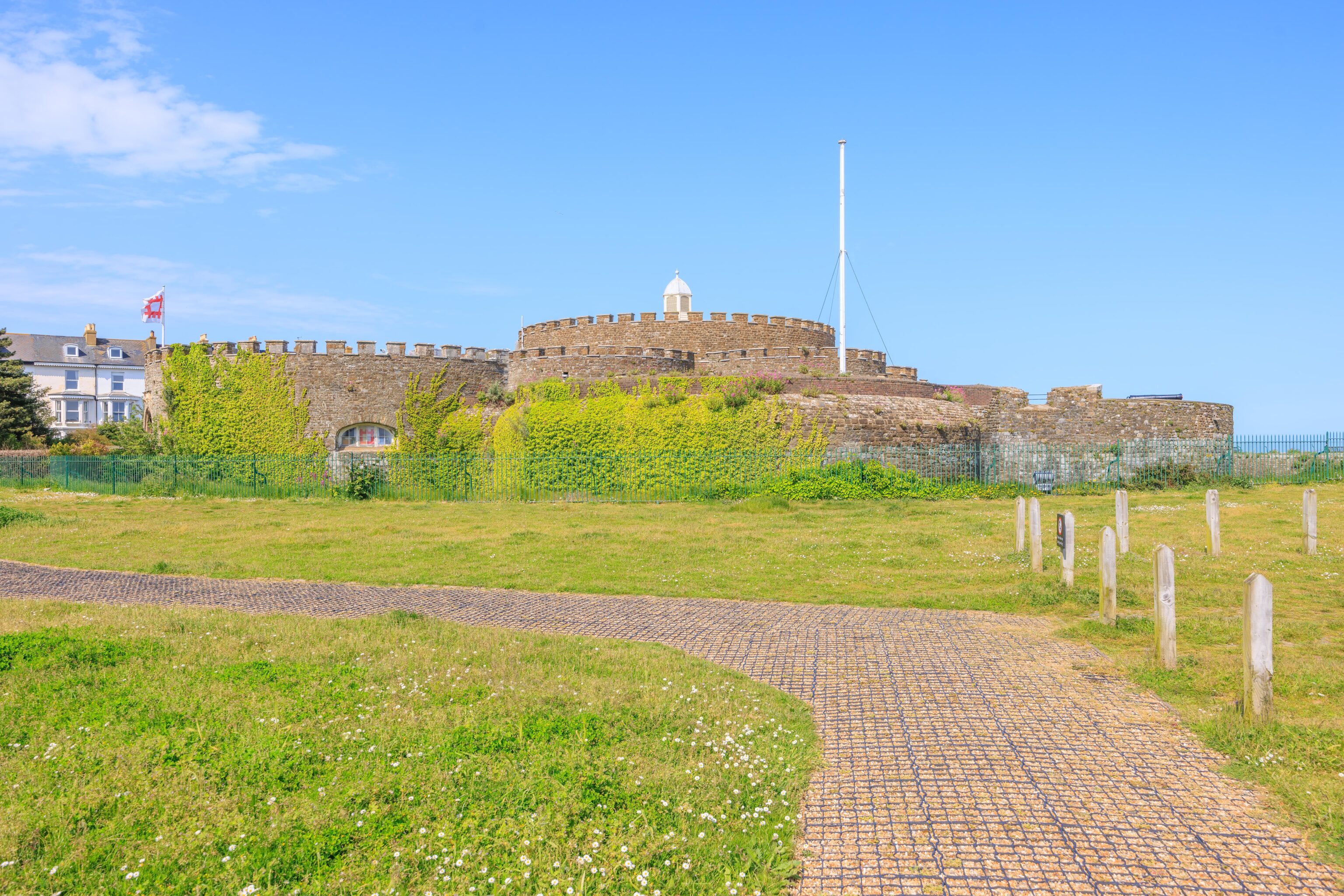
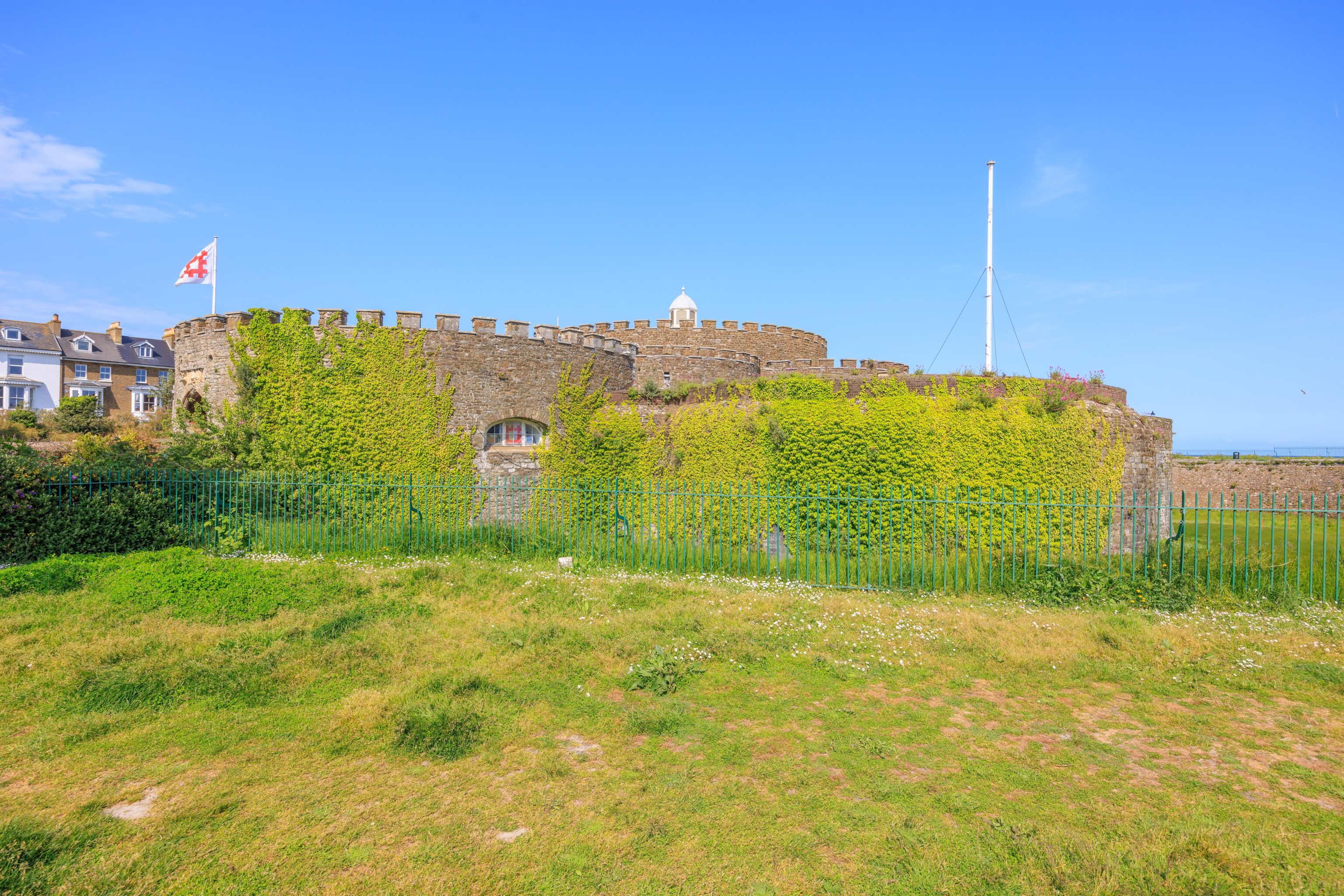
Walmer Castle was built as an artillery fortress. Its structure is very different from castles built in the era of knights on horseback and when swords, pikes, and crossbows were effective weaponry. It also wasn’t designed as a residence like many other castles were. It thus looks very different from all the other castles we’ve been to in England on this trip. The castle does have a moat. The Kent County Council’s page on the castle indicates that the moat was originally filed with water.
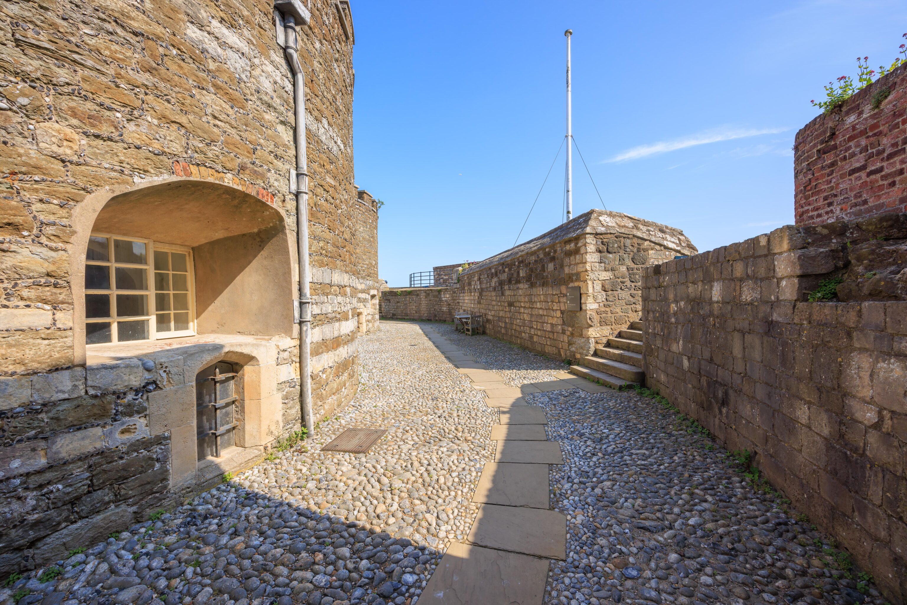
Just inside the entrance to the castle.
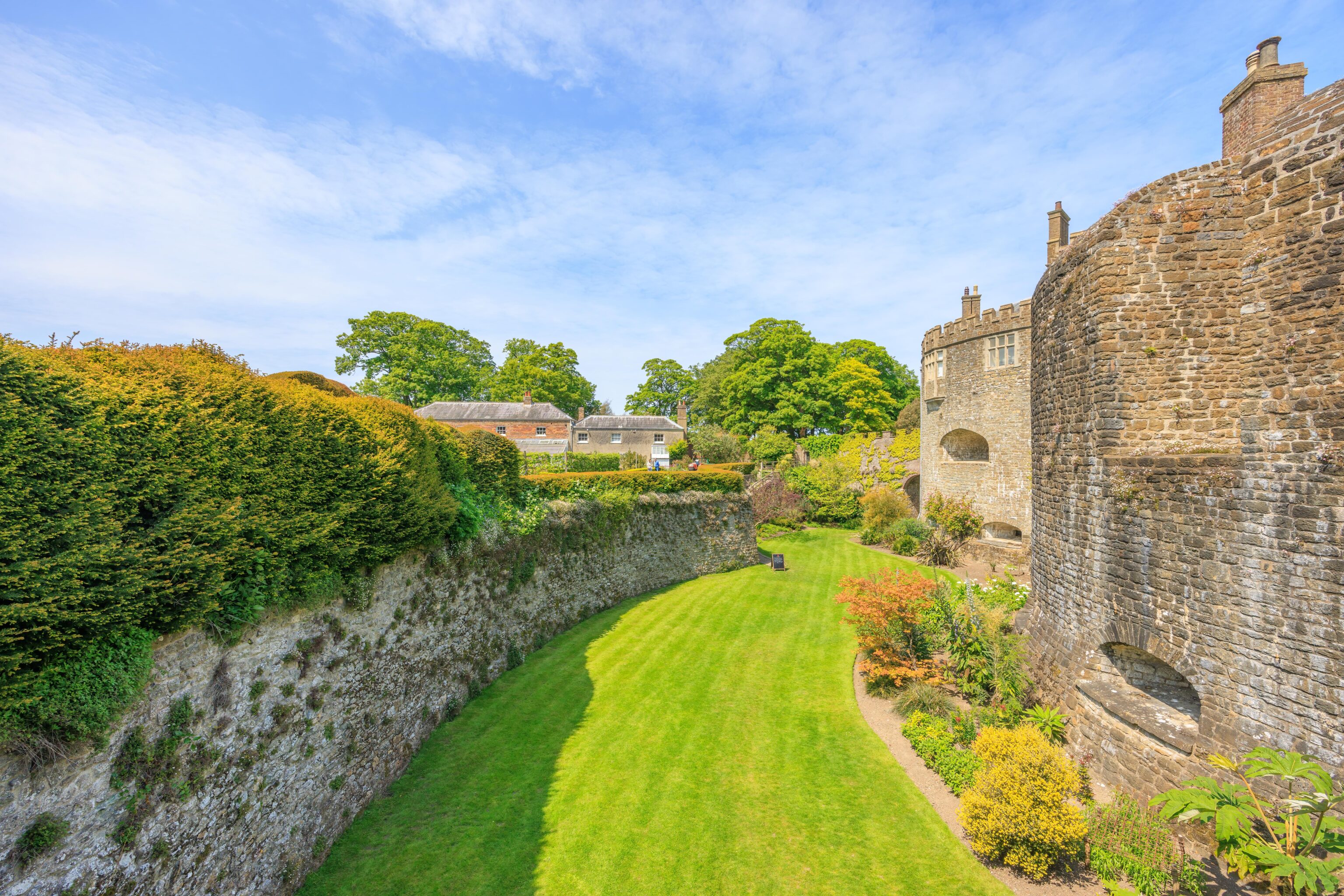
The castle consists of a circular keep in the middle and four partial circle bastions around it. In some places, there is space between the bastions and the keep. This space is used in places for things like the modern cafe tables for eating.
Walmer Castle was converted to a residence for the Lord Warden of the Cinque Ports. The Lord Warden was previously responsible for the Cinque Ports. In more recent times, the Lord Warden become a ceremonial title but still granted the use of Walmer Castle as a residence.
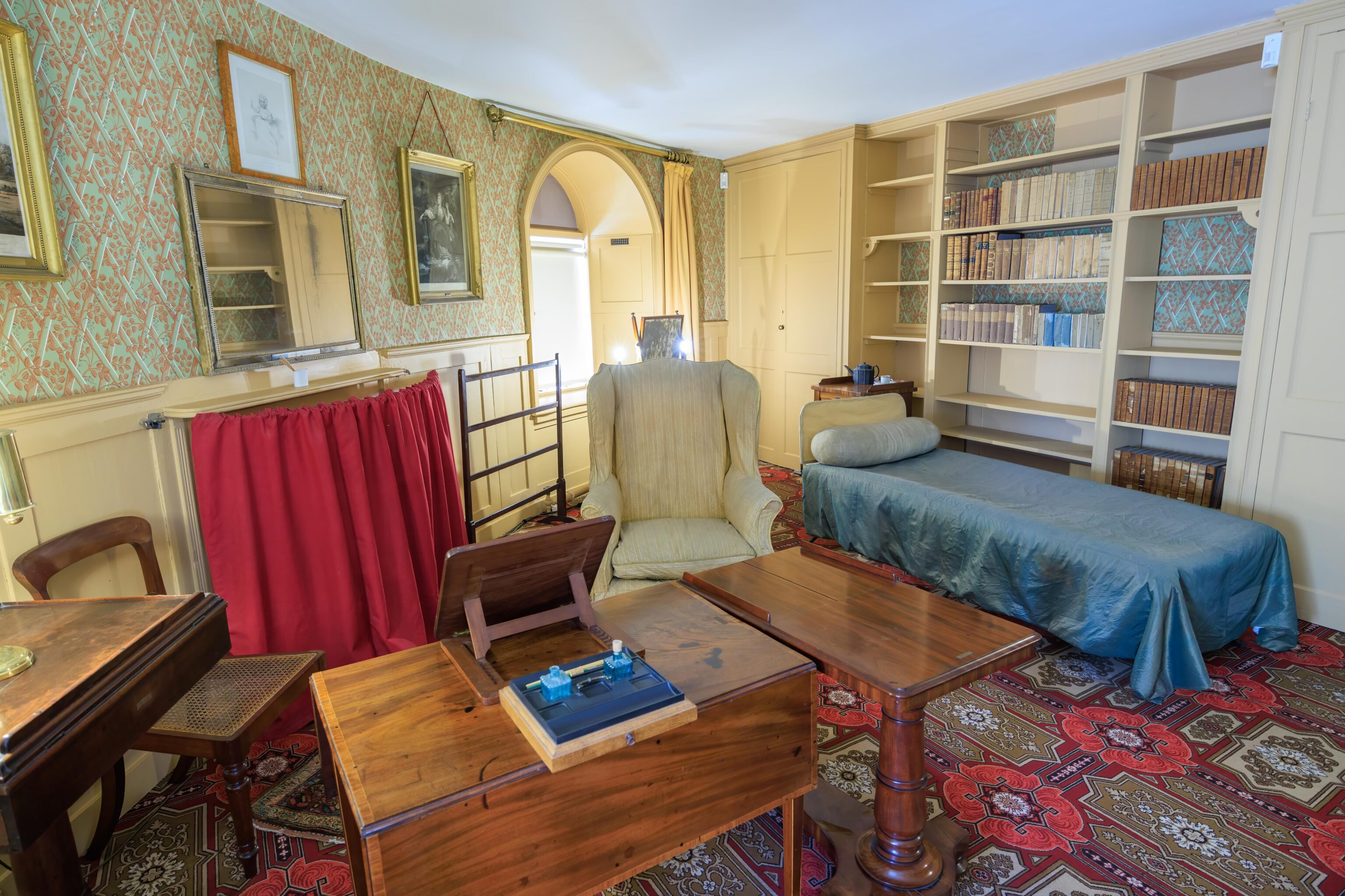
It turns out that there have been some rather famous Lord Wardens. The Duke of Wellington, Arthur Wellesley, who defeated Napoleon at Waterloo, resided and died here. He died in chair in this photo!
The Queen Mother, Queen Elizabeth, was also a Lord Warden and holidayed here. Other Lord Wardens are not people that would be well known to Americans like ourselves but would possibly be familiar at some level to the English.
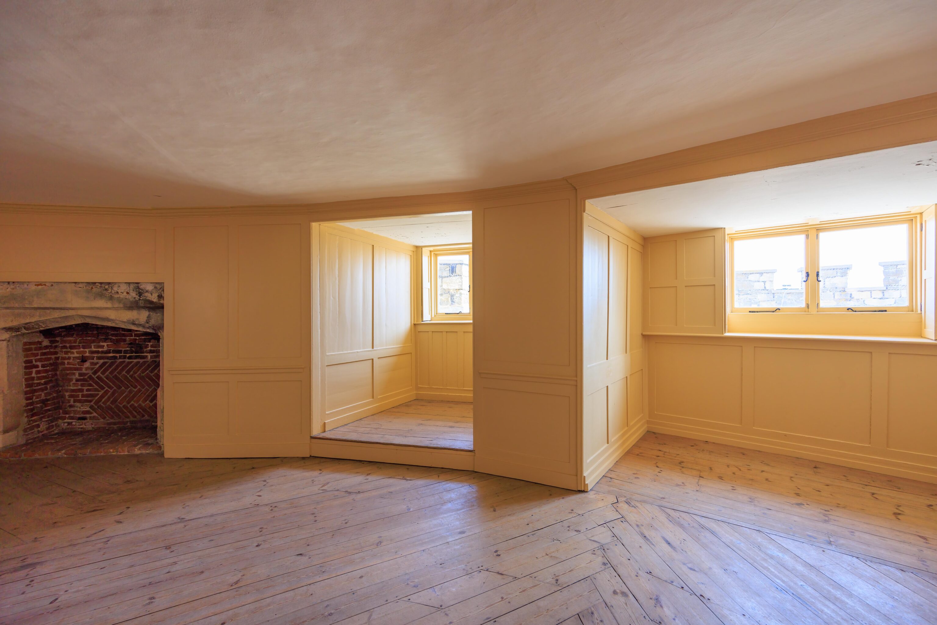
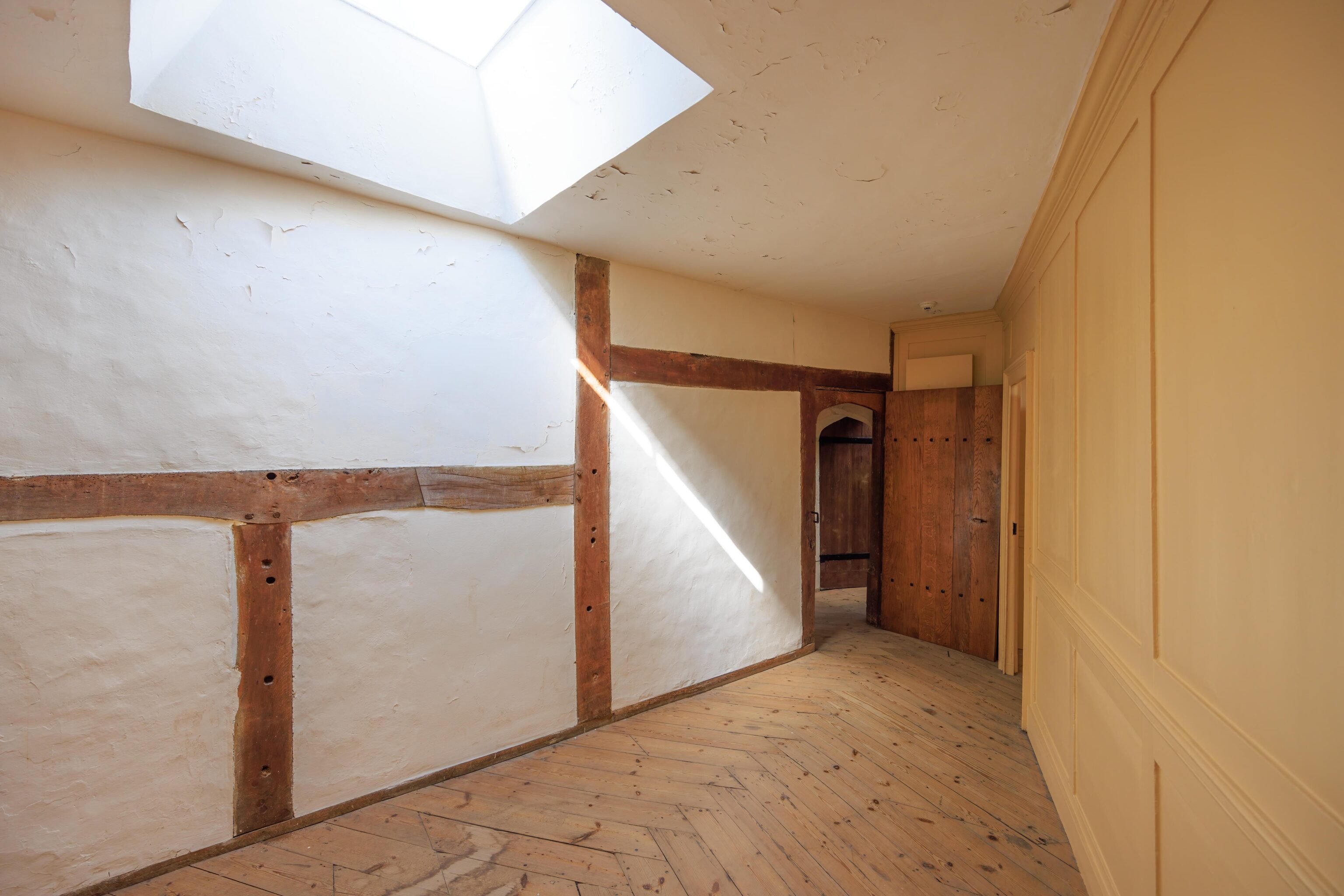
Walmer Castle’s interior looks much like a well maintained older home. There is nothing particularly ornate like in the palaces that we’ve been in and the decor generally looks pretty normal.
Even the windows looks like they belong on a regular home.
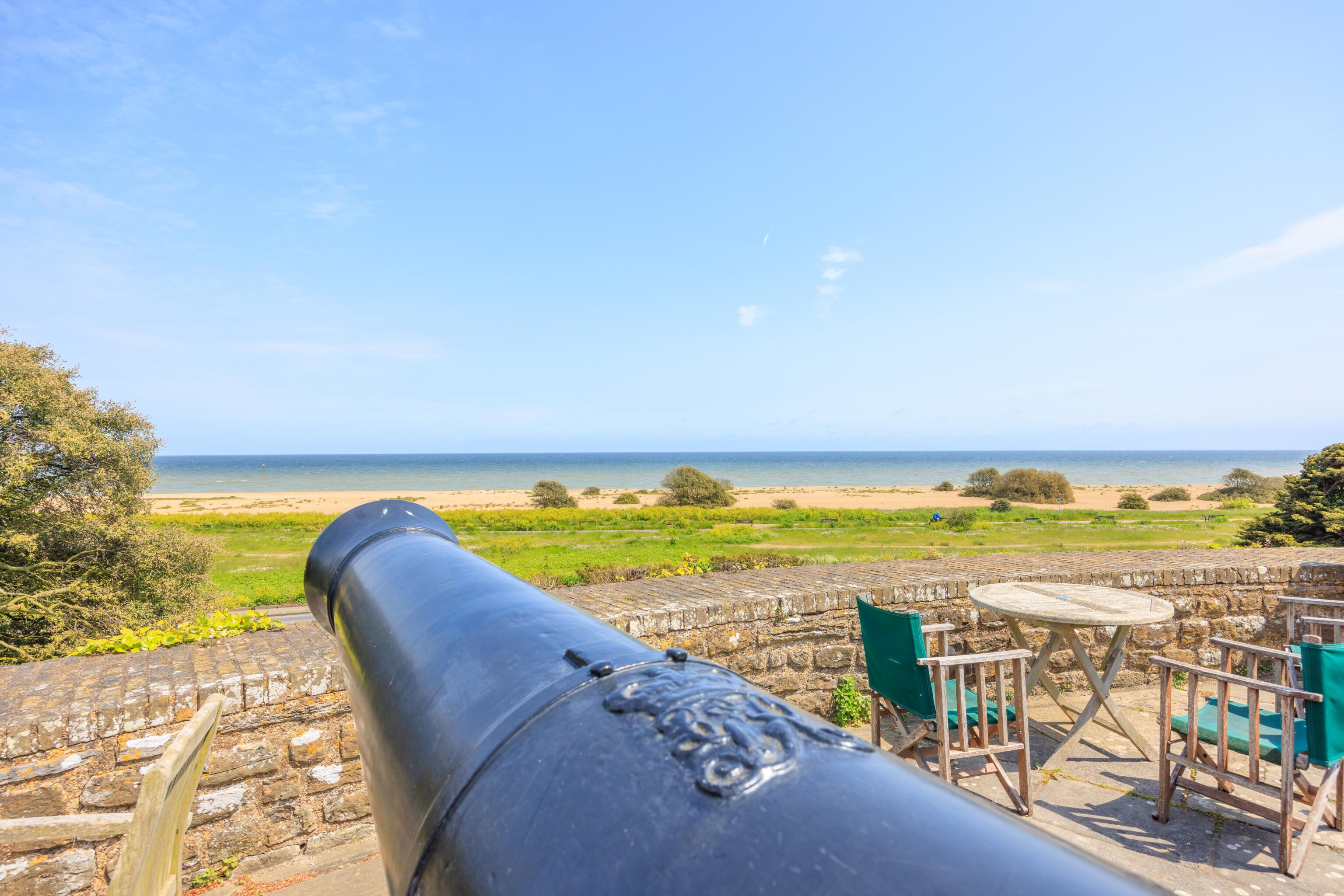
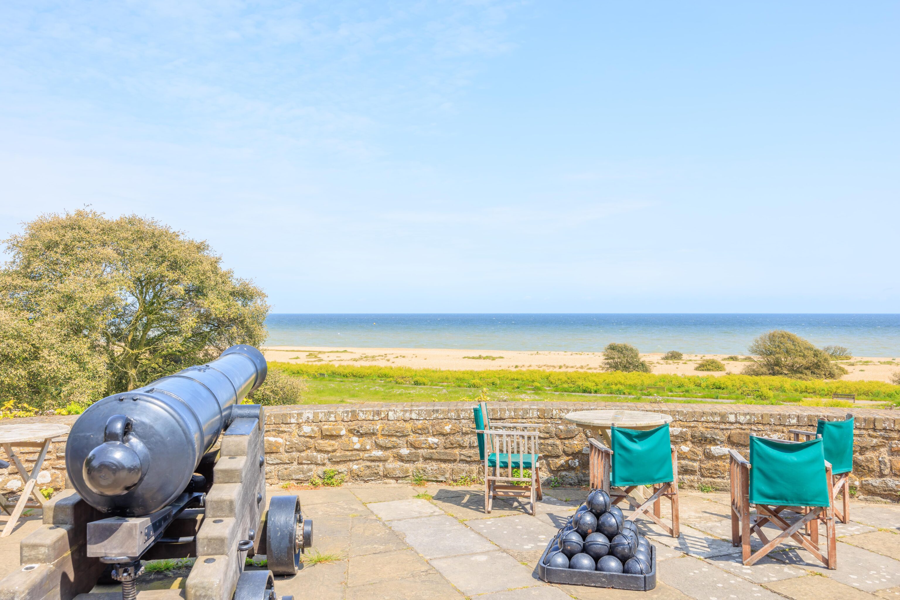
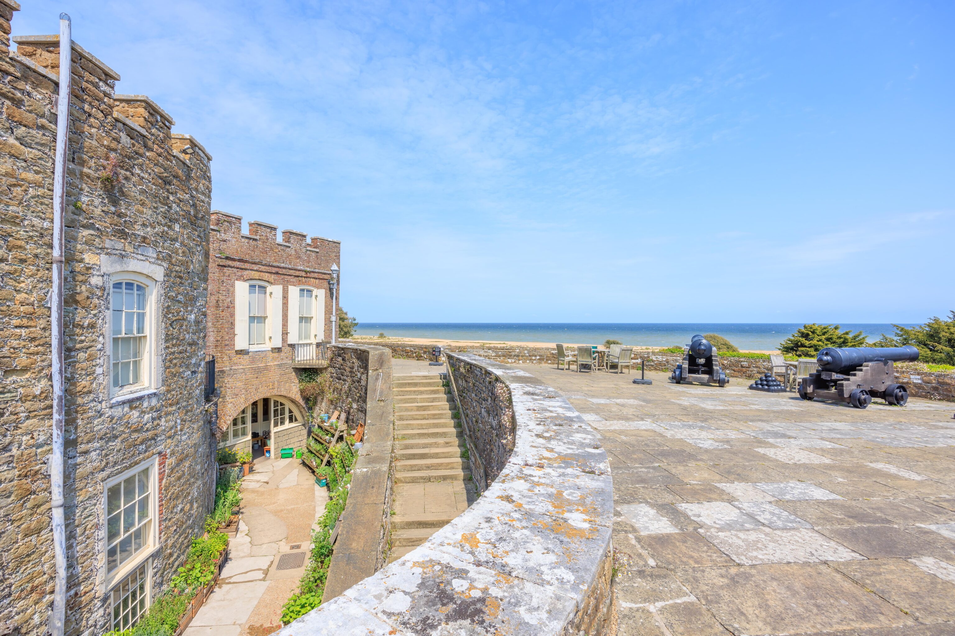
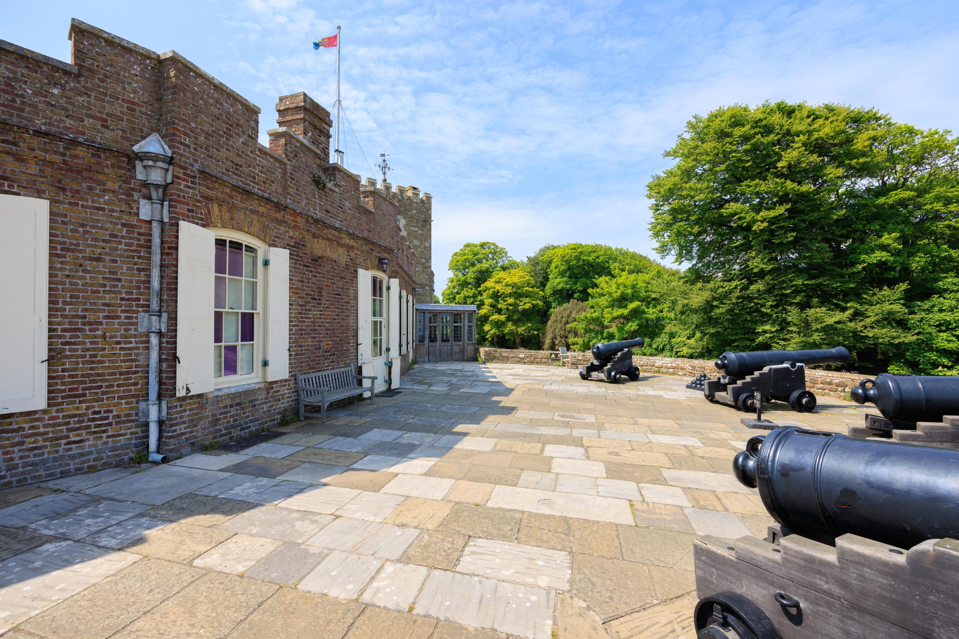
Two of the rounded bastions currently have flat roofs. There were a few cannons pointing outwards as well as some chairs and tables for modern day visitors to relax.
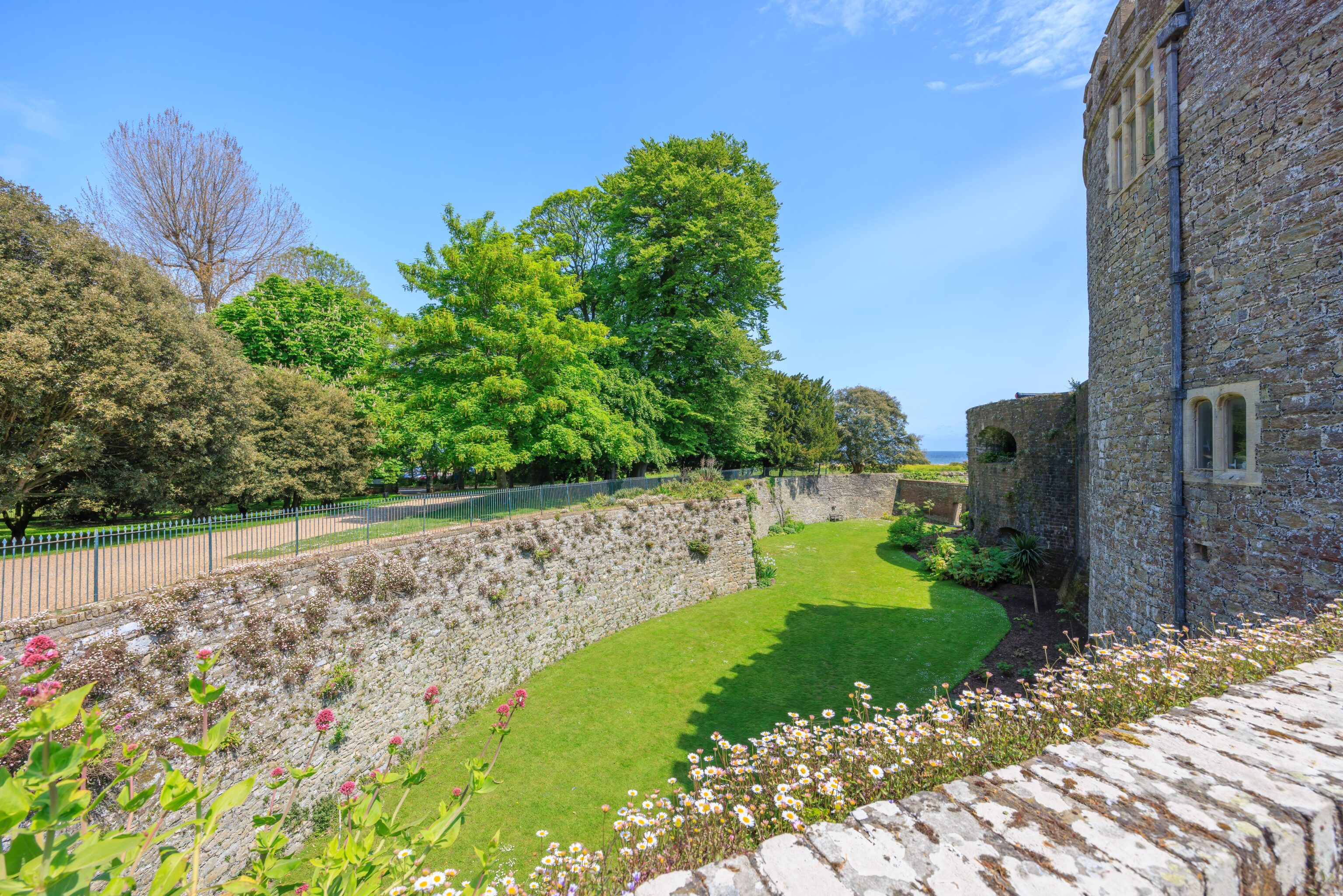
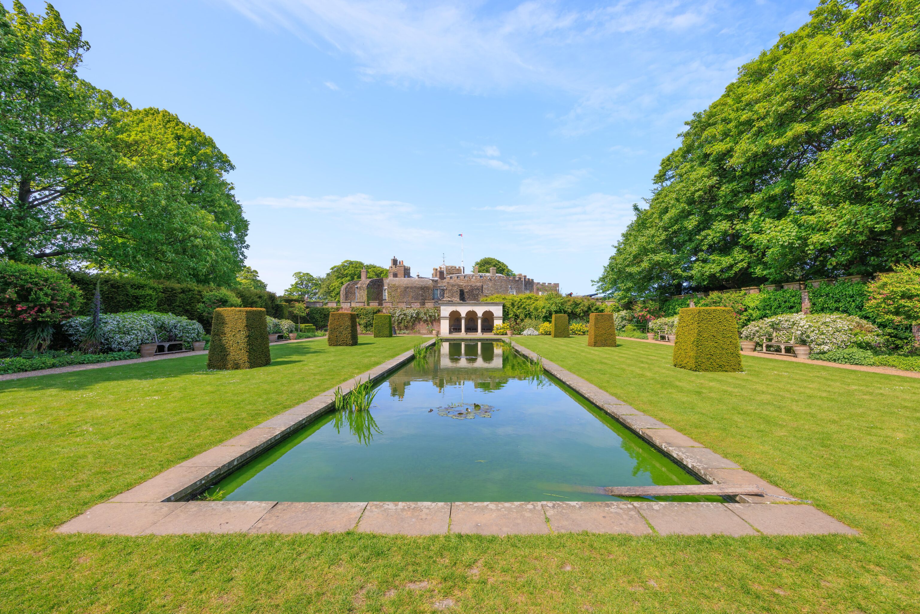
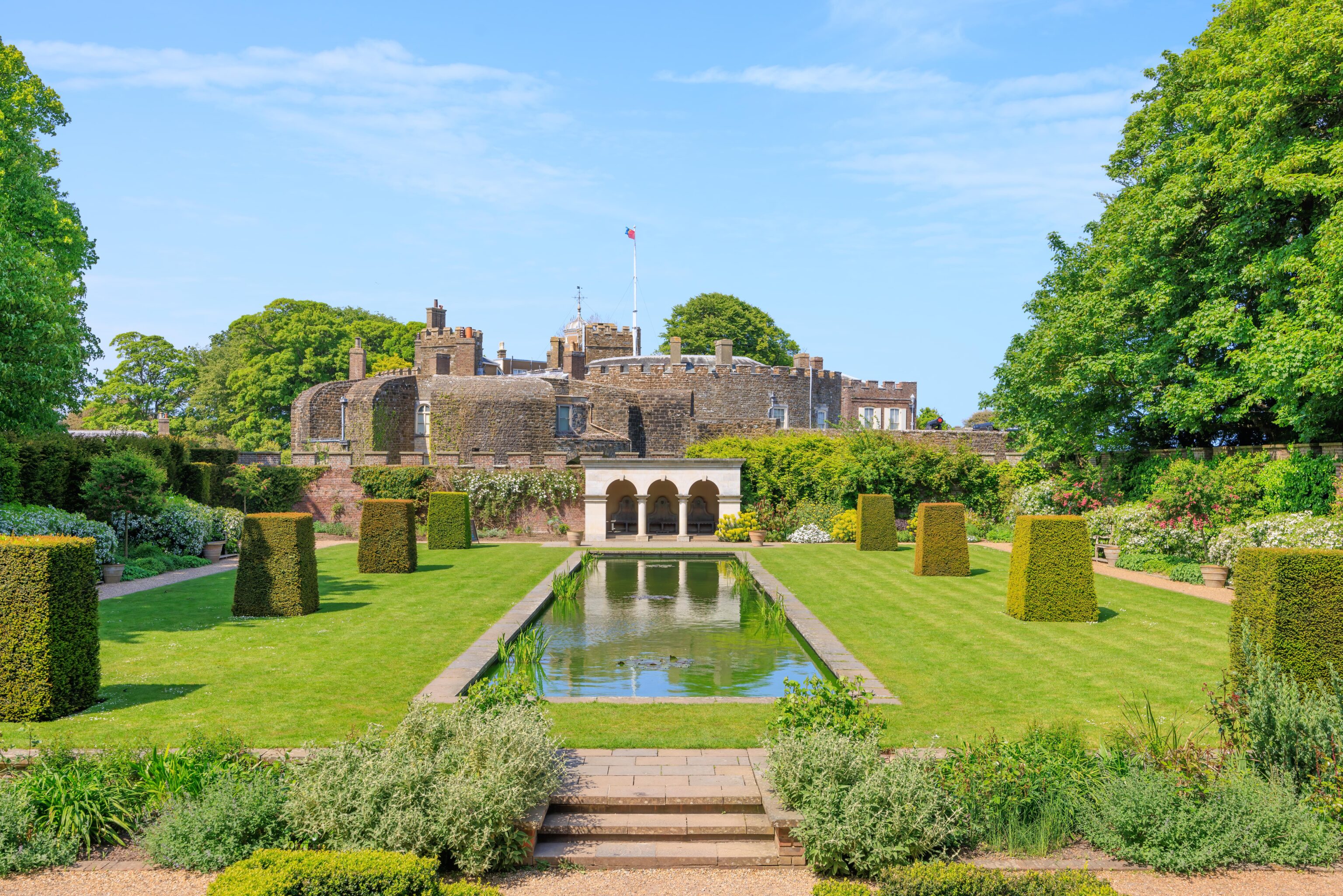
The castle has extensive gardens on the inland side. They are in this direction, to the west.
The castle was designed to defend against attackers from the sea. It is very close to the beach. Going exactly east, one would end up in Belgium near Ostend.
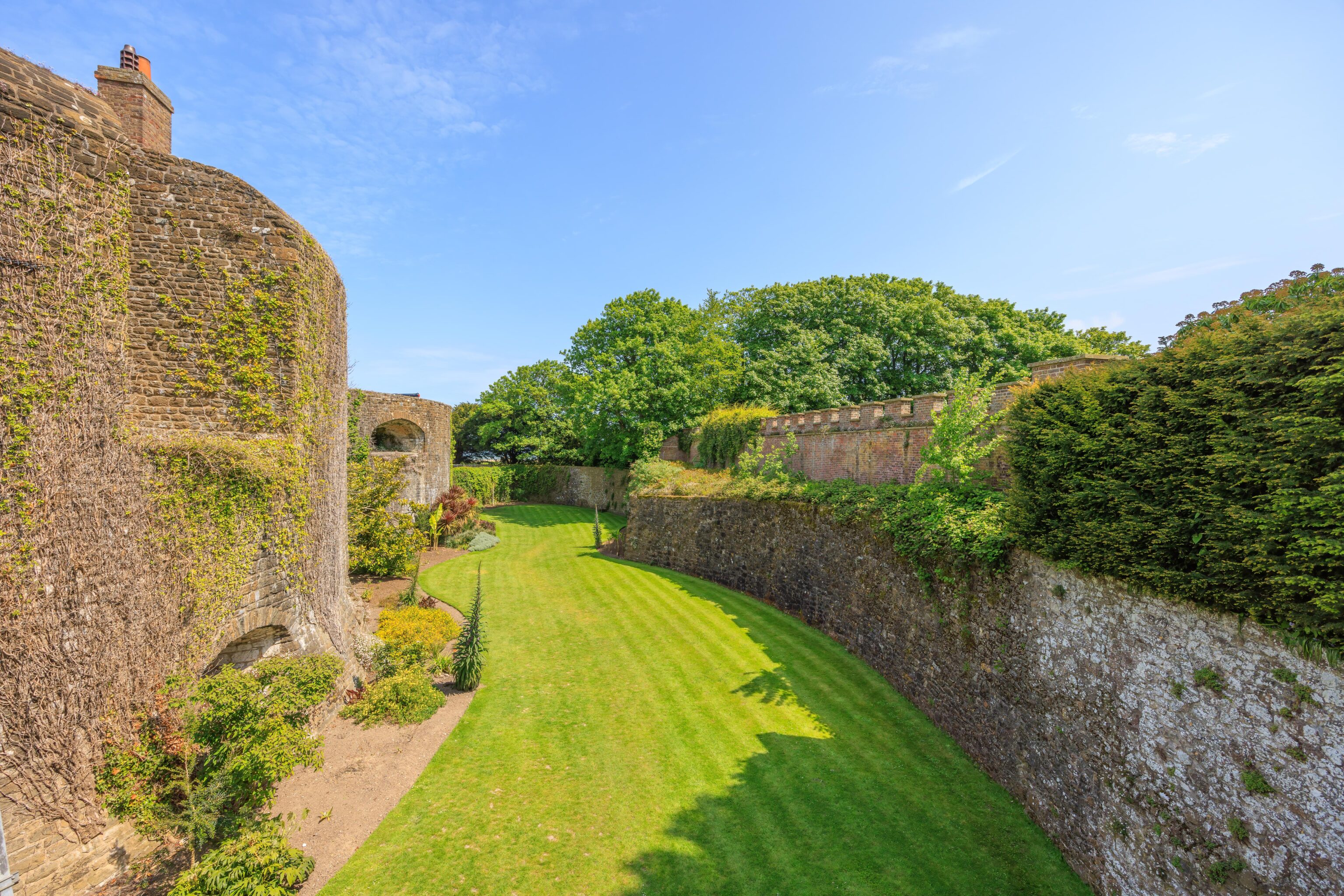
The moat no longer contains water, just some nicely maintained grass.
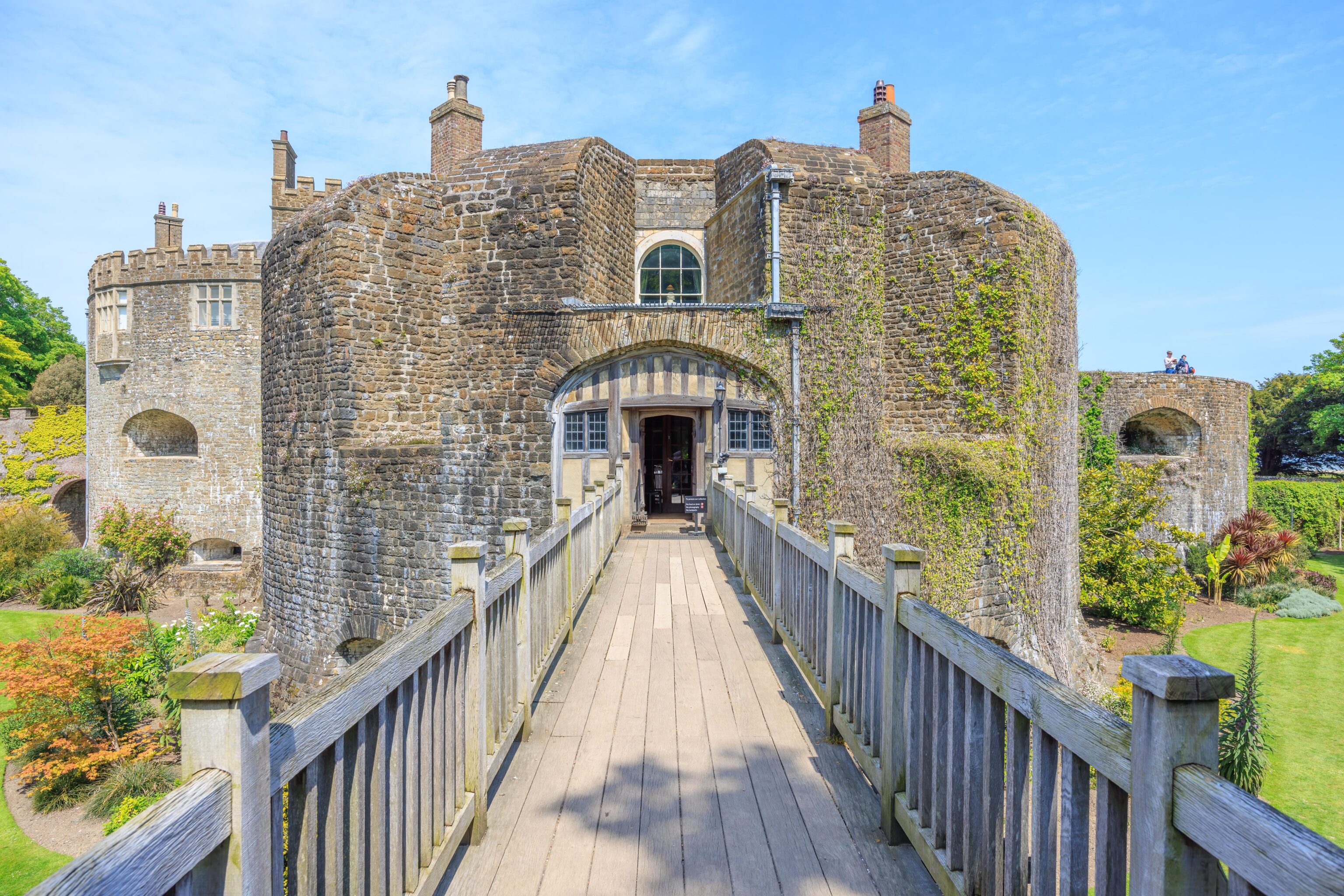
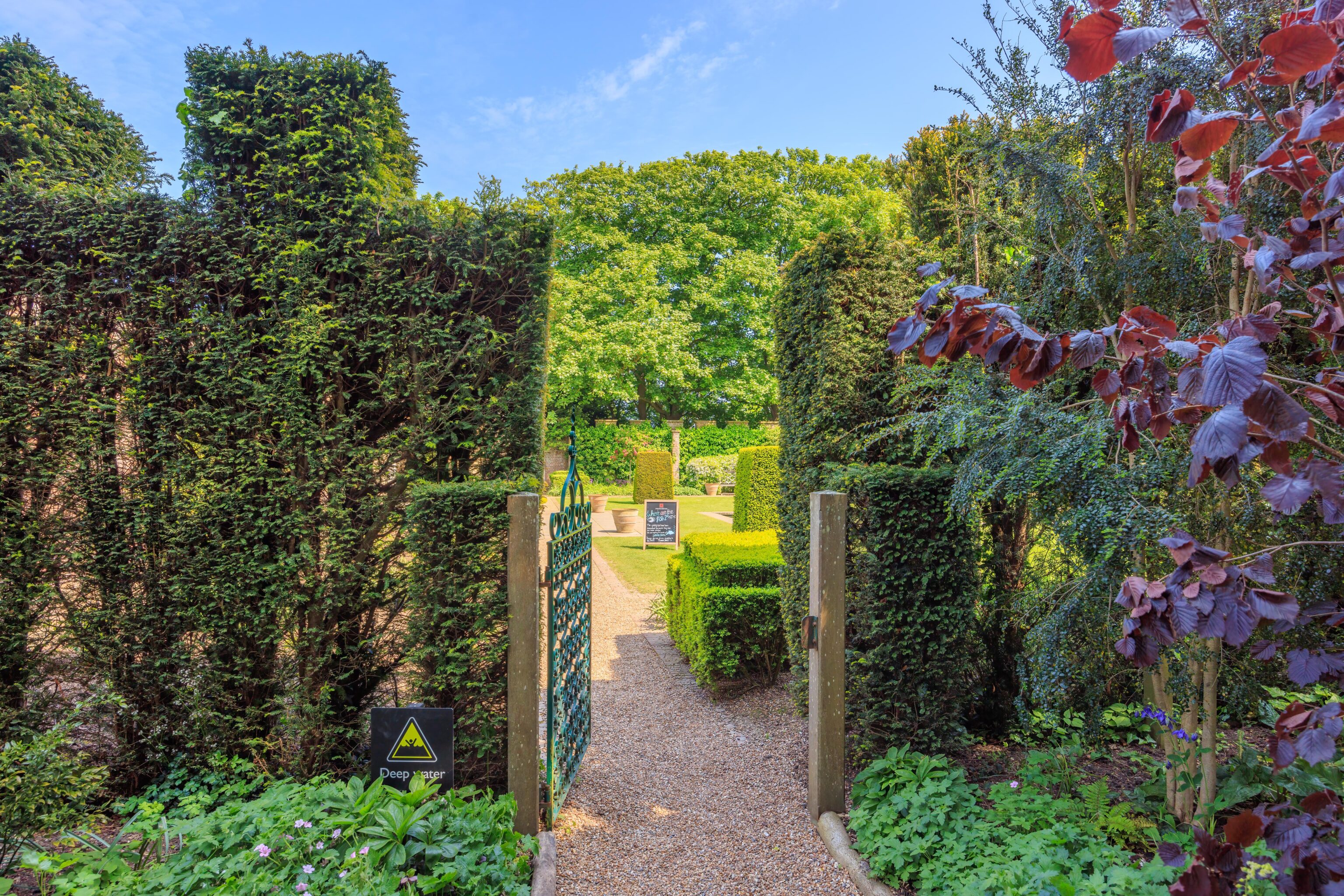
We went back down to ground level and exited to the gardens. This is how the castle looks from the west end of the bridge over the moat.
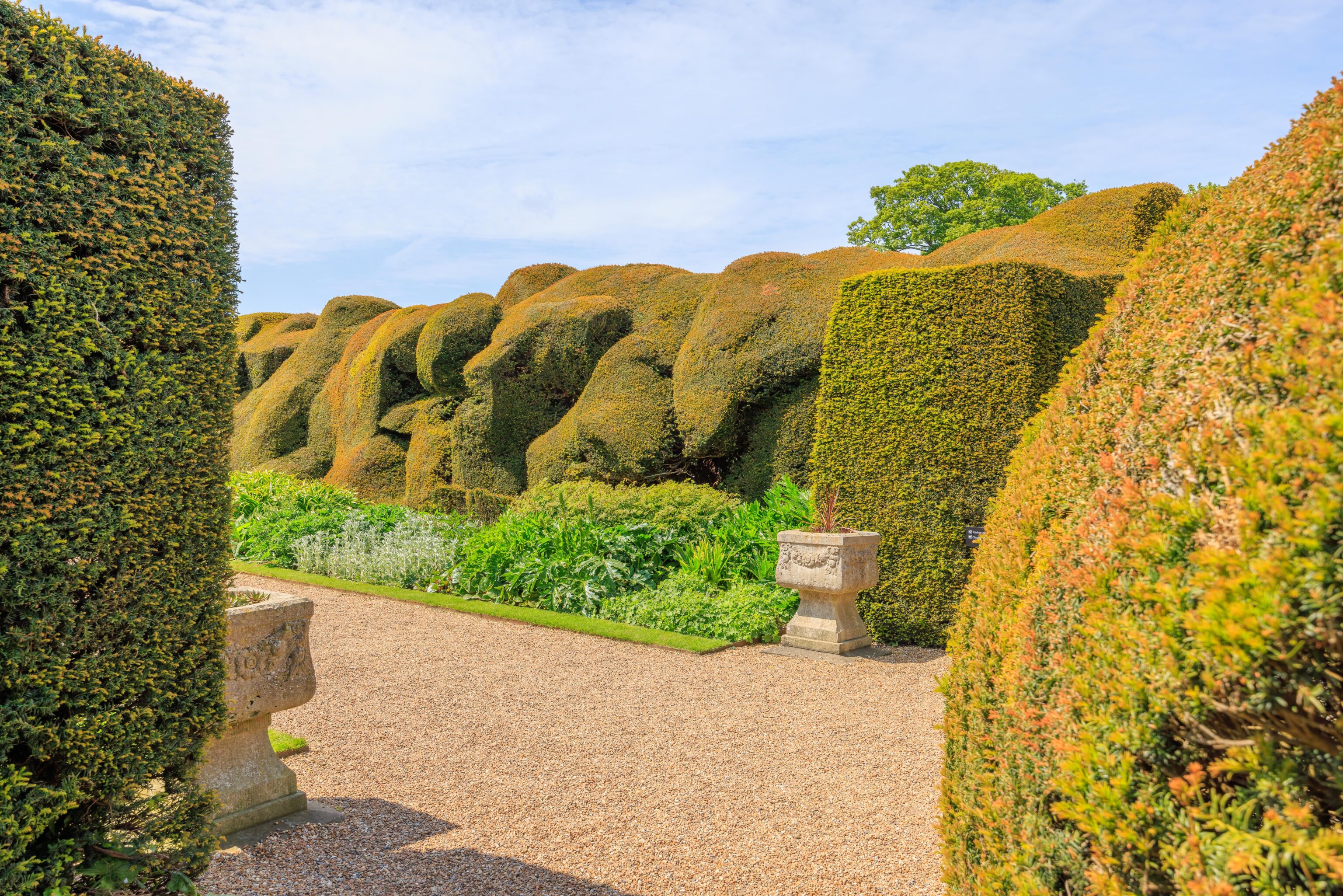
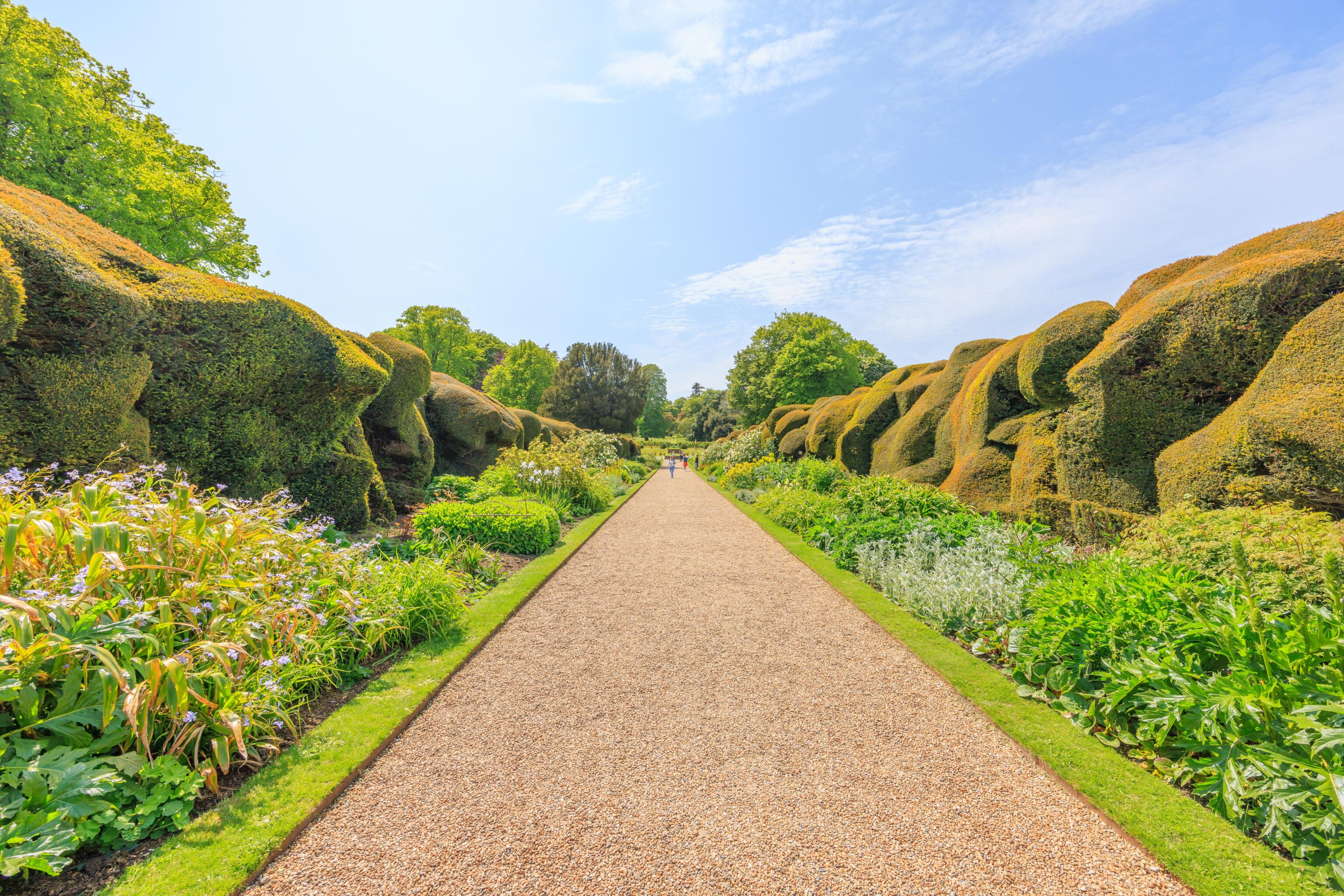
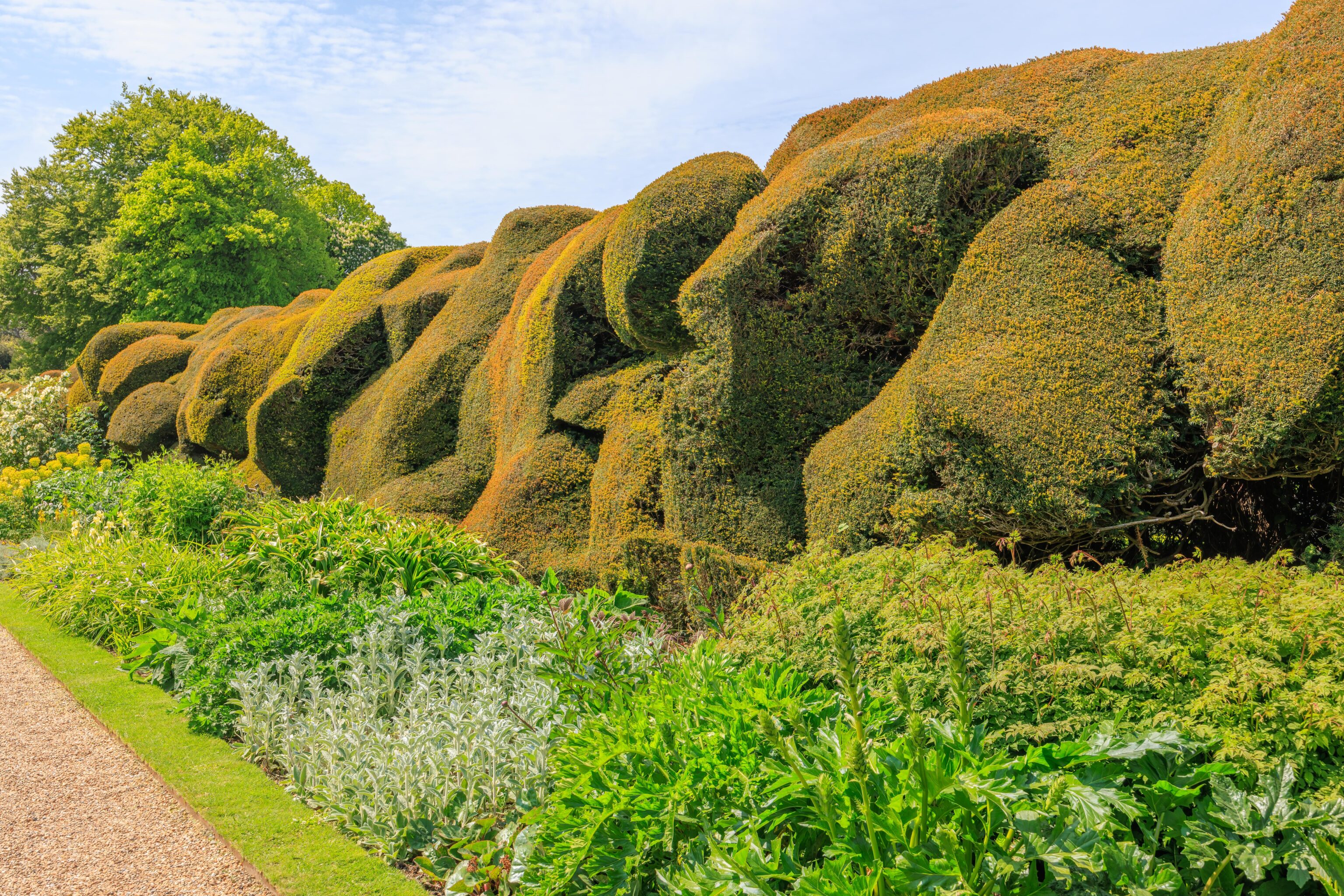
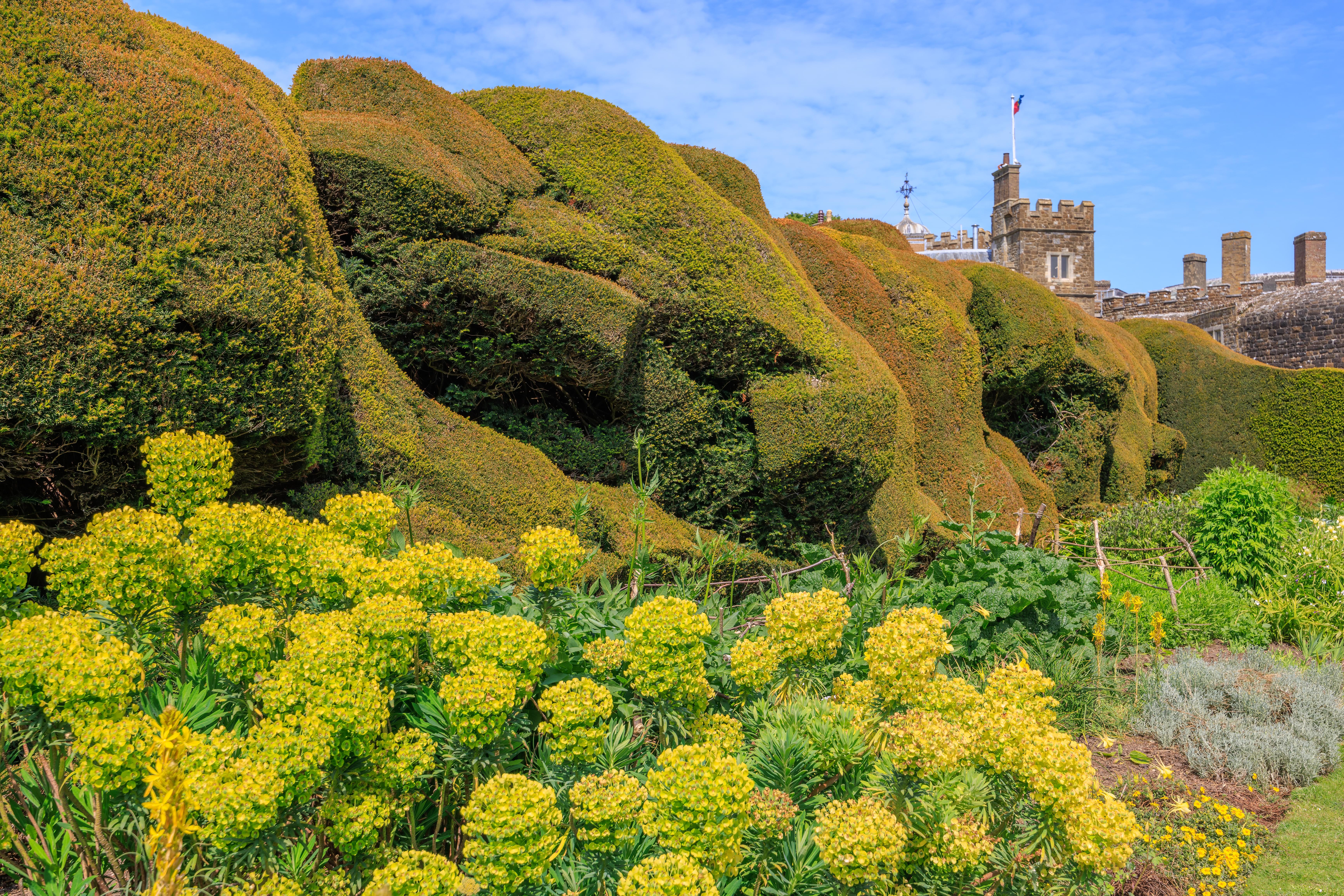
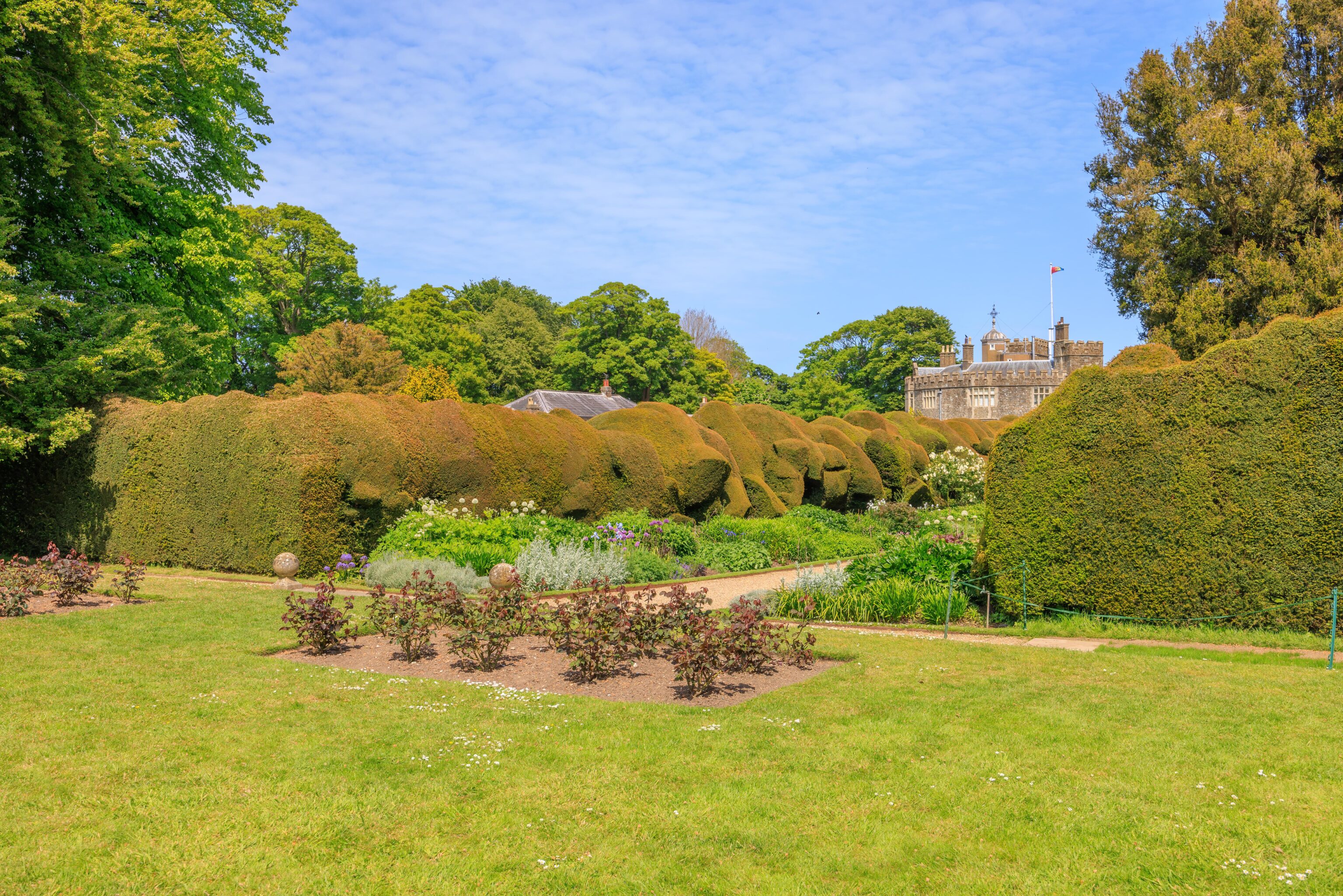
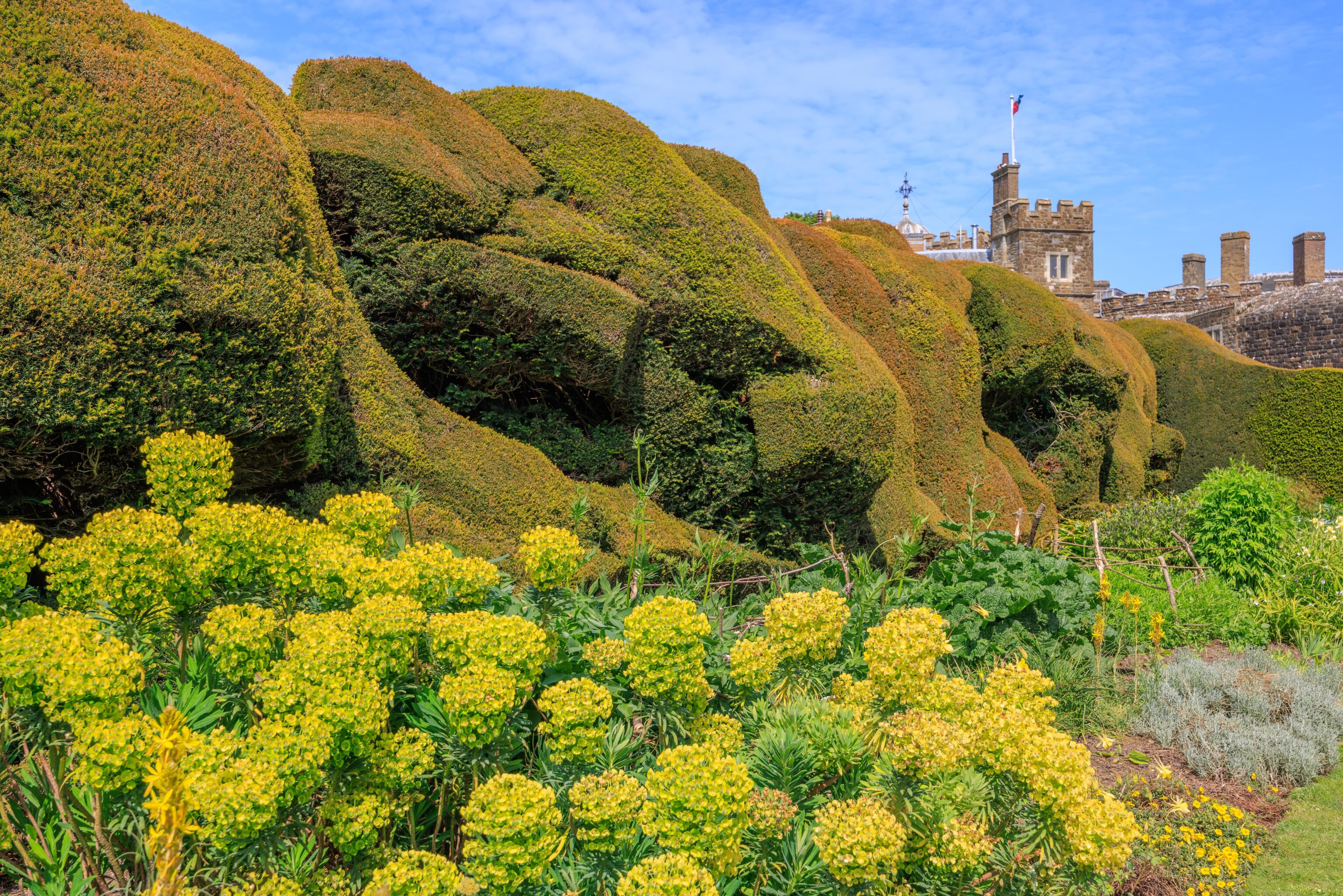
This part of the garden is called the Broadwalk. It is lined on both sides by a “cloud hedge.” It makes for a very unique and appealing appearance!
The garden, of course, offers views of the castle.
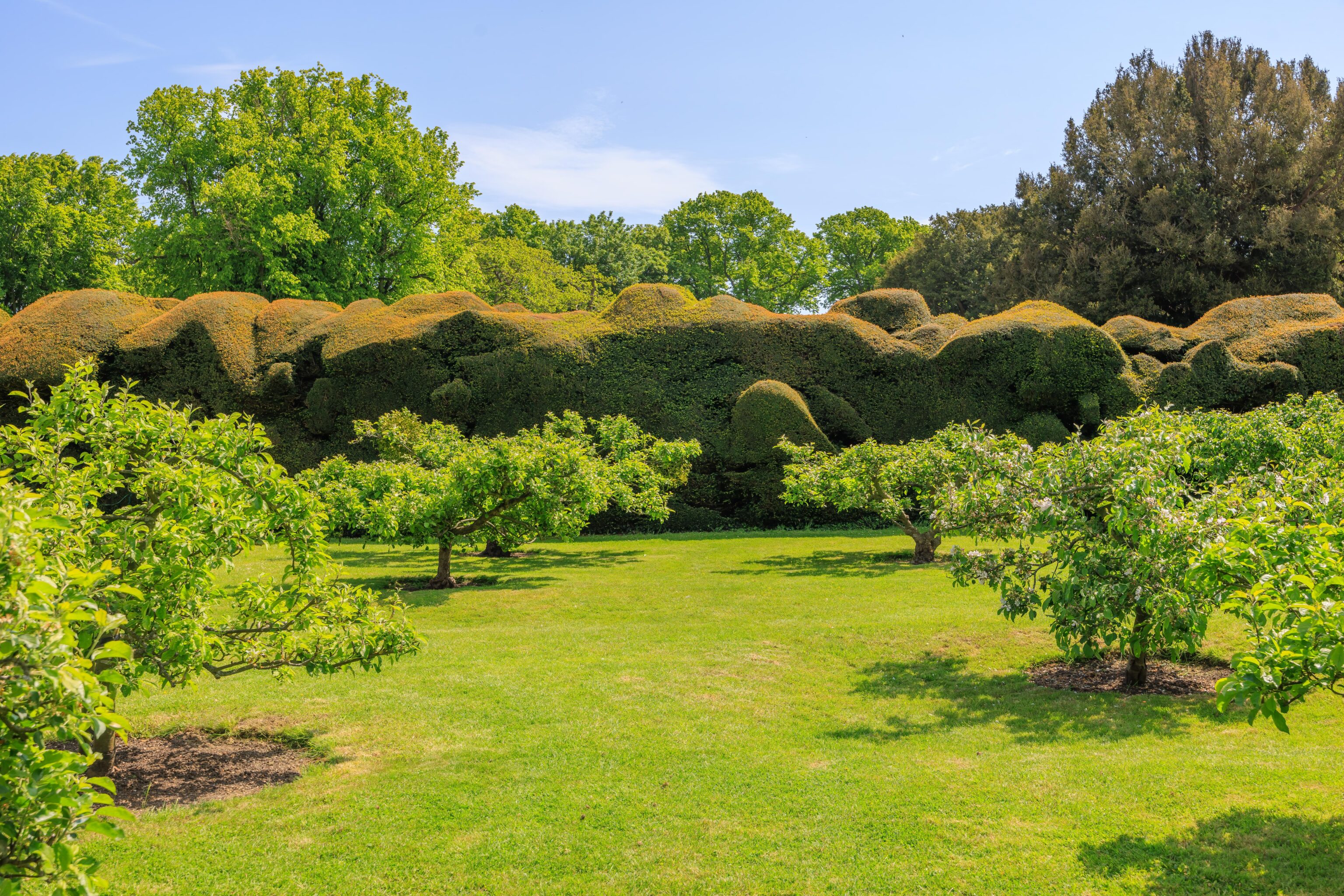

We walked to the northern edge of the garden and headed west, further inland. The hedge is nicely sculpted on the outside of the Broadwalk as well.
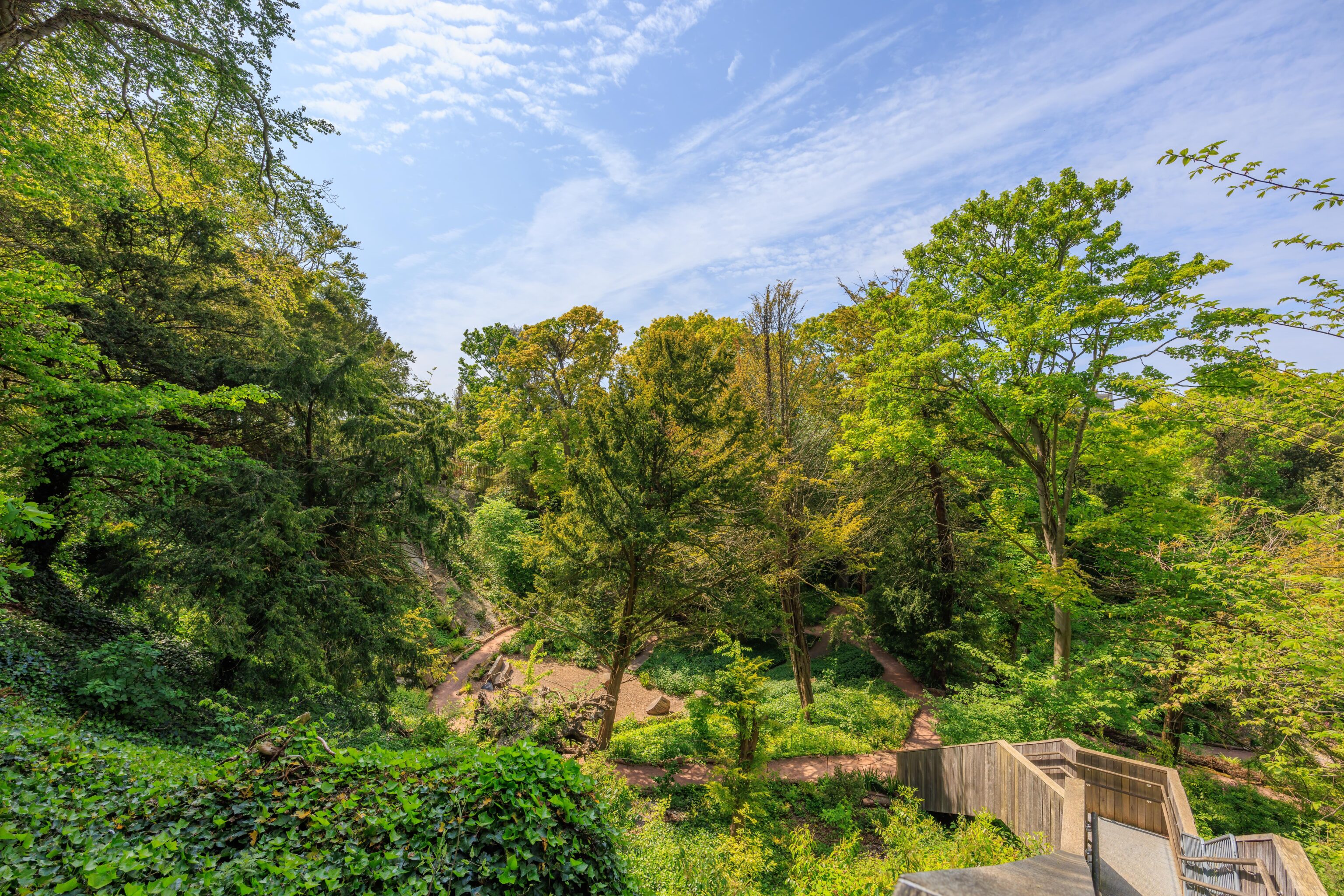
The path soon enters a wooded area. After a bit of walking, we ended up atop these stairs. The area below is the Glen. It was formerly a chalk quarry that was turned into a garden in the 19th century. It had become overgrown but was recently restored. We did not venture down. There isn’t enough time in day to explore everything everywhere!
We headed back towards the castle and ended up at the far end of the Broadwalk.
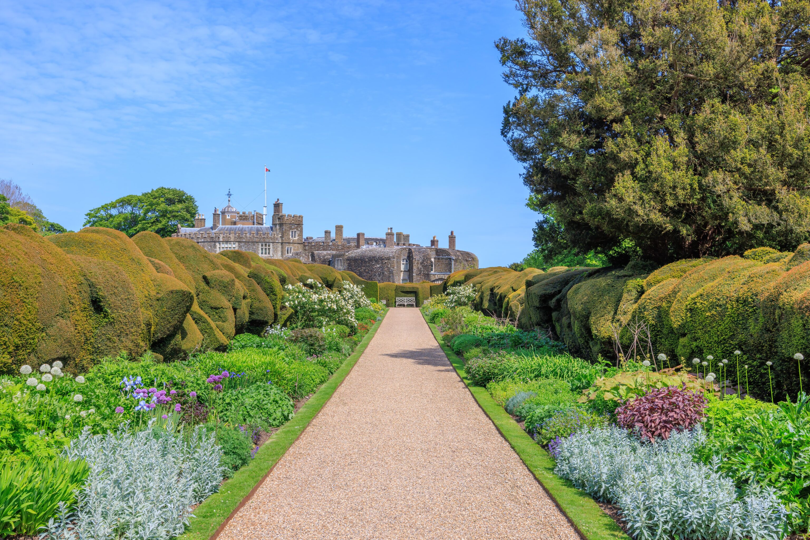
Previously, when we were on the eastern end, we didn’t actually walk through the Broadwalk. But now, we walked through it from west to east.
We headed to the Queen Mother’s Garden, south of the castle and southeast of the Broadwalk.
The Queen Mother’s Garden is a nice little space with a reflecting pool, seating, and some bushes that seem to have been trimmed so they look like concrete blocks. That’s probably not the intended description!
There is also a bench with a sculpture of a corgi. There is a photo of the Queen Mother sitting on a bench with a corgi in this garden. Its unfortunately not the same bench, the bench isn’t in the location where the photo was taken, and the corgi isn’t in the right position. Other than the details not being quite right, its still a nice place to sit!
We then headed back into the castle to make our way back to our car.
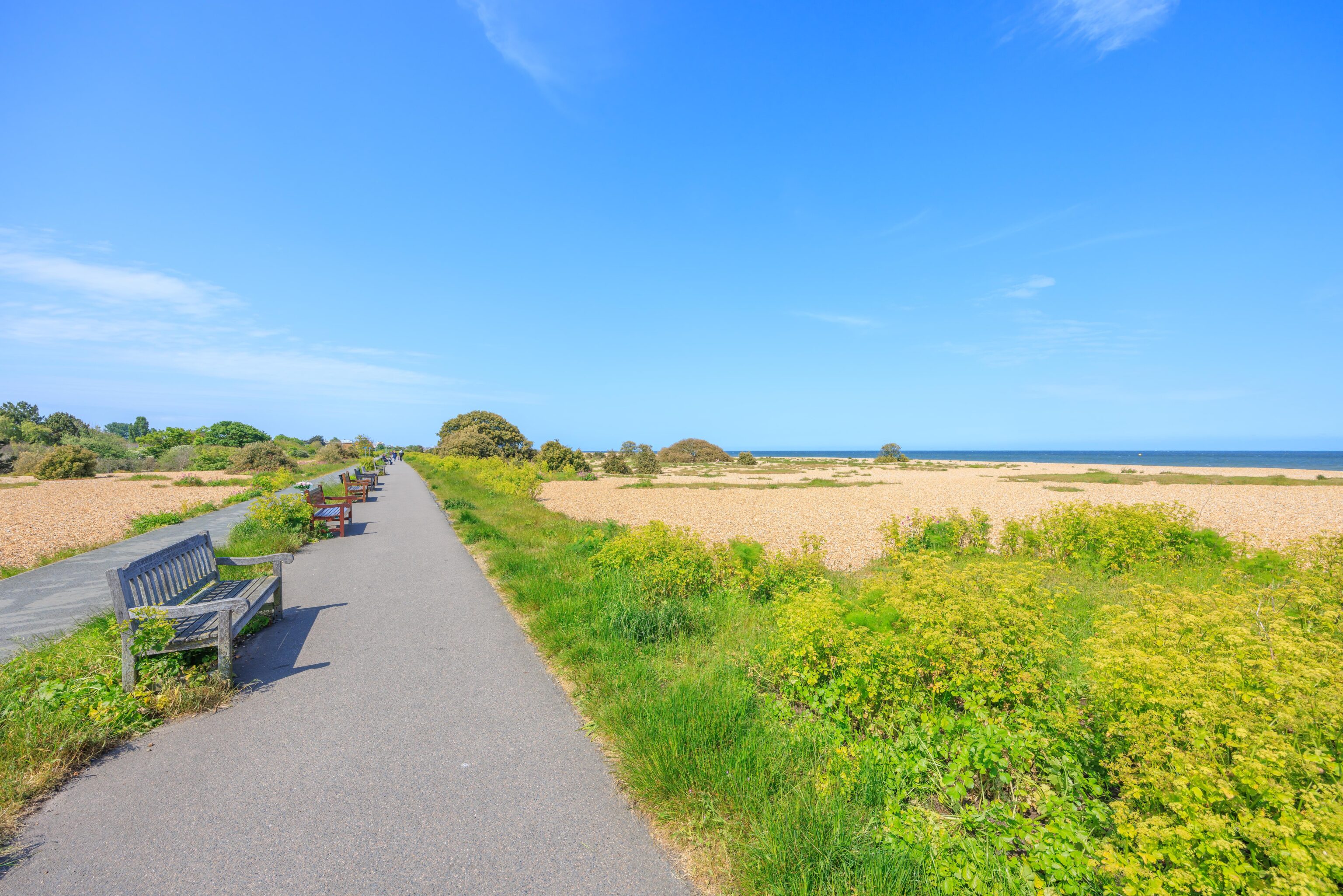
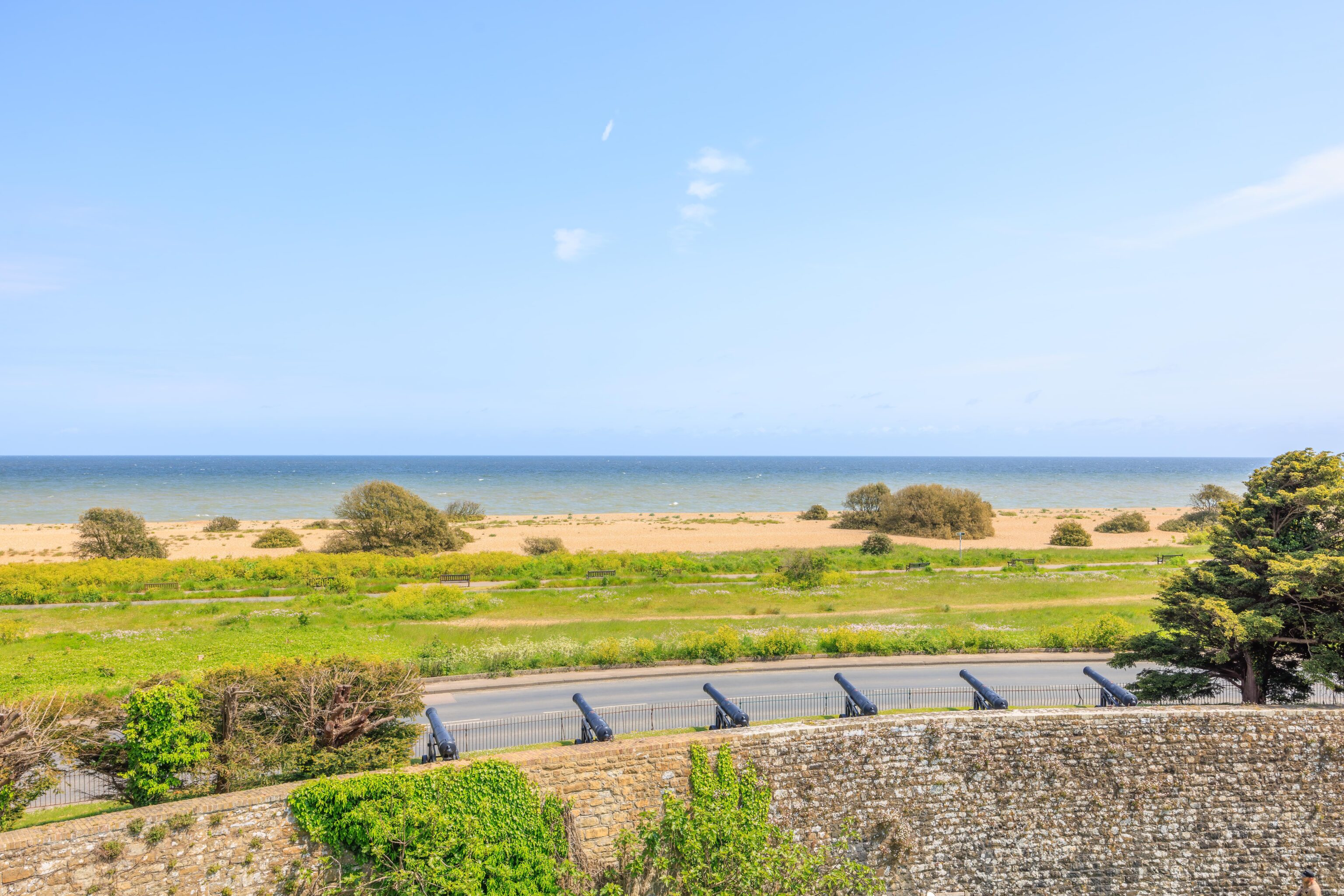
We decided to walk past the car park and check out the beach. It seemed nice and sandy!
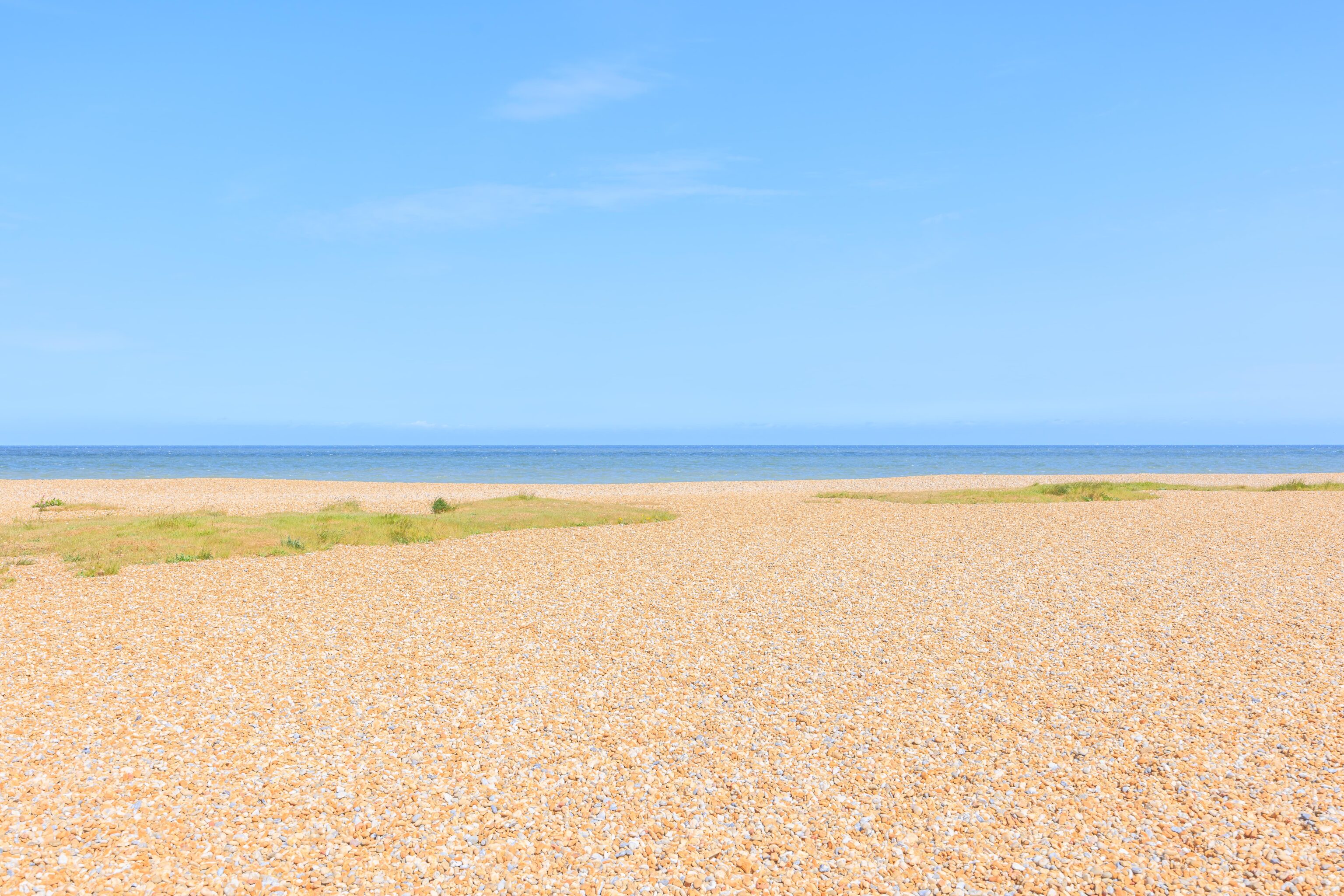
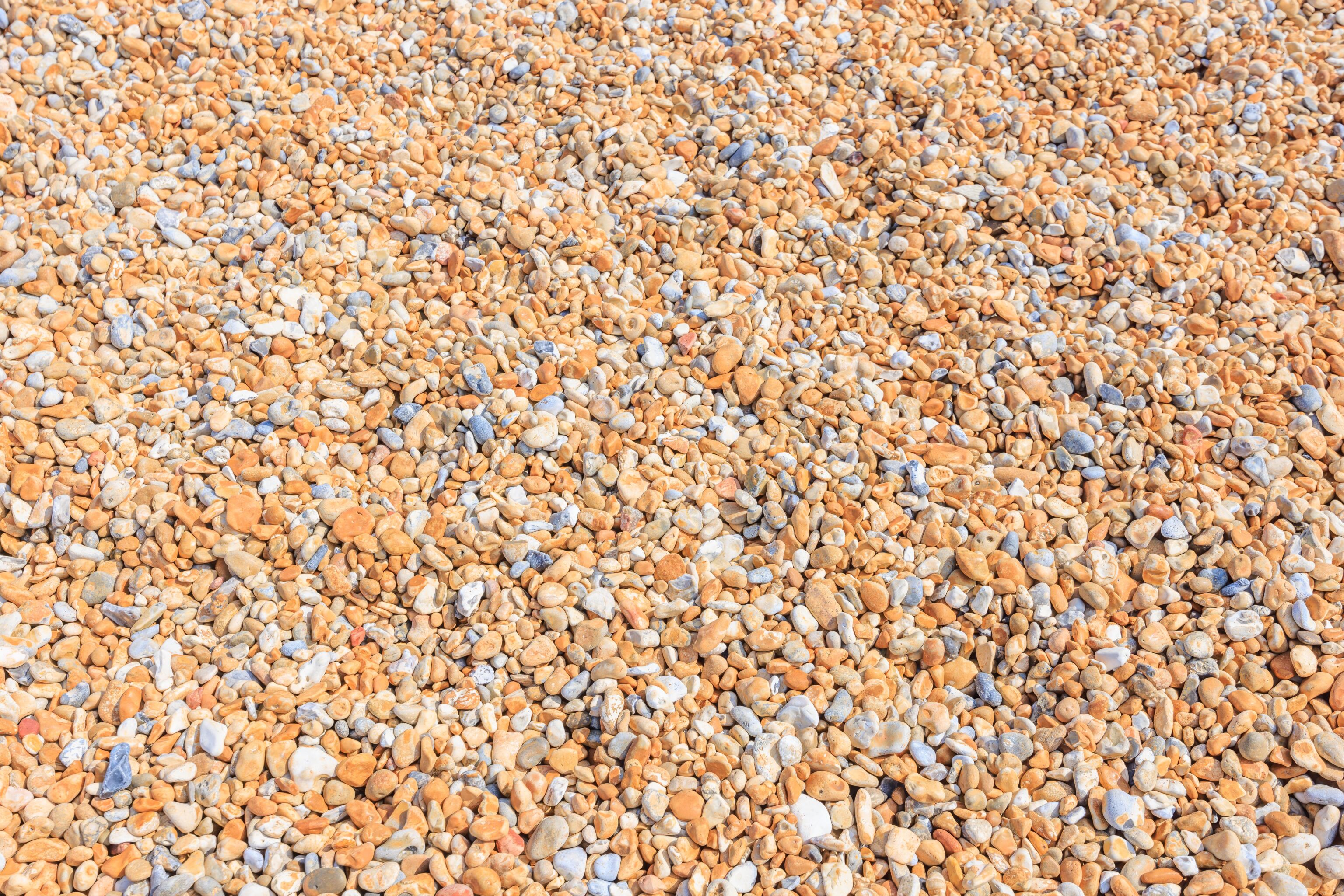
It turns out that it isn’t a sand beach at all! The beach is made up of small rocks! They were all very nicely smoothed though and easy to walk on.
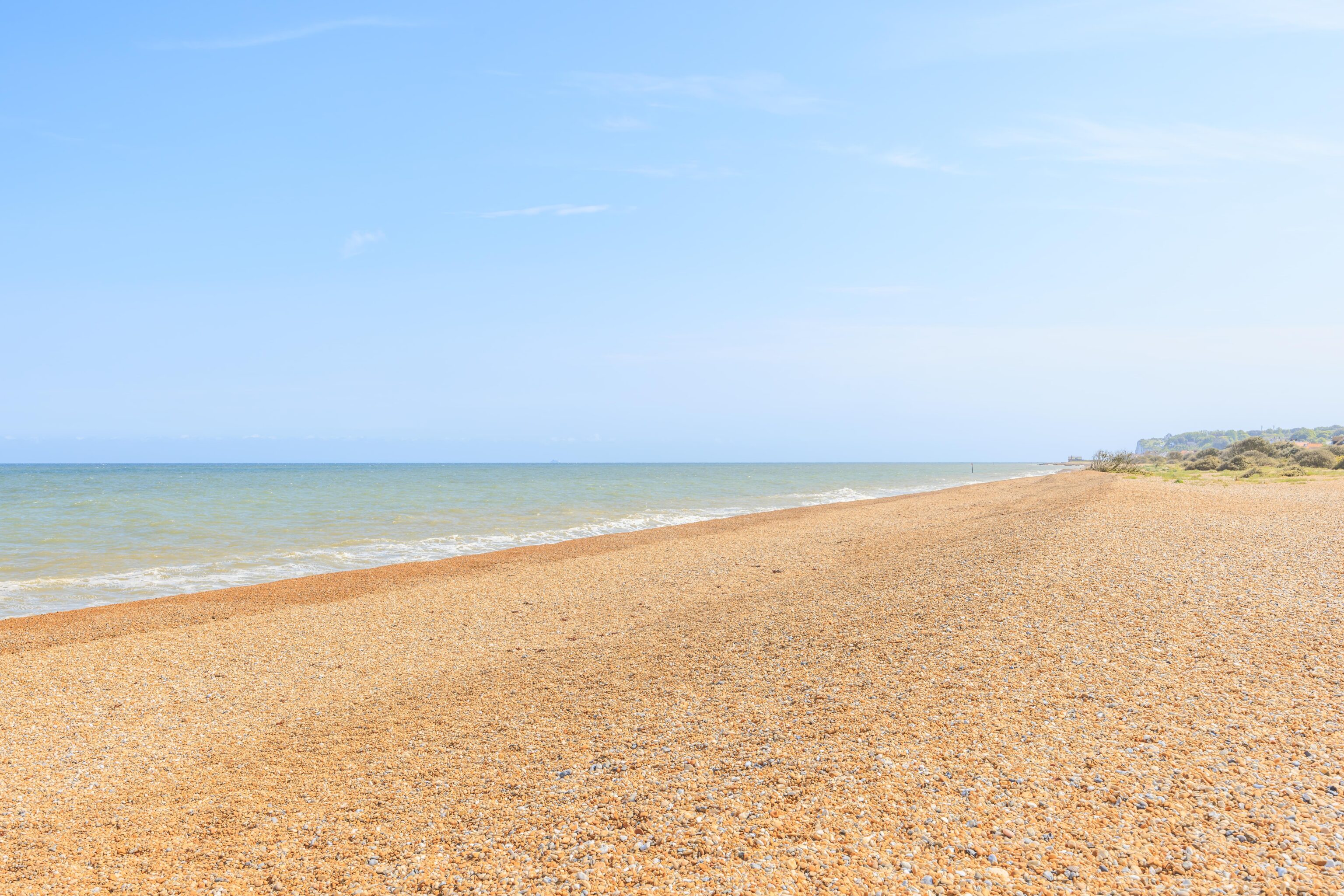
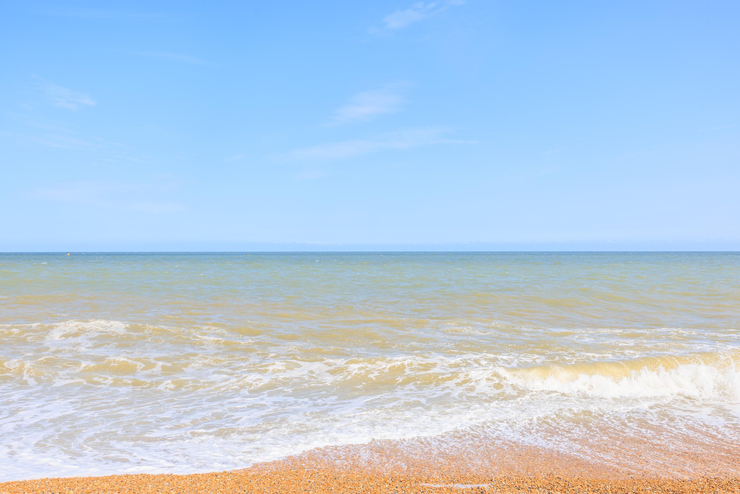
There was a somewhat steep drop-off into the sea. This is probably considered the North Sea, depending on exactly where the English Channel’s boundaries are defined. We didn’t try to go near the water.
Deal Castle
We drove north a few minutes to reach Deal Castle. We paid £1 to park. We could have gotten a free parking pass but it didn’t seem worth it to walk in, get the pass, then have to come back to the car.
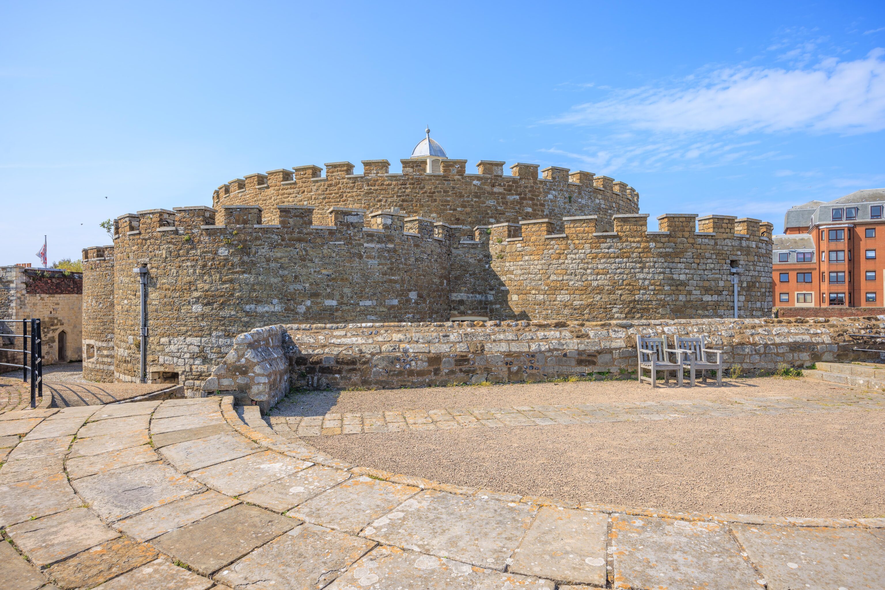
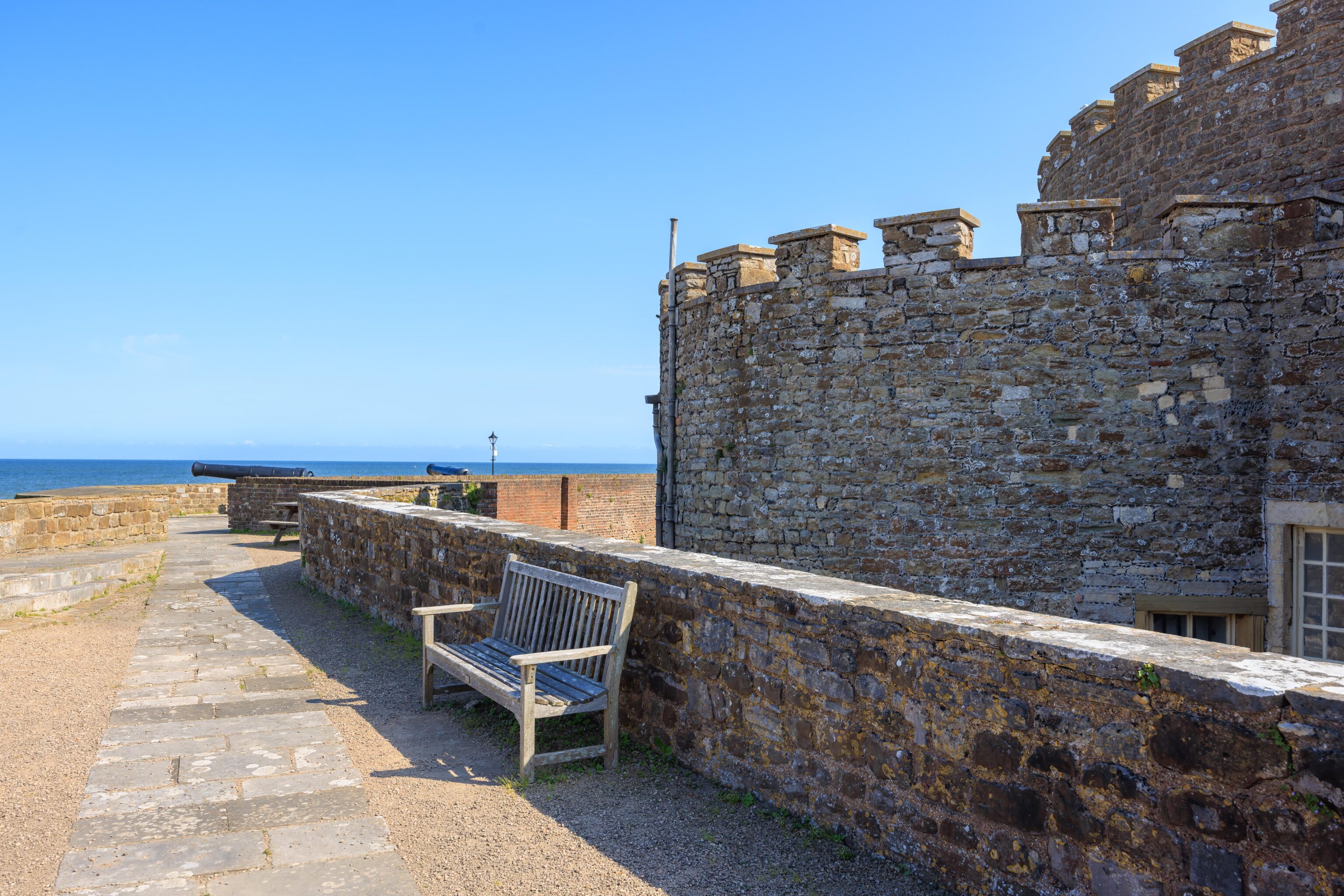
Deal Castle is an artillery fortress, similar to Walmer Castle. It is a bit larger and has a different design. The circular central keep has six protruding partial circular bastions. There are another six partial circular bastions surrounding the central structure. Satellite view on Google Maps provides a better visual description!
We decided to first check out a bit of the castle’s exterior before heading inside.
Like Walmer Castle, the outer bastion rooftops can be walked on. Unlike Walmer Castle though, there wasn’t much there. It was mostly just empty space with a few chairs and a few cannons, though none of the cannons made it into these photos!
Deal Castle was not converted into a residence like Walmer Castle. The interior lacks any sort of decor.
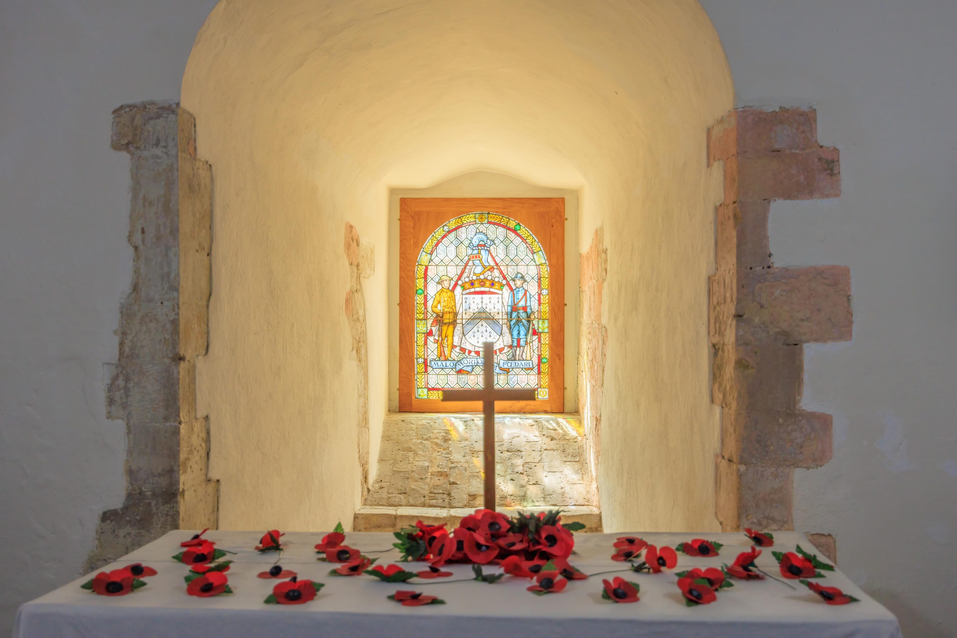
There was a small chapel, dedicated to those who died during World War I. I don’t know if the use of poppies is common throughout all of the Commonwealth nations. But certainly in the UK and Australia, they are a symbol of remembrance to those who died in war. As they say, “lest we forget.”
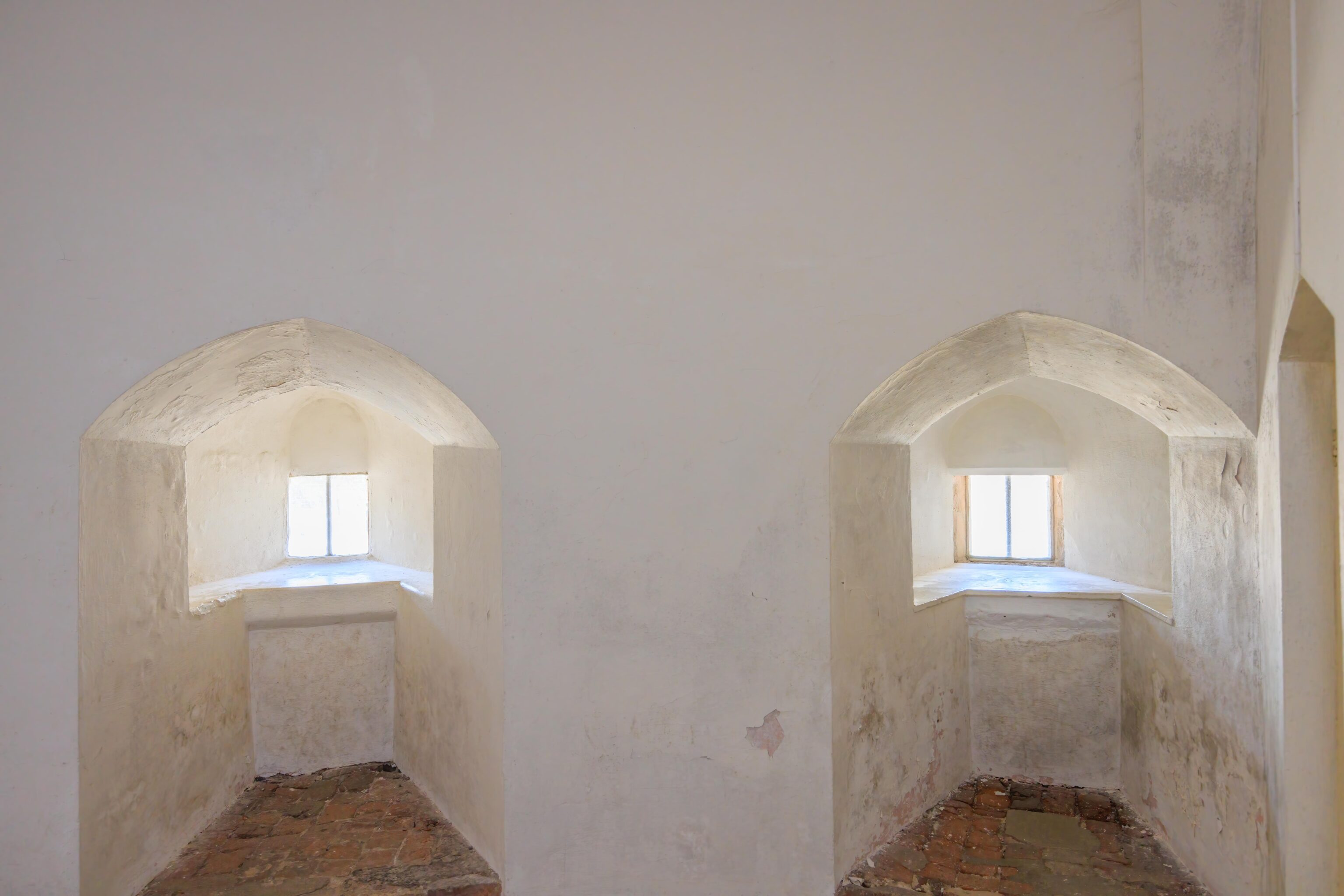
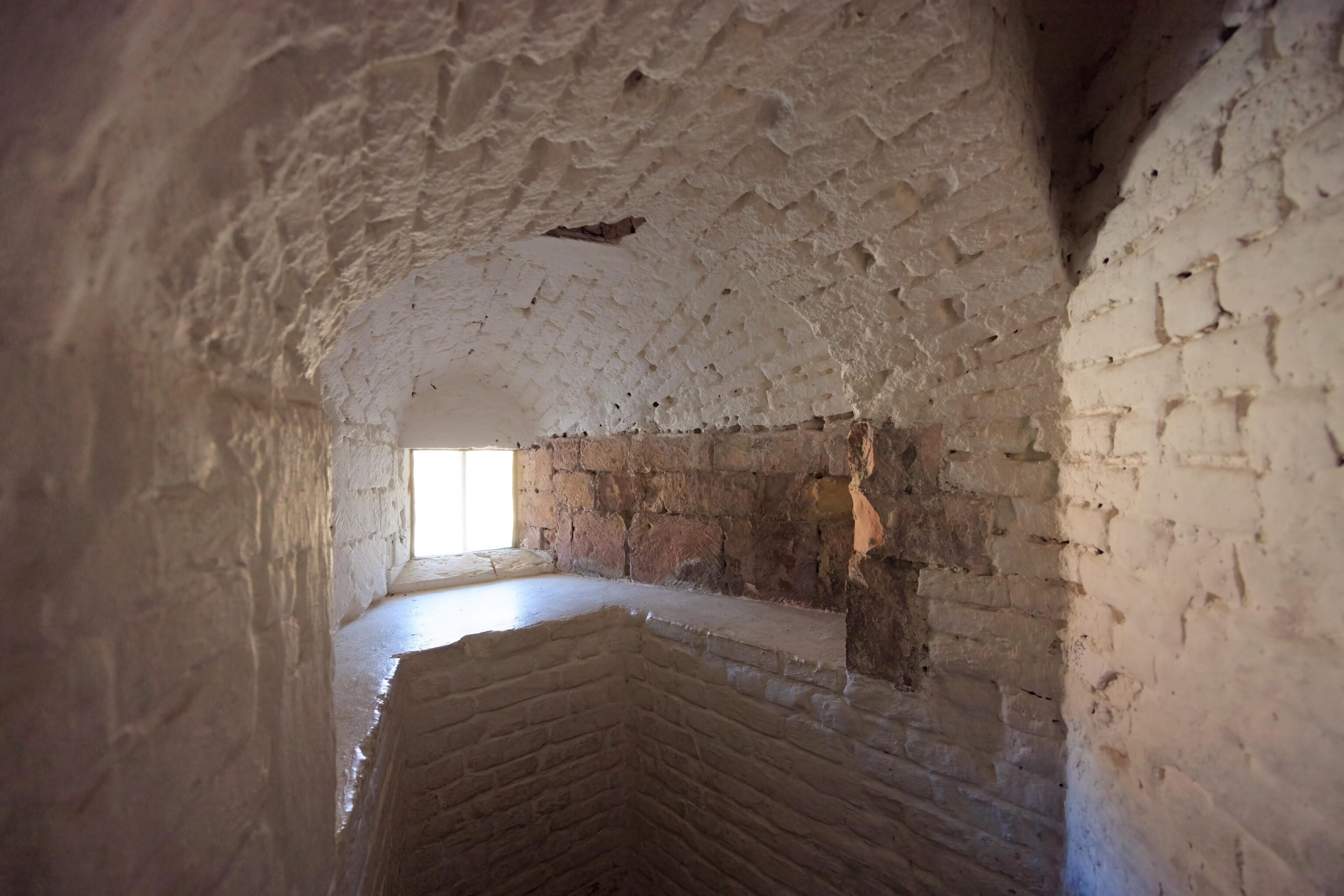
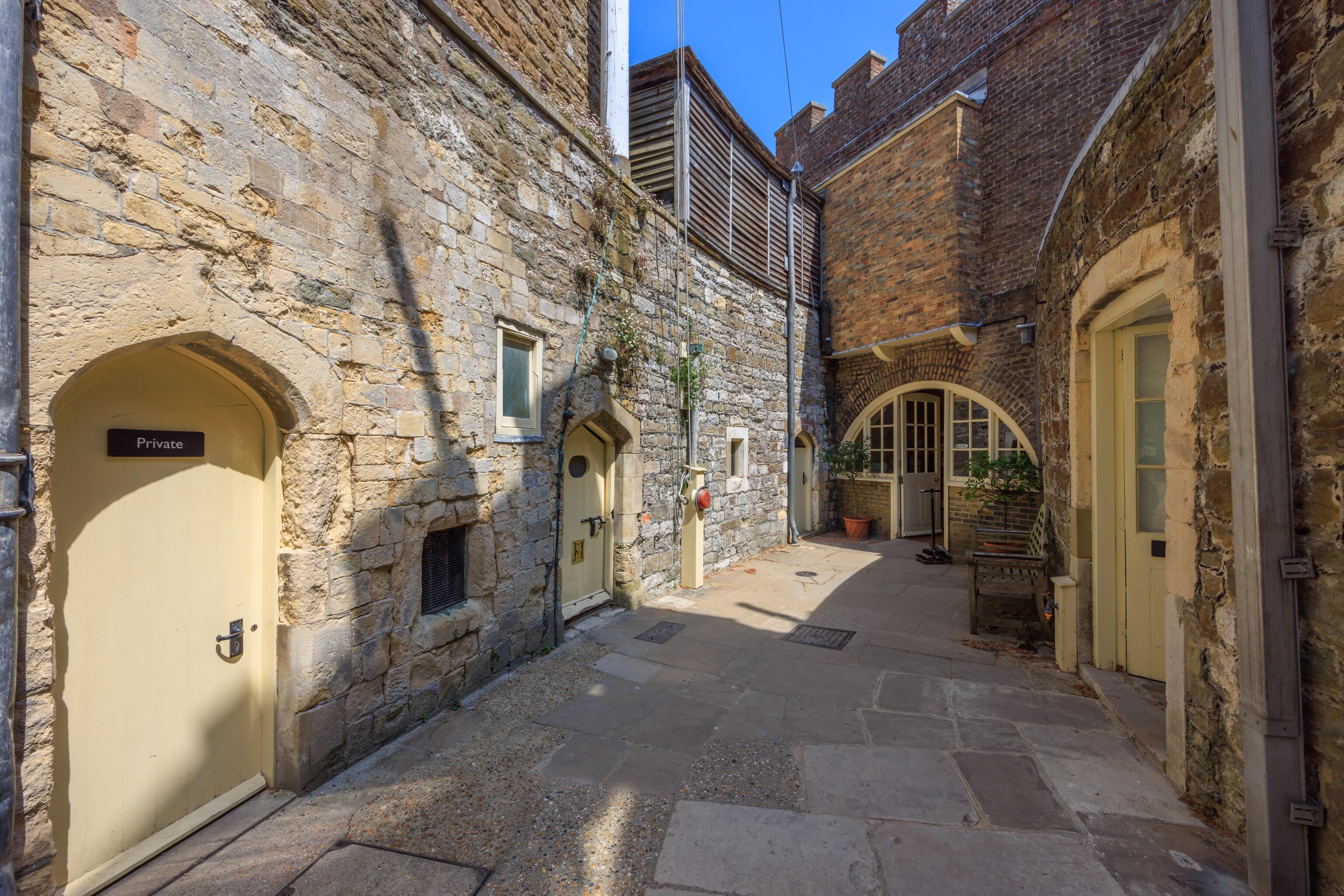
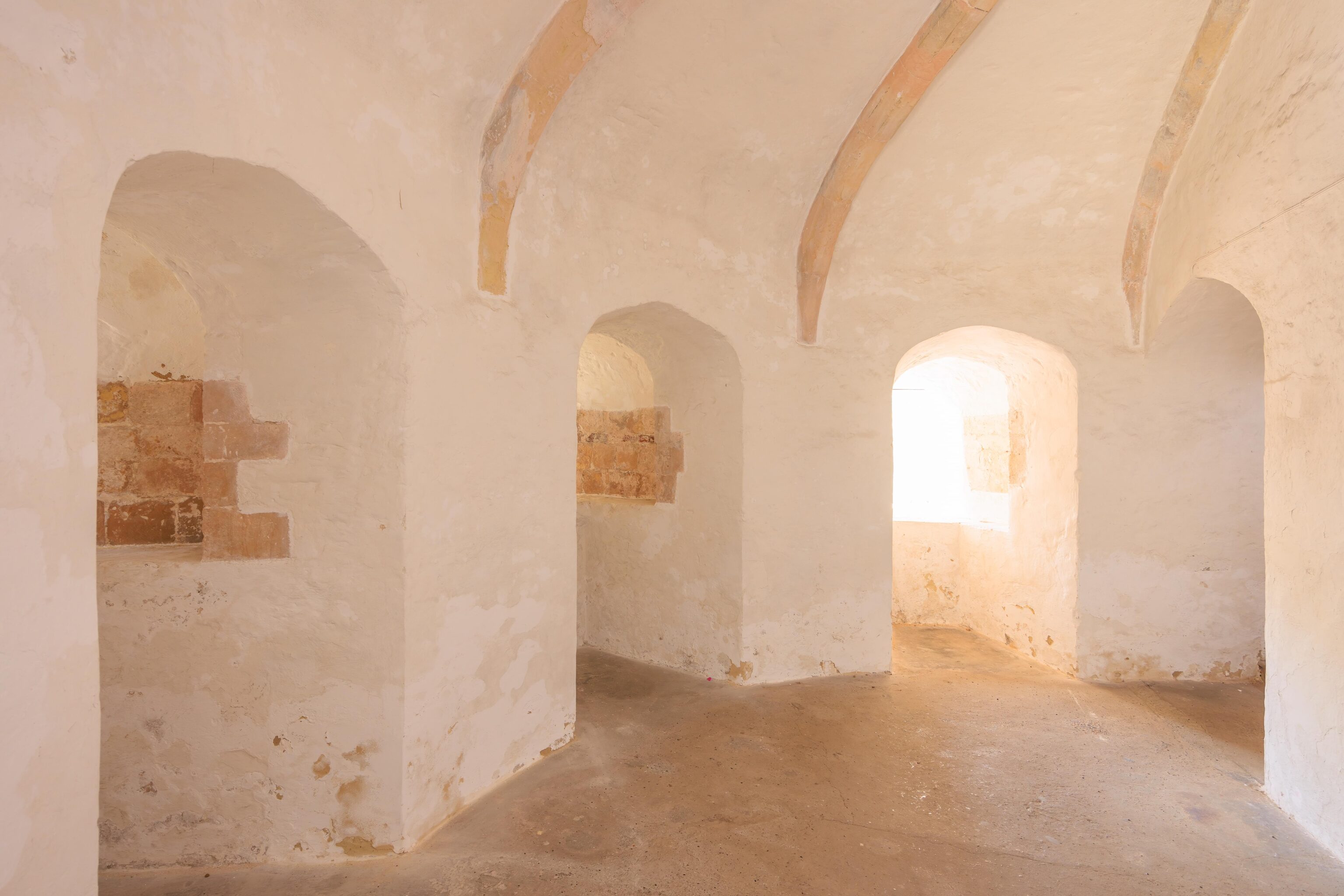
The rooms in the castle varied greatly in appearance. The castle has two above ground floors, connected by stairs in the center of the keep.
We then headed downstairs into the basement. There seemed to be an art exhibition or gallery, which seemed a bit weird. We didn’t photograph it.
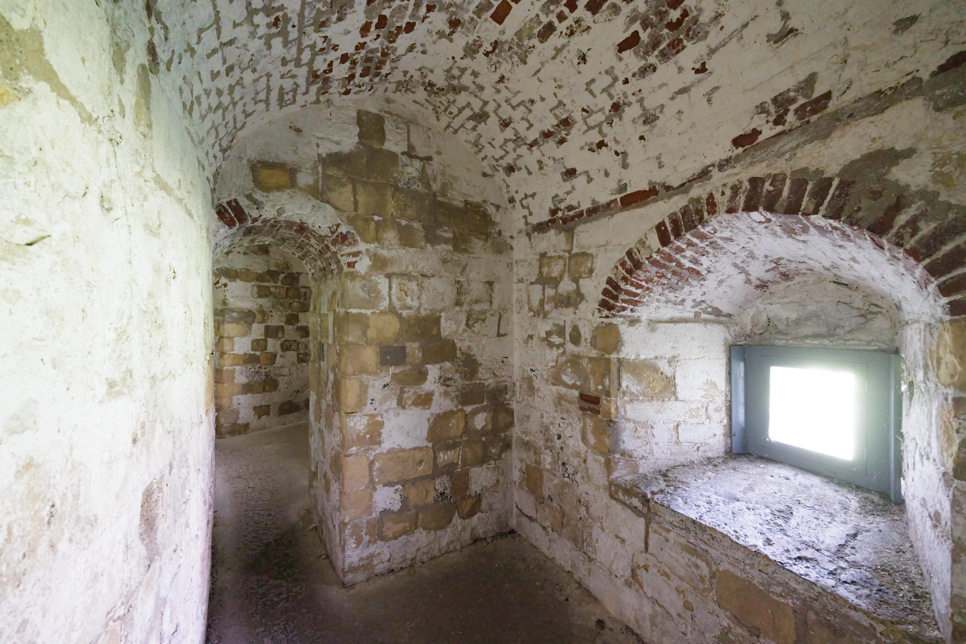
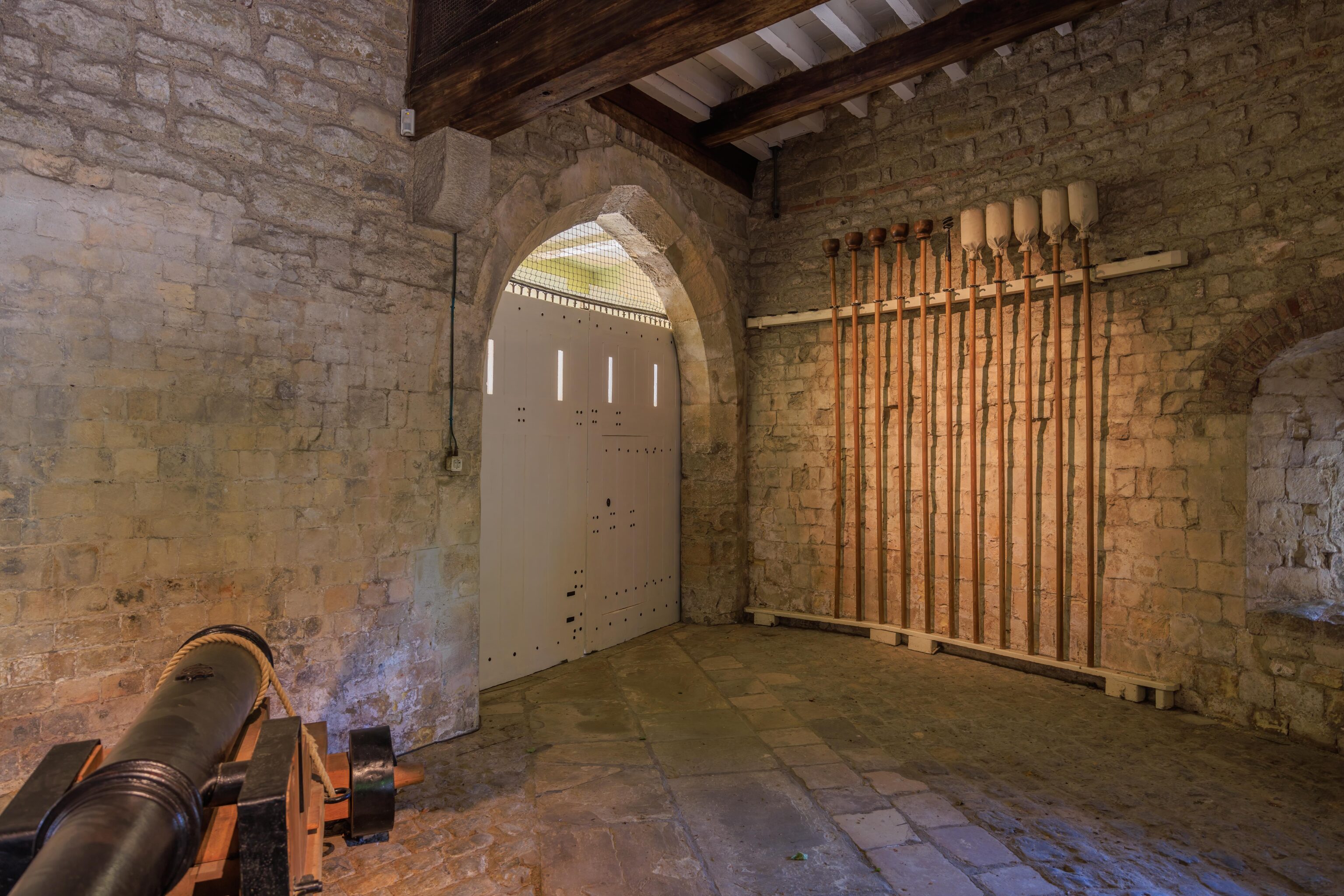
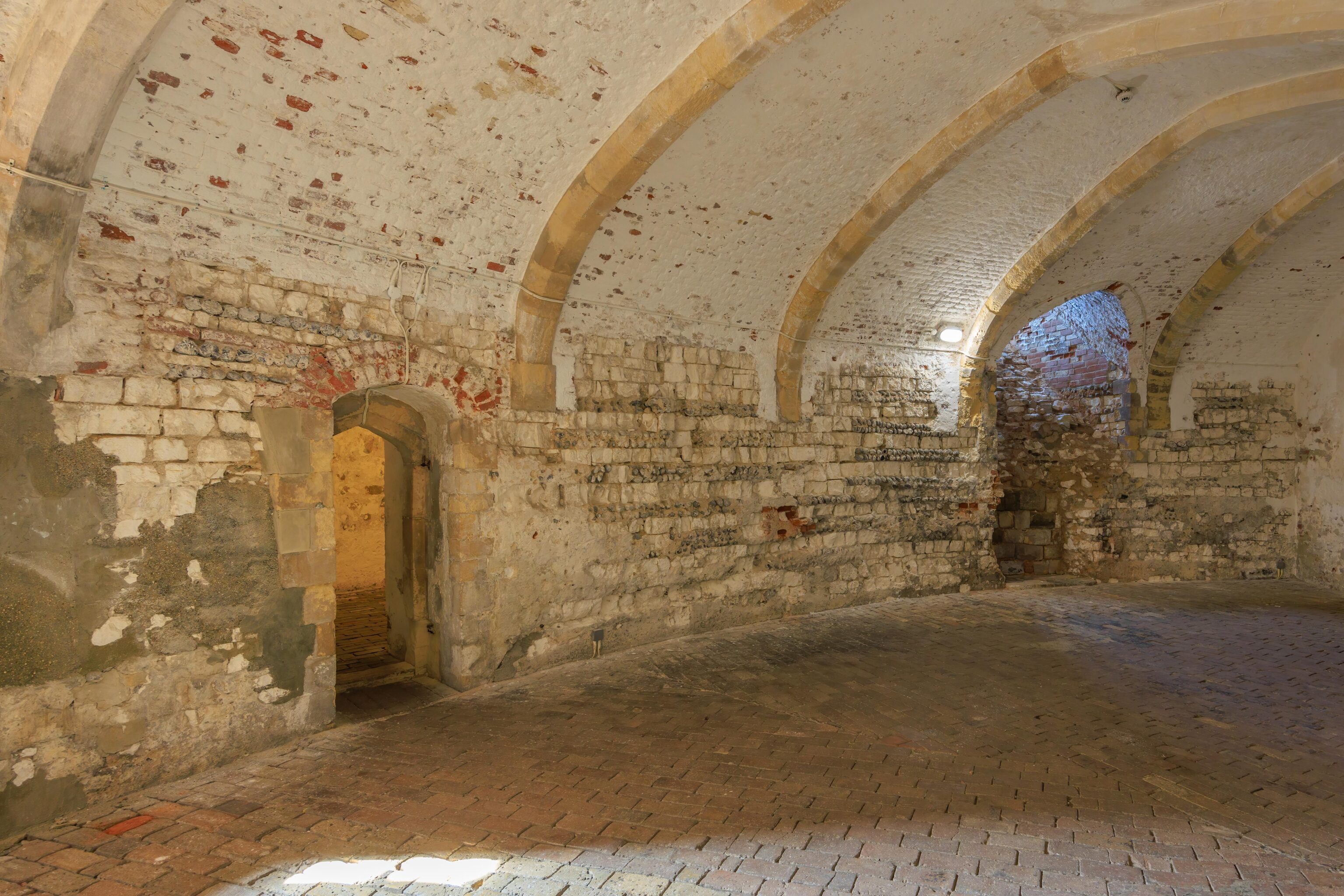
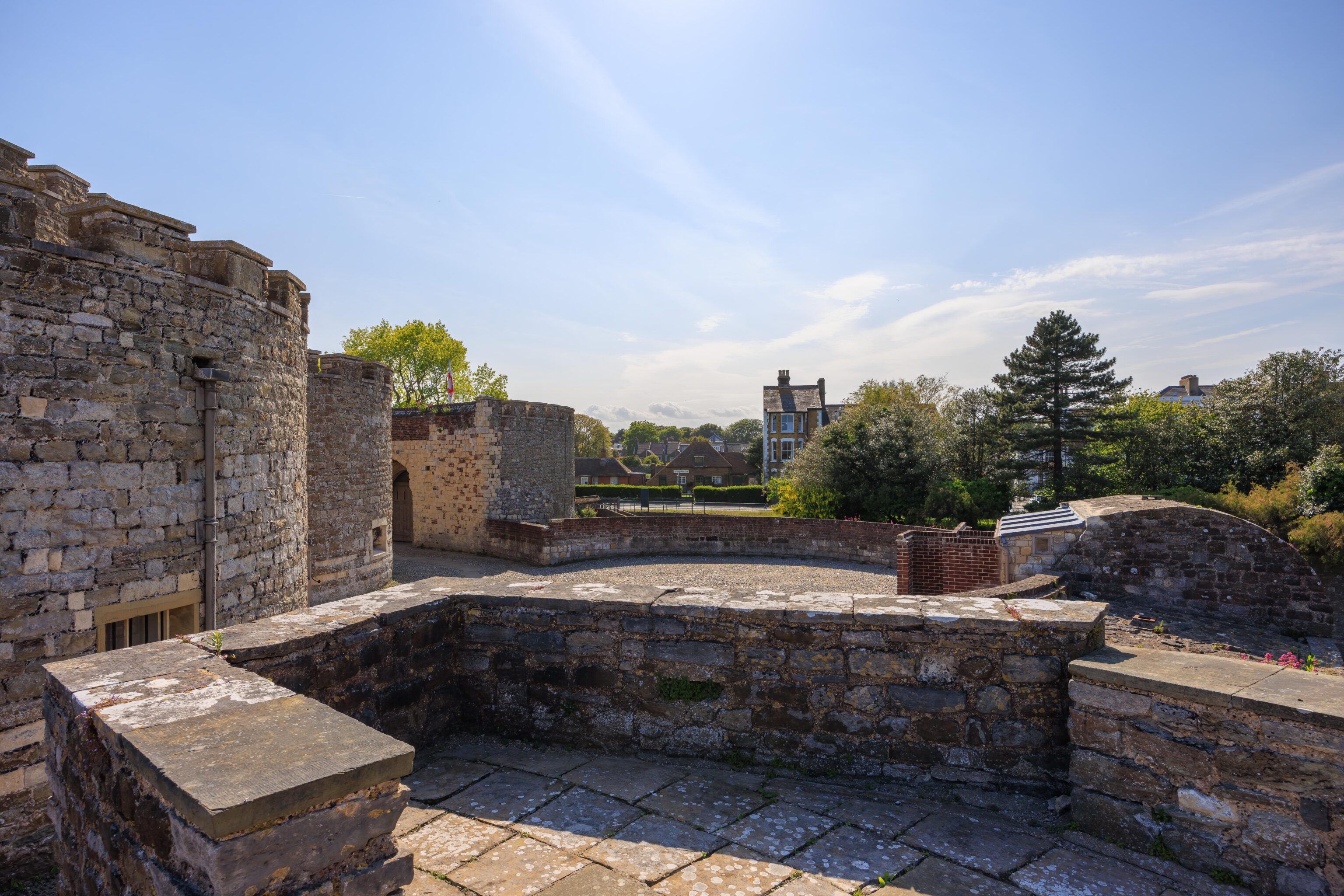
There are narrow passageways around the outer edge of the castle called the Rounds. There are periodic windows, more likely holes in the wall for firing guns in the original design. These windows open up into the moat area and serve a defensive function for anyone trying to directly attack the castle. This area is very dark and rather confusing which was an intended feature in case attackers were able to break in. There seems to only be two entrances into the Rounds on opposite sides of the castle. Half of the passageways were closed due to flooding. Viewing a diagram of the castle helps to understand the structure of this part of the castle in particular.
One notable feature was that there were small vents above each room where defenders may have fired guns. The vents were to allow smoke to escape.
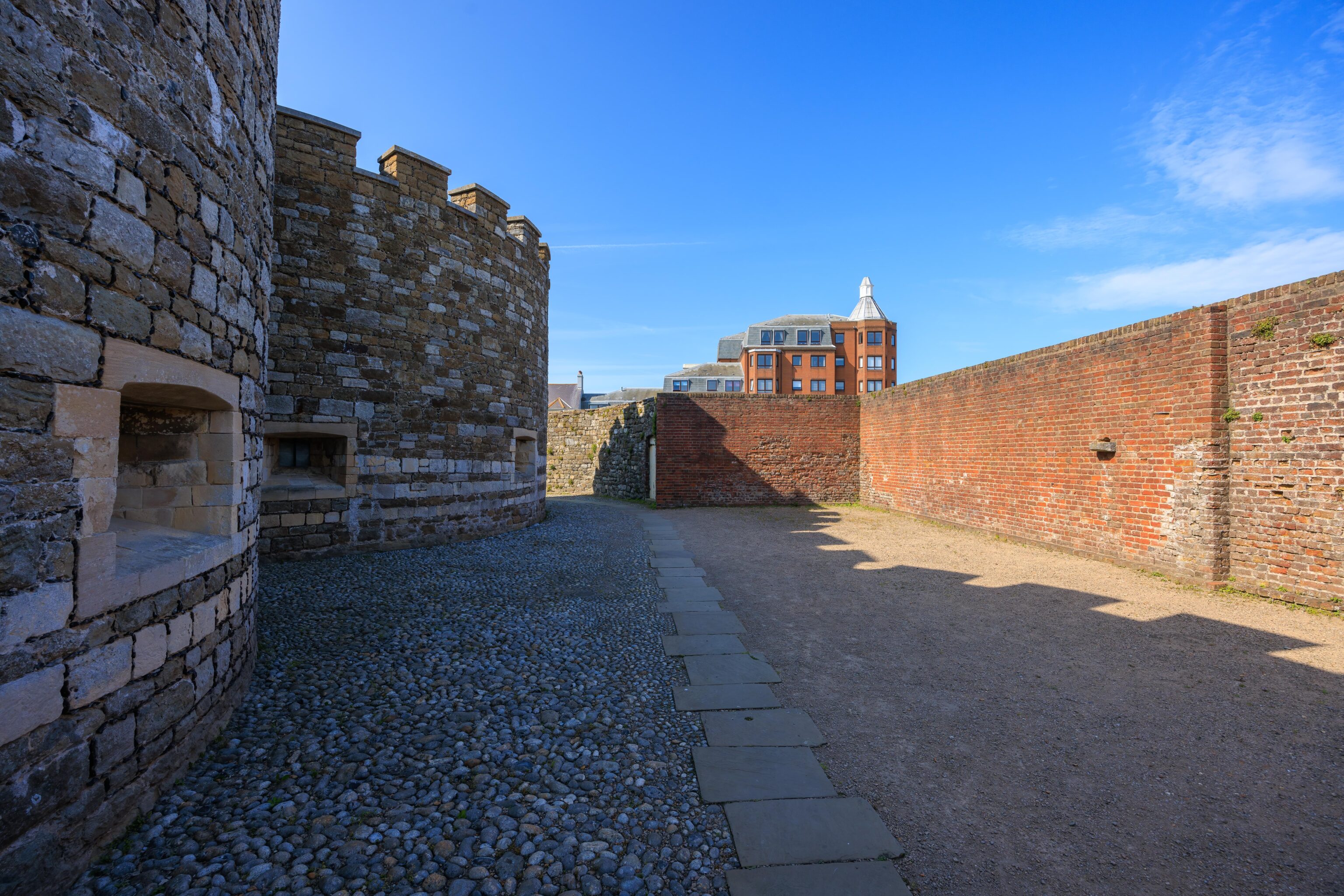
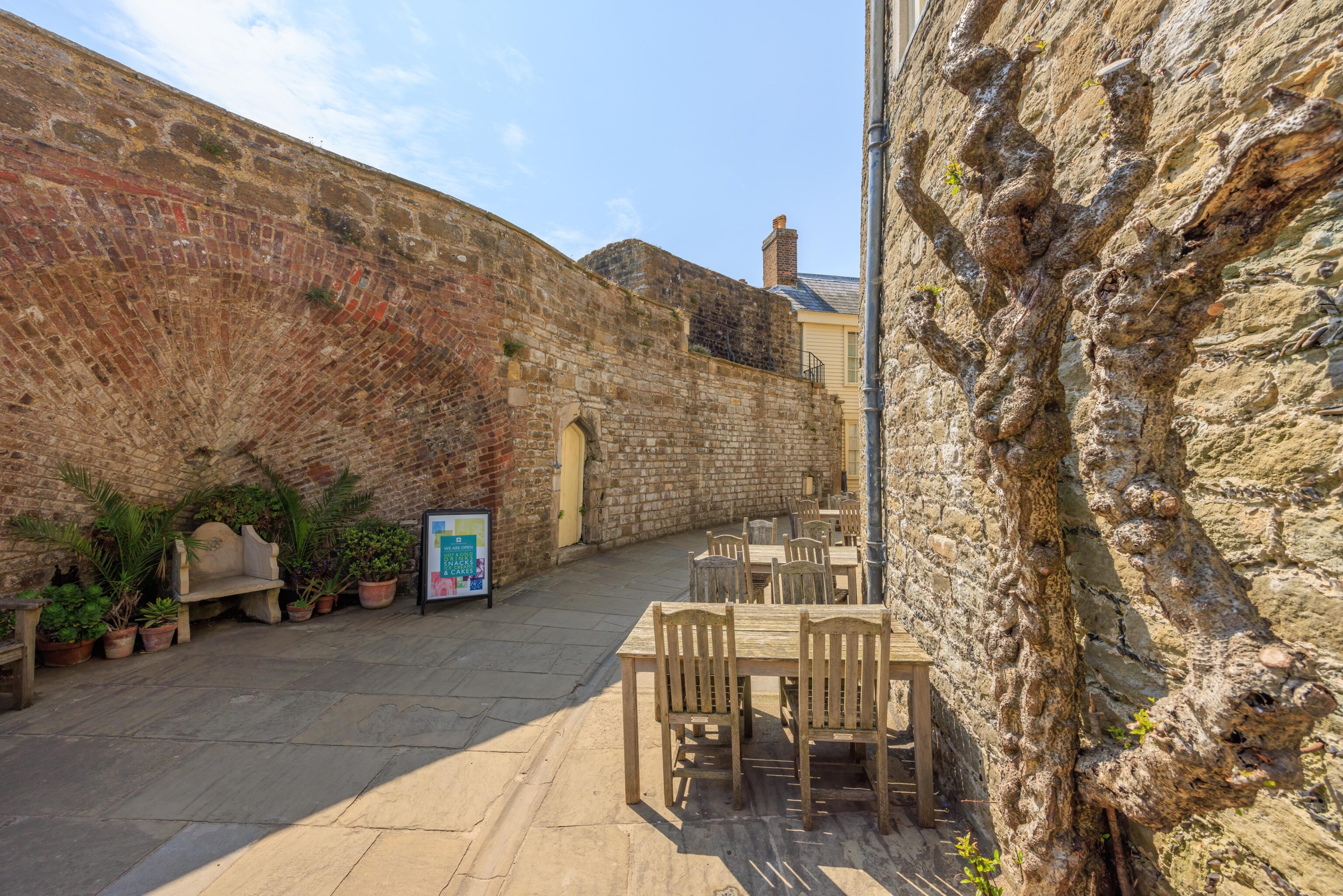
After leaving the underground area of the castle, we looped around the exterior via the north side.
We ended our brief visit with just few minutes of parking time remaining.
Canterbury
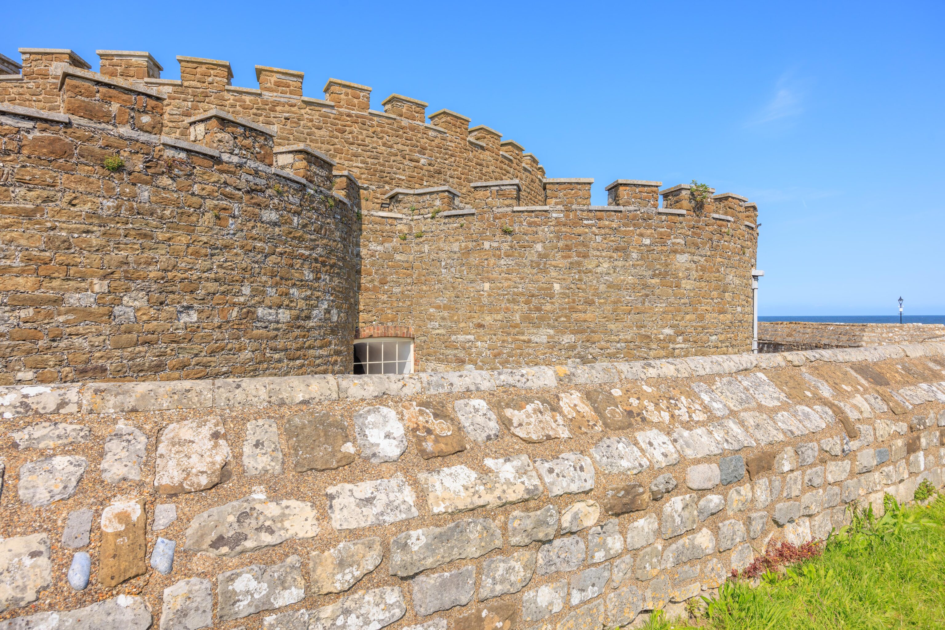
After returning to town, we made dinner reservations. We had some time before then so we decided to walk around the town to see the remains of its city walls.
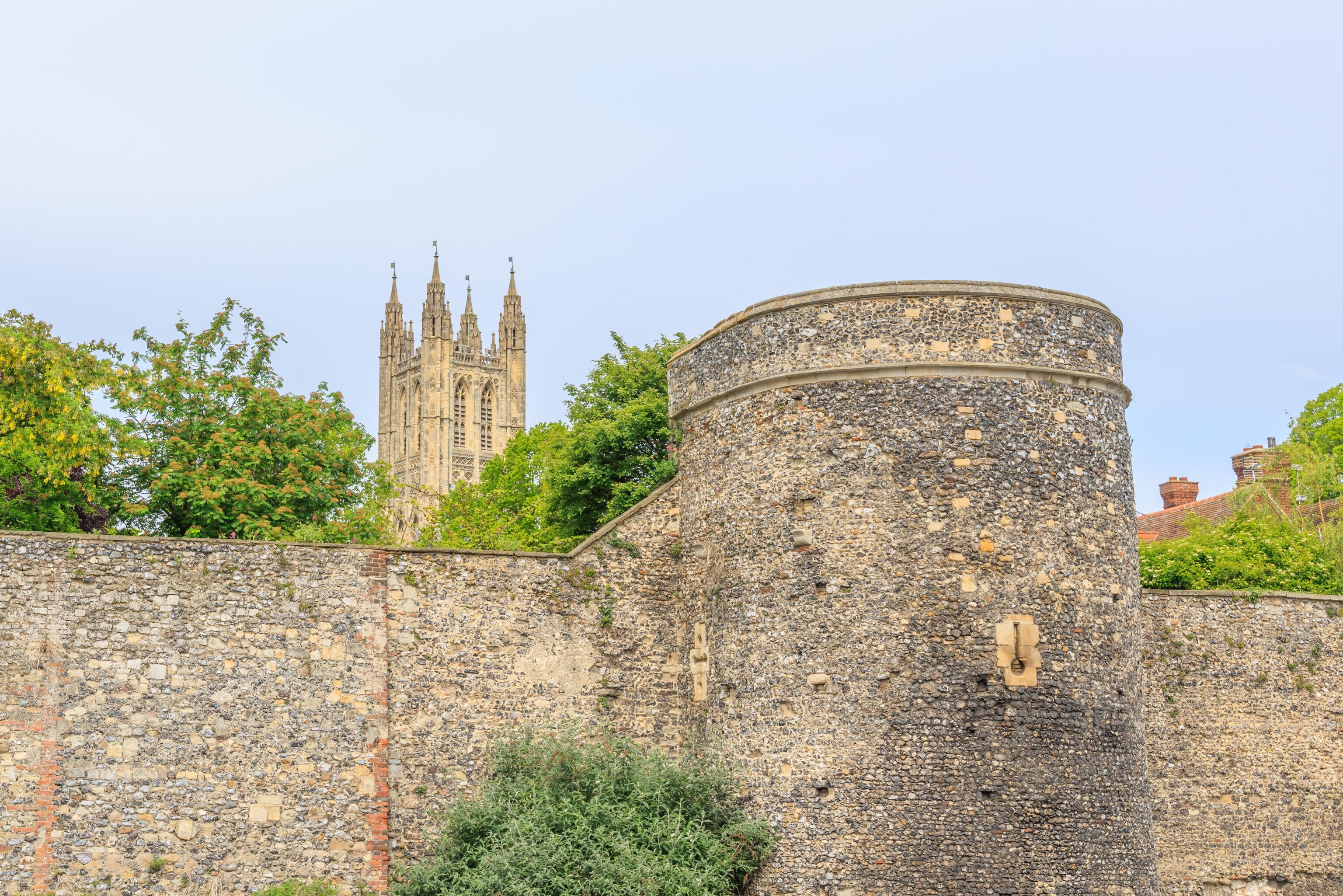
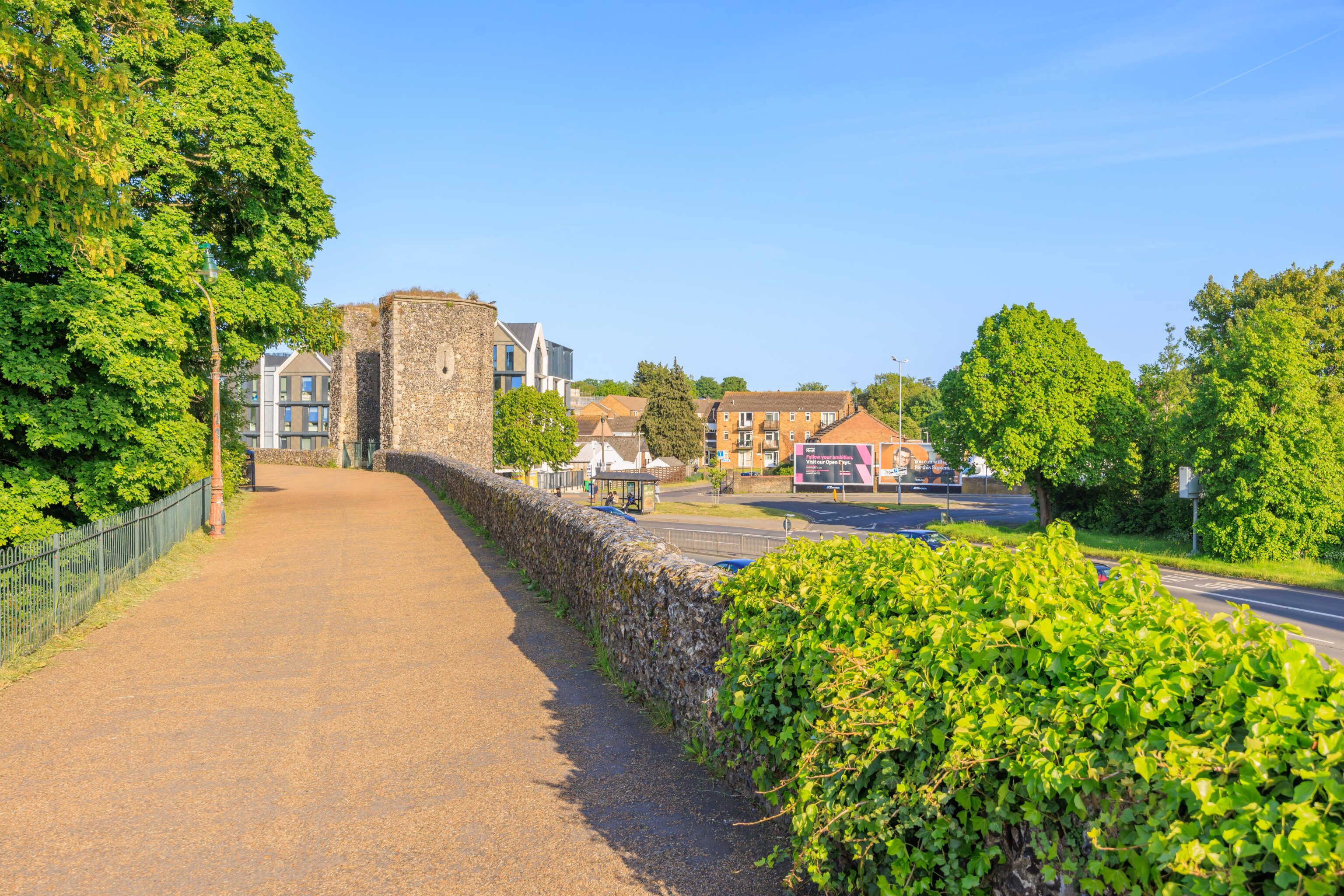
Earlier in the day, we saw part of the walls that were on the eastern edge of the cathedral. There is another section of wall still standing on the southern side of the city. The top of this wall can be accessed by ramps and stairs. It is surrounded by a modern day ring road.
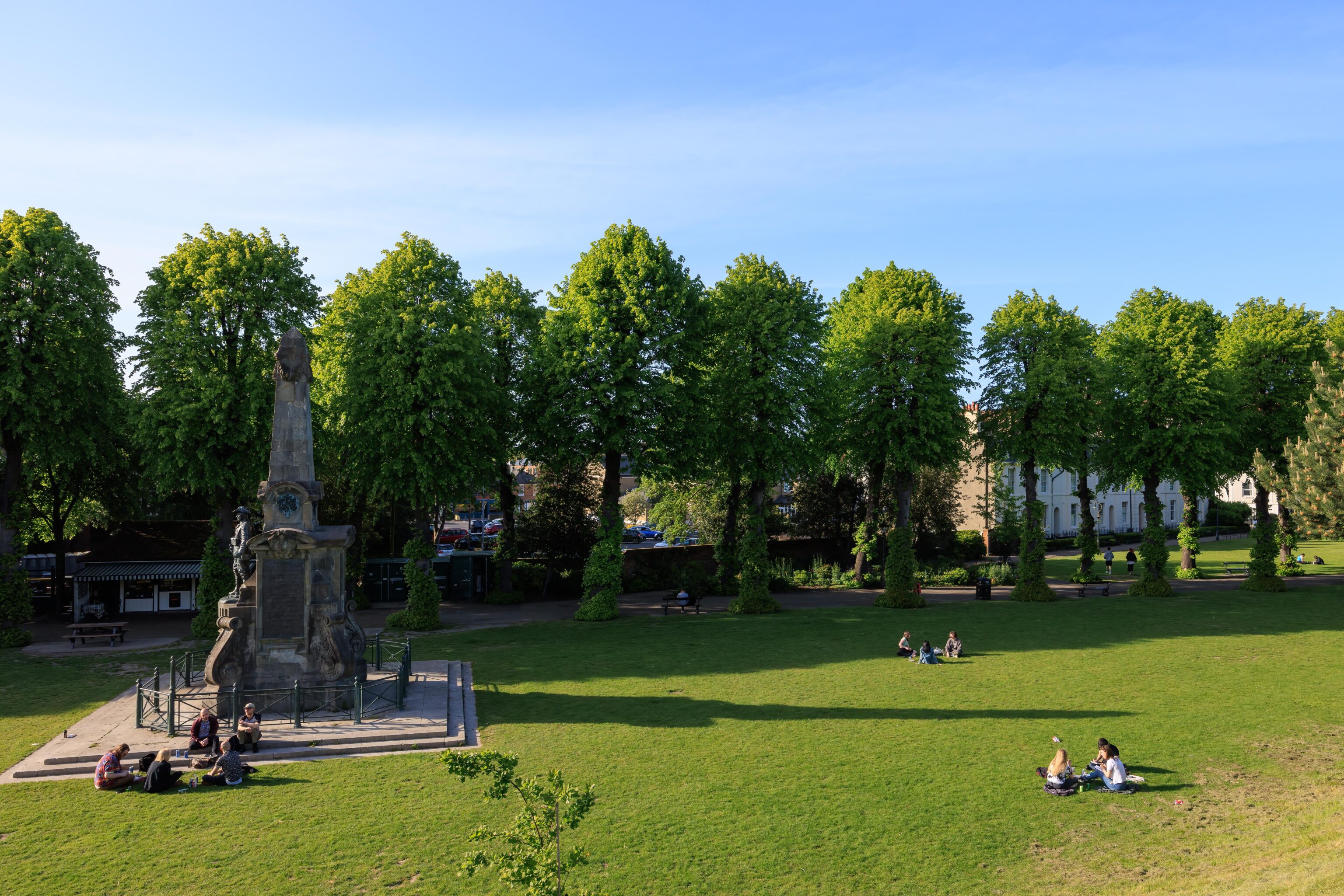
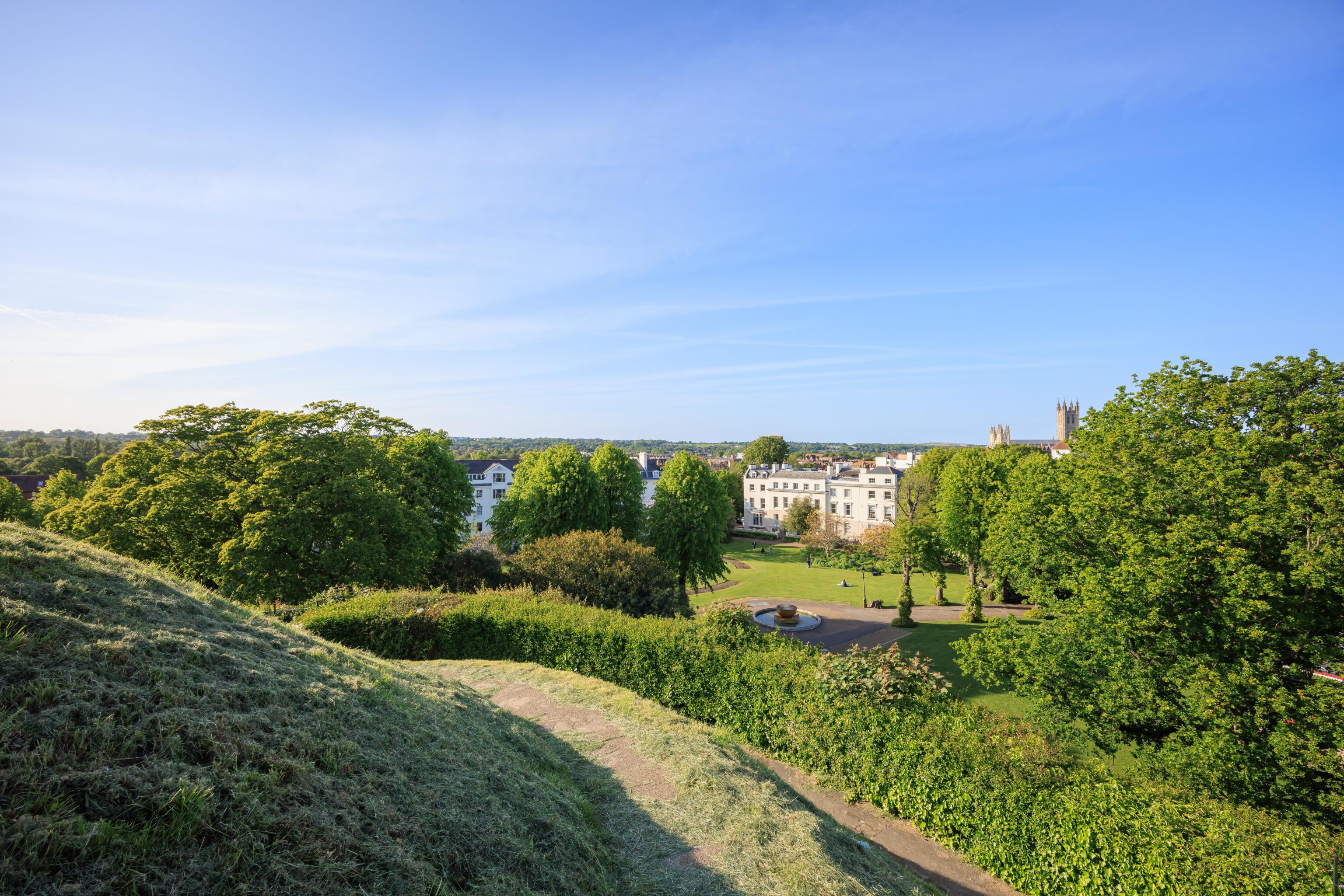
According to Wikipedia, Canterbury has the highest student to permanent resident ratio in the UK. We did see many young people, presumably students, here at the Dane John Gardens. The castle wall, unfortunately, isn’t high enough to see above the nearby trees and buildings.
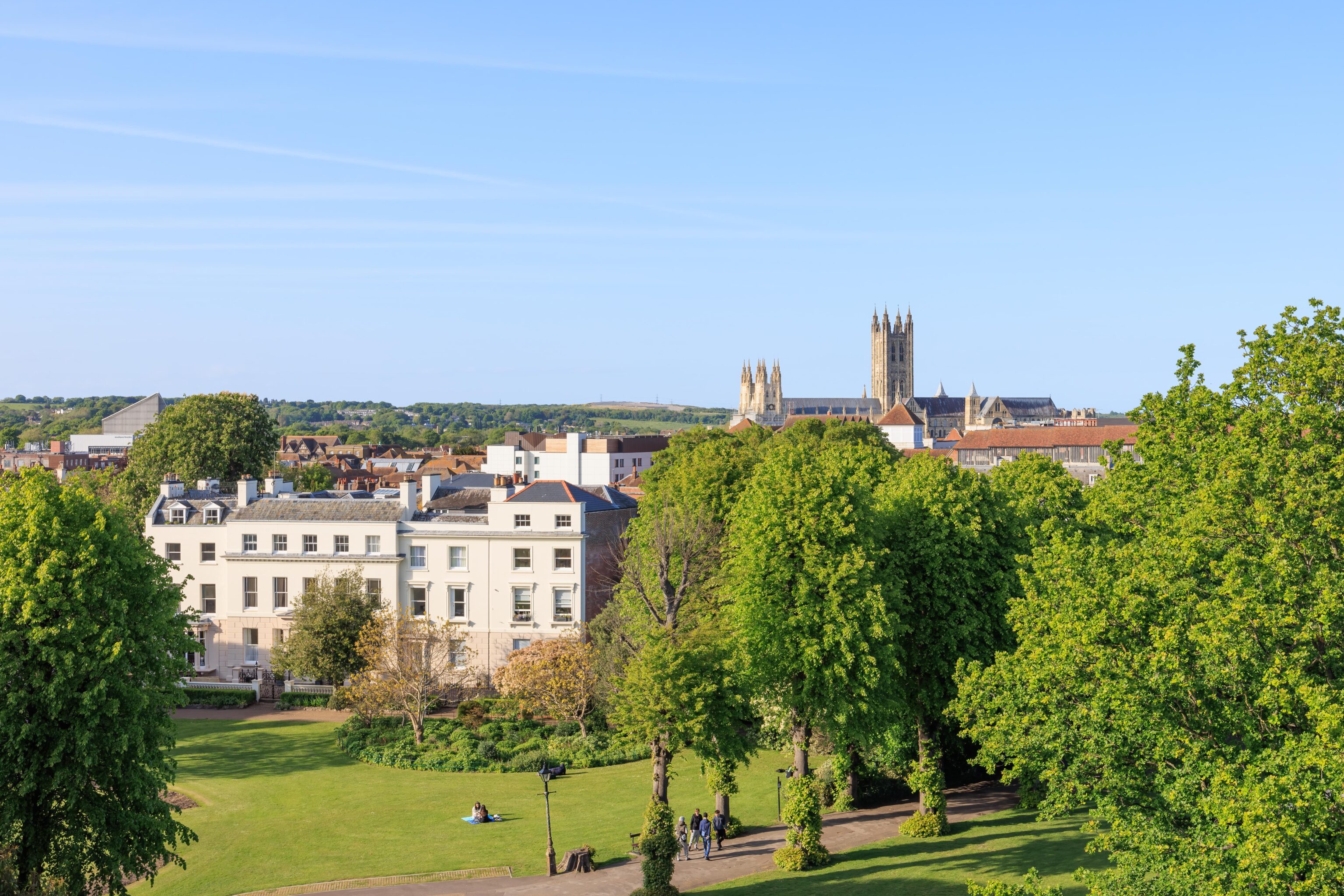
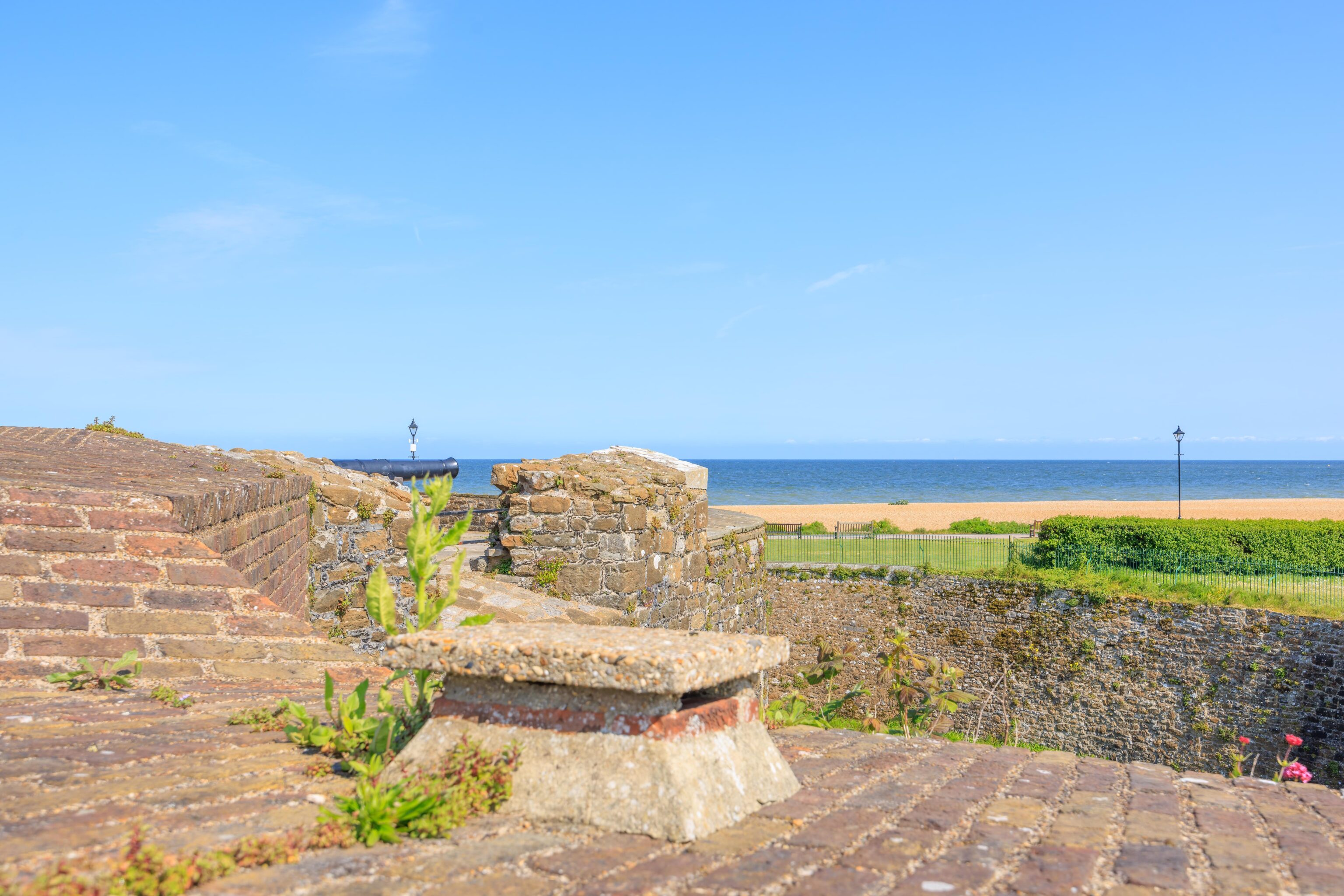
There is a tall mound at the southern tip of the city wall. We walked to the top of this mound to check out the view. It is slightly higher than most of the surrounding trees and buildings. We could see more of Canterbury Cathedral than we could see from any other place that we’ve been in the city.
The view in the opposite direction, to the south, isn’t particularly interesting. It did have a nice view of one of the half towers that line the city walls. These are open in the city facing side, likely because attackers aren’t expected from that position.
After take a quick look at the surrounding scenery, we headed back down to the city wall.
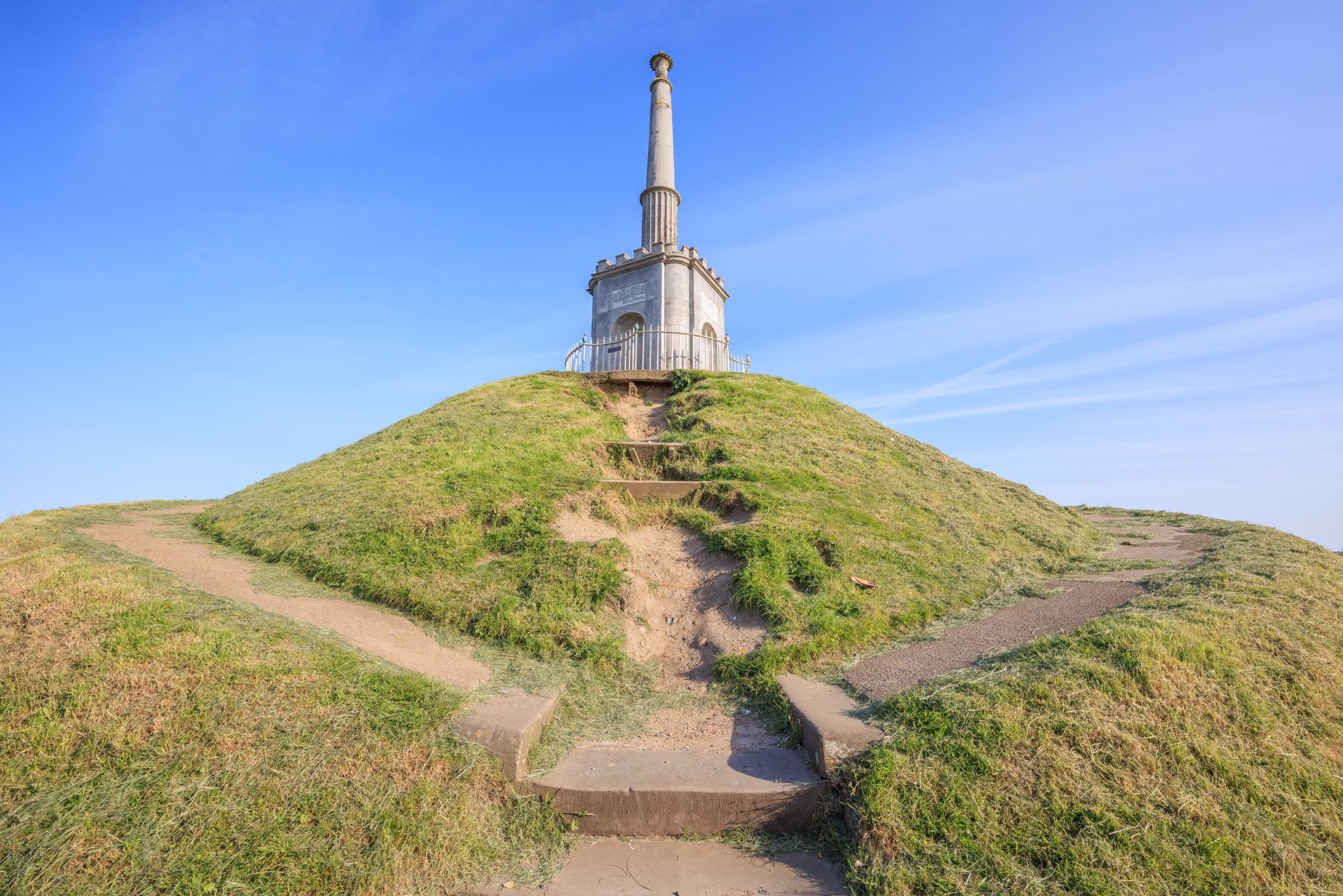
There is a monument, The Simmons Memorial, at the top of the mound. The mound was formerly a Roman burial site.
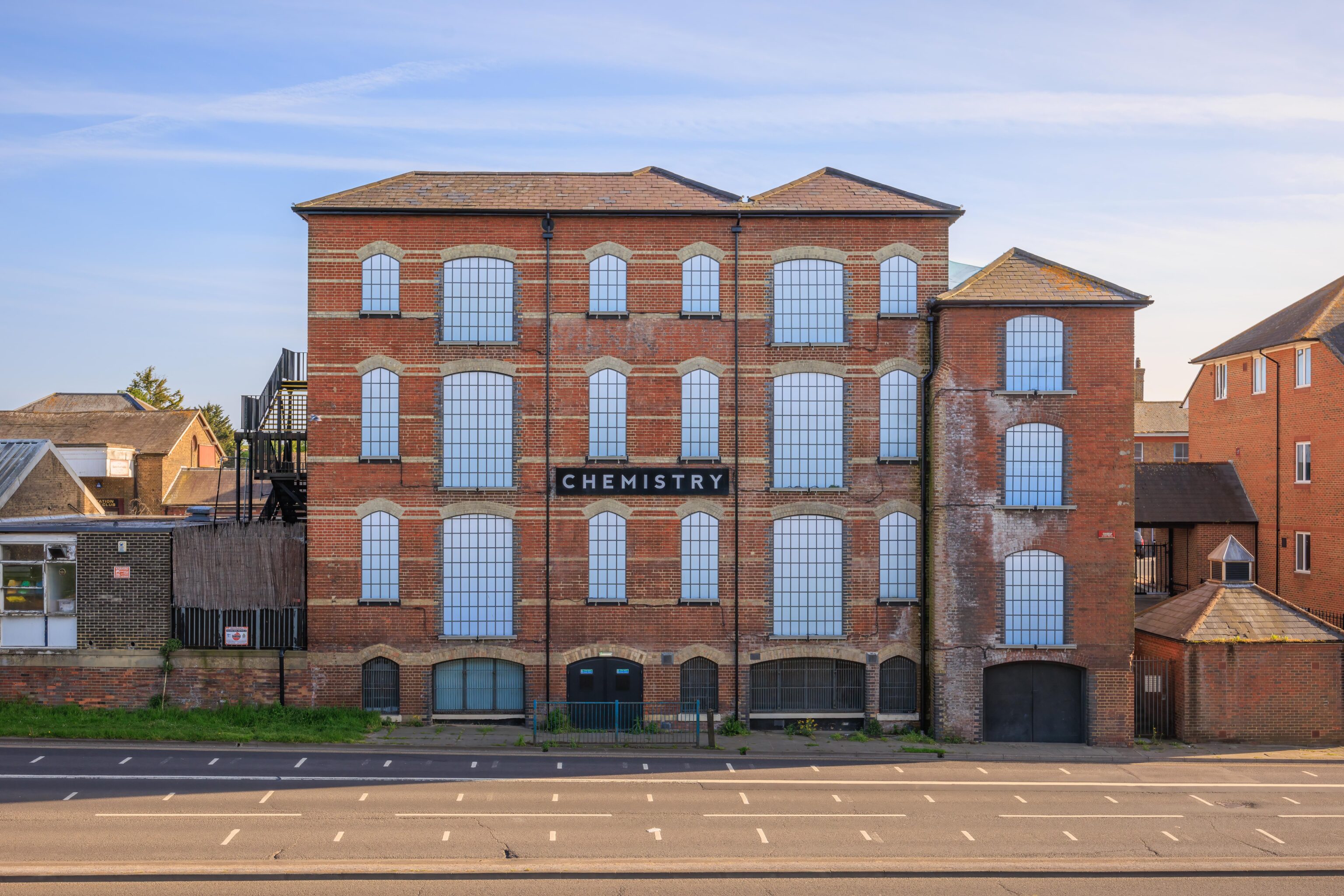
At first, we thought this was maybe a school building. But oddly it just says Chemistry and the windows are all covered with some non-transparent material. After looking on Google Maps, this is a nightclub!
Looking back at the way we came from.
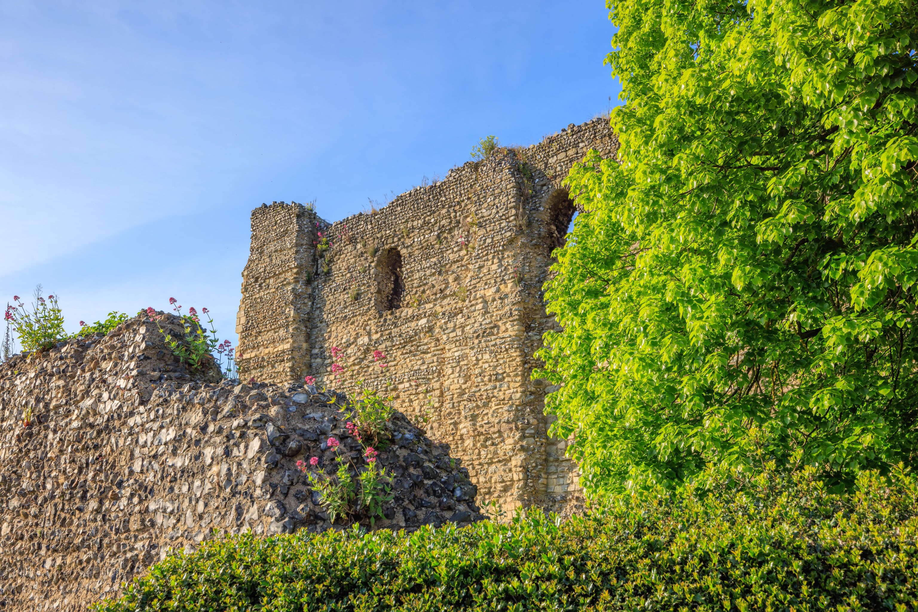
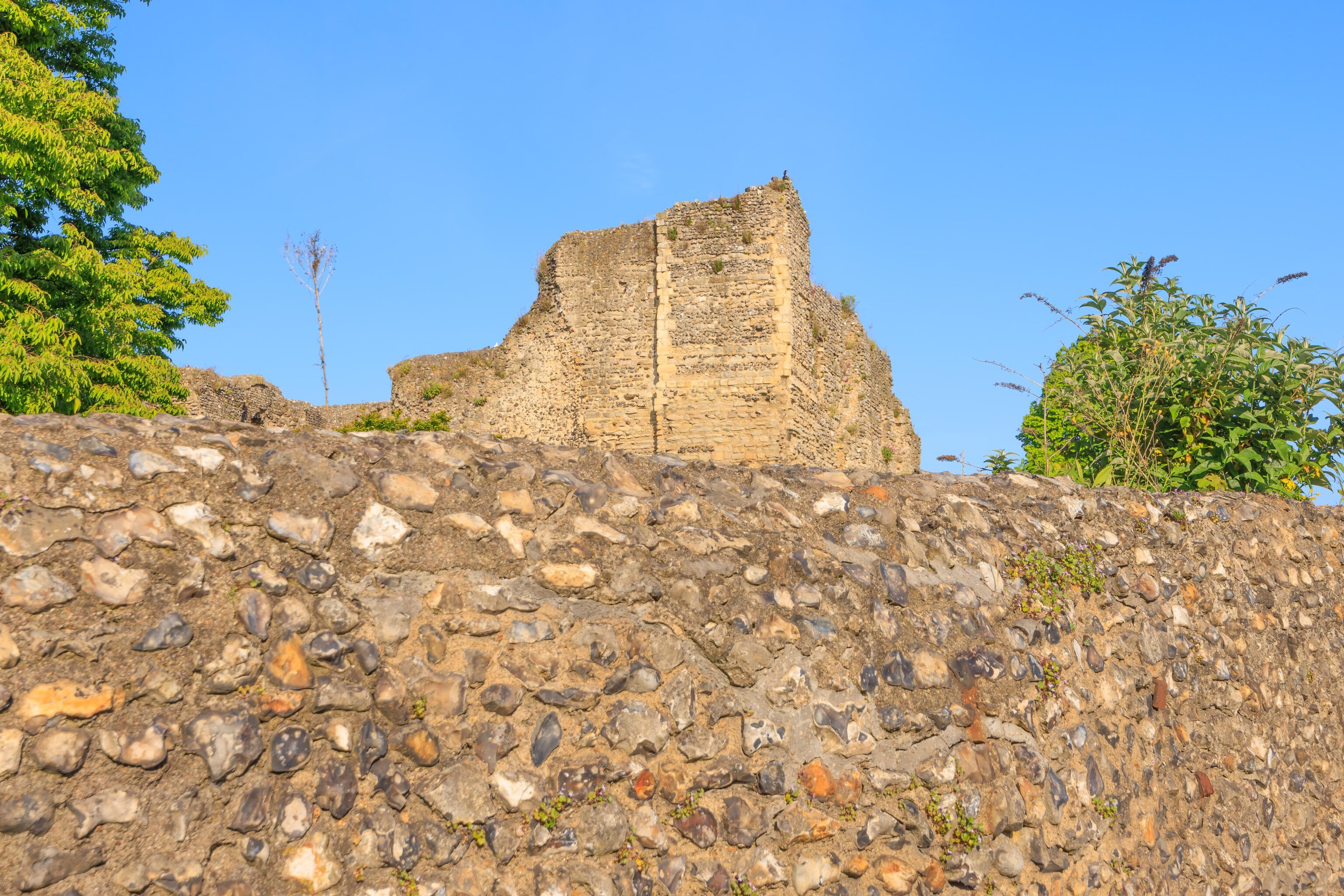
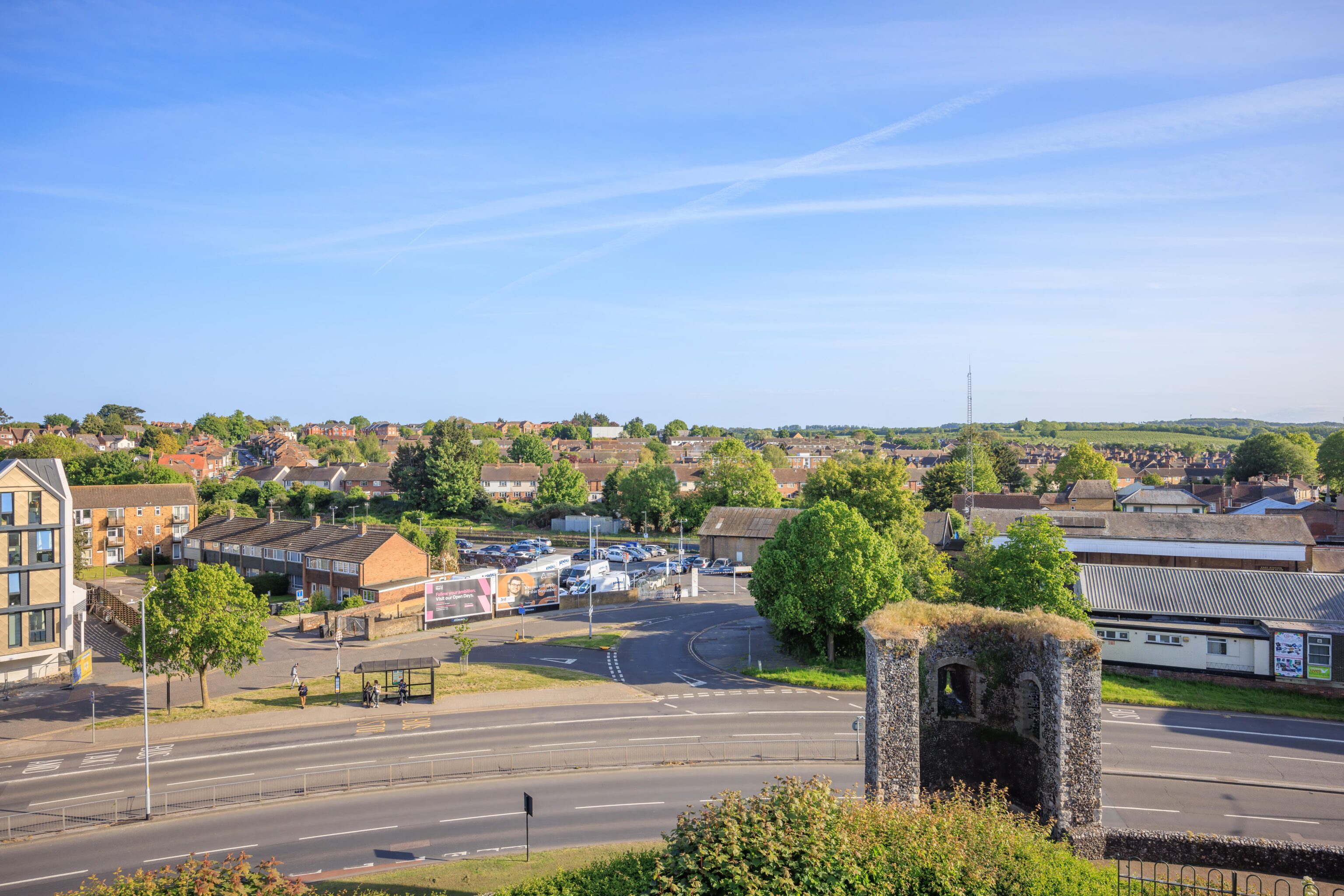
The city wall ended not far from the Chemistry nightclub. After returning to street level, we walked through a surface car park and reached the ruins of Canterbury Castle. It is apparently possible to get closer, though it wasn’t obvious from the west side by the road. Google Maps indicates that it is currently closed due to unsafe conditions.
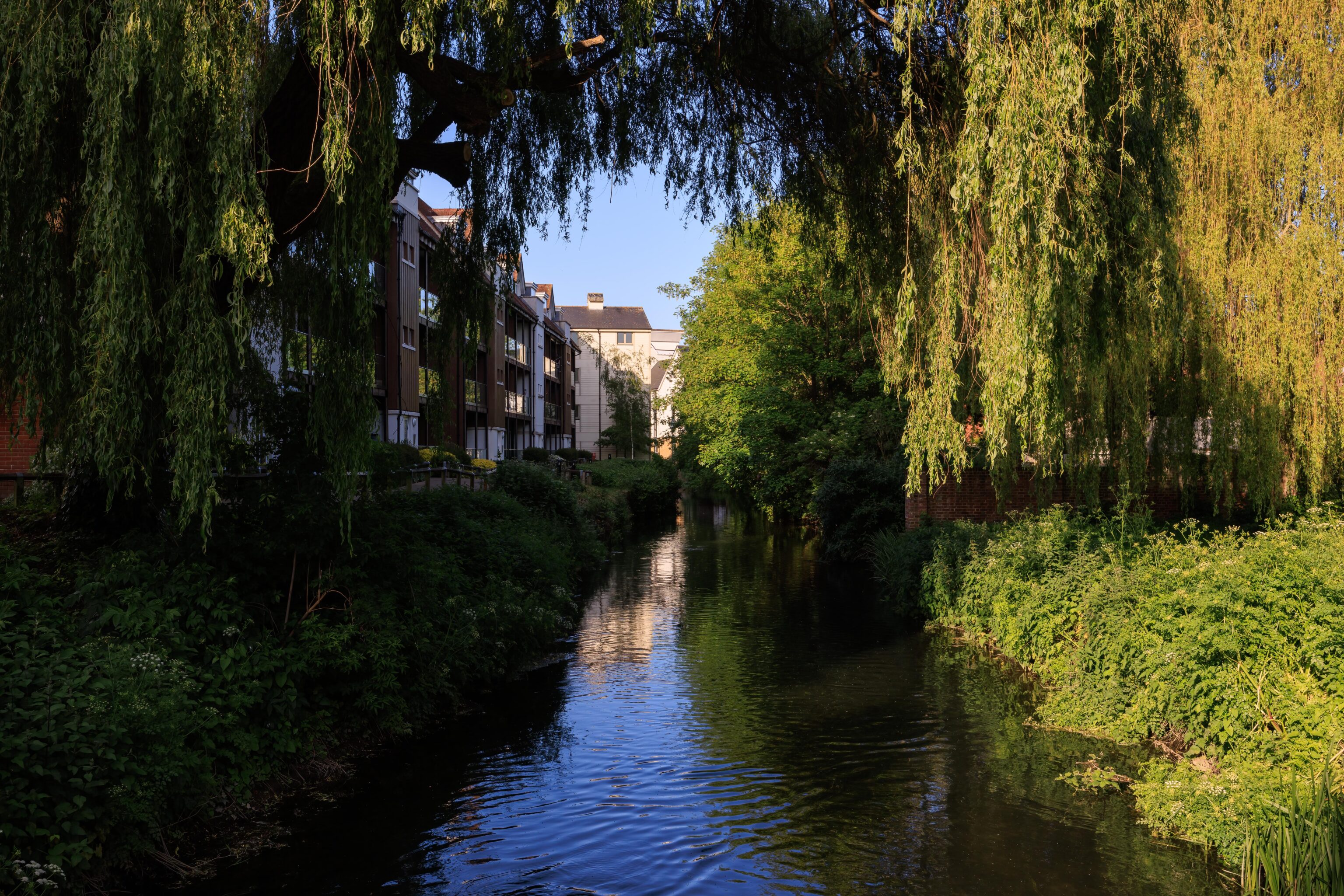
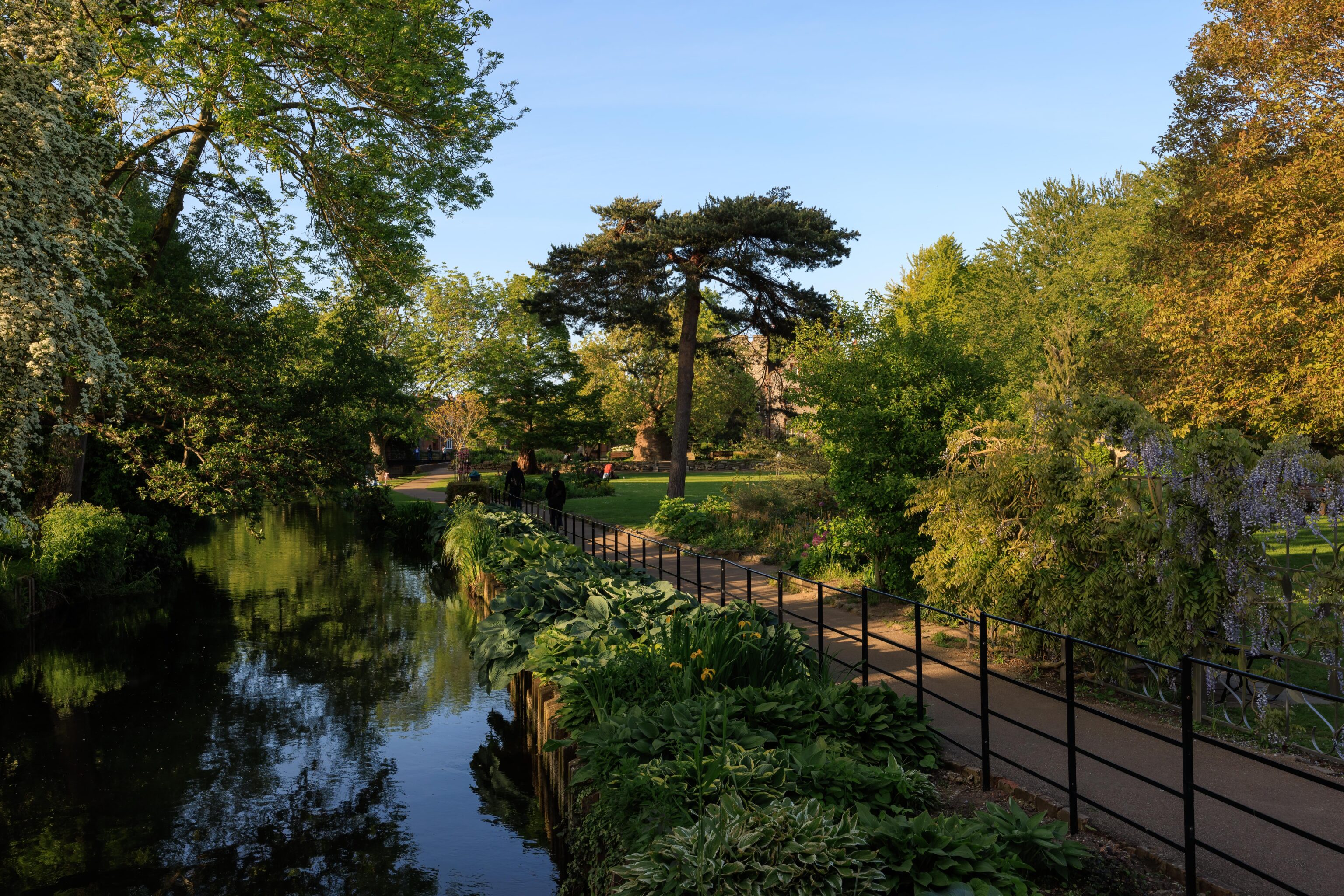
After continuing past the castle, we reached a river, the Great Stour. The view is pretty looking to the east with plenty of foliage on both sides. There is a underpass beneath a road behind us. While walking through, we saw two male Mallards engaged in quite a vigorous fight!
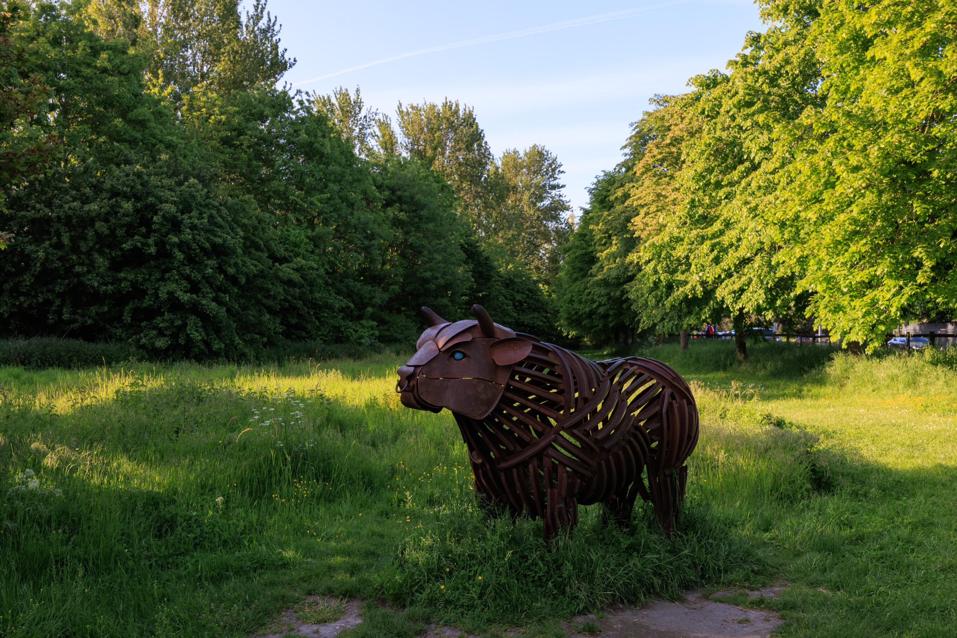
After crossing under the road, we entered the Westgate Parks. Heading northwest, we came across this sculpture of a bull.
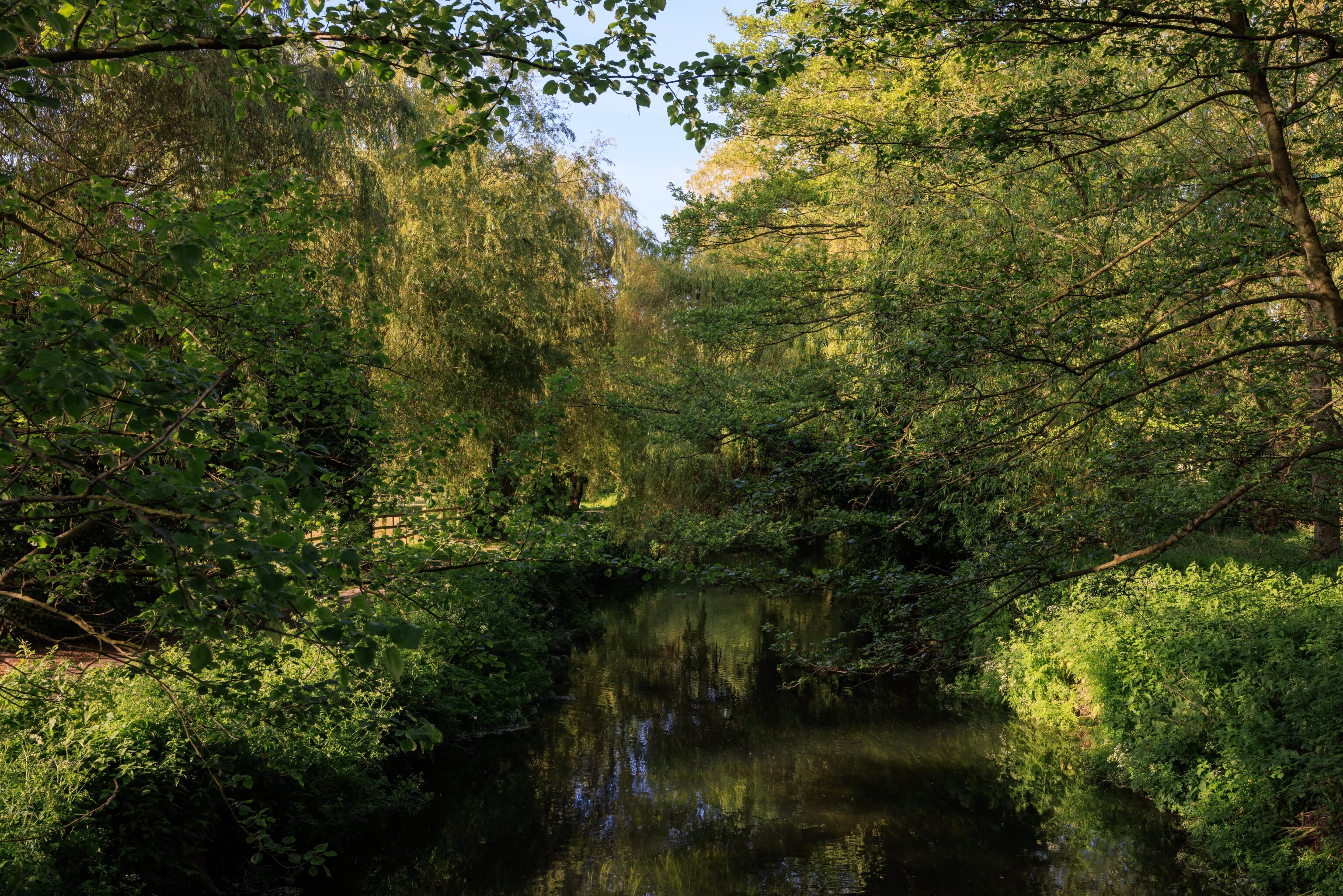
We soon reached a bridge where we crossed over the Great Stour again. Looking at the map, the river splits and rejoins itself multiple times.
After crossing the bridge, we headed northeast on a path by the river’s northern edge. After walking for awhile, we passed under another road and eventually came to another bridge across the river.
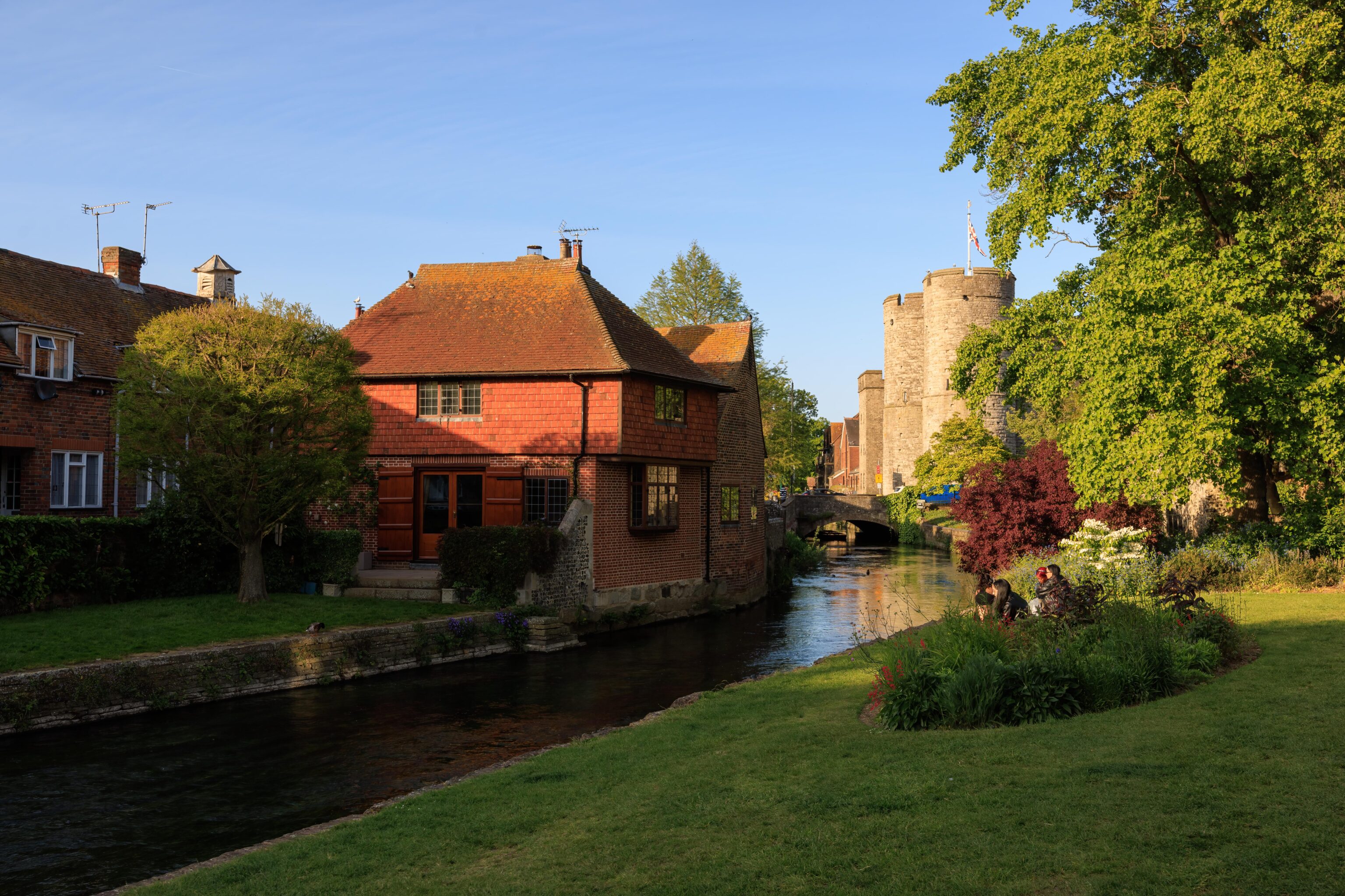
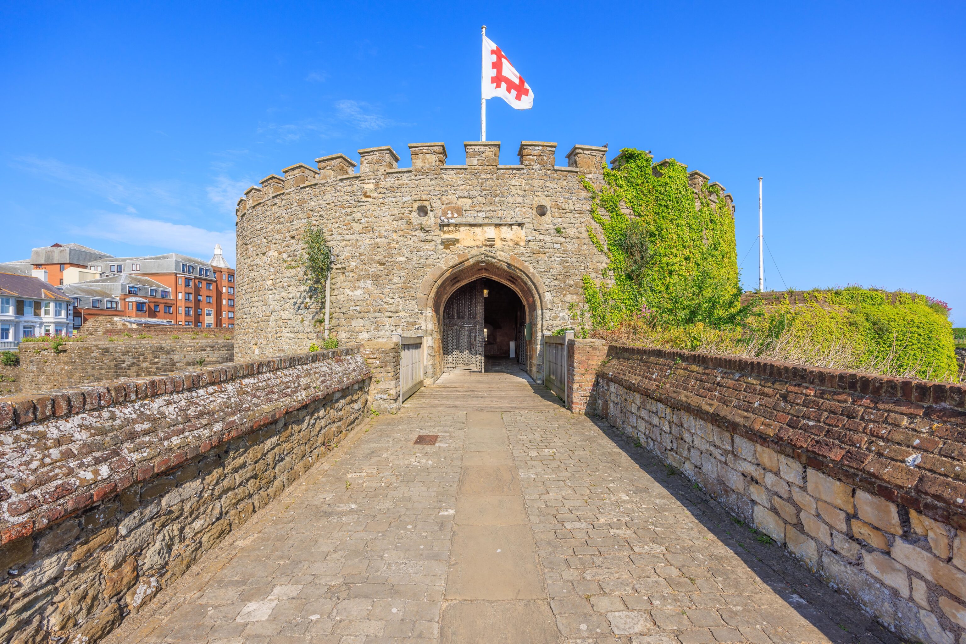
After crossing, we walked along the south bank of the river until we soon saw the Westgate Towers.
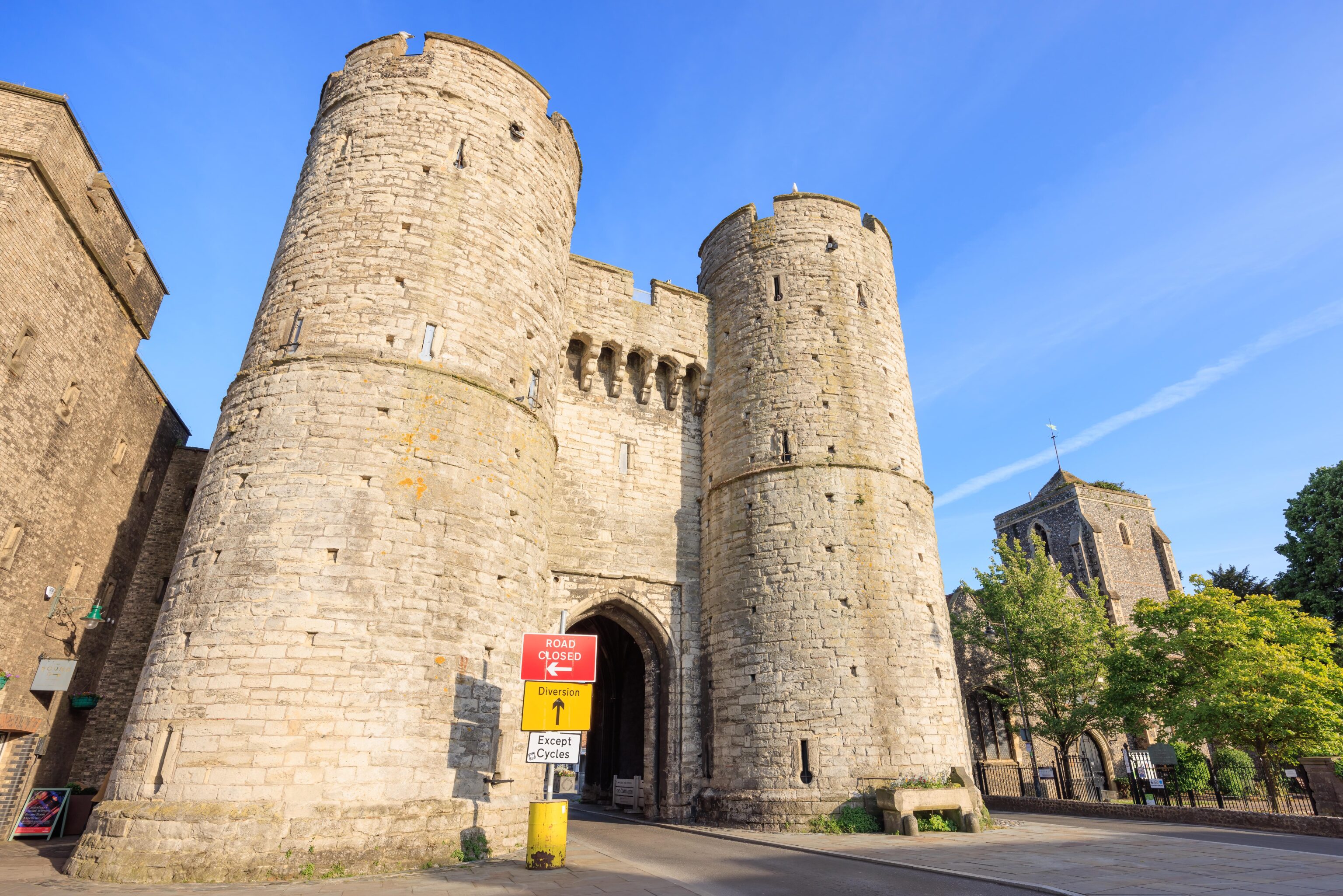
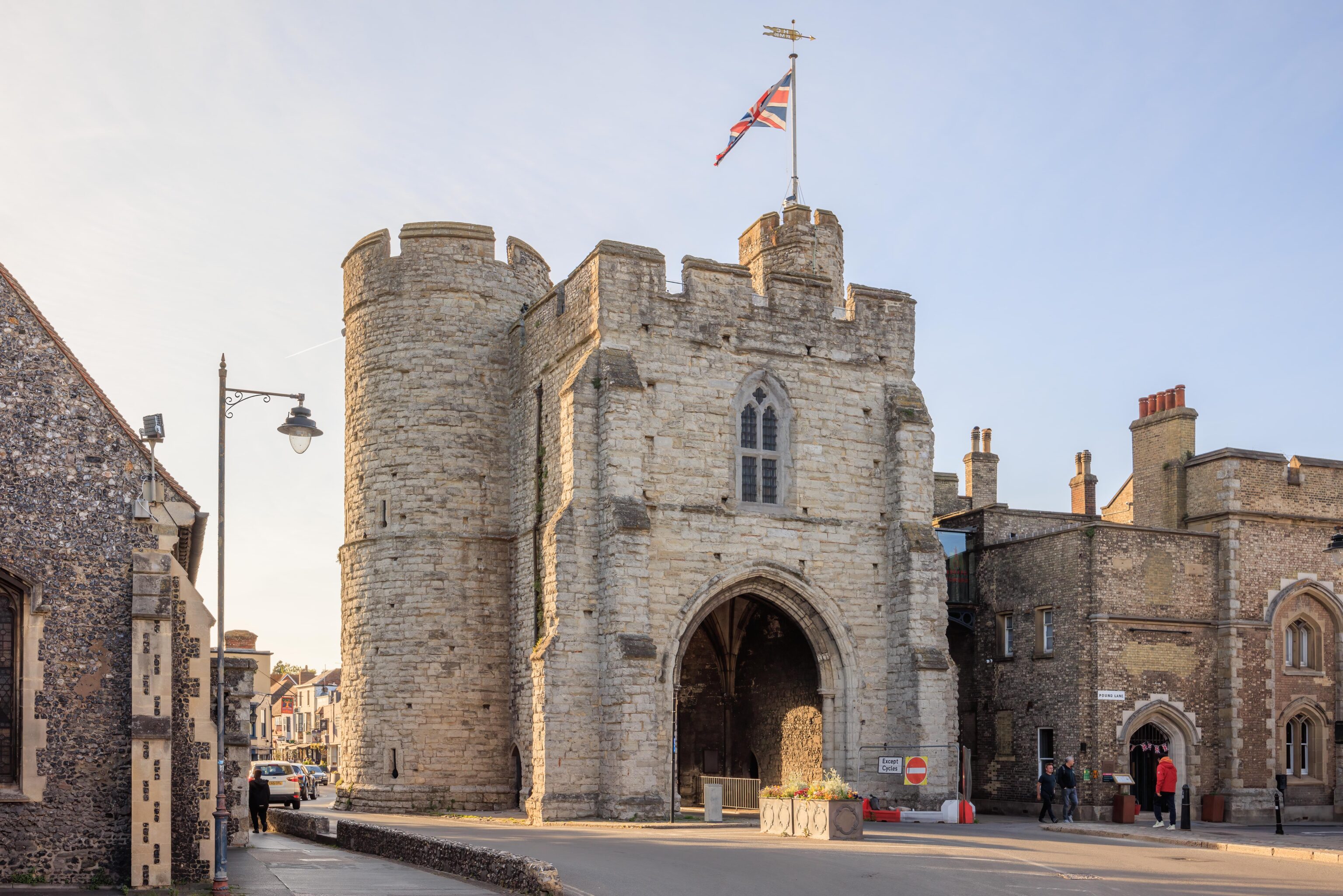
This gate into the city, from the 14th century, currently operates as a museum and scenic viewpoint. It has very limited hours though.
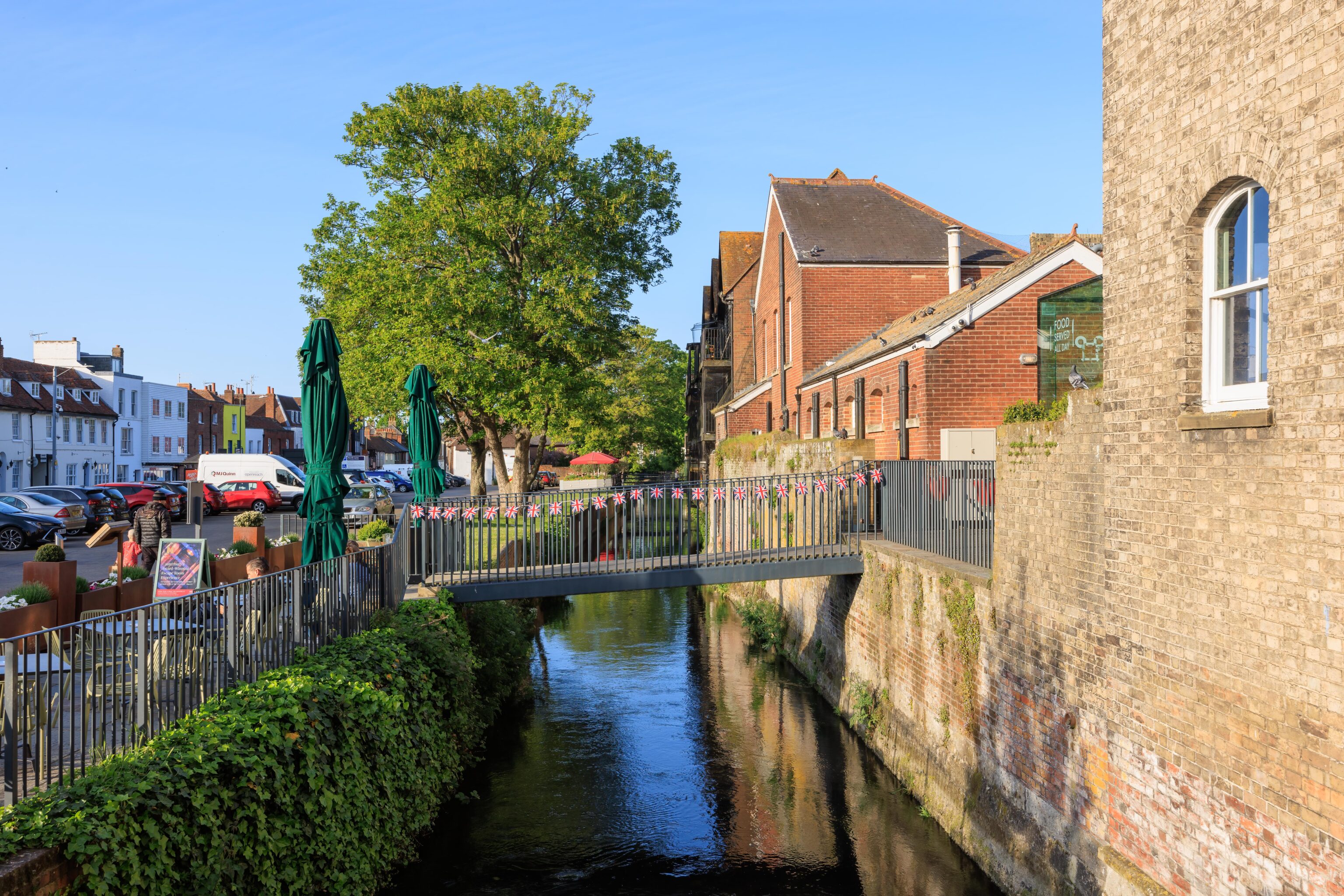
We didn’t continue any further along the river but it looked nice!
One Reply to “Kent [England, UK]”